- Chesham Bois
-
Coordinates: 51°41′06″N 0°36′18″W / 51.685°N 0.605°W
Chesham Bois 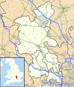
 Chesham Bois
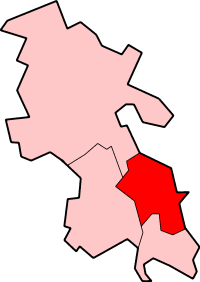
Chesham Bois shown within BuckinghamshirePopulation 3,013 [1] OS grid reference SU965995 District Chiltern Shire county Buckinghamshire Region South East Country England Sovereign state United Kingdom Post town AMERSHAM Postcode district HP6 Dialling code 01494 Police Thames Valley Fire Buckinghamshire Ambulance South Central EU Parliament South East England UK Parliament Chesham & Amersham List of places: UK • England • Buckinghamshire Chesham Bois (traditionally
 /ˌtʃɛsəm ˈbɔɪz/, after the nearby River Chess, but now more commonly /ˌtʃɛʃəm ˈbɔɪz/) is a village in Buckinghamshire, England, adjacent to both Amersham and Chesham.
Contents
History
Initially a hamlet in the parish of Chesham, the manor was assessed at 1½ hides in the reign of King Edward the Confessor.[2] The estate belonged to a brother of King Harold, who was killed with him at the Battle of Hastings and probably William the Conqueror gave this ‘royal’ land to his own half-brother, Odo Bishop of Bayeux.[3] The village gets its name from the de Bosco family[4] (the French version of which was 'de Bois') and by 1213 in the reign of King John a William du Bois was holding the manor.[2] By about 1430, in the reign of Henry VI, the manor had been acquired by the Cheynes of Chenies who remained for over 300 years, before conveying the manor to the Duke of Bedford in 1735.[2][5] Chesham Bois House, the site of the manor, was the subject of an archaeological excavation by Time Team, which was broadcast in the United Kingdom on Channel 4 in March 2007.[6][7]
Famous people born in Chesham Bois were the crime writer and composer Edmund Crispin, Lieutenant Commander Peter Scawen Watkinson Roberts, who was awarded the Victoria Cross for gallantry in the face of the enemy during World War II and Mervyn King, current governor of the Bank of England.
Today
The village contains two churches: the Anglican church of St. Leonard's (started in the 12th century) and the Roman Catholic Church of Our Lady (built in 1915 and extended in 1953). Chesham Bois C of E Combined School is located down Bois Lane, a mixed primary school with over 200 pupils. The Beacon School is also located in the village and is an independent preparatory school educating over 400 boys. Also on located in the Village is Our Ladys Roman Catholic Combined School which is opposite the church of the same name. Elangeni School is situated at the end of Woodside Avenue and is a mixed state school. A 40-acre (160,000 m2) sycamore and ash wood and common is the site of the local cricket pavilion, as well as being the site for the biennial village fete.
Today some of Chesham Bois merges into Amersham-on-the-Hill. It still remains a particularly splendid part of the Chiltern Hills.
External links
- Chesham Bois Cricket Club
- Chesham Bois House
- Chesham Bois Parish Council
- Chesham Bois Village
- Chess Valley Archaeological & Historical Society
- Location map (Multimap)
- Pictures of Chesham Bois
- St. Leonard's Church, Chesham Bois
References
- ^ neighbourhood Statistics 2001 Census
- ^ a b c "Detailed ownership of the Manor from thr reign of Edward the Confessor to 1903". British History online. http://www.british-history.ac.uk/report.aspx?compid=42548. Retrieved 2007-12-30.
- ^ "A history of Chesham Bois House". http://www.cheshamboishouse.co.uk/history_of_site.php. Retrieved 2007-12-30.
- ^ "mention of the name de Bosco in 1806 in "Magna Britannia"". http://met.open.ac.uk/genuki/big/eng/bkm/CheshamBois/Index.html. Retrieved 2007-12-30.[dead link]
- ^ "Details of the Cheyne family links for Chesham Bois". http://www.cb5.co.uk/annsemark.htm. Retrieved 2007-12-30.
- ^ "The Cheyne gang". http://www.channel4.com/history/microsites/T/timeteam//2007_ches.html. Retrieved 2007-12-30.
- ^ "Discussion on Time Team Forum". http://community.channel4.com/eve/forums/a/tpc/f/8896096411/m/3170019757. Retrieved 2007-12-30.
Categories:- Villages in Buckinghamshire
- Civil parishes in Buckinghamshire

Wikimedia Foundation. 2010.