- North Palisade
-
North Palisade 
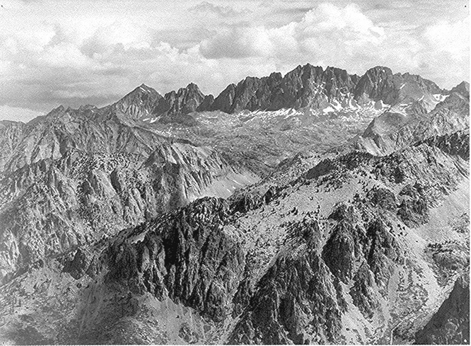
North Palisade from Windy Point (by Ansel Adams, 1936)Elevation 14,248 ft (4,343 m) NAVD 88[1] Prominence 2,895 ft (882 m) [2] Parent peak Mount Whitney [2] Listing SPS Emblem peak [3] Location Fresno County, California, USA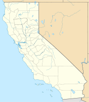
 North Palisade
Range Sierra Nevada, Palisades Coordinates 37°5′39″N 118°30′52″W / 37.09417°N 118.51444°WCoordinates: 37°5′39″N 118°30′52″W / 37.09417°N 118.51444°W[5] Topo map USGS North Palisade Quadrangle [4] Geology Type Igneous, primarily diorite [6] Climbing First ascent July 25, 1903 by James S. Hutchinson, Joseph N. LeConte, James K. Moffitt [7] Easiest route The LeConte Route, class 4 [8] North Palisade is the third highest mountain in the Sierra Nevada range of California. It is the highest peak of the Palisades group of peaks in the central part of the range. It sports a small glacier (the Palisade Glacier) and several highly prized rock climbing routes on its northeast side.
Contents
History
North Palisade has a collection of names from the 19th century. The Wheeler Survey referred to it as Northwest Palisade in 1878. The following year, Lil Winchell called it Dusy's Peak after local rancher Frank Dusy. In 1895, Bolton Brown advocated yet another name, after David Starr Jordan.[7] U.S. Senator Diane Feinstein, supported by U.S. Senator Barbara Boxer, has introduced legislation to rename the peak as "Brower Palisade", in honor of environmentalist David Brower. There is significant opposition to this proposal.[9]
The first ascent was made on July 25, 1903 by James S. Hutchinson, Joseph Nisbet LeConte and James K. Moffitt.[7] They approached the area overland from south of the Palisades, and scouted possible routes from the summits of Marion Peak and Mount Sill. Armed with this intelligence, they planned to ascend the southwest chute of the U Notch, and find a way to bypass the rock face between the notch and the upper reaches of North Palisade. Around 13,100 feet (4,000 m), they followed a northward branch of this chute, and slowly climbed a difficult system of cracks. From here they found a catwalk ledge that took them to a series of icy gullies, bound toward the summit. These gullies were blocked by a pair of chockstones, requiring class 4 moves to pass. Beyond these obstacles, they crested the southeast ridge, and climbed a series of granite blocks to the summit.[6][8]
After making this climb, LeConte is quoted as writing in a letter, "I have called the peak merely the North Palisade. Put Dusy's name on some less imposing mass, and give us a name to be handed down through all time."[10] The peak has been called North Palisade since that day, and received official recognition by the U.S. Board on Geographic Names.[4]
Subsidiary peaks
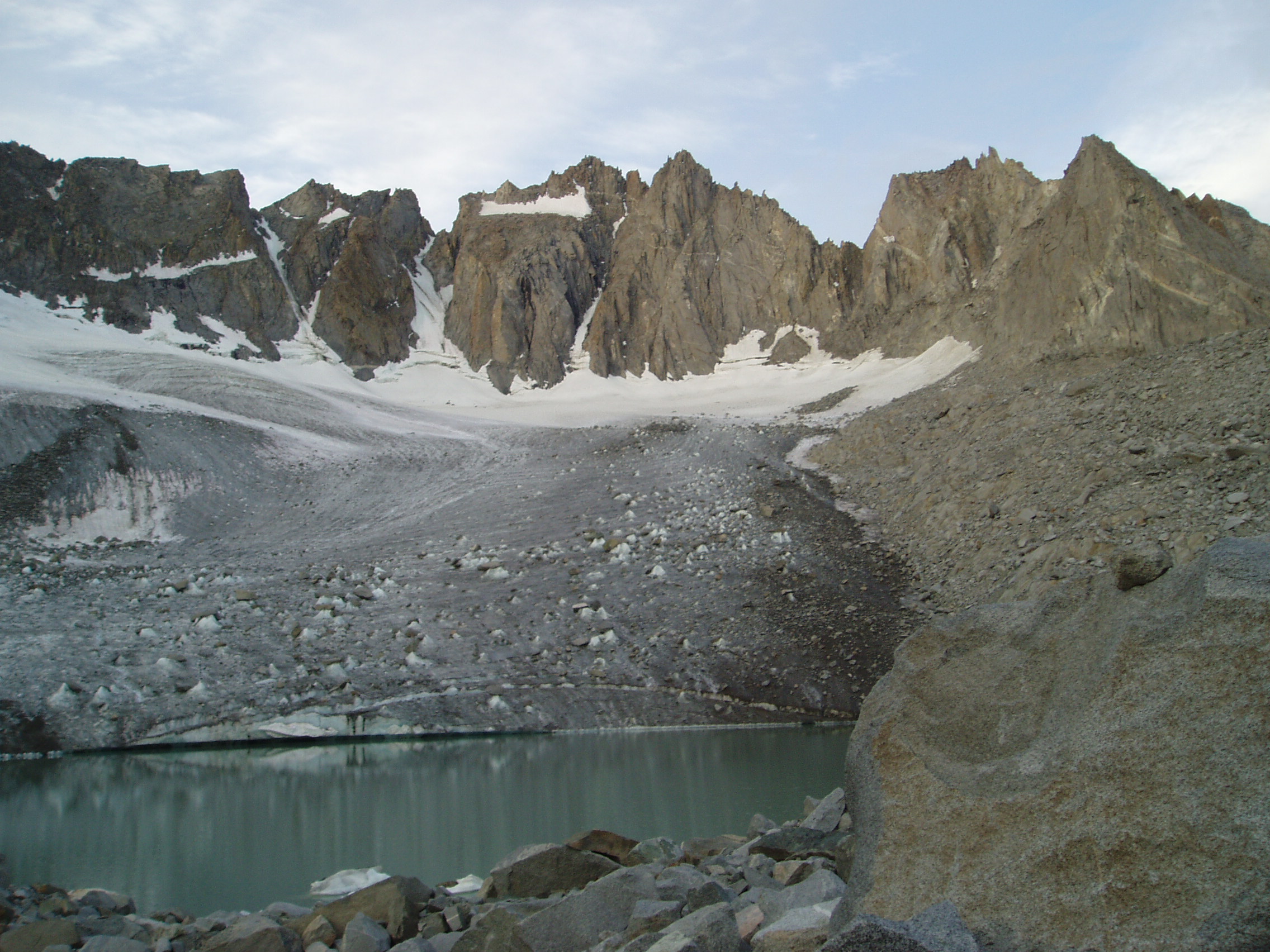
 Thunderbolt, Starlight, North Palisade, and Polemonium Peaks
North Palisade has several named subsidiary peaks (nearby peaks which have less than 300 ft (91 m) of topographic prominence). These all lie on the main ridge crest, and are as follows:
- Polemonium Peak, 14,080+ ft (4,292+ m). Prominence of 160 feet (49 m).[11] This lies between the "U-Notch" and "V-Notch" couloirs (popular snow/ice climbs), 0.15 mi (0.25 km) east-southeast of North Palisade. Named on the USGS topographic map. The peak is named for the Polemonium eximium skypilot (plant) found in the area.[12]
- Starlight Peak, 14,200 feet (4,328 m). Prominence of 80 feet (24 m).[13] This is the northwest summit of North Palisade, less than 0.1 mi (0.15 km) from the main summit. Some climbing routes end atop this peak known for its famous "Milk Bottle", a 20 ft (6.1 m) pillar of rock with huge exposure (class 5.6).
- Thunderbolt Peak, 14,003 feet (4,268 m). Prominence of 223 feet (68 m).[14] About 0.25 mi (0.4 km) northwest of North Palisade. Named on the USGS topographic map. The Sierra Club guidebook notes: "This was the last 14,000 foot (4,267 m) peak to be climbed in the Sierra. During a wild storm on the first ascent, a bolt of lightning left Jules Eichorn severely shaken; hence the name".[15]
See also
- California 4000 meter peaks
- List of California fourteeners
- List of highest points in California by county
- Mountain peaks of California
- Mountain peaks of North America
- Mountain peaks of the United States
- Palisades of the Sierra Nevada
References
- ^ The elevation of this summit has been converted from the National Geodetic Vertical Datum of 1929 (NGVD 29) elevation of 14,242 feet (4,341 m) to the North American Vertical Datum of 1988 (NAVD 88) elevation of 14,248 feet (4,343 m). National Geodetic Survey
- ^ a b "California P 2,000 Summits". Peaklist.org. http://www.PeakList.org/USlists/CAP2000.html. Retrieved 2008-09-08.
- ^ "Sierra Peaks Section List". Angeles Chapter, Sierra Club. http://angeles.sierraclub.org/sps/spslist.pdf. Retrieved 2008-09-28.
- ^ a b "North Palisade". Geographic Names Information System, U.S. Geological Survey. 1981-01-19. http://geonames.usgs.gov/pls/gnispublic/f?p=gnispq:3:::NO::P3_FID:264233. Retrieved 2008-11-28.
- ^ "North Palisade". NGS data sheet. U.S. National Geodetic Survey. http://www.ngs.noaa.gov/cgi-bin/ds_mark.prl?PidBox=HR2629. Retrieved 2009-12-11.
- ^ a b Porcella, Stephen; Cameron M. Burns. Climbing California's Fourteeners: 183 Routes to the Fifteen Highest Peaks. Seattle: The Mountaineers Books. ISBN 0898865557.
- ^ a b c Farquhar, Francis P. (1926). Place Names of the High Sierra. San Francisco: Sierra Club. http://www.yosemite.ca.us/library/place_names_of_the_high_sierra/n.html. Retrieved 2008-11-28.
- ^ a b Secor, R.J.. The High Sierra: Peaks, Passes and Trails (2nd ed.). Seattle: The Mountaineers Books. pp. 241–247. ISBN 0-89886-625-1.
- ^ Dorworth, Dick (January 7, 2009). "A mountain by any other name". Idaho Mountain Express and Guide. http://www.mtexpress.com/index2.php?ID=2005124273. Retrieved 2009-12-11.
- ^ Anton, Mike (November 13, 2008). "Admirers of environmentalist seek a monument 14,242 feet high". Los Angeles Times. http://www.latimes.com/news/local/la-me-brower13-2008nov13,0,972816,full.story. Retrieved 2009-12-11.
- ^ "Polemonium Peak, California". Peakbagger.com. http://www.peakbagger.com/peak.aspx?pid=2728.
- ^ "Polemonium Peak". Geographic Names Information System, U.S. Geological Survey. http://geonames.usgs.gov/pls/gnispublic/f?p=gnispq:3:::NO::P3_FID:274665. Retrieved 2009-12-11.
- ^ "Starlight Peak, California". Peakbagger.com. http://www.peakbagger.com/peak.aspx?pid=16763.
- ^ "Thunderbolt Peak, California". Peakbagger.com. http://www.peakbagger.com/peak.aspx?pid=2725.
- ^ Roper, Steve (1976). The Climber's Guide to the High Sierra. San Francisco: Sierra Club Books. ISBN 0-87156-147-6.
External links
- "North Palisade". Bivouac.com. http://www.bivouac.com/MtnPg.asp?MtnId=12989.
- "North Palisad". SummitPost.org. http://www.summitpost.org/page/150406.
- "North Palisade - Aerial view (Including Subsidiary Peaks)". Timberline Trails. http://timberlinetrails.net/NorthPalisadeAerialPhoto.html.
- "Climbing North Palisade via the U-Notch Couloir". SierraDescents.com. http://www.sierradescents.com/climbing/north-palisade/u-notch-couloir.html.
Categories:- Fourteeners of California
- United States National Park high points
- Mountains of Kings Canyon National Park
- Mountains of the John Muir Wilderness
- Mountains of Inyo County, California
- Mountains of Fresno County, California

Wikimedia Foundation. 2010.