- Cherwell Valley services
-
Cherwell Valley Services 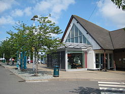
The former main building County Oxfordshire Road M40 Coordinates 51°56′57″N 1°11′55″W / 51.949116°N 1.198555°WCoordinates: 51°56′57″N 1°11′55″W / 51.949116°N 1.198555°W Operator Moto Hospitality Date opened 1994 Website Moto 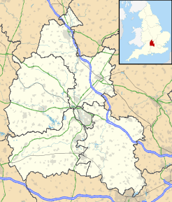
 Cherwell Valley services (Oxfordshire)
Cherwell Valley services is a motorway service station on the M40 motorway near Bicester in Oxfordshire, England. In August 2011 it was rated as 3 stars by quality assessors at Visit England;[1] however, it is unknown whether this was a rating of the new or temporary building.[2]
Contents
History
It was opened in 1994 and gave the 89-mile motorway its first service station, four years after its completion. The site was previously occupied by a toilet facility, which had been there since the motorway's opening.
Three more service stations have since been added on the M40:
A Travelodge has existed at the service station since its opening.
Facilities
The following facilities are available at Cherwell Valley:[2]
- Costa Coffee
- Burger King
- Upper Crust
- Krispy Kreme (Donuts Stand)
- The Eat & Drinks Company
- Marks & Spencer (Simply Food)
- WHSmith
- Fonebitz
- Lucky Coin (Gaming)
- Full House (Gaming)
- Travelodge Motel
- Cash Machine
- Payphones
- Toilets
- Kids Play Area
- Moto Meeting (Meeting Room)
- Esso Fuel
Location
The services are located at junction 10 of the M40, and are accessed from a roundabout on the junction.
2010 fire
On 15 April 2010, the main building was destroyed by fire.[3][4] The main site was to be rebuilt to a similar style to Wetherby services on the A1(M).[5] Construction on the new building started on 27 June 2010 and was completed for reopening on 30 June 2011.[6]
References
- ^ "Consultancy Services". Visit England. http://www.visitengland.org/busdev/bussupport/qadays/Consultancy.aspx. Retrieved 9 November 2011.
- ^ a b "Cherwell Valley". Motorway Services Online. http://motorwayservicesonline.co.uk/Cherwell_Valley. Retrieved 9 November 2011.
- ^ "Fire destroys M40 Cherwell Valley services". BBC News Channel. 15 April 2010. http://news.bbc.co.uk/1/hi/england/oxfordshire/8622754.stm. Retrieved 16 April 2010.
- ^ Shepherd, Tom (15 April 2010). "Fire destroys Cherwell Valley Services". Oxford Mail. http://www.oxfordmail.co.uk/news/8101767.UPDATE__Fire_destroys_Cherwell_Valley_Services/. Retrieved 15 April 2010.
- ^ "unknown". Cherwell District Council. http://cherweb.cherwell-dc.gov.uk/AnitePublicDocs/05997903.pdf.[dead link]
- ^ "Cherwell Valley Services on M40 reopens after fire". BBC News Oxford. 29 June 2011. http://www.bbc.co.uk/news/uk-england-oxfordshire-13963700. Retrieved 9 November 2011.
External links
- Moto official site — Cherwell Valley
- Motorway Services Online — Cherwell Valley
- Motorway Services Info — Cherwell Valley
Previous:
OxfordMotorway service stations on the
M40 motorwayNext:
WarwickMoto Hospitality Locations Bridgwater · Burton-in-Kendal · Cardiff West · Cherwell Valley · Chieveley · Doncaster North · Donington Park · Exeter · Frankley · Heston · Hilton Park · Grantham North · Kinross · Knutsford · Lancaster Forton · Leigh Delamere · Medway · Pease Pottage · Reading · Scotch Corner · Severn View · Southwaite · Stafford (northbound) · Stirling · Swansea · Tamworth · Thurrock · Toddington · Trowell · Wetherby · Winchester · Woolley Edge · TodhillsFood franchises Burger King · Eat & Drink Co · Harry Ramsden's · Upper Crust · Greggs · Domino's Pizza · Costa Coffee · Krispy Kreme · West Cornwall Pasty Company ·Retail franchises Fuel franchises Accomodation franchises Facilities Categories:- 1994 establishments
- M40 motorway service stations
- Moto motorway service stations
- Buildings and structures in Oxfordshire
- Transport in Oxfordshire


Wikimedia Foundation. 2010.