- Tai Mo Shan
-
Tai Mo Shan 
Tai Mo Shan, viewed from Tai To YanElevation 957 m (3,140 ft) Location Location of Tai Mo Shan in Hong Kong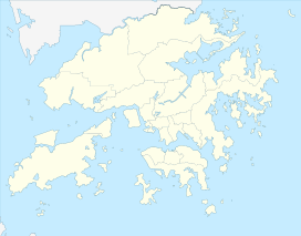
 Tai Mo Shan
Location Centre of the New Territories,  Hong Kong
Coordinates 22°24′42.52″N 114°7′23.32″E / 22.4118111°N 114.1231444°ECoordinates: 22°24′42.52″N 114°7′23.32″E / 22.4118111°N 114.1231444°E  Tai Mo Shan Road, and Tai Mo Shan peak in distance
 Tai Mo Shan capped in the mist
 Tai Po, as seen from top of Tai Mo Shan. MacLehose Trail Stage 8 is visible on the ridge of the mountain on the right.
Tai Mo Shan (Chinese: 大帽山; pinyin: Dàmàoshān / Dàmào Shān=Big Hat Mountain; Cantonese Yale: daaih mouh sāān; also traditional Chinese: 大霧山; simplified Chinese: 大雾山; pinyin: Dàwùshān / Dàwù Shān Foggy Mountain; Cantonese Yale: daaih mouh sāān) has the highest peak in Hong Kong, with an altitude of 957 m. It is located approximately at the geographical centre of the New Territories.
The area surrounding Tai Mo Shan is a country park, which covers an area of 14.40 km² and adopts the same name - Tai Mo Shan Country Park. It is located to the north of Tai Lam Country Park
Contents
Geology
Tai Mo Shan is made up of volcanic rocks of Jurassic age.[1] The volcanic rocks are mainly coarse ash crystal tuff.[2] To the northwest, the west and the south of the peak, the valleys contain large deposits of colluvium. The upper slopes are distinctly "ribbed", as is especially evident after a hill fire. These are stone terraces, running obliquely downhill to the valleys. It is also claimed to be Hong Kong's most misty area due to it being covered in clouds almost daily.
It is rather easy to hike to the peak as there is a road all the way at a comfortable gradient. One cannot actually reach the highest point on Tai Mo Shan as it is occupied by a Hong Kong Observatory (ex-RAF) weather radar station.
Vegetation
There are forest plantations in the southeastern part of the park. Limited by climatic and geographic factors, these plantations end at the 550 metre contour, above which shrubs and grasses dominate.
In the past, Tai Mo Shan was famous for a type of green tea, called mist or cloud tea, which grew wild up on the mountain side. Occasionally, local people can still be seen picking the tea shoots for brewing green tea.
Camellia sinensis var. waldenae (formerly Camellia waldenae) are found on the mountain.
Wildlife
Some montane birds and rare species of snakes and butterflies breed here. There are also freshwater crabs, feral dogs, feral cats, oxen and wild boar.
Places of interest
A series of barbecue and picnic sites are provided along Route Twisk, the Shek Kong - Pat Heung catchwater and the Tuen Mun catchwater.
The Rotary Park at Tai Mo Shan which has a car-park and extensive picnic facilities, is especially popular. Tourist groups often come here for a brief stop to enjoy the panoramic view. On a clear day even Lantau and its adjacent islands can be seen. Tai Mo Shan Visitor Centre is located not far away from the carpark, along Tai Mo Shan Road, which leads to the weather station on the top of the mountain.
There is a Hiking Practice Trail for learning the techniques of hiking adjacent to the Tai Mo Shan car park. Those who would prefer short walks may visit the family walks in the park.
The country code
Visitors in country parks are asked to help keep the parks clean and prevent hill fires so that the facilities can be enjoyed by all. In 1986, a 34 hour blaze destroyed 282,500 trees at Shing Mun and Tai Mo Shan and ravaged 7.40 km² of countryside. Fire is the greatest threat to the beauty of the country parks.
Transportation
Servicing the entrance of Tai Mo Shan Country Park, is Route Twisk's route 51, operating between Tsuen Wan Nina Tower I (near Tsuen Wan West MTR Station) and Kam Sheung Road MTR Station at approximately 30-minute intervals. The bus also stops at Tsuen Wan MTR Station. (HK$7.80)
Cycling
Cyclists can sometimes be seen cycling up Tai Mo Shan on Route Twisk as part of their hill training regimen. The road is narrow at times and can be dangerous. In the winter, if the weather is cold there is frost on the top of the mountain, little icicles form on the trees. Temperatures can fall below 0 degrees Celsius.
See also
- Geography of Hong Kong
- Country parks and conservation in Hong Kong
- List of areas of Hong Kong
- List of mountains, peaks and hills in Hong Kong
Notes and references
- ^ "8 Mesozoic Post-Volcanic and Tertiary Sedimentary Rocks". CEDD. http://www.cedd.gov.hk/eng/about/organisation/pvtert.htm. Retrieved 20 December 2008.
- ^ R.J. Sewell, S.D.G. Campbell, C.J.N. Fletcher, K.W. Lai & P.A. Kirk (2000). The Pre-Quaternary Geology of Hong Kong. Government of Hong Kong SAR. ISBN 9620202996.
- Initial text based on information provided by the Hong Kong Agriculture, Fisheries and Conservation Department (AFCD), under the provision that the re-dissemination or reproduction is for non-commercial use. [1]
External links
Conservation designations in Hong Kong Country parks New Territories EastClear Water Bay · Kam Shan · Kiu Tsui · Lion Rock · Ma On Shan · Pat Sin Leng · Plover Cove · Plover Cove (Ext.) · Sai Kung East · Sai Kung West · Sai Kung West (Wan Tsai Ext.)New Territories WestSpecial Areas Marine parks See also: Site of Special Scientific InterestCategories:- Mountains, peaks and hills of Hong Kong
- Country parks and special areas of Hong Kong
- Volcanism of Hong Kong
- Jurassic volcanism
- Extreme points of Hong Kong


Wikimedia Foundation. 2010.