- Olivers Battery
-
For other uses, see Oliver's Battery (disambiguation).
Coordinates: 51°02′42″N 1°21′08″W / 51.0450°N 1.3523°W
Oliver's Battery 
The earthworks and shops in Oliver's Battery Road South.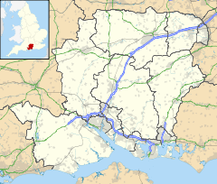
 Oliver's Battery
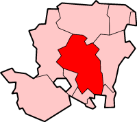
Oliver's Battery shown within HampshirePopulation 1,600 OS grid reference SU458277 - London 62.2m District Winchester Shire county Hampshire Region South East Country England Sovereign state United Kingdom Post town Winchester Postcode district SO22 Dialling code 01962 Police Hampshire Fire Hampshire Ambulance South Central EU Parliament South East England UK Parliament Winchester List of places: UK • England • Hampshire Olivers Battery (sometimes known as Oliver's Battery) is a civil parish in Hampshire, England, of some 700 households located just to the south of the City of Winchester. The parish was founded in 1956 on land that was formerly part of Compton parish. The parish does not include the whole of the settlement known informally as Oliver's Battery, with the northern boundary following the A3090 and therefore excluding Oliver's Battery Road North. It is the area where England International footballer Wayne Bridge was raised.[citation needed]
Contents
History
The name Olivers Battery refers to a prominent iron age earthwork. A fine Anglo-Saxon bowl [1] from a burial within the Battery [2] was on show for many years at the British Museum, but has now been returned to Winchester City Museum on long term loan [3]. The parish also contains a number of bronze age burial mounds. The Olivers Battery name dates back to the English Civil War and is specifically associated with Oliver Cromwell's siege of Winchester in 1645. A map of 1780 refers to the area as "Cromwell's Camp" and later maps show it as "Oliver Cromwell's Battery". The ancient earthwork may well have provided a suitable campsite for the besieging Parliamentarian forces, but cannon of the period would have lacked the range to fire on Winchester Castle and city walls from the so-called battery site.
For centuries, Olivers Battery was open downland grazed by sheep. Permanent settlements only appeared in the early years of the twentieth century with the establishment of a military camp. During the First World War the army maintained an extensive Veterinary Hospital for horses. After the war, the camp was split up into small holdings with army huts being used as dwellings. Gradually, a community developed as huts were replaced with houses and other homes were built.
In the late 1970s the community was bisected by Badger Farm Road (now the A3090), which acts as a south-western ring road for Winchester. A southern Winchester park-and-ride scheme opened in 2010 and is intended to reduce rush-hour congestion on this road [1].
Facilities
There is a local shopping centre built in the 1960s, with Sub Post Office. A small Anglican church, St Mark's, doubles up as a village hall and there is also a Catholic church, St Stephen's. Oliver's Battery Primary School was opened in 1973. St Peter's Catholic Primary School was built in the 1990s (having originated in Winchester in the 1850s), next to St Stephen's. The Catholic school and church are in Oliver's Battery Road North, and therefore not within the civil parish. There is no secondary school, but Kings' School is within walking distance.
Further reading
David Farmer, 2000, A Brief History of Oliver's Battery (pamphlet)
References
External links
- Parish homepage
- Oliver's Battery Primary School
- St Peter's Catholic School
- Oliver's Battery Countryside Group
Categories:- Civil parishes in Winchester
- History of Winchester
- Villages in Hampshire


Wikimedia Foundation. 2010.