- Merewether, New South Wales
-
Merewether
Newcastle, New South Wales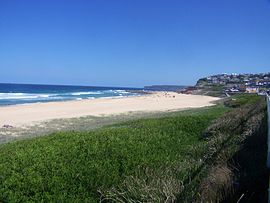
Merewether Beach.Population: 10,368[1] • Density: 3049.4/km² (7,897.9/sq mi) Note1 Established: 1890 Postcode: 2291 Coordinates: 32°56′34″S 151°45′9″E / 32.94278°S 151.7525°ECoordinates: 32°56′34″S 151°45′9″E / 32.94278°S 151.7525°E Area: 6.1 km² (2.4 sq mi) Location: - 3 km (2 mi) SW of Newcastle
- 6 km (4 mi) ESE of Charlestown
LGA: City of Newcastle Region: Hunter County: Northumberland Parish: Newcastle State District: Newcastle Federal Division: Newcastle Suburbs around Merewether: Adamstown Hamilton South, The Junction Bar Beach Adamstown, Merewether Heights Merewether Pacific Ocean Highfields Whitebridge, Pacific Ocean Pacific Ocean Merewether is a suburb of Newcastle, New South Wales, Australia, located 3 km (2 mi) from Newcastle's central business district with a population of around 10,000. The suburb stretches 3 km (2 mi) from Merewether Beach in the east to Adamstown in the west.
Contents
Establishment
Merewether was originally part of the Burwood Estate, and takes its name from the owner, Edward Christopher Merewether. The Church of England parish church is St.Augustine, in Llewellyn Street, the land and cost of erection met by Mr. Edward Merewether. It became the centre of a new Provisional District in the Diocese of Newcastle in 1890. In 1891 the Census gave the population as 4,700. Merewether was incorporated as a Municipality in 1885, covering 1,110 acres (4.5 km2) and 31 km (19 mi) of streets. The Mayor in 1901 was David Lloyd, a funeral director who resided in Railway Street. The former Council Chambers, opposite the Post Office, are today the clubhouse of the Australian Returned Services League. In 1938 an Act of the New South Wales Parliament created a "City of Greater Newcastle", incorporating 11 municipalities into one local government area, including Merewether.
Industries
The dominant industry within the old municipality was coal mining, with the last colliery, at Glebe, not closing until 1959 due to an industry slump. This was served by a railway which left the main Government line in the city centre, crossed the main Hunter Street, passed down the centre of Burwood Street, crossed Newcastle's Civic Park, passed under Laman Street and continued along its own permanent way through the suburb of Cook's Hill, to The Junction, past its school then up Merewether Street embankment crossing Llewellyn, Caldwell & Ridge Streets, past the telephone exchange, up Morgan Street, crossing Yule Road to the Newcastle Coal Mining Company's colliery complex.[2] The privately operated railway included Australia's first 2 railway tunnels, built in 1861 & 1862 respectfully, that were cut under Merewether Bluff.[3]
The Happy Valley Colliery (tunnel), opposite Rowan Street, and worked by the Maheen family, also closed about the same time.
Coal mining also took place to the south of Merewether at Murdering Gully, on Burwood Beach. That area is now part of the Glenrock State Conservation Area. Access to this colliery was via a railway which ran from The Junction past Merewether Beach and through two tunnels directly above the Ocean Baths. This colliery, consisting of a number of tunnels which fed a large coal loader above the beach, closed down during the 1949 miners' strike and did not reopen.
Merewether also once had extensive pottery works and brickyards, the last to close being Hughes' Pottery, opposite The Junction School, in the last two decades of the 20th century.
-

Merewether's Glebe Colliery, c1900.
-

Coal-loader for Glenrock Colliery, Murdering Gully, Merewether, c1940
-

The last coal train leaves Glebe colliery and is about to cross Yule Road, 1959.
Beaches
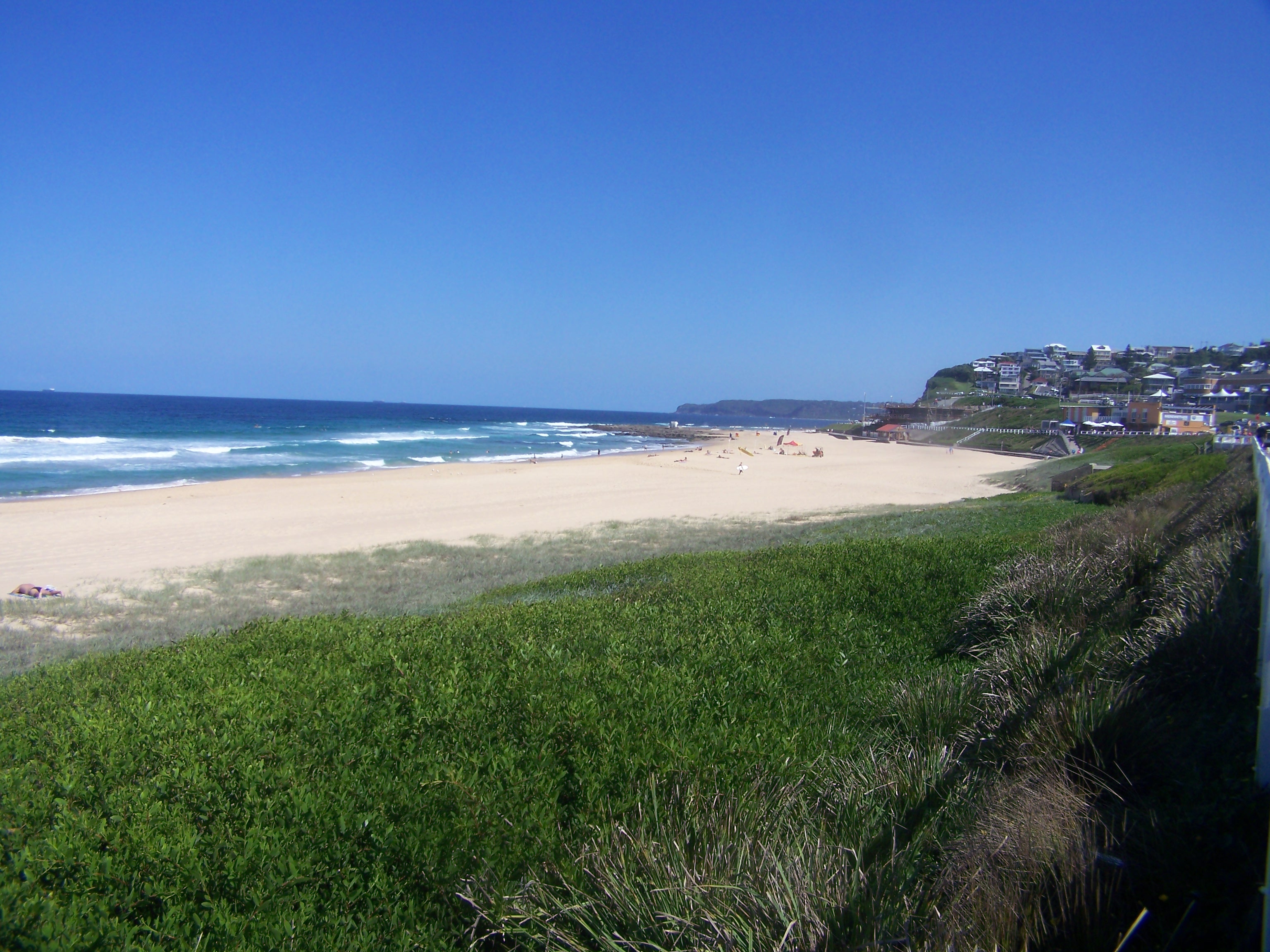
 Looking towards Merewether's beaches, taken from above Bar Beach looking south.
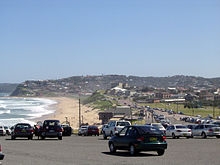
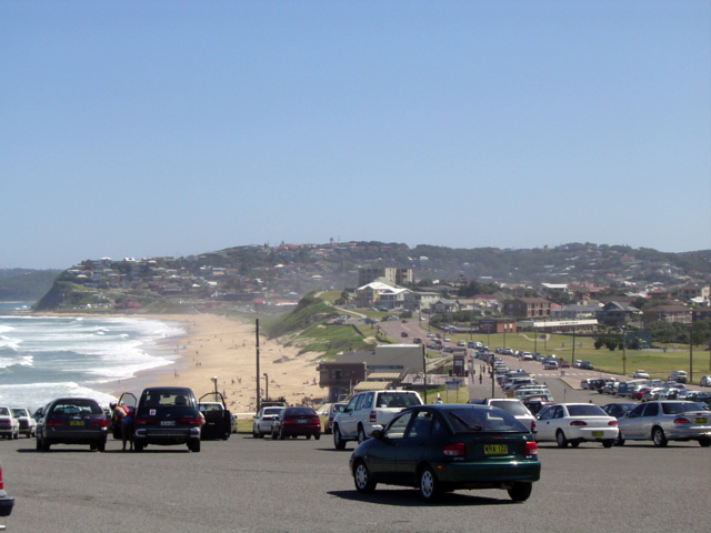
The suburb of Merewether includes some of Newcastle's most famous beaches. Dixon Park Beach leads south onto Merewether Beach and a little further to the small Ladys Beach and the more isolated Burwood Beach which leads to Glenrock Lagoon. At the southern end of Merewether Beach are the Merewether Ocean Baths, the largest ocean baths in the Southern Hemisphere. Merewether Beach is home to Merewether SLSC the oldest lifesaving club in the Hunter Region[4] and the Merewether Surfboard Club the most successful boardriders club in Australia
In 2006, organisers of Newcastle Surfest announced that the competition would be moving from Newcastle Beach to Merewether Beach, in order to capitalise on the beaches superior surfing conditions, caused by the rock bottom of the beach, compared to the mud bottom of Newcastle Beach.
Professional Surfer Mark Richards is a resident of Merewether.
Education
 Earthquake damage to the Boy's dept., at The Junction School, April 1990.
 The Junction School, 1960, before most of it was destroyed in the Dec 1989 earthquake. Left is the Infants School, centre the Girl's School, and right, the Boys School.
There are two primary schools in the suburb - Merewether Public [State] School in Henry Street at the Glebe and the Catholic Holy Family Primary School in Janet Street. Two more, Merewether Heights Public School on Scenic Drive and The Junction Public School (founded in 1872) are located in Merewether Heights and The Junction respectively, on the borders that those suburbs share with Merewether.[5] Pupils from the schools feed into the secondary schools of Newcastle High School, the Catholic St Pius X college at Adamstown or the Anglican-affiliated Newcastle Grammar School. Merewether High School, an academic selective public school, is actually located 600 m (1,969 ft) from Merewether in the suburb of Broadmeadow.
General
 Opening of the new Merewether Bowling Club-house, 1967. L to R: Frank Brent, past President of the Northern District Bowling Association, Ray Simmons, NDBA President, and Wal Frost, Club President.
Merewether, once served by electric tramways to the city, and today by buses, has excellent road connections to all sections of Newcastle and the major highways which serve it. Merewether's oldest mansion is Hillcrest, originally the residence of the Merewether family. Above it is the Scenic Drive with many expensive 'modern' homes, which date from the late 1950s upwards, with spectacular views.
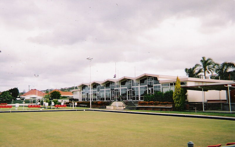
 Merewether Bowling Club.
Following 18 months construction, Merewether Bowling Club, with one green, was opened on 6 February 1954 upon a long-closed old colliery west of the railway line, in Caldwell Street. Following the closure of the railway in 1960 the land it occupied next to the club was purchased and another green established, and on Sunday 12 February 1967, Club President Wallace Frost opened the "magnificent" and extensive new Club House which had cost $100,000 dollars.[6]
At Merewether is the Lingard Private Hospital, in the lower part of Merewether Street.
Notes
- ^ Approximately 44% of Merewether is uninhabited bushland that forms part of the Glenrock State Conservation Area. The density figure represents the average population density in the populated area of the suburb.
References
- ^ Australian Bureau of Statistics (25 October 2007). "Merewether (State Suburb)". 2006 Census QuickStats. http://www.censusdata.abs.gov.au/ABSNavigation/prenav/LocationSearch?collection=Census&period=2006&areacode=SSC14331&producttype=QuickStats&breadcrumb=PL&action=401. Retrieved 2008-01-22.
- ^ "Railway lifted Merewether, Old Glebe Colliery railway". State Library of New South Wales. 1956-08-23. http://libapp.sl.nsw.gov.au/cgi-bin/spydus/FULL/PM/BSEARCH/27/37622,7. Retrieved 2008-01-22.
- ^ Glenrock State Conservation Area, Plan of Management, Department of Environment, Climate Change & Water, NSW National Parks and Wildlife Service, New South Wales Government, September 2010, p.28 (accessed 13 July 2011)
- ^ Watson, Chris (18 October 2007). "Beating back the sea". The Newcastle Herald (John Fairfax Holdings Limited): p. 6 (Supplement).
- ^ "Merewether". Land and Property Management Authority - Spatial Information eXchange. New South Wales Land and Property Management Authority. http://imagery.maps.nsw.gov.au/?role=mysuburb&search=suburb&suburb=Merewether. Retrieved 2008-05-14.
- ^ Newcastle District Bowls Journal, vol.5, no.6, 17 February 1967, (front page report)
Bibliography
- Newcastle - 150 Years, edited by Eric Lingard, Newcastle, 1947.
- The Diocese of Newcastle, by A.P.Elkin, Sydney, 1955.
- Federal Directory of Newcastle and District for 1901, Newcastle, reprinted 1982, ISBN 0-9593518-0-9
External links
- Glenrock Railway & Burwood Colliery
- Newcastle City Council item on Merewether History
- Merewether Weather
Categories:- Suburbs of Newcastle, New South Wales


Wikimedia Foundation. 2010.