- Clisham
-
Clisham An Cliseam 
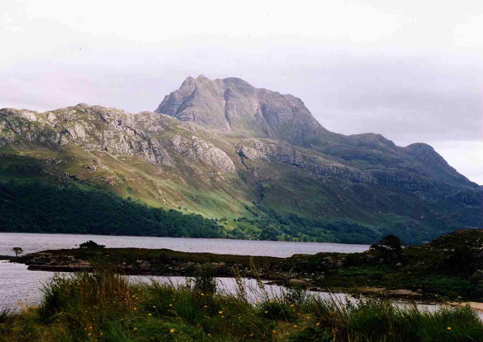
Elevation 799 m (2,621 ft) Prominence 799 m (2,621 ft) Ranked 35th in British Isles Parent peak none - HP Lewis and Harris Listing Corbett, Marilyn Location Location North Harris, Western Isles, Scotland Topo map OS Landranger 13 or 14 OS grid NB154073 The Clisham (Scottish Gaelic: An Cliseam) is a mountain on the island of Harris in the Western Isles of Scotland. At 799 metres (2,621 ft) it is the highest mountain in the Outer Hebrides and the archipelago's only Corbett.
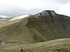
The easiest ascent of the mountain starts from the highest point of the A859 road between Tarbert and Ardvourlie (Aird a' Mhulaidh), and climbs the broad southern shoulder. A longer and more varied expedition starts at a bridge over the Scaladale River (Abhainn Scaladail) near Ardvourlie, from where the minor summit of Tomnabhal (552 metres (1,811 ft)) may be ascended before continuing on to the Clisham. Many walkers taking this option continue west then north along the ridge, taking in the summits of Mulla-Fo-Deas (743 metres (2,438 ft)), Mulla-Fo-Thuath (720 metres (2,362 ft)) and Mullach an Langa (614 metres (2,014 ft)), thus completing a round known as the Clisham Horseshoe.
Coordinates: 57°57′49″N 6°48′50″W / 57.96365°N 6.81396°W
Most prominent hills of Britain Northern Highlands Foinaven · Ben Hee · Ben Hope · Ben Loyal · Ben Klibreck · Ben More Assynt · Canisp · Cùl Mòr · Ben More Coigach · Beinn Dearg · Ben Wyvis · An Teallach · Slioch · Sgùrr Mòr (Fannichs) · Fionn Bheinn · Beinn Alligin · Beinn Eighe · Liathach · Beinn Bhàn · Sgorr Ruadh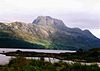
Western Highlands Sgùrr a' Choire Ghlais · Sgùrr na Lapaich · Càrn Eige · Beinn Fhada · Sgùrr Fhuaran · A' Chràlaig · Sgùrr a' Mhaoraich · Gleouraich · Sgùrr nan Eugallt · Ladhar Bheinn · Sgùrr na Cìche · Càrn Mòr · Sròn a' Choire Ghairbh · Sgurr Thuilm · Gaor Bheinn · Rois-bheinn · Sgùrr Ghiubhsachain · Sgùrr Dhòmhnuill · Garbh Bheinn · Creach BheinnCentral and Eastern
HighlandsCreag Meagaidh · Ben Nevis · Stob Coire Easain · Binnein Mòr · Chno Dearg · Ben Alder · Sgor nam Fiannaidh · Beinn a' Bheithir · Beinn Sgulaird · Bidean nam Bian · Ben Macdui · Beinn a' Ghlò · LochnagarSouthern Highlands Islands An Cliseam · Beinn Mhòr (South Uist) · The Storr · Sgùrr Alasdair · Blà Bheinn · Beinn na Caillich · Sgurr na Coinnich · Askival · Ben More (Mull) · Dun da Ghaoithe · Beinn an Òir · Goat Fell · SnaefellScottish Lowlands,
England and WalesMerrick · Broad Law · Scafell Pike · Helvellyn · Skiddaw · Cross Fell · Snowdon · Glyder Fawr · Carnedd Llewelyn · Aran Fawddwy · Cadair Idris · Pen y Fan · Waun FachCategories:- Mountains and hills of the Scottish islands
- Marilyns of Scotland
- Corbetts
- Harris
- Landforms of the Western Isles
- Western Isles geography stubs


Wikimedia Foundation. 2010.