- Mannar Island
-
Mannar
மன்னார்— Island — 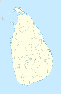
 Mannar
Coordinates: 9°03′0″N 79°50′0″E / 9.05°N 79.833333°E Country Sri Lanka Province Northern District Mannar DS Division Mannar Mannar (Tamil: மன்னார்) Island, formerly called Manar Island, is part of Mannar District, Sri Lanka. It is linked to the rest of Sri Lanka by a causeway.It has an area of about 50 square kilometres, mainly covered with vegetation and sand.
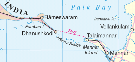
Between 1914 and 1964, there was a train and ferry link from mainland India via Dhanushkodi and Talaimannar to Colombo, but this was not resumed after the disastrous damages caused by a cyclone in 1964.
The island is dry and barren; fishing is economically important.[1]
It main settlements are Mannar and Erukkulampiddi on its eastern coast and Pesalai on its northern coast, all connected by the A14 road which leads across the bridge to mainland Sri Lanka[2][3]
 Mannar Island and adjacent Adam's Bridge
Coordinates: 9°03′N 79°50′E / 9.05°N 79.833°E
References
- ^ Britannica article.
- ^ Google. Google Maps (Map).
- ^ Microsoft and Harris Corporation Earthstar Geographics LLC. Bing Maps (Map).
Categories:- Islands of Sri Lanka
- Mannar District
- Tamil stubs
- Northern Province, Sri Lanka geography stubs

Wikimedia Foundation. 2010.