- Killucan and Rathwire
Infobox Irish Place
name = Killucan
gaeilge = "Cill Lucaine"
crest
motto =
map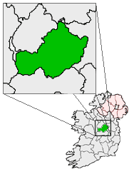
pin coords = left: 100px; top: 65px
north coord = 53.5050
west coord = 7.1469
irish grid = N566514
area =
elevation = 128m
province =Leinster
county =County Westmeath
town pop = 575
rural pop =
census yr = 2002
web =
|The villages of Killucan ( _ga. Cill Lucaine, Church of Lucan) and Rathwire ( _ga. Ráth Guaire, Fort of Guaire) nestle closely together in gentle, rolling countryside in the east of the Irish
County Westmeath . They have a combined population of 575 (2002census ) but this will be considerably expanded with this year's (2006) census. Killucan is on theR156 road about km to mi | 15 | abbr=yes | precision=0 fromMullingar and km to mi | 60 | abbr=yes | precision=0 fromDublin .Local economy
The villages have prospered throughout their history due to their excellent land and transport links to
Dublin . TheRoyal Canal , the Sligo-Dublin railway line pass through the area although neither is used as a mode of transport any more. Thecanal is impractical while the railway station closed many years ago (although the line remains in use). Killucan and its neighbouring village of Rathwire have recently prospered due to their proximity to the M4motorway to Dublin which means it is less than an hour's drive away, well within Dublin's ever expandingcommuter belt . This has led to the construction of many new housing estates in recent years as theCeltic Tiger has led to many new houses being needed within reach of Dublin. Killucan/Rathwire was well suited to this rapid expansion as it had many of the facilities needed for an increased population, unlike many other of the small towns in Ireland which have rapidly grown recently. There are three primary schools and one secondary school in the area as well as ample sport facilities (such as a free golf course and fishing lake), a library and many other amenities. The majority of its inhabitants work in Dublin or nearby Mullingar. The only large employer in the area is Shay Murtagh's Quarry and concrete production.History of Rathwire
Both Killucan and Rathwire have ancient origins, as indicated by the ancient "Fairy Fort" in Rathwire. According to legend this was built by the Chieftain Guaire who gave Rathwire its name. The ruins of the
hillfort remain on the western end of the village. Legend has it that Guaire is buried in the ruins and is guarded by a savage dog who does not want the remains disturbed. Subsequently the Norman LordHugh de Lacy built his Motte against to the remains of Guaire's. In 1210 the notorious King John came to Rathwire to subdue the De Lacys when he fought and won theBattle of Killucan . While here he also received the Celtic king of Connacht,Cathal Crobderg O'Connor who travelled to make his submission.History of Killucan
The origins of the name Killucan are uncertain. It probably comes from the Irish "Cill Lucaine", (Church of Lucan). Lucan was a 6th century
abbot who is believed to have founded amonastery in the area. The monastery however did not survive to theMiddle Ages and no trace of it remains today. Some believe that Lucaine is in fact a corruption of Etchén, who was bishop of the nearbyClonfad monastery. Whichever version is correct, the present day church in Killucan is St. Etchén's. There has been a church on this site since the time of the Normans (the De Lacys). The present church on the site dates from 1802. Inside this church is a 13th century font. On the east end of the site are the remains of an 15th centurymedieval church. Although the site was initially used as aCatholic church, it was changed to aprotestant (Anglican ) one during the Cromwellian Plantation. After the Penal Laws persecuting Catholics were lifted in the 19th century a new Catholic church,St Joseph 's was built in Rathwire.Killucan Parish
The
Parish of Killucan is one of the largest in Westmeath (by area). It includes both Killucan and Rathwire as well as the countryside around them. The village ofRaharney about km to mi | 4 | abbr=yes | precision=1 to the east of Killucan is also part of Killucan parish. St. Joseph's Church is in Rathwire while St. Mary's is in Raharney. TheParish Priest 's house (Parochial House ) is in RathwireTransport
The Royal Canal
The twin villages reached the height of their prosperity during the 18th and 19th centuries due to the arrival of first the
Royal Canal in 1805 and later theMidland Great Western Railway . The canal which stretches km to mi | 15 | abbr=yes | precision=0 from Dublin to theriver Shannon atCloondara inCounty Longford was built between 1790 and 1817, reaching Killucan from Dublin in 1805. It grew in importance transporting people and goods until the mid 1800s. After this the advent of rail and road travel in Ireland led to its slow decline and it formally closed in 1961. It was abandoned and became unusable for many years. Nowadays thanks to theRoyal Canal Amenity Group it has been restored for leisure boats from Dublin toAbbeyshrule in Co. Longford. The remaining section from Abbeyshrule to Cloondara was due to open in 2006. It is to walk the entire length using theRoyal Canal Way . The Canal is a particularly important amenity in Killucan, being used forfishing , walks, boating and even canoeing. The Harbour at Thomastown (1 kilometer South of Killucan) was recently expanded to cater for the growing number of tourists who rentbarges from there. The canal through Killucan passes through the Killucan Flight, a stretch of eight locks over km to mi | 2 | abbr=yes | precision=0 . East of the flight there are no further locks for km to mi | 27 | abbr=yes | precision=0 while there are no further locks to the east until past Mullingar, the highest point on the Canal.Railway
The
Midland Great Western Railway reached the town in 1848, when their railway line was extended fromHill of Down toMullingar . The station closed in 1963. The signal cabin remained open until 2005 when automated signaling was introduced. Recently there has been talk of the train station being reopened, althoughIrish Rail , the state owned railway company, have rejected the suggestion.ee also
*
List of towns in the Republic of Ireland
*Market Houses in the Republic of Ireland External links
* [http://homepage.eircom.net/~rcag/home.html Royal Canal Amenity Group]
* [http://www.shaymurtagh.ie/ Shay Murtagh Precast]
* [http://homepage.eircom.net/~gerryo/main.html Killucan Web Pages]
* [http://www.killucan.com/index.htm Killucan On Line]
* [http://www.fallingrain.com/world/EI/29/Rathwire.html Rathwire, Ireland Page]
Wikimedia Foundation. 2010.