Serviceton, Victoria

Serviceton, Victoria

Infobox Australian Place | type = town
name = Serviceton
state = vic


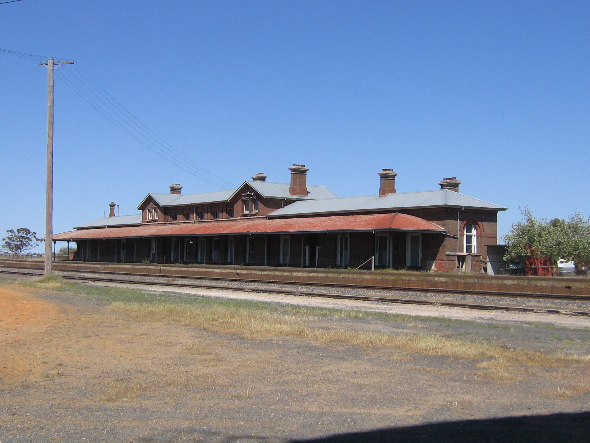
caption = Platform side of Serviceton railway station
lga = Shire of West Wimmera
postcode = 3420
est = 1887
pop = 377
elevation= 119
maxtemp = 21.2
mintemp = 8.1
rainfall = 490
stategov = Lowan
fedgov = Mallee
dist1 = 437
location1= Melbourne
dist2 = 294
location2= Adelaide (SA)
dist3 = 139
location3= Horsham
dist4 =
location4=

Serviceton is a small town in Victoria, Australia, located near the Victorian-South Australian border, 437 kilometres north-west of Melbourne. The town was named after James Service, Premier of Victoria in 1880 and from 1883-86. At the 2006 census, Serviceton and the surrounding area had a population of 377.Census 2006 AUS
id=SSC26597
name=Serviceton (State Suburb)
accessdate=2007-08-07
quick=on
]

When the Victorian and South Australian railways were joined at the old border in 1887, a station was built on the border. The border was intended to be on the 141st meridian east but, owing to a surveying error, border markers were placed 3.6 km west of the meridian. Victoria finally succeeded in having the erroneously surveyed border declared to be the legal border in 1913, and therefore Serviceton is now fully in Victoria. The station is not used but The Overland passes through the town. [cite web
title =Serviceton
work =Travel
publisher =The Sydney Morning Herald
date =February 8 2004
url =http://www.smh.com.au/news/Victoria/Serviceton/2005/02/17/1108500207300.html
accessdate = 2007-02-05
] Nevertheless, the old South Australian Railways, and its successors, the Australian National Railways Commission, the National Rail Corporation and the Australian Rail Track Corporation have continued to own the railway to Serviceton outright.

The town is the subject of a Tom Waits song entitled "Town With No Cheer" from his album Swordfishtrombones. [cite web |url=http://www.ripcat.free-online.co.uk/waitshtml/swordfishtromboneslyrics.htm#Swordfishtrombones |title=Swordfishtrombones - Lyrics |accessdate=2007-08-07 |publisher=Ripcat]

Notes


Wikimedia Foundation. 2010.

Игры ⚽ Нужно сделать НИР?

Look at other dictionaries:

  • Serviceton — La gare de Serviceton Administration Pays …   Wikipédia en Français

  • Serviceton railway line, Victoria — VictorianRailwayLineInfobox type = vic name = Serviceton yearcommenced = yearopened = 1862 yearcompleted = to South Australian border in 1887 yearclosed = fate = lengthkm = stations = tracks = Single broad gauge to Ararat, standard gauge beyond… …   Wikipedia

  • List of localities in Victoria (Australia) — Map of Local Government Areas in Victoria This is a list of locality names and populated place names in the state of Victoria, Australia, outside the Melbourne metropolitan area. It is organised by region from the south west of the state to the… …   Wikipedia

  • List of closed railway stations in Victoria — This is a list of former railway stations and railway lines in Victoria, Australia. Many of these stations and lines have abandoned or demolished. For closed railway station in suburban Melbourne see List of closed railway stations in… …   Wikipedia

  • Rail transport in Victoria — Infobox rail railroad name = Railways of Victoria logo filename = logo size = system map caption = Victorian railway network, passenger lines in colour, freight only lines in grey marks = locale = Victoria, Australia start year = 1854 end year =… …   Wikipedia

  • South Australia-Victoria border dispute — The legal and geographic border between the Australian states of South Australia and Victoria was proclaimed in 1836 by Imperial Statute as the 141st degree meridian of longitude east of Greenwich . Due to human error by numerous explorers and… …   Wikipedia

  • Nurcoung, Victoria — Nurcoung Victoria …   Wikipedia

  • Warrenheip railway station, Victoria — VictorianClosedRailwayStation NAME= Warrenheip IMAGELINK=VLine VLocity Warrenheip.jpg CAPTION = V/Line VLocity train passing the junction at Warrenheip LINE=Serviceton DISTANCE=107.20 km PLATFORMS= 1 TRACKS= 2 STATUS=Closed OPENED=February 1 1873 …   Wikipedia

  • Minimay, Victoria — Minimay Victoria Entry into Minimay with the population signposted …   Wikipedia

  • Nhill railway station, Victoria — VlineRailwayStation1 NAME=Nhill CODE=NHL DISTANCE=399.69 km LINES=Serviceton line PLATFORMS=1 TRACKS=1 (1 SG) STATUS=Unmanned FACILITIES= [http://www.viclink.com.au/stop/view/20616 Link] TIMETABLES=Link MELWAYORVICROADS= MELWAY=Nhill railway… …   Wikipedia

Share the article and excerpts

Direct link
Do a right-click on the link above
and select “Copy Link”