- Microdistrict
-
 One of the typical Tbilisi microdistricts
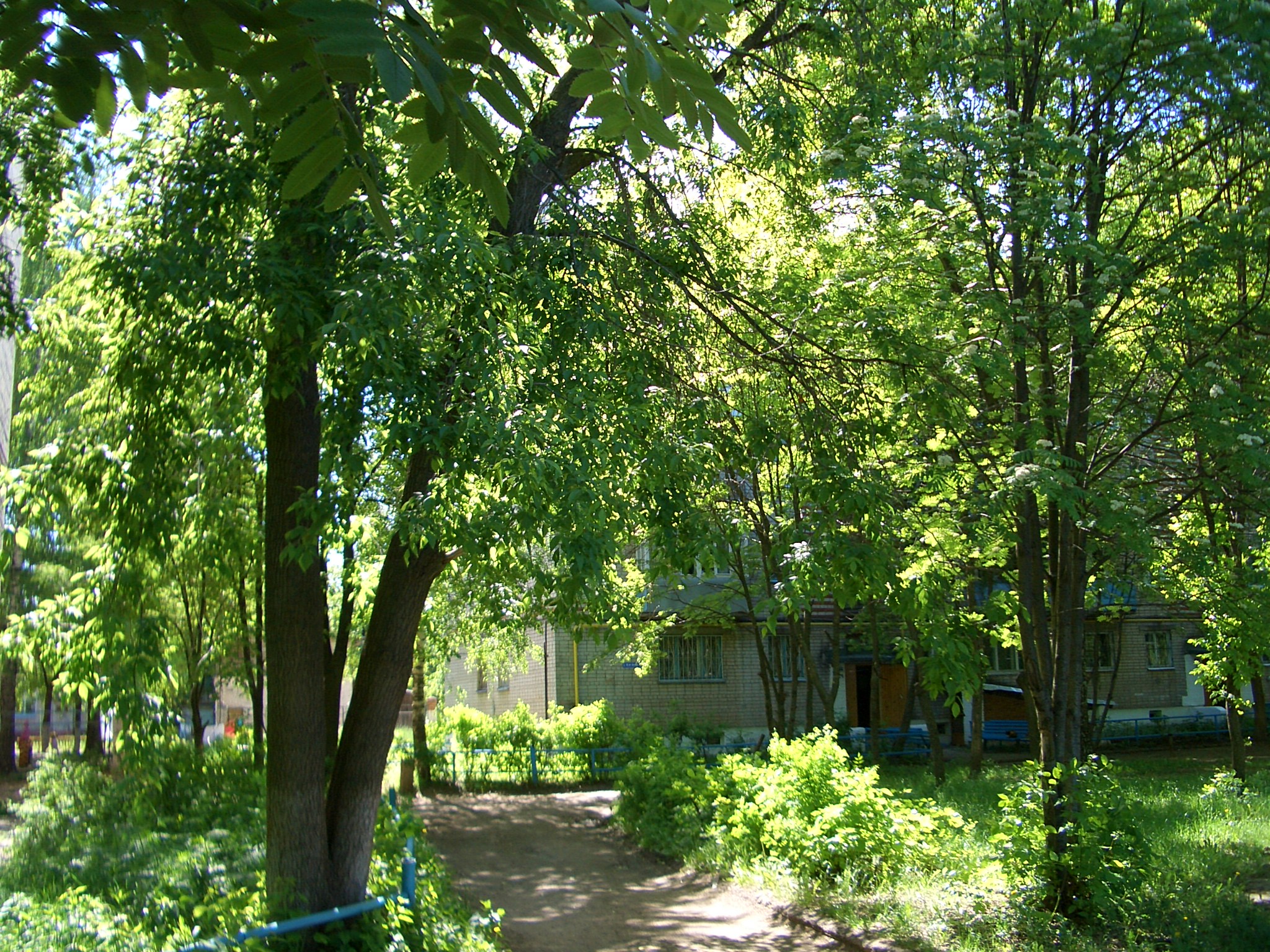
 Inside 1st Microraion, Kstovo, Russia. This district was built in the late 1960s, and by the 2000s the trees have grown taller than the 5-story apartment buildings.
 16th Microdistrict of Zelenograd, Russia
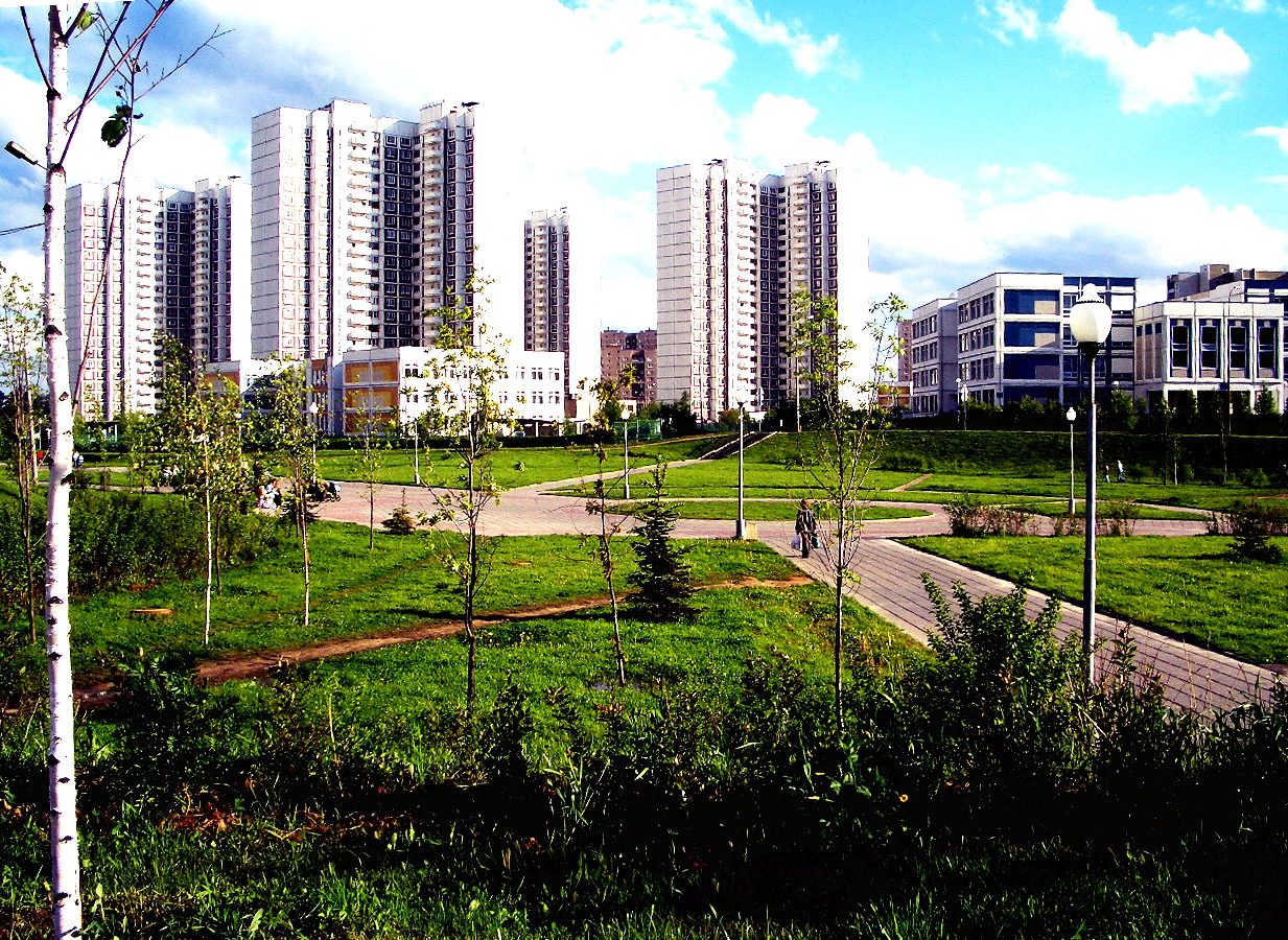
 Bragino miscrodistrict in Yaroslavl, Russia
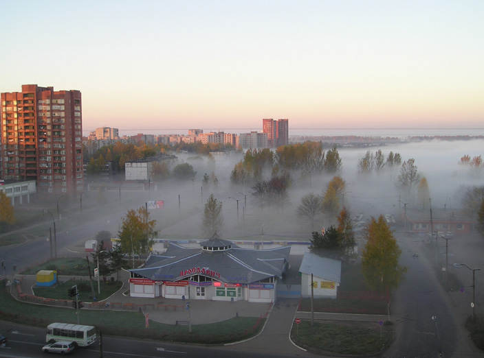
Microdistrict, or microraion (Russian: микрорайо́н, Ukrainian: Мікрорайон), is a residential complex—a primary structural element of the residential area construction in the Soviet Union and in some post-Soviet and former Communist states. Residential districts in most of the cities and towns in Russia and the republics of the former Soviet Union were built in accordance with this concept.
According to the Construction Rules and Regulations of the Soviet Union, a typical microdistrict covered the area of 10–60 hectares (30–160 acres), up to but not exceeding 80 hectares (200 acres) in some cases, and comprised residential dwellings (usually multi-story apartment buildings) and public service buildings. As a general rule, major motor roads, greenways, and natural obstacles served as boundaries between microdistricts, allowing an overall reduction in city road construction and maintenance costs and emphasizing public transportation. Major motor roads or through streets were not to cross microdistricts' territories. The entrances to a microdistrict's territory were to be located no further than 300 meters (1000 ft) apart.
Standards also regulated the accessibility of the public service buildings (excluding schools and pre-school facilities) by imposing a 500-meter (1,500–foot) limit as the farthest distance from any residential dwelling. One of the city-planners' tasks was to ensure that the fewest number of public buildings was built to cover the microdistrict's territory in accordance with the norms. Typical public service structures include secondary schools, pre-school establishments (usually combined kindergarten and nursery), grocery stores, personal service shops, cafeterias, clubs, playgrounds, and building maintenance offices, as well as a number of specialized shops. The exact number of buildings of each type depended on the distance requirement and the microdistrict's population density and was determined by means of certain per capita standards.
Contents
History
1920s–1950s
The history of microdistricts as an urban planning concept dates back to the 1920s when the Soviet Union experienced a very fast rate of urbanization. So-called residential complexes—compact territories with residential dwellings, schools, shops, entertainment facilities, and green spaces—started to prevail in the urban planning practices as they allowed for more careful and efficient planning of the rapid spatial expansion. Residential complexes were seen as an opportunity to build a collective society [1], an environment suitable and necessary for the new way of life [2].
In the 1930s, residential complexes grew in size, covering territories of up to five to six hectares. A system of building residential complexes was gradually replaced with a concept of a city block. Such blocks generally comprised residential buildings along the perimeter, and residential buildings intermingled with public service buildings in the inner area. However, it was unfeasible to provide all public services within every city block due to the latter's relatively compact size, so it was not unusual when a school, a kindergarten, or a store served the population of several blocks, which were often separated by major motor roads. The system of the city blocks also required a developed network of roads, thus increasing the maintenance and construction costs and complicating organization of the public transportation.
1940s and 1950s saw further enlargement and grouping of the city blocks. However, new construction was based on the same principles as in the previous decades and could not keep up with the increasing housing demand. Labor-intensive industrialization of the country demanded more workers, which was hard to achieve with housing accommodations lacking [1].
1950s–1990s
In the mid-1950s, the problems of the urban planning were revisited by the authorities. The new urban planning concept was based on the concepts of residential districts (with 10,000–30,000 inhabitants each), consisting of several microdistricts (with 8,000–12,000 inhabitants each), which in their turn comprised several residential complexes (with 1,000–1,500 inhabitants each). In larger cities, residential districts were grouped into urban zones, the population of which could reach one million. Each microdistrict provided the population with facilities need on the daily basis, whereas services in lesser demand were available on the residential district level. This concept was backed up with reorganization of the Soviet construction industry—panel block apartment buildings became widespread as they allowed for fast, although often low-quality, construction, reduced costs, and economies of scale. The whole construction process was simplified and standardized, leading to erection of the rows and rows of faceless grey rectangular apartment buildings which are now prevalent in every city and town of the former Soviet Union countries. It is necessary to point out that, however, flats in those buildings were given away to citizens freely — that was a very reason why government tried to reduce costs. A humorous look at the potential consequences of living in such a bland and repetitive atmosphere can be found in the hugely popular Mosfilm production Irony of Fate.
Modern times
The dissolution of the Soviet Union led to a sharp decline in the residential construction volume. During the 1990s, urban planning was mostly ignored as there was virtually no new construction. 2000s brought a slow growth of the housing construction volume, as well as numerous criticisms of the microdistricts model. Urban planning, no longer an area of centralized government planning, was delegated to the regions, which are now coping with the task of maintaining deteriorating housing assets of the Soviet era.
See also
- Neighborhood
- Housing estate
- Bedroom community
- Tower block
- Panelák, Plattenbau, Panelház
References
- ^ a b Ir. M.H.H. van Dijk, IsoCaRP Congress 2003, Planning and politics
- ^ Michael Gentile, Dept. of Social and Economic Geography, Uppsala University, Urbanism and Disurbanism in the Soviet Union[1]
- Great Soviet Encyclopedia, entry on "микрорайон"
- (Russian) "Строительные нормы и правила. Градостроительство. Планировка и застройка городских и сельских поселений", СНиП 2.07.01—89, 1989 — Construction Rules and Regulations. City-Planning. Planning and Development of Urban and Rural Settlements, SNiP 2.07.01—89, 1989
- (Russian) Н. С. Сапрыкина, "Основные градостроительные концепции и современные проблемы реконструкции жилой среды середины 1950-х — 1960-х гг. — N. S. Saprykina, Principal city-town concepts and modern problems of reconstruction of the mid-1950s—1960s residential environments[2]
External links
- Smart Growth Parallels Russian Soviet Planning, excerpts from The Soviet Review, a journal of translations, Vol. 2, #4, April 1961
Categories:- Human habitats
- Urban studies and planning terminology
- Public housing
- Soviet architecture
- Neighborhoods


Wikimedia Foundation. 2010.