- Nouadhibou
-
Nouadhibou — Commune and town — A street in Nouadhibou Location in Mauritania
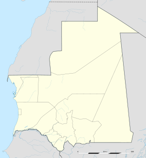
 Nouadhibou
Coordinates: 20°56′N 17°2′W / 20.933°N 17.033°WCoordinates: 20°56′N 17°2′W / 20.933°N 17.033°W Country  Mauritania
Region Dakhlet Nouadhibou Region Population – Total 90,000 Nouadhibou (Arabic: نواذيبو; formerly Port-Étienne) is the second largest city in Mauritania and serves as a major commercial centre. The city itself has about 75,000 inhabitants expanding to over 90,000 in the larger metropolitan area. It is situated on a 40-mile peninsula or headland called Ras Nouadhibou, Cap Blanc, or Cabo Blanco, of which the western side, with the city of Lagouira, is part of Western Sahara. Nouadhibou is consequently located merely a couple of kilometers from the border between Mauritania and Western Sahara.
Contents
Overview
The city is divided into four major areas: the city centre, including the airport; Numerowatt to the north; Cansado, the main residential area, to the south; and a dormitory town for Port Minéralier in the far south, from which iron ore mined in Zouerat is exported.
Attractions in Nouadibou include the Table Remarquable, several markets, a ships' graveyard and Mediterranean monk seals.
The port of Nouadhibou is the final resting place of over 300 ships and hence the world’s largest ship graveyard. Unlike the arrival en masse of ships at Mallows Bay, here the number of craft has built up over time, as corrupt officials accepted bribes from boat owners to allow them to dump their vessels in the area.
The major economic activity is fishing; however, the largest industry is processing iron ore that has transported by train from the interior mining towns of Zouérat and Fdérik. These freight trains can be as much as 3 km long, reputedly the longest in the world. The railway also carries passengers and calls at Choum.
On 30 June 1973, at the time of the second-longest solar eclipse in 20th century, an aerobee rocket was launched at Nouadhibou for solar research.[1]
From February 2006 onwards Nouadhibou has become the departure point for African migrants trying to reach the Canary Islands. This extremely dangerous route to reach the European Union has become popular as a result of increased emigration controls along the Moroccan coast and around the Spanish enclaves of Ceuta and Melilla in the second half of 2005.
The city is reputedly also a centre of trading of meteorites found in the Sahara.[1]
Transportation
Paved roads
Nouadhibou is linked with the Coastal Motorway RN2 to the capital Nouakchott (a distance of 450km) and by highway to the Western Sahara border in the north (a distance of 70km).
Railway
Nouadhibou also is connected by railway to the iron mines in Zouérat, 670km to the east.
References
- ^ "Meteorite smugglers anger scientists". London: BBC. 2007-04-16. http://news.bbc.co.uk/2/hi/africa/6549197.stm. Retrieved 2007-06-23.
External links
Urban Industrial Urban Agricultural Adel Bagrou · Aere Mbar · Aghchorguitt · Ain Ehel Taya · Aioun · Ajar · Aleg · Amourj · Aoueinat Zbel · Aoujeft · Arr · Atar · Azgueilem Tiyab · Bababé · Bagrou · Barkeol · Bassiknou · Bethet Meit · Boghé · Bokkol · Bou Lahrath · Bougadoum · Bouheida · Bouhdida · Boulenoir · Bouly · Boumdeid · Bousteila · Boutilimitt · Cheggar · Chinguitti · Dafor · Daghveg · Dar El Barka · Dionaba · Djeol · Djiguenni · El Ghabra · El Ghaire · Fassala · Foum Gleita · Ghabou · Gouraye · Gueller · Guerou · Hamod · Hassichegar · Jidr-El Mouhguen · Kaédi · Kamour · Kankossa · Keur-Macene · Kobeni · Koumbi Saleh · Lahraj · Legrane · Leouossy · Lexelba · Maghama · Magta-Lahjar · Male · Mbagne · Mbalal · Mbout · Mederdra · Monguel · Moudjeria · Nbeika · Ndiago · Néma · Niabina · Noual · Ouad Naga · Ouadane · Oualata · Oueid Jrid · Ould Yenge · Rdheidhi · R' Kiz · Sangrave · Sélibaby · Soudoud · Tachott · Tamchekett · Tawaz · Tékane · Tichit · Tidjikja · Tiguent · Timbedra · Timzinn · Tintane · Touil · Tufunde Cive · Wahatt · WoumpouRural Agricultural Agharghar · Aghoratt · Agoueinit · Ain Savra · Ain Varba · Ajoueir · Aouleiguatt · Aweintat I · Bagodine · Baidiyam · Bangou · Bareina · Beileguet Litama · Benamane · Beribavatt · Blajmil · Boeir Tores · Bouanze · Boubacar Ben Amer · Boutalhaya · Chelkhet Tiyad · Daw · Devaa · Dhar · Diadibeny Gandega · Dielwar · Dodol Cover · Doueirara · Edbaye El Hejaj · Edebaye Ehl Guelay · Egjert · El Aria · El Khatt · El Medah · El Megve · El Melgua · El Mouyessar · El Verea · Elb Address · Feireni · Ganki · Gasra El Barka · Ghlig Ehel Boye · Gogui · Guateidoume · Hassi Abdallah · Hassi Attilla · Hassi El Ahmed Bichna · Hassimhadi · Hsey Tine · Inal · Jreif · Kouroudel · Ksar el Barka · Laftah · Lahrach · Leghligue · Lehreijat · Lehseira · Lekhcheb · Leweynatt · Lexeiba · Maaden · Mabrouk I · Mabrouk II · Megva · Melga · Melzem Teichett · Modibougou · N' Savenni · Nebaghia · Nere Walo · Nouamghar · Nouamleine · Nteichitt · Ntrguent · Ouad Amour · Ould Birem · Ouldmbouni · Oum Avnadech · Ou, Lahyadh, Radhi · Sagne · Sani · Sava · Soufa · Taguilalett · Tarenguet Ehel Moul · Tektaka · Tenaha · Tenhemad · Tensigh · Tikobra · Tinghadej · Tmeimichatt · Tokomadji · Toutel · Voulaniya · Vrea Litama · WaliCategories:- Populated places in Mauritania
- Dakhlet Nouadhibou Region
- Regional capitals in Mauritania
- Communes of Mauritania
- Railway stations in Mauritania


Wikimedia Foundation. 2010.