- Lafayette, Louisiana metropolitan area
Infobox Settlement
official_name = Lafayette
other_name = Vermilionville
native_name =
nickname = Hub City
settlement_type =
motto =
imagesize =
image_caption =
flag_size =
image_
seal_size =
image_shield =
shield_size =
city_logo =
citylogo_size =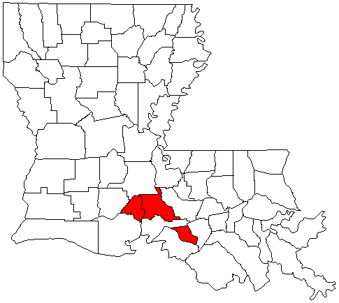
mapsize = 175 px
map_caption = Map of Louisiana highlighting the Lafayette metropolitan area
mapsize1 =
map_caption1 =
image_dot_
dot_mapsize =
dot_map_caption =
dot_x = |dot_y =
pushpin_
pushpin_label_position =
pushpin_map_caption =
pushpin_mapsize =
subdivision_type =
subdivision_name =
subdivision_type1 =
subdivision_name1 =
subdivision_type2 =
subdivision_name2 =
subdivision_type3 =
subdivision_name3 =
subdivision_type4 =
subdivision_name4 =
government_footnotes =
government_type =
leader_title =
leader_name =
leader_title1 =
leader_name1 =
leader_title2 =
leader_name2 =
leader_title3 =
leader_name3 =
leader_title4 =
leader_name4 =
established_title =
established_date =
established_title2 =
established_date2 =
established_title3 =
established_date3 =
area_magnitude =
unit_pref =
area_footnotes =
area_total_km2 =
area_land_km2 =
area_water_km2 =
area_total_sq_mi =
area_land_sq_mi =
area_water_sq_mi =
area_water_percent =
area_urban_km2 =
area_urban_sq_mi =
area_metro_km2 =
area_metro_sq_mi =
population_as_of = 2006
population_footnotes =
population_note =
population_total =
population_density_km2 =
population_density_sq_mi =
population_metro =254,432
population_density_metro_km2 =
population_density_metro_sq_mi =
population_urban =
population_density_urban_km2 =
population_density_urban_sq_mi =
population_blank1_title =
population_blank1 =
population_density_blank1_km2 =
population_density_blank1_sq_mi =
timezone =
utc_offset =
timezone_DST =
utc_offset_DST =
latNS=30.223
longEW=-92.019
elevation_footnotes =
elevation_m =
elevation_ft = 36
postal_code_type =
postal_code =
area_code =
blank_name =
blank_info =
blank1_name =
blank1_info =
website = http://www.lafayettela.gov/
footnotes = Named forGilbert du Motier, marquis de La Fayette The Lafayette Metropolitan Statistical Area is a metropolitan area in the south central
Acadiana region ofLouisiana that covers two parishes - Lafayette and St. Martin. As of the 2000 census, the MSA had a population of 239,086 (though a July 1, 2007 estimate placed the population at 256,494). [cite web | url = http://www.census.gov/popest/metro/tables/2007/CBSA-EST2007-01.csv | title = Annual Estimates of the Population of Metropolitan and Micropolitan Statistical Areas: April 1, 2000 to July 1, 2007 (CBSA-EST2007-01) | format = CSV | work = 2007 Population Estimates | publisher =United States Census Bureau , Population Division | date =2008-03-27 | accessdate = 2008-03-29] It is also part of the largerLafayette-Acadiana Combined Statistical Area (Populaton: 538,470).Parishes
*Lafayette Parish
*St. Martin ParishCommunities
*Arnaudville (partial)
*Breaux Bridge
*Broussard
*Carencro
*Cecilia
*Coteau Holmes (unincorporated)
*Duson (partial)
*Henderson
*Lafayette (Principal city)
*Milton (unincorporated)
*Morgan City (partial)
*Parks
*St. Martinville
*Scott
*YoungsvilleDemographics
As of the
census GR|2 of 2000, there were 239,086 people, 89,536 households, and 61,826 families residing within the MSA. The racial makeup of the MSA was 71.86% White, 25.46% African American, 0.28% Native American, 1.05% Asian, 0.02% Pacific Islander, 0.45% from other races, and 0.87% from two or more races. Hispanic or Latino of any race were 1.56% of the population.The median income for a household in the MSA was $33,610, and the median income for a family was $40,737. Males had a median income of $33,565 versus $20,558 for females. The
per capita income for the MSA was $16,495.Politics
The area of Lafayette is politically conservative, however, it does not always vote Republican in elections.
Economy
The economy in the Lafayette area is mostly made up of healthcare and associated services, tourism, oil-related business, car sales, and the restaurant industry.
ee also
*
List of cities, towns, and villages in Louisiana References
Wikimedia Foundation. 2010.