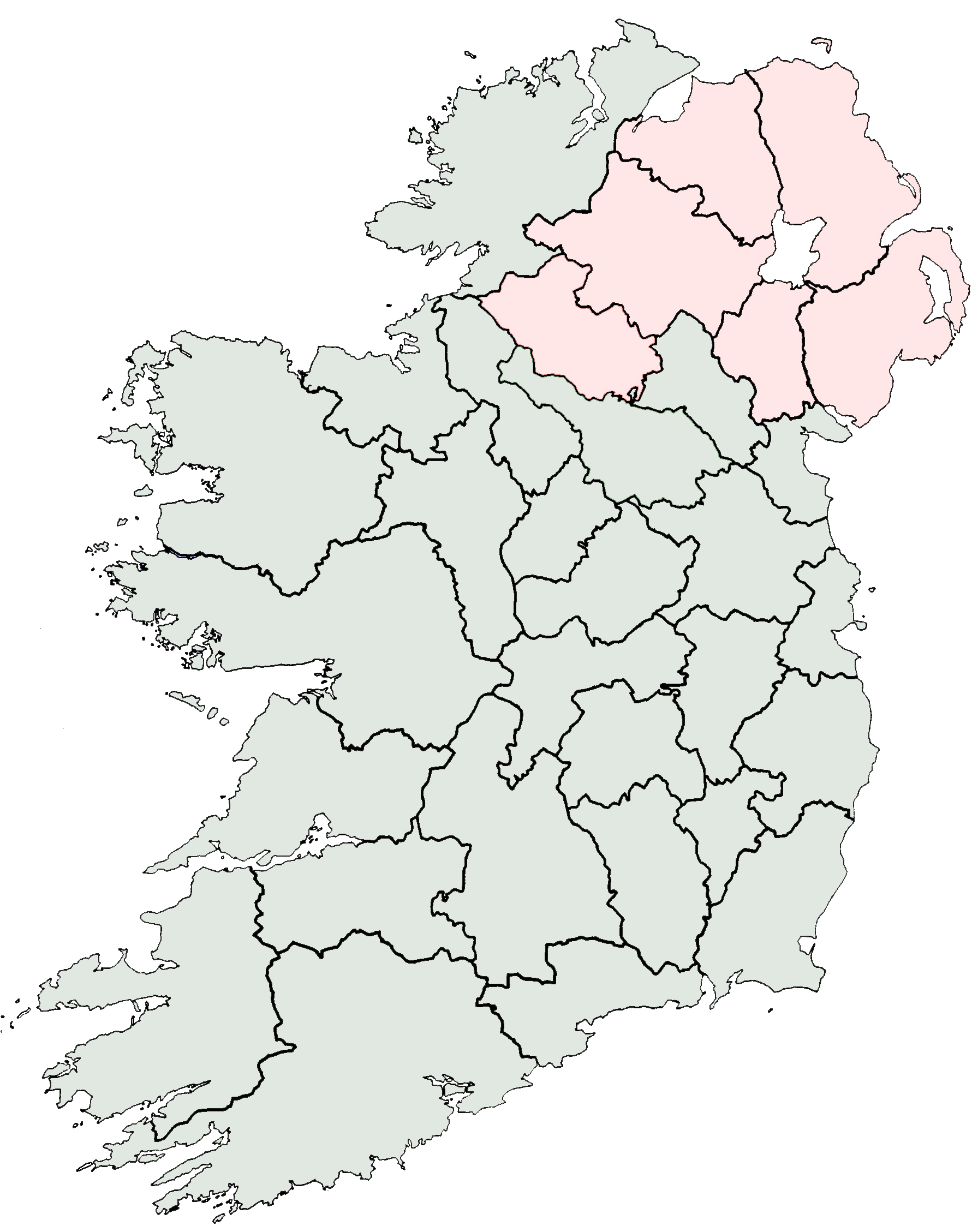
- County Offaly
-
County Offaly
Contae Uíbh Fhailí
Coat of armsMotto: Esto Fidelis (Latin)
"Be Faithful"
Country Ireland Province Leinster Dáil Éireann Laois-Offaly EU Parliament East County seat Tullamore Government - Type County Council Area - Total 2,000 km2 (772.2 sq mi) Area rank 18th Population (2011) 76,806 - Rank 23rd Car plates OY Website offaly.ie County Offaly (Irish: Contae Uíbh Fhailí) is a county in Ireland. It is part of the Midlands Region and is also located in the province of Leinster. It is named after the ancient Kingdom of Uí Failghe and was formerly known as King's County until the establishment of the Irish Free State in 1922. Offaly County Council is the local authority for the county. The population of the county is 76,806 according to the 2011 census.[1]
Contents
Geography and political subdivisions
Offaly is the 18th largest of Ireland’s 32 counties by area and the 23rd largest in terms of population.[2] It is the fifth largest of Leinster’s 12 counties by size and the 9th largest by population. It is the largest county by area and the second largest by population in the Midlands.
Towns and villages
Historical populations Year Pop. ±% 1653 7,654 — 1659 8,310 +8.6% 1821 131,088 +1477.5% 1831 144,225 +10.0% 1841 146,857 +1.8% 1851 112,076 −23.7% 1861 90,043 −19.7% 1871 75,900 −15.7% 1881 72,852 −4.0% 1891 65,563 −10.0% 1901 60,187 −8.2% 1911 56,832 −5.6% 1926 52,592 −7.5% 1936 51,308 −2.4% 1946 53,686 +4.6% 1951 52,544 −2.1% 1956 51,970 −1.1% 1961 51,533 −0.8% 1966 51,717 +0.4% 1971 51,829 +0.2% 1979 57,342 +10.6% 1981 58,312 +1.7% 1986 59,835 +2.6% 1991 58,494 −2.2% 1996 59,117 +1.1% 2002 63,663 +7.7% 2006 70,868 +11.3% 2011 76,806 +8.4% [3][4][5][6][7][8] - Ballinagar
- Ballyboy
- Banagher
- Birr
- Cadamstown
- Clara
- Cloghan
- Clonygowan
- Clonbullogue
- Clonmacnoise
- Coolderry
- Crinkill
- Croghan
- Daingean
- Edenderry
- Ferbane
- Geashill
- Horseleap
- Kilcormac
- Killeigh
- Killoughey
- Kinnitty
- Moneygall
- Mountbolus
- Portarlington
- Rahan
- Rhode
- Shannonbridge
- Shannon Harbour
- Shinrone
- Tullamore
- Walsh Island
Physical geography
Tullamore is the county town and largest town in Offaly and is the 30th largest in Ireland. Offaly borders seven counties, the second most of any county after Tipperary, which borders eight. Offaly is bordered by Galway, Roscommon, Tipperary, Laois, Westmeath, Kildare and Meath. The Slieve Bloom Mountains are in the southern part of the county on the border with Laois. Offaly has the 24th highest county peak in Ireland. The highest point is Arderin (Irish: Ard Éireann) in the Slieve Blooms at 527 metres (1,729 ft). The Slieve Bloom Mountains contain the county's highest points including Stillbrook Hill and Wolftrap Mountain which are the county's second and third highest peaks. Croghan Hill rises from the Bog of Allen and is located in northern Offaly. Although only 234 metres high, it is known for its view over the surrounding area and it stands out by itself.
In the northwestern part of the county is the floodplain of the River Shannon. The River Camcor runs through the town of Birr and is a Wild Trout Conservation Area. The River Brosna runs across the county from Lough Owel in Westmeath to Shannon Harbour. Silver River runs through several towns in the south of the county before joining Brosna near the town of Ferbane. The Grand Canal also runs across the county from Edenderry on the north-east to Shannon Harbour before joining the Shannon. The county contains many small lakes from Lake Boora to Pallas Lake and it also contains 42 hectares of swamp. There are a number Eskers in the counties landscape including Esker Riada.
Offaly largely comprises a flat landscape and is known for its extensive bog and peatlands. There are many large bogs in Offaly including the Bog of Allen, Clara bog, Boora bog and Raheenmore Bog which are spread out across the county with the Bog of Allen extending into four other counties. The county consists of approximately 42,000 hectares of peatlands which is 21% of Offaly's total land area.
Offaly contains approximately 9,000 hectares (22,239 acres) of forest and woodland area, which only amounts to 4.5% of the county's land area. This includes woodlands within the Slieve Blooms and the Lough Boora Parklands. Roughly 75% of Offaly's forested area is Conifer High Forest.
History
One of the earliest known settlements in County Offaly is at Boora bog which dates back to the Mesolithic era. Excavations here provides evidence of a temporary settlement as no structures were found at the site. Stone axes, arrow heads and blades were discovered which date to between 6.800 - 6,000 BCE.[9]
The monastic complex of Clonmacnoise was of the most important in Ireland. Located at the River Shannon near Shannonbridge, it was the greatest centre of learning in Europe during the first millennium. It was regarded as the most important centre for learning, Arts and Crafts and Christianity in Europe and today tourists may see the famous Celtic Crosses of Clonmacnoise at the site.
Before the plantation of Offaly by English settlers, the territories it comprises were controlled principally by the Ó Conchubhair Fáilghe clan in the North/East of the county (anglicised as: O'Conor Faly) and the Ó Céarbhaill of Eile (anglicised as: O'Carroll Ely) in the south. In 1556 an Act of the Irish parliament created "King's County", named after the then King of Spain, England and Ireland Philip.[10] After the creation of the Irish Free State in 1922 the name was changed to County Offaly.
Local government and politics
Offaly County Council based in the county hall in Tullamore is responsible for local services such as housing policy, social and cultural services, economic development and planning, motor taxation and infrastructural policy in the county. 21 councillors are elected from the 4 electoral areas of Tullamore (7 members), Ferbane (4 members), Edenderry (6 members) and Birr (4 members). Councillors are also elected to town councils in Birr, Tullamore and Edenderry. At national level Offaly is part of the Laois/Offaly constituency which elects 5 TDs to the Dail. In the 2011 Election parts of the south of County Offaly form part of the North Tipperary constituency.
Demographics
 Birr Castle
The 2006 population figure for County Offaly is the highest for the county since 1881.[11] The Central Statistics Office estimates that the increase in population between 2002 and 2006 (7,205) comprised a natural increase of 2,026 people with the balance of 5,179 accounted for by net in-migration from within Ireland as well as abroad. Offaly’s population growth during the period 2002–2006 (11.3%) has been stronger than the National average (8.2%). This may be attributed to proximity to the Greater Dublin Area, recent increased accessibility to Dublin (M6, M7, and improved rail services) and the differential in house prices between Dublin and Offaly.[11]
The population of many towns has risen dramatically over the period 1996 to 2006: Birr +21.5%, Tullamore +28.8% and Edenderry +53.9%. Portarlington has had a population increase of 50.1% from 2002 to 2006 alone.[11]
In 2006 the age profile of the population is as follows:[11]
- <15 years ... 22.52%
- 15-64 yrs ... 66.54%
- >65 years ... 10.95%
Places of interest
- A notable tourist attraction is the narrow gauge Clonmacnoise and West Offaly Railway in Blackwater Bog.
- Birr in the south of the county is best known for its castle and gardens. Birr Castle is owned by the Parsons family, (the family bears the title: 'Earl of Rosse') and is best known for its 19th-century telescope.
- Sculpture in the Parklands around Lough Boora in Boora Bog.
- Charleville Castle located in Tullamore
- Ancient Christian monastic site at Clonmacnoise along with ancient examples of the Irish High cross such as the 'Cross of the Scriptures', the round tower and visitors center.
- Kinnitty Castle
- Slieve Bloom Mountains with panoramic views of Counties Offaly and Laois
- Banagher on the river Shannon for cruises along the river.
- The Lough Boora Parklands are a haven for wildlife and most notably contain the last Irish population of the grey partridge.
Sport
Gaelic Games are the most popular sports in the county with Gaelic Football and Hurling teams present in all parish communities throughout the county. Birr is generally considered a Hurling stronghold. The team have won 4 All-Ireland Senior Club Hurling Championships. The county teams also have had national success in both Hurling and Gaelic Football, winning the Liam McCarthy Cup 4 times and the Sam Maguire Cup 3 times. The football team is perhaps best known for the Seamus Darby goal in the dying minutes of the 1982 football final when Offaly took the title by one point denying Kerry a historic 5 All-Ireland titles in a row.
Other popular sports in the county include Rugby and Association Football where Tullamore Town F.C. are in the A Championship.
Economy
Traditionally, agriculture and industry have been the main driving force of the economy in the county. Offaly has extensive bogland particularly in the northern parts of the county that forms part of the Bog of Allen. Bord na Móna was founded in 1946 and provided employment to hundreds of people in Offaly by making peat briquettes (for home domestic use) and supplying peat to power stations operated by the ESB. Peat briquettes are currently made at the Bord na Móna factory at Derrinlough near Birr. Consequently with vast reserves of peat the ESB has a number of power stations providing energy to the national grid. Today, power stations are operating at Shannonbridge and Edenderry. With the continuing depletion of the bogs a number of power stations have closed down in recent years. The ESB power station at lumcloon, Ferbane was also a major employer in the midlands but closed in 2001. Rhode power station also closed down soon afterwards. These were major landmarks in Offaly with large cooling towers that were visible for miles around Offaly and beyond, but were demolished soon after the power stations closed. Many bogs are now used as wildlife reserves or for tourism activities such as lough Boora.
The opening of the Grand Canal in the 18th century brought prosperity to towns such as Banagher and Tullamore. Both towns were important stops on the Dublin to Limerick navigation which supported a number of industries and brought cheap and efficient water transport to the county in that era.
The Celtic Tiger also brought an increase in economic activity to Offaly with business enterprise and industrial parks opening in Birr, Edenderry and Tullamore. Many people particularly in the east of the county are within an easy commuting distance to Dublin where many find employment.
Transport
Rail
Offaly has a number of train stations, these including Tullamore railway station, Clara railway station and Portarlington railway station. Tullamore and Clara railway stations are on the main Dublin to Ballina/Galway/Westport railway line with regular trains serving the area especially for Dublin commuters. All trains to the south and west of Ireland pass through Portarlington railway station from Heuston Railway Station in Dublin. Birr railway station closed in the 1960s.
Road
Three main national secondary routes pass through the county. The N52 road passes from Kilbeggan to Tullamore and Birr which then continues to Nenagh where it intersects with the M7. The N62 from Athlone passes through Ferbane and Birr and continues onto Roscrea and Thurles. The N80 route starts in Tullamore and continues to the south east passing through Portlaoise and Carlow. There are no main national primary routes in the county, however, the M6 skirts the county to the north and the M7 skirts the county to the south through Moneygall. Road infrastructure has improved with the completion of the Tullamore bypass in 2009 and improved access to regional citys following completion of the intercity motorway network.
Bus
Bus Éireann provide public transport services throughout the county with regular bus services to Limerick and Waterford from Athlone bus station. Other private bus coach services provide direct bus services from Birr to Dublin such as Kearns bus service who run several services daily. Slieve Bloom Coaches run services from Tullamore and Portarlington to Dublin.
Waterway
The Grand Canal connecting Dublin to the river Shannon was constructed through the towns of Edenderry and Tullamore and joins the Shannon at Shannon Harbour. Traditionally this was an important route for transport, communication and trade between Dublin, Limerick and the midlands of Ireland. The route fell into decline as road transport became more popular. Much of the route is now used for boating and leisure activities.
Media
Radio
Midlands 103 (originally Midlands Radio 3) which broadcasts to Laois, Offaly and Westmeath is based in Tullamore and has studios across the midlands. RTE's medium wave transmitter broadcasting RTE Radio 1 was also located in Tullamore but transmission stopped in 2008.
Print
A number of local newspapers are published in Offaly. The Offaly Express, Offaly Independent and Tullamore Tribune are based in Tullamore. The Midland Tribune based in Birr covers local news in the west and south of the county as well as parts of North Tipperary including the towns of Birr, Roscrea and Nenagh and surrounding areas.
People
- The former Taoiseach, Brian Cowen, was born in Clara, County Offaly on 10 January 1960. He now lives on the outskirts of Tullamore.
- The short story writer, novelist and playwright William Trevor (KBE) was born in County Offaly, and raised in County Cork.
- The world-famous scientist John Joly was born at Bracknagh in 1857.
- The current Irish Open champion, golfer Shane Lowry.
- Ged Corcoran, rugby league player, former Halifax RLFC of Super League and currently playing for Toulouse Olympique.
- William Parsons, 3rd Earl of Rosse, astronomer
- Barry Glendenning, journalist
- Mundy, musician
- Neil Delamere, comedian
See also
- List of abbeys and priories in Ireland (County Offaly)
- Lord Lieutenant of King's County
- High Sheriff of King's County
References
- ^ Census 2006 - Population of each province, county and city
- ^ Corry, Eoghan (2005). The GAA Book of Lists. Hodder Headline Ireland. pp. 186–191. ISBN 0340896957.
- ^ For 1653 and 1659 figures from Civil Survey Census of those years, Paper of Mr Hardinge to Royal Irish Academy March 14, 1865.
- ^ Census for post 1821 figures.
- ^ "Home". Histpop.Org. 2004-07-01. http://www.histpop.org. Retrieved 2011-02-14.
- ^ NISRA. "Northern Ireland Statistics and Research Agency - Census Home Page". Nisranew.nisra.gov.uk. http://www.nisranew.nisra.gov.uk/census. Retrieved 2011-02-14.
- ^ Lee, JJ (1981). "On the accuracy of the Pre-famine Irish censuses". In Goldstrom, J. M.; Clarkson, L. A.. Irish Population, Economy, and Society: Essays in Honour of the Late K. H. Connell. Oxford, England: Clarendon Press.
- ^ Mokyr, Joel; O Grada, Cormac (November). "New Developments in Irish Population History, 1700–1850". The Economic History Review 37 (4): 473–488. doi:10.1111/j.1468-0289.1984.tb00344.x. http://www3.interscience.wiley.com/journal/120035880/abstract.
- ^ "Activities in Offaly: The Bogland - Na Portaigh (section)". Offaly Historical & Archaeological Society. 2009. http://www.offalyhistory.com/articles/11/1/Activities-in-Offaly/Page1.html. Retrieved 2 June 2009.
- ^ 3 & 4 Phil & Mar, c.2 (1556)
- ^ a b c d "Demographic context". Offaly County Council Development Plan 2009 - 2015. http://www.offaly.ie/NR/rdonlyres/A4AD027E-87E4-4353-917B-47C75D92768F/1095/Chapter2ContextandChallenges_FEB08.pdf. Retrieved 2008-06-28.
External links
- Offaly County Council
- Tullamore & District Chamber of Commerce
- Tullamore Life & Community
- The Offaly Express Newspaper
- Offaly Football and Hurling Club New York
- Athlone Cricket Club - County Offaly
- Ferbane Town Website - County Offaly
- Offaly Historical & Archaeological Society
Places in County Offaly County town: Tullamore Towns 
Villages and
TownlandsBallinagar · Ballyboy · Ballycumber · Banagher · Blue Ball · Bracknagh · Brosna · Cadamstown · Capppancur · Clareen · Cloghan · Clonbollogue · Clonmacnoise · Clonony · Clonygowan · Coolderry · Crinkill · Croghan · Cushina · Daingean · Doon · Dunkerrin · Durrow · Geashill · Horseleap · Kilcormac · Killeigh · Killoughey · Kinnitty · Moneygall · Mountbolus · Pollagh · Rahan · Rhode · Roscore · Shannonbridge · Shannon Harbour · Shinrone · Walsh Island
Landforms Arderin · Barcam · Bog of Allen · Boora bog · Carroll's Hill · Farbreague · Clara Bog · Croghan Hill · Esker Riada · Grand Canal · Raheenmore Bog · River Brosna · River Camcor · River Shannon · Silver River · Stillbrook Hill · Wolftrap Mountain
Topics Education in County Offaly · Geography of County Offaly · History of County Offaly · List of National Monuments in County Offaly · List of townlands in County Offaly · Media in County Offaly · Mountains and hills of County Offaly · Politics of County Offaly · Religion in County Offaly · Rivers of County Offaly · Transport in County Offaly
Counties of Ireland Counties of Ireland The counties are listed per province Connacht 
Munster Clare · Cork (Cork City) · Kerry · Limerick (Limerick City) · Tipperary (North Tipperary • South Tipperary) · Waterford (Waterford City)
Leinster Carlow · Dublin (Dublin City • Dún Laoghaire–Rathdown • Fingal • South Dublin) · Kildare · Kilkenny · Laois · Longford · Louth · Meath · Offaly · Westmeath · Wexford · Wicklow
Ulster Italics denote non-administrative counties. Brackets denote eponymous cities or non-traditional counties. † denotes counties of Northern Ireland Categories:- Untranslated Irish place names
- County Offaly
- Leinster
- Counties of the Republic of Ireland
- States and territories established in 1556
- Local administrative units of the Republic of Ireland


Wikimedia Foundation. 2010.