- U.S. Route 66 in Oklahoma
-
U.S. Route 66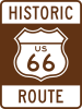


Interstate 40 Business; State Highway 66 Route information Maintained by ODOT (I-40 Bus., SH-66); county and local gov'ts Length: 374.6 mi[2] (602.9 km)
(as close as possible to the latest surface alignments, except at Tulsa and Oklahoma City)
The length of SH-66 is 192.8 mi (310.3 km)Existed: December 7, 1926[1] – April 1, 1985[1] Major junctions West end: 
 US 66/Spur 30 towards Shamrock, TX
 US-81 in El Reno (west end of SH-66)
 US-60 near White Oak (east end of SH-66)
East end: 

 US 66/US 69 Alt. towards Baxter Springs, KS
Highway system United States Numbered Highways
List • Bannered • Divided • ReplacedOklahoma State Highways
Oklahoma turnpike system←  SH-65
SH-65SH-67  →
→The historic U.S. Route 66 ran from west to northeast across the U.S. state of Oklahoma, along the path now taken by Interstate 40 and State Highway 66. It passed through Oklahoma City, Tulsa, and many smaller communities. West of the Oklahoma City area, it has been largely replaced by I-40; the few independent portions that are still state-maintained are now Interstate 40 Business. However, from Oklahoma City northeast to Kansas, the bypassing Interstate 44 is mostly a toll road, and SH-66 remains as a free alternate.
Contents
History
The history of Route 66 in Oklahoma can be traced back to two auto trails—the St. Louis, Missouri–Las Vegas, New Mexico, main route of the Ozark Trails network, and the Fort Smith, Arkansas–Amarillo, Texas, Postal Highway.[3] In the state highway system, approved in mid-1924, the portions of these in Oklahoma, which crossed at Oklahoma City, became State Highway 7 and State Highway 3 respectively.[4][5] U.S. Route 66 was designated in late 1926, and followed these state highways with one exception: a new State Highway 39 was created to carry Route 66, leaving SH-7 at Commerce and heading east and north to the state line in the direction of Baxter Springs, Kansas.[6] (The short stub of SH-7 north of Commerce remained until it became part of US-69 in the mid-1930s.[7])
Over the years, many portions of Route 66 west of Oklahoma City were replaced with Interstate 40. On the other hand, the Turner Turnpike and Will Rogers Turnpike were built parallel to Route 66 east of Oklahoma City, and Route 66 remained on the old road as a free alternate to the turnpikes. Route 66 was entirely eliminated by the American Association of State Highway and Transportation Officials on April 1, 1985. In Oklahoma, the portions west of Oklahoma City that had not been rerouted onto I-40 became business loops of I-40 through Sayre, Elk City, Clinton, and El Reno. The still-independent route, starting at US-81 in southeastern El Reno, became State Highway 66, using surface streets except through Oklahoma City and Tulsa, where Route 66 had been rerouted onto the freeways. SH-66 ends at US-60 west of Vinita, where Route 66 overlapped US-60 and US-69 to east of Commerce. The remaining independent portion to the Kansas state line became part of a new US-69 Alternate.[1][8]
Route description
Texas border to Elk City
By 1916, a series of unpaved state roads was laid out from Texola, just east of the Texas state line, east via Erick to Delhi, north to Sayre, and east and north via Doxey to Elk City.[9] It became part of Route 66 in 1926; this initial alignment ran along the state line from a bit south of the old railroad grade south to E1240 Road, and then ran east through Texola on Fifth Street. After a mile south on N1680 Road, it turned east on E1250 Road to Erick, then south again on N1750 Road, east on E1260 Road, south on N1810 Road, and east on E1270 Road to Delhi. Traffic turned north at N1870 Road (now US-283), jogging west on E1250 Road at the mismatch in the section lines, and entered Sayre on N1870 Road. The bridge over the North Fork of the Red River in Sayre was built of timber in 1924 and upgraded and widened with steel in 1933. It was bypassed in 1958, and has been demolished; its remains are on private property. The original Route 66 passed through Sayre on Main Street (now SH-152) and Fourth Street, leaving to the east on Benton Boulevard (E1180 Road). It then turned north on N1900 Road, east on E1170 Road (there was a cutoff on the southeast side of the railroad at this turn), north on N1960 Road, east on E1160 Road, and north on N2000 Road into Elk City on Randall Avenue. Short sections of this — a bridge on E1170 Road east on N1950 Road (SH-34) and the crossing of Elk City Lake on N2000 Road — no longer exist.[1]
A new alignment from the state line to Elk City was built in the late 1920s. It only coincided with the earlier route through Texola and through Sayre; the rest was entirely separate. Except in Sayre, where the city had paved the road with Portland cement (PC) in 1926, the state began paving the road in 1928 and 1929 with asphalt over a concrete base from Elk City to several miles east of Hext. It switched to PC in 1929, paving the remainder from east of Hext to the state line from 1929 to 1931. This alignment followed E1240 Road from the state line to Texola, and then the present main road through Erick and Hext to south of Sayre. The old cement lies in the center of the four-lane road through Texola, and then mainly follows the westbound lanes to Erick, through which it again lies in the center. A short abandoned piece of PC, including ruins from a former bridge over a creek, is located to the south of the road, between N1700 and N1710 Roads. Beyond Erick, the PC was again built in the present location of the westbound lanes, but has since been paved over until the I-40 interchange (exit 11). Just past exit 11, the road becomes two lanes, and the original road — mostly built as PC, but later resurfaced in asphalt, and once the westbound lanes of a divided highway - is now abandoned to the north of the open roadway; a 1928 concrete federal aid primary marker lies 0.8 miles (1.3 km) west of Hext. Beyond Hext, where I-40 comes in from the south, the two-lane road crosses to the original roadway; the later eastbound lanes are now the westbound lanes of I-40. The 1929 alignment curved to the north into N1870 Road west of exit 20, following Main Street and Fourth Street as the original route did. However, it continued beyond Benton Boulevard to Sayre Avenue, turning off onto the present four-lane I-40 Bus. towards I-40 exit 25. Just prior to the exit, Route 66 curved northeast along the northside frontage road. It crossed to the south side after exit 26, crossing Timber Creek on a 1928 through truss bridge, and crossed again just east of the N1910 Road overpass. This part of the north frontage road, from east of N1910 Road to exit 32, retains the original 1928-1929 paving, as well as a 1926 box drain. Between exit 32 and Elk City, the original road (resurfaced) is now the westbound lanes of I-40 Bus., where another 1926 box drain still stands.[1]
A second set of lanes was added, mostly on the south side of the two-lane road, from 1955 to 1961, except through Texola, Erick, and Sayre, where the existing road was widened to four lanes. The old road was bypassed in several places: west of Texola, where the new road went diagonally northwest to the state line;[citation needed] between N1700 and N1710 Roads, where a straighter alignment was built to the north; entering Sayre from the south, where it continued on what is now the northside frontage road to Fourth Street (effective July 14, 1958); and at Timber Creek, where the two-lane road used the southside frontage road, and both directions of the four-lane road used the present I-40. Between the Sayre and Elk City business loops, except over Timber Creek, the new eastbound lanes are now the eastbound lanes of I-40; further west, between Sayre and Hext, they are the present westbound lanes.[1]
I-40 was completed in its present state in 1966 between Sayre and Elk City; the bypasses of both cities opened in October 1970, with the Sayre bypass project extending west to the point east of Hext where I-40 curves away from the old road. (The relocation here was made on June 1, 1970.) The rest of I-40 west to Texas opened on September 2, 1975. Except for the bypasses around Sayre and Elk City, Route 66 was moved to the new I-40; most of it was given to Beckham County, but the old route through Erick, which had overlapped State Highway 30, became State Highway 30 Business. When Route 66 was decommissioned on April 1, 1985, the Sayre and Elk City business loops were created. I-40 Business through Erick, between exits 5 and 11, replaced SH-30 Bus. in 1987, based on traffic data.[1]
Through Oklahoma City
Route 66 was signed in Oklahoma City by 1929. Its initial routing entered from the west on 39th Street and turned south on Classen Boulevard and east on 23rd Street. State Highway 7 entered from the south on Robinson Avenue, which also carried State Highway 4, State Highway 9, and U.S. Highway 77. At the intersection of 23rd Street and Lincoln Boulevard, just north of the State Capitol, State Highways 3 and 9 continued east, along with U.S. Highway 266, while the other routes, including Route 66, turned north. After leaving the city limits, continuing on Lincoln Boulevard (including the present Beverly Drive), it jogged east on Grand Boulevard (now Interstate 44) to reach Kelley Avenue.[10] By 1931, traffic was routed via Western Avenue rather than Classen Boulevard, and a new U.S. Route 66 Alternate bypassed downtown, turning north rather than south on Western Avenue to Britton and east on Britton Road to Kelley Avenue.[11] By 1935 Route 66 used May Avenue rather than Western Avenue; the alternate route continued to use Western Avenue,[12] moving to Classen Boulevard south of 53rd Street on March 18, 1936. The alternate route was eventually moved to May Avenue on May 6, 1947.[1]
On March 2, 1953, about the time the Northwest Expressway, Northeast Expressway, and Turner Turnpike were completed, US 66 was realigned to make use of this bypass. It turned north from 39th Street at May Avenue to reach the expressways, and followed them to Kelley, where it continued to turn north towards Edmond. The continuation of the Northeast Expressway to the Oklahoma City Terminus of the turnpike was labeled State Highway 66A; this route had extended west to May Avenue before March 2.[13] (State Highway 3 used the Northwest Expressway west of May Avenue.) The old Route 66 through downtown, via May Avenue, 23rd Street, and Lincoln Boulevard, became U.S. Route 66 Business, and the alternate route was eliminated. A short realignment was made on August 2, 1954, using the new West Expressway from 39th Street and May Avenue to the Northwest Expressway west of Classen Boulevard.[1]
State Highway 66A became part of Route 66 by 1956, when the new road (now Interstate 35) was built from the Turner Turnpike north to Route 66 east of Edmond. The old route via Edmond became State Highway 66 (and State Highway 77, since it had replaced U.S. Highway 77).[14] The business route was deleted on March 5, 1979, and at about the same time the new route of the West Expressway, bypassing Classen Circle, was completed.[1][15]
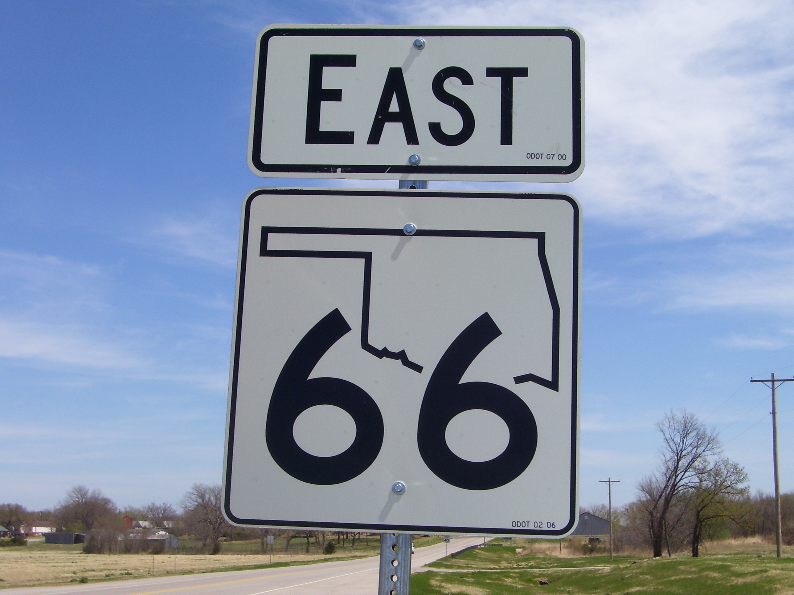
 New-style SH-66 shield west of Arcadia
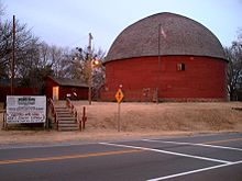 The Round Barn in Arcadia
Through Tulsa
By 1929, Route 66 had been marked through Tulsa, entering from the southwest on Southwest Boulevard (then Quanah Avenue) to the old 11th Street Bridge over the Arkansas River, a concrete arch bridge from 1916 that is now on the National Register of Historic Places. It left the bridge on Maybelle Avenue, and turned east on 11th Street, north on Cheyenne Avenue, east on 7th Street, north on Detroit Avenue, east on 2nd Street, north on Lewis Avenue, and east on Admiral Place to the city limits. Outside the city, the original route turned south on Mingo Road and east on 11th Street, turning north on 193rd Avenue to reach Catoosa.[10] A relocation, approved on July 7, 1932, simplified the routing through Tulsa, taking it east on 11th Street all the way from the bridge to 193rd Avenue. (U.S. Highway 75 and State Highway 11 remained on Admiral Place, the former using the old Route 66 alignment through downtown.)[1][16]
U.S. Route 66 Bypass was established on June 4, 1951 along the proposed Skelly Drive, which was not finished until the late 1950s, when it became part of Interstate 44.[citation needed] Route 66 itself was moved to Skelly Drive on November 3, 1959, and the old route on Southwest Boulevard and 11th Street, west of the Skelly Drive interchange east of downtown, became U.S. Route 66 Business. (The only change in this route was made in the early 1970s,[17] during construction of Interstate 444, when it was moved to 12th Street west of Denver Avenue.) The business route was eliminated on January 15, 1973, removing all state highways from surface streets in downtown Tulsa, except for a temporary routing of U.S. Highway 64 and State Highway 51 on 15th Street until the Broken Arrow Expressway was completed.[1][18]
Tulsa to Kansas border
As with the rest of Route 66 in Oklahoma, the majority of this segment follows Oklahoma state highway 66, with a number of older alignments that take Route 66 through many of the communities along the way. From the northeast side of Tulsa, at the intersection of 193rd Ave and Interstate 44/state highway 66, two or three routes are available, depending on which sources one considers to be official:
- The simplest route follows 193rd St. north onto the I-44 east entrance ramp. At the "top" of the ramp, the route diverts across the freeway and down a left exit onto state highway 66 almost immediately. The route then proceeds along state highway 66 through Catoosa and Chelsea.
- A second route proceeds north on 193rd Ave, crossing under I-44, and turns northeast onto Cherokee St. This route turns east onto Rice St, crosses state highway 66, and then turns northeast onto "Old US Highway 66". This road turns north as it joins with 225th St. This road splits into a "Y" just before it intersects with state highway 66. Maps indicate that both sides of the "Y" intersect with state highway 66, and that the right side of this "Y" leads the traveler to cross state highway 66 again, to find an abandoned segment of Route 66 on the other side.
- A third route proceeds north on 193rd Ave, past I-44, and turns northeast onto Cherokee St. One then turns hard right onto Antry Dr., then left onto state highway 66. The route turns east onto Rice St, then northeast onto "Old US Highway 66", north on 225th St, and then northeast back onto state highway 66.
Route 66 then follows state highway 66 northeast through Verdigris and into Claremore. One may either continue on state highway 66 all the way through town, or divert one block west and take the older alignment down J.M Davis Blvd. The route re-joins state highway 66 via Stuart Roosa Dr., at the north end of town.
Route 66 then proceeds north and east via state highway 66. Other communities along this stretch of road include Sequoyah, Foyil, and Busyhead. In Chelsea, state highway 28 briefly merges with state highway 66, then diverges north after about 5 blocks, while state highway 66 continues toward White Oak. After White Oak, US 60/US 69 join the route. Just beyond this intersection, state highway 2 joins the route as the road continues to Vinita. In the downtown area of Vinita, state highway 2 diverges to the north while US 60/US 69/Route 66 turn to the right. The highway crosses I-44 just east of the city and intersects with state highways 82 and 85. At the latter junction, the highway takes a turn to the north and continues through Afton.
Just east of Afton, there are two possible alignments:
- One may turn off to the right onto E 220 Road. This is actually a stretch of the original 9-foot-wide (2.7 m) "sidewalk" highway. The driver would follow the road straight at first, then follow the original roadbed as it curves to the right, avoiding the 90-degree intersection ahead. This joins with S 520 road and intersects with and crosses US 69. One should proceed straight on S 520 Road, crossing US 69 and eventually crossing over I-44. Less than one mile (1.6 km) later, the roadbed curves to the east onto 210th road, again avoiding the 90-degree intersection. Less than one mile (1.6 km) after this, the sidewalk road becomes regular paved roadway, which then intersects with US 69. At this point, Route 66 turns north to follow the main highway.
- Alternatively, one may remain on US 69, bypassing the sidewalk road entirely and continuing northeast. After about 2 miles (3.2 km), US 59 joins the route (about half way between the two ends of the sidewalk route). At the US 60/US 69/I-44 interchange, US 69 continues north while US 60 diverts east.
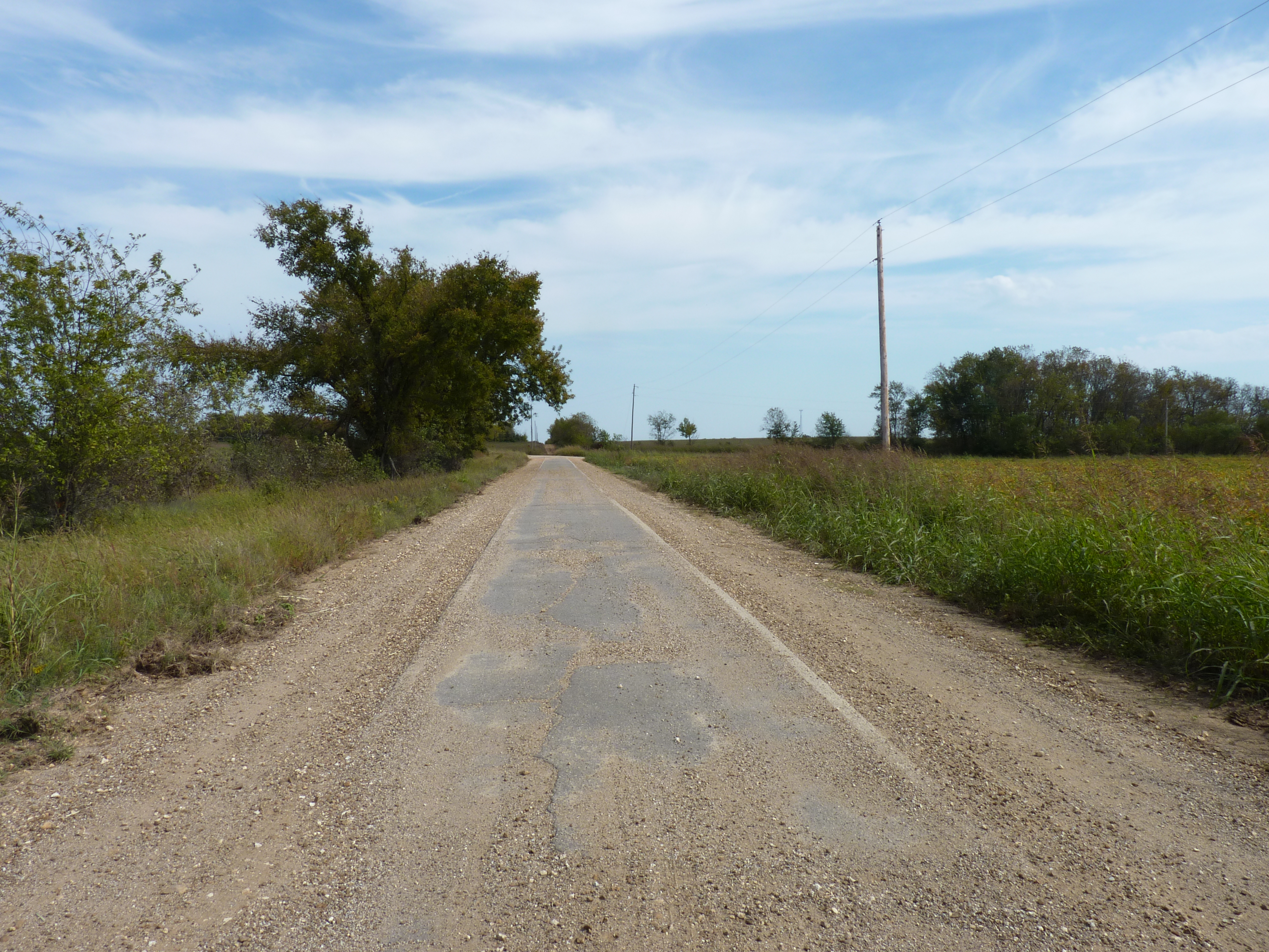
 "Sidewalk highway" section of Route 66 near Miami, Oklahoma.
Shortly after Narcissa, another section of the old Route 66 alignment is available, again as a stretch of sidewalk highway:
- At 140th road, the original Route 66 alignment turns to the right, onto another stretch of sidewalk highway. The roadbed turns north onto 540th road after one mile (1.6 km), then east onto 130th road after another mile. After about 1.5 miles (2.4 km), the route turns north onto "E" St. SW. The route continues north through a rural-looking residential area and joins with state highway 125 after one mile (1.6 km). After another 1.4 miles (2.3 km), the road bends to the right and crosses the Neosho River, then bends to the left and joins with Main Street in Miami, Oklahoma. The Route continues north through town. Like the stretch of road near Afton, the sidewalk roadbed bends and curves around the corners, avoiding the actual 90-degree intersections entirely.
- Alternatively, one may remain on US 59/US 69, bypassing the sidewalk road. State highway 10 joins the route about 3.3 miles (5.3 km) beyond Narcissa, and US 59 diverts to the west at this intersection. US 69/Route 66 continues northeast into Miami. At the intersection with Main Street, state highway 10 proceeds east, while US 69/Route 66 diverges to the north.
Route 66/US 69 continues north through Miami. As of this writing (16 Sept 2008), a construction project has parts of Main St. blocked, but a detour is available via one of the parallel streets. As the highway exits to the north, an alternate alignment becomes available:
- At the intersection with Newman Road, US 69 bends northeast. Just past Newman Road is an exit that takes one back onto Main Street; a sign is currently in place directing travelers to take this exit to remain on Route 66. From here, Route 66 proceeds north through the "back" side of Commerce, Oklahoma. Route 66 turns east at Commerce St. and proceeds through the downtown area of Commerce. Route 66 turns north at Mickey Mantle Blvd to rejoin with US 69.
- Alternatively, one may remain on US 69, bypassing the downtown area of Commerce.
US 69/Route 66 bends to the east as it exits the north side of Commerce. About 1.8 miles (2.9 km) after this bend, US 69 diverts to the north. Alternate US 69 begins at this point, and Alternate 69/Route 66 continues east, bending north as the highway enters the south end of Quapaw, Oklahoma. The Route continues through Quapaw and proceeds northeast to the Oklahoma/Kansas state line, where it becomes Kansas state highway 66.
Major intersections
The mileage is measured along each numbered route — the six business loops and SH-66.
County Location Mile[19] Road(s) Notes Beckham Spur 30 (Texas)Spur 30 becomes old Route 66 at the state line Texola Grand Avenue (N1675 Road) To I-40 exit 1 0.7  I-40 Bus. west (Honeyfarm Road/N1720 Road)
I-40 Bus. continues west to I-40 exit 5 1.35  SH-30 south
West end of SH-30 overlap Erick 3.5 SH-30 northEast end of SH-30 overlap; to I-40 exit 7 7.9  I-40
I-40East end of I-40 Bus.; I-40 exit 11 Hext Hext Road (N1810 Road) To I-40 exit 14 Sayre 0.2  I-40 Bus. west; US-283 south
I-40 Bus. continues west to I-40 exit 20; west end of US-283 overlap 2.0  SH-152
To I-40 exit 23 3.09[20] US-283 northEast end of US-283 overlap 4.6 I-40 Bus. eastI-40 Bus. continues east to I-40 exit 25 (mile 4.78) N1900 Road To I-40 exit 26 0.3 I-40 Bus. westI-40 Bus. continues west to I-40 west at exit 32 N1950 Road to SH-34 To I-40 east at exit 32  SH-6 north (E1110 Road)
West end of SH-6 overlap Merritt Road (N1970 Road) To I-40 exit 34 Elk City SH-6 south (Main Street)East end of SH-6 overlap Eastern Avenue To I-40 exit 40 9.2  I-40 Bus. east; SH-34 south
I-40 Bus. continues east to I-40 at exit 41 (mile 9.66); west end of SH-34 overlap 9.2 SH-34 north (N2025 Road)East end of SH-34 overlap -
This list is incomplete; you can help by expanding it.
References
- ^ a b c d e f g h i j k l Oklahoma Department of Transportation, Oklahoma's Memorial Highways & Bridges: Historic Route 66, including maps from Jim Ross, Oklahoma Route 66, 2001
- ^ Google Maps driving directions:
- ^ Map of the Ozark Trails
- ^ State of Oklahoma, Preliminary Designation of the State Highway System, approved August 28, 1924
- ^ Rand McNally Auto Road Atlas, 1926, accessed via the Broer Map Library
- ^ Oklahoma State Highway System 1927, Progress Map as of November 1, 1927
- ^ Oklahoma State Highway Commission, Official State Highway Map of Oklahoma, February 1934
- ^ Oklahoma Department of Transportation, Chronological History of US Highway 69 Alternate
- ^ Oklahoma Department of Highways, The State of Oklahoma, 1916: this map shows the original main road, mostly along section lines, though it is occasionally off by a mile from what other sources indicate.
- ^ a b Oklahoma State Highway Commission, Official Map of the State Highways of Oklahoma (back side), January 1, 1929
- ^ Oklahoma State Highway Commission, Official Highway Map (back side), July 1, 1931
- ^ Oklahoma State Highway Commission, Official State Highway Map of Oklahoma (back side), 1935
- ^ Oklahoma State Highway Commission, Oklahoma (back side), 1953
- ^ Oklahoma State Highway Commission, Oklahoma (front side), 1956
- ^ Oklahoma State Highway Commission, Oklahoma 1979 Map (front side)
- ^ Oklahoma State Highway Commission, Official State Highway Map (back side), August 1933
- ^ Federal Highway Administration, National Bridge Inventory database, 2006
- ^ Oklahoma State Highway Commission, Oklahoma 1974 Map (back side)
- ^ Oklahoma Department of Transportation, Control Section Maps 2006-2007 and County Section Line Maps
- ^ Oklahoma Department of Transportation, Log of U.S. Highway 283 as of November 19, 2002
Related Links
Further reading
- Ross, Jim (2001). Oklahoma Route 66. Ghost Town Press. ISBN 0967748127.
National Register of Historic Places in Caddo County, Oklahoma Anadarko Anadarko Armory · Anadarko Downtown Historic District · First Baptist Church (Colored) · Randlett Park

Apache Amphlett Brothers Drug & Jewelry Store · Apache State Bank
Binger Caddo County Medicine Creek Archaeological District
Bridgeport Bridgeport Hill-Hydro Route 66 Segment
Fort Cobb Fort Cobb Site
Gracemont Stevens Rock Shelter
Hinton Hydro Provine Service Station
See also: National Register of Historic Places listings in Caddo County, Oklahoma and List of National Historic Landmarks in Oklahoma  U.S. Route 66
Previous state:
TexasOklahoma Next state:
KansasCategories:- U.S. Route 66
- U.S. Highways in Oklahoma


Wikimedia Foundation. 2010.