- Oaks Park (stadium)
-
Coordinates: 37°49′59″N 122°16′54″W / 37.83306°N 122.28167°W
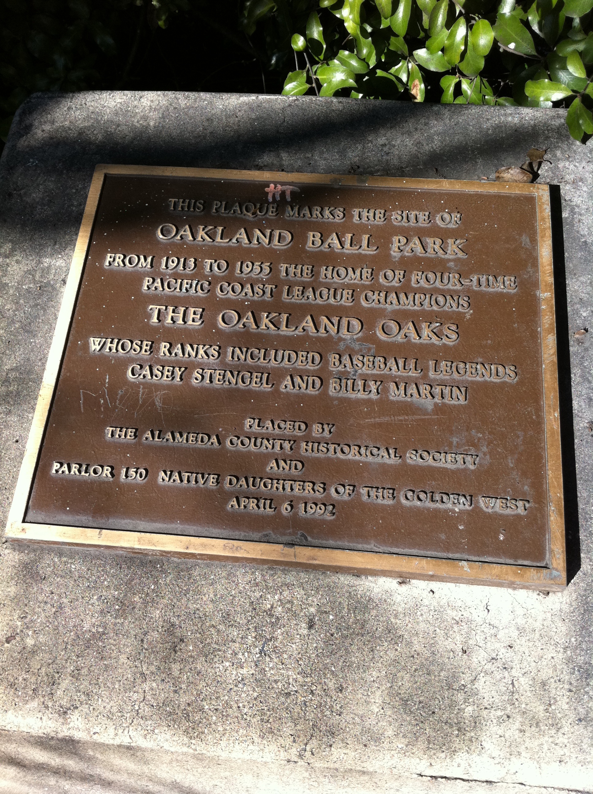
 Plaque commemorating Oakland Ball Park.
Oaks Park, formally known as the Oakland Baseball Park, and at times nicknamed Emeryville Park, was a baseball stadium in Emeryville, California. It was primarily used for baseball, and was the home field of the Oakland Oaks Pacific Coast League baseball team. It opened in 1913 and held 7,000 people. The Oaks played there until 1955.
The ballpark was located within the city limits of Emeryville, between Oakland and Berkeley. The site was on the block bounded by 45th Street (north, first base); San Pablo Avenue (east, third base); Park Avenue (south, left field); and Watts Street (west, right field). The stadium did not front directly on San Pablo where a strip of various small commercial buildings stood, now replaced by a single one-story commercial building with several chain businesses.
Oaks Park was highly accessible, as a major streetcar line ran on San Pablo Avenue, and a station serving several of the Key System's transbay commuter rail lines existed a few blocks south at Yerba Buena Avenue.
The Oaks had been playing most of their home games (except Thursdays and Sunday mornings) at Recreation Park in San Francisco, starting when that new ballpark opened in 1907. Even after moving back to Oakland, the Oaks would play a number of games each year in San Francisco. PCL founding father J. Cal Ewing owned both the Oaks and the San Francisco Seals from 1903 until sometime in the 1920s, at which point the Oaks began playing all their games in Oakland.
The Oaks, faced with declining attendance and a detoriating ballpark, moved to Vancouver in 1956, two years before Major League Baseball came to the Bay Area, and twelve years before the arrival of the Oakland Athletics. Oaks Park, unsuitable for major league ball in any case, was long demolished by then.
Until recently, the site of the park was partly an empty, fenced-off lot, with Pixar Studios overlapping it where Watts Street used to run through. Currently it is part of the Phase II of Pixar Studios expansion and will be a parking lot with a public bicycle path and park on the San Pablo side of the property.
Sources
- Take Me Out to the Ball Park, Lowell Reidenbaugh, The Sporting News, 1983 & 1987, p.200
External links
Categories:- Emeryville, California
- Minor league baseball venues
- Sports in Oakland, California
- Sports venues in California
- Baseball venues in California
Wikimedia Foundation. 2010.