- Maryland Route 33
-
This article is about the current Maryland Route 33. For the former MD 33, see Maryland Route 17.
Maryland Route 33

Route information Maintained by MDSHA Length: 23.17 mi[1] (37.29 km) Major junctions West end: Black Walnut Point Road in Tilghman Island  MD 579 near Saint Michaels
 MD 329 near Royal Oak
 MD 370 near Easton
 MD 322 in Easton
East end: Washington Street in Easton Location Counties: Talbot Highway system Maryland highway system
Interstate • US • State • Minor • Former • Turnpikes←  MD 32
MD 32MD 34  →
→Maryland Route 33 (MD 33) is a state highway in the U.S. state of Maryland. The state highway runs 23.17 mi (37.29 km) from Tilghman Island east to Washington Street in Easton. MD 33 connects Easton, the county seat of Talbot County, with all communities on the peninsula that juts west into the Chesapeake Bay between the Miles River and Eastern Bay on the north and the Tred Avon River and Choptank River on the south. The state highway passes through the historic town of Saint Michaels, home of the Chesapeake Bay Maritime Museum, and enters Tilghman Island by passing over Knapps Narrows on the busiest drawbridge in the United States.
MD 33 between Easton and Saint Michaels was one of the original state roads outlined by the Maryland State Roads Commission in 1909. The state highway was constructed between Easton and Claiborne, the terminus of a ferry to Annapolis, in the late 1910s and early 1920s, and was originally designated MD 17. The portion of the highway between Claiborne and Tilghman Island was constructed as MD 451 in the early 1930s. The state highway was extended north to MD 404 in Matapeake on Kent Island when the western terminus of the ferry from Claiborne was moved to Romancoke in the late 1930s. MD 33 received its present number in a 1940 number swap with present MD 17. Following the shutdown of the ferry, MD 33 was extended west along MD 451 to Tilghman Island and the Romancoke–Matapeake highway was redesignated MD 8. In Easton, MD 33 was extended north along Washington Street in the late 1940s and then along Easton Parkway, presently MD 322, in the mid 1960s, before the eastern terminus returned to its present location in the late 1970s.
Contents
Route description
MD 33 begins at the start of state maintenance 0.10 mi (0.16 km) south of Wharf Road and Phillips Road on Tilghman Island.[1] The roadway continues south as Black Walnut Point Road, a county highway that leads to the namesake point at the south end of the island.[1][2] MD 33 heads north through the village of Tilghman Island as two-lane Tilghman Island Road, passing Tilghman Elementary School and many businesses before leaving the island by crossing Knapps Narrows on a single bascule drawbridge that is the busiest drawbridge in the United States.[1][2][3] Shortly after leaving Tilghman Island, the state highway passes through a mix of forest and farmland, passing the hamlets of Sherwood and Wittman and several pieces of old alignment of the highway. MD 33 curves to the east around the head of Harris Creek and passes through McDaniel before reaching Claiborne Road, which was formerly MD 451 and heads northwest to the village of Claiborne.[2]
 Westbound MD 33 past bridge over Oak Creek in Newcomb.
MD 33 continues southeast as St. Michaels Road.[1] The state highway passes the northern terminus of MD 579 (Bozman Neavitt Road) and around the head of Broad Creek before curving south and passing through the town of Saint Michaels and its namesake historic district.[2] MD 33 is known as Talbot Street within the town, where the highway passes the entrance to the Chesapeake Bay Maritime Museum, marked by the previous drawbridge over Knapps Narrows.[1] The state highway curves to the southeast within the town and continues straight out of town through a mix of farmland and forests until the hamlet of Newcomb, where MD 329 (Royal Oak Road) splits to the south towards Royal Oak and Bellevue while MD 33 curves east to cross Oak Creek along the shore of the Miles River. MD 33 continues northeast, collecting the other end of MD 329 before passing a few riverfront subdivisions ahead of the intersection with MD 370 (Unionville Road).[2] Shortly after entering the town limits of Easton, the state highway crosses Tanyard Branch at the intersection with MD 322 (Easton Parkway), a bypass of the town that connects with US 50 in both directions.[1][2] MD 33 continues east as Bay Street toward downtown Easton, where the highway reaches its eastern terminus at Washington Street.[2]
History
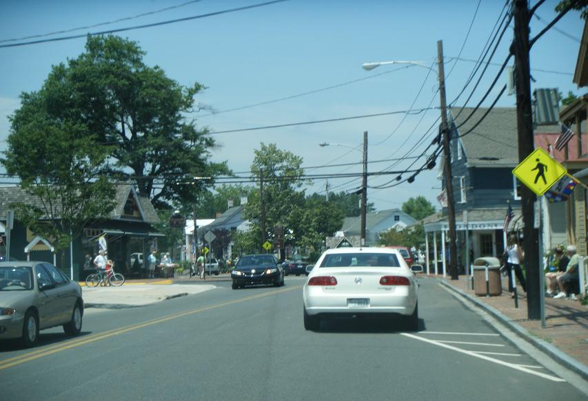
 Westbound MD 33 at intersection with Railroad Street/Cherry Street in Saint Michaels.
The portion of present-day MD 33 between Easton and Saint Michaels was designated one of the original state roads when the Maryland State Roads Commission laid out the original state road system in 1909.[4] However, the Easton–Saint Michaels road was not considered a necessary component of the system, so construction in its modern form was delayed in favor of the Easton–Wye Mills road.[5] A 2-mile (3.2 km) section of the road between the eastern intersection with MD 329 and MD 370 was paved by 1910.[6] The first sections of modern MD 33 constructed by the State Roads Commission were between Saint Michaels and Claiborne, which became the terminus of the Claiborne–Annapolis Ferry in 1919. Sections were completed between the two villages in 1919 and 1920.[7][4] A section of the highway was also completed between Easton and the MD 370 intersection in 1920.[4] The Easton–Claiborne Road was completed in 1924.[8] When numbers were assigned to certain state highways beginning in 1927, the road was designated MD 17.[9]
The next section of present-day MD 33 was constructed between Claiborne and the highway's present western terminus on Tilghman Island as MD 451. The sections from Claiborne to a point between Wittman and Sherman and on Tilghman Island were completed around 1930.[4] The gap between Knapps Narrows and Sherman was filled in 1933.[10][11] MD 451 was completed when a new single bascule drawbridge was completed over Knapps Narrows in 1934.[3] MD 17 was extended from Claiborne across Eastern Bay along Romancoke Road to MD 404 in Matapeake on Kent Island in 1938.[12][13] This section was added in response to the replacement of the Claiborne–Annapolis ferry route with a Claiborne–Romancoke route in 1938, with traffic following the new section of MD 17 to Matapeake to take a second ferry across the Chesapeake Bay to Annapolis.[12][14] MD 17 switched numbers with MD 33, the highway connecting Brunswick and Wolfsville in Frederick County that is presently MD 17 in 1940.[15]

After a new, straighter US 213 (replaced by US 50 in 1949) was completed from south of Easton to Wye Mills in 1948, MD 33 was extended north along Washington Street within Easton to the new bypass.[16][17][18] Following the closing of the Claiborne–Romancoke ferry in 1953, MD 33 and MD 451 switched alignments in 1957; MD 33 achieved its present western terminus at Tilghman Island while MD 451 became a short highway from MD 33 to Claiborne.[19][20] MD 33 between Romancoke and Matapeake was redesignated MD 8 in 1960.[21] MD 451 was removed from state maintenance in 1998.[22][23]
Easton Parkway was constructed as a western bypass of Easton in the 1960s. MD 33 was moved from Washington Street to the part of the bypass north of present MD 33 when that section of Easton Parkway opened in 1965.[24] MD 322, which was assigned to the southern part of Easton Parkway, replaced MD 33 on Bay Street between Easton Parkway and Washington Street, the latter of which became a northern extension of MD 565.[25] In 1978, MD 322 was assigned to all of Easton Parkway and MD 33 assumed its present eastern terminus.[26] The Knapps Narrows drawbridge was replaced by a new drawbridge in 1998.[3] The 1934 drawbridge was transferred to the entrance of the Chesapeake Bay Maritime Museum in Saint Michaels.[3][27]
Junction list
The entire route is in Talbot County.
Location Mile[1] Destinations Notes Tilghman Island 0.00 Black Walnut Point Road south Western terminus 0.87 Drawbridge over Knapps Narrows McDaniel 10.00 Claiborne Road north – Claiborne Former MD 451; old alignment of MD 33 10.81 MD 579 south (Bozman Neavitt Road) – Bozman, NeavittSt. Michaels 13.10 Dodson Avenue – Chesapeake Bay Maritime Museum Newcomb 16.33 MD 329 east (Royal Oak Road) – Royal Oak, Bellevue16.97 Bridge over Oak Creek 18.43 MD 329 west (Royal Oak Road) – Royal Oak20.93 MD 370 north (Unionville Road) – UnionvilleEaston 22.66  MD 322 (Easton Parkway) to US 50 – Cambridge, Bay Bridge
23.17 Washington Street Eastern terminus; former MD 565 and US 213 1.000 mi = 1.609 km; 1.000 km = 0.621 mi References
- ^ a b c d e f g h "Highway Location Reference: Talbot County" (PDF). Maryland State Highway Administration. 2009. http://www.marylandroads.com/Location/2009_TALBOT.pdf. Retrieved 2010-09-09.
- ^ a b c d e f g Google, Inc. Google Maps – Maryland Route 33 (Map). Cartography by Google, Inc. http://maps.google.com/maps?f=d&source=s_d&saddr=Black+Walnut+Point+Rd&daddr=Bay+St&geocode=Ff-iTgId1ypz-w%3BFaiwTwIdHCt3-w&hl=en&mra=ls&sll=38.707966,-76.338488&sspn=0.00048,0.001206&ie=UTF8&t=h&z=12. Retrieved 2010-09-09.
- ^ a b c d Bailey, Steve (May/June 2010). "Ups & Downs". Chesapeake Life (Baltimore: Alter Communications). http://www.chesapeakelifemag.com/index.php/cl/features_article/feature_knapps_narrows_drawbridge/. Retrieved 2010-09-12.
- ^ a b c d Report of the State Roads Commission of Maryland. 1927-1930. Baltimore: Maryland State Roads Commission. 1930-10-01. pp. 20–21, 229. http://www.archive.org/details/reportofstateroa1927mary. Retrieved 2010-09-04.
- ^ Report of the State Roads Commission of Maryland. 1912-1915. Baltimore: Maryland State Roads Commission. May 1915. p. 54. http://www.archive.org/details/annualreportsofs1912mary. Retrieved 2010-09-04.
- ^ Maryland Geological Survey. Map of Maryland (Map) (1910 ed.).
- ^ Report of the State Roads Commission of Maryland. 1916-1919. Baltimore: Maryland State Roads Commission. January 1920. p. 48. http://www.archive.org/details/annualreportsofs1916mary. Retrieved 2010-09-09.
- ^ Report of the State Roads Commission of Maryland. 1924-1926. Baltimore: Maryland State Roads Commission. January 1927. p. 34. http://www.archive.org/details/annualreportsofs1924mary. Retrieved 2010-09-09.
- ^ Maryland Geological Survey. Map of Maryland: Showing State Road System and State Aid Roads (Map) (1927 ed.).
- ^ Report of the State Roads Commission of Maryland. 1931-1934. Baltimore: Maryland State Roads Commission. 1934-12-28. p. 356. http://www.archive.org/details/reportofstateroa1931mary. Retrieved 2010-09-09.
- ^ Maryland Geological Survey. Map of Maryland Showing State Road System: State Aid Roads and Improved County Road Connections (Map) (1933 ed.).
- ^ a b Maryland State Roads Commission. Map of Maryland Showing State Road System (Map) (1938 ed.).
- ^ Report of the State Roads Commission of Maryland. 1937-1938. Baltimore: Maryland State Roads Commission. 1939-03-04. p. 105. http://www.archive.org/details/reportofstateroa1937mary. Retrieved 2010-09-09.
- ^ Maryland State Roads Commission. General Highway Map: State of Maryland (Map) (1939 ed.).
- ^ Maryland State Roads Commission. Map of Maryland Showing Highways and Points of Interest (Map) (1940 ed.).
- ^ Maryland State Roads Commission. Maryland: Official Highway Map (Map) (1948 ed.).
- ^ Report of the State Roads Commission of Maryland. 1947-1948. Baltimore: Maryland State Roads Commission. 1949-02-15. p. 106. http://www.archive.org/details/reportofstateroa1947mary. Retrieved 2010-09-09.
- ^ Maryland State Roads Commission. Maryland: Official Highway Map (Map) (1949 ed.).
- ^ Maryland State Roads Commission. Maryland: Official Highway Map (Map) (1954 ed.).
- ^ Maryland State Roads Commission. Maryland: Official Highway Map (Map) (1957 ed.).
- ^ Maryland State Roads Commission. Maryland: Official Highway Map (Map) (1960 ed.).
- ^ Maryland State Highway Administration. Maryland: Official Highway Map (Map) (1997 ed.).
- ^ "Highway Location Reference: Talbot County" (PDF). Maryland State Highway Administration. 1999. http://www.marylandroads.com/Location/1999_TALBOT.pdf. Retrieved 2010-09-09.
- ^ Maryland State Roads Commission. Maryland: Official Highway Map (Map) (1965 ed.).
- ^ United States Geological Survey (1974-07-01). Easton, Maryland, United States (Map). Topo Map. http://msrmaps.com/image.aspx?T=2&S=12&Z=18&X=507&Y=5365&W=3&qs=. Retrieved 2010-09-09.
- ^ Maryland State Highway Administration. Maryland: Official Highway Map (Map) (1978 ed.).
- ^ Google, Inc. Google Maps – 1934 Drawbridge at entrance to Chesapeake Bay Maritime Museum (Map). Cartography by Google, Inc. http://maps.google.com/maps?ie=UTF8&hq=&hnear=7600+Maple+Ave,+Takoma+Park,+Montgomery,+Maryland+20912&ll=38.788582,-76.224362&spn=0.00096,0.002411&t=h&z=19. Retrieved 2010-09-09.
External links
Roads in Talbot County, Maryland State highways 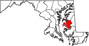
U.S. Highways Categories:- State highways in Maryland
- Roads in Talbot County, Maryland


Wikimedia Foundation. 2010.