Moab Fault

Moab Fault

Coordinates: 38°38′N 109°40′W / 38.633°N 109.667°W / 38.633; -109.667

Looking closer and closer at the fault zone, reveals more and more faults at smaller and smaller scales. In this sense faulting is fractal.

The Moab Fault, near Moab, Utah, USA is a well exposed and much studied geological fault. The Moab fault is an extensional fault that runs approximately NW-SE, passing to the west of the Arches National Park. The rocks on the SW side of the fault have been lifted up forming steep cliffs of Triassic Wingate sandstone and Chinle formation.

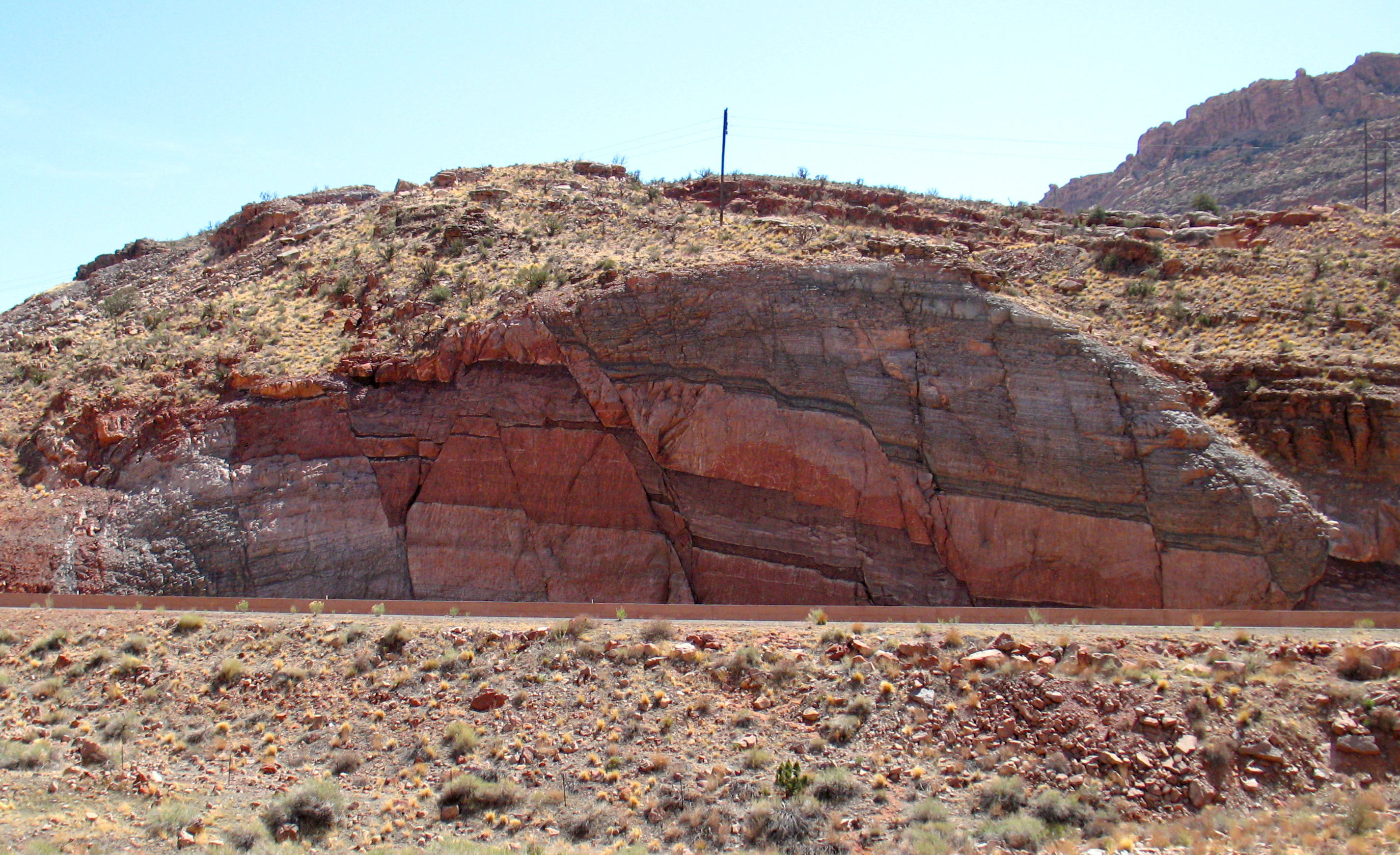
At the north end of the Moab valley, there is a fault transfer zone, where the fault steps east. This zone transfers the displacement along the fault from one segment to another. Within this zone there is very dense faulting. This is revealed in the road cutting for Highway 191 as seen in this picture taken from the nearby Arches National Park visitor centre.

Fault damage zones have great commercial interest to petroleum geoscientists as they can dramatically affect the performance of hydrocarbon reservoirs.


Wikimedia Foundation. 2010.

Игры ⚽ Нужно сделать НИР?

Look at other dictionaries:

  • Marianna Fault — Location of Marianna The Marianna Fault is a fault located near Marianna, Arkansas. The discovery was first announced by seismologists on January 21, 2009. It is not part of the more famous nearby New Madrid Seismic Zone …   Wikipedia

  • Clarendon-Linden fault system — Location of the Clarendon Linden fault system in western New York The Clarendon Linden fault system is a major series of fault lines in western New York state, in the United States. It extends through Orleans, Genesee, Wyoming, and into Allegany… …   Wikipedia

  • Denali Fault — Tectonic map of Alaska and northwestern Canada showing main faults and historic earthquakes The Denali Fault is a major intracontinental dextral (right lateral) strike slip fault in western North America, extending from northwestern British… …   Wikipedia

  • New Madrid Seismic Zone — Coordinates: 36°34′57″N 89°35′17″W / 36.58245°N 89.58801°W / 36.58245; 89.58801 …   Wikipedia

  • Geology of North America — The geology of North America, like most topics of scientific study, is undergoing progressive investigation by numerous public and private sector earth scientists, academicians, and students. In that regard, the detailed picture is subject to… …   Wikipedia

  • Arches National Park — IUCN Category II (National Park) …   Wikipedia

  • New York-Alabama Lineament — The New York Alabama Lineament is a magnetic anomaly in the geology of eastern North America running from Alabama to New York. The lineament is defined by discontinuities in aeromagnetic measurements indicating an approximately 220 kilometre… …   Wikipedia

  • GEOGRAPHICAL SURVEY — Names The name Ereẓ Israel (the Land of Israel) designates the land which, according to the Bible was promised as an inheritance to the Israelite tribes. In the course of time it came to be regarded first by the Jews and then also by the… …   Encyclopedia of Judaism

  • biblical literature — Introduction       four bodies of written works: the Old Testament writings according to the Hebrew canon; intertestamental works, including the Old Testament Apocrypha; the New Testament writings; and the New Testament Apocrypha.       The Old… …   Universalium

  • Biblical Geography —     Biblical Geography     † Catholic Encyclopedia ► Biblical Geography     With the exception of the didactic literature, there is no book in the Bible which, to a greater or less extent, does not contain mention of, or allusions to, the… …   Catholic encyclopedia

Share the article and excerpts

Direct link
Do a right-click on the link above
and select “Copy Link”