- Chacarita, Buenos Aires
-
Chacarita — Barrio — Los Andes Park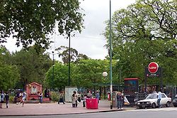 Location of Chacarita within Buenos Aires
Country  Argentina
Autonomous City Buenos Aires Comuna C15 Area - Total 2.8 km2 (1.1 sq mi) Population (2001) - Total 27,440 - Density 9,800/km2 (25,381.9/sq mi) Time zone ART (UTC-3) Cementerio de la Chacarita
Estación Federico LacrozeChacarita is a barrio or district in the north-central part of Buenos Aires, Argentina. Located between Colegiales, Palermo, Villa Crespo, La Paternal and Villa Ortúzar, this is a quiet neighbourhood with tree-lined streets, a combination of vintage rowhouses and apartment buildings. Locally, it's probably best known for the 70 hectare (175 acre) Chacarita Cemetery.
History
 Entrance to Chacarita Cemetery
 Lacroze Avenue.
The territories of this district belonged formerly to the Jesuits, who had small farms. Its name comes from the word "small farm" or chácara in old Spanish. Following the Suppression of the Jesuits in 1767, they were expelled and all their goods were declared property of the Crown.
One of the few and most important remaining residences from the era is that of the Comastri family, which at the moment is the Escuela Nacional de Educación Técnica N° 34.
Chacarita is the namesake for both a well-known tango, Encuentro obligado, and the Chacarita Cemetery. The area's principal park is Los Andes, which was inaugurated in 1941. The meeting place of the neighbourhood is the “Club Chacarita Juniors”.
Transportation
Numerous important avenues and rail lines traverse the Chacarita district, among them the Urquiza and San Martín railway lines, and Elcano, Del Campo, Garmendía, Warnes, Dorrego, Álvarez Thomas and Córdoba Avenues. Jorge Newbery Avenue is characterized for being the only way funeral cars are allowed to go towards the cemetery, whose main entrance is on 780 Guzmán Street.
Federico Lacroze Station commuter rail terminal, which handles local and long-distance services, is also located in Chacarita.
References
- (Spanish) Barrios Porteños
Barrios of Buenos Aires 
Agronomía · Almagro · Balvanera · Barracas · Belgrano · Boedo · Caballito · Chacarita · Coghlan · Colegiales · Constitución · Flores · Floresta · La Boca · La Paternal · Liniers · Mataderos · Monte Castro · Monserrat · Nueva Pompeya · Núñez · Palermo · Parque Avellaneda · Parque Chacabuco · Parque Chas · Parque Patricios · Puerto Madero · Recoleta · Retiro · Saavedra · San Cristóbal · San Nicolás · San Telmo · Vélez Sársfield · Versalles · Villa Crespo · Villa del Parque · Villa Devoto · Villa Lugano · Villa Luro · Villa Mitre · Villa Ortúzar · Villa Pueyrredón · Villa Real · Villa Riachuelo · Villa Santa Rita · Villa Soldati · Villa Urquiza
Categories:- Neighbourhoods of Buenos Aires
- Argentina geography stubs


Wikimedia Foundation. 2010.