- Riverdale, Toronto
-
Riverdale — Neighbourhood — The corner of Logan and Wolfrey, looking southwest.
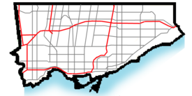
 Location within Toronto
Coordinates: 43°40′04″N 79°20′59″W / 43.66775°N 79.34961°WCoordinates: 43°40′04″N 79°20′59″W / 43.66775°N 79.34961°W Country  Canada
Province  Ontario
City  Toronto
 View of downtown from Withrow Park.
Riverdale is a large neighbourhood in Toronto, Ontario, Canada. It is bounded by the Don River Valley to the west, Danforth Avenue and Greektown to the north, Jones Avenue, the CN/GO tracks, and Leslieville to the east, and Lake Shore Boulevard to the south.
The popular teen drama shows The Kids of Degrassi Street, Degrassi Junior High, Degrassi High, and Degrassi: The Next Generation are named after the South Riverdale street of the same name.
Contents
Character
Known by many Torontonians as a thriving residential neighbourhood, from the strong arts community that caters to independent galleries on Queen St, to the large corporate film studios along the waterfront. Riverdale was formerly a town before it was annexed by the City of Toronto in 1884. Its tree-lined side-streets are complemented by the various styles of Victorian and Edwardian residential architecture, primarily built between the 1880s and the Great Depression. The neighbourhood has seen the rise and fall of prosperity over the past century. The grand homes built on some streets are a testimony to prosperous times. Despite this rich housing stock, the area was considered to be down-and-out in the 1970s. Since then, the area has rebounded dramatically and is now a trendy and expensive residential district, attracting many young professionals and families.[citation needed]
The main commercial streets in the neighborhood are: Danforth Avenue which has a high concentration of Greek restaurants in addition to a variety of boutique and mainstream shops; Gerrard Street East, home to Asian shops and restaurants of East Chinatown and the Gerrard Square Mall; and Queen Street East featuring a variety of restaurants, cafes, and small shops.
The neighbourhood features three large recreational parks; Riverdale Park, adjacent to the Don River, Withrow Park, in the north east of Riverdale, and Jimmie Simpson Park, in the southeast.
Schools
- Riverdale Collegiate Institute is the neighbourhood's local high-school.
- Earl Grey Senior Public School is the area's local middle school, grade 7-8.
- Quest Alternative School[1] is the area's original alternative middle school, and one of the first in Toronto. Consisting of 68 students and 4 staff, Quest celebrated its 25th anniversary in 2008. The school's motto is: "Structure to learn and freedom to grow", and its focus is on student-centered learning and diverse curriculum.
- East Alternative School of Toronto[2] is another local alternative middle school, specializing in social justice and visual arts. It also has 68 students and accepts students from all over Toronto.
- Withrow Avenue Junior Public School[3], Jackman Avenue Junior Public School[4] , Frankland Community School[5], are the three local junior public schools in North Riverdale.
- Holy Name Catholic School is overseen by the Toronto Catholic District School Board and teaches grades K - 8.
- 'Montcrest School is located on Montcrest Boulevard and several houses on Broadview Avenue just north of Riverdale Park. The school is relatively small with just over 300 students, which leads to a much more personal environment. Montcrest School has classes from Junior Kindergarten to Grade 8, Montcrest school is also a private school who has been in operation since 1961,[6] previously operating under the name The January School. Montcrest is a non-denominational school, and has offered an enhanced education program for children with learning special education needs.
Institutions
Riverdale is also home to Bridgepoint Health (formerly Riverdale Hospital), and the Don Jail, both at the corner of Broadview Avenue and Gerrard Street East.
The Riverdale Zoo was Toronto's zoological park before the opening of the Toronto Zoo in the early 1970s. Now called Riverdale Farm, it continues as an educational farm for school children and the general public. Oddly, Riverdale Farm is not actually in the Riverdale neighbourhood, but is located west of the Don River in Cabbagetown. The two neighbourhoods are closely linked even though they are separated by the Don River. Also home to the former of location of the Ralph Day Funeral Home which has since been relocated from its location on Danforth Avenue east of Broadview Avenue
Parks and recreation
There are three medium to large sized parks in Riverdale. At the west edge between Broadview Avenue and the Don Valley Parkway just north of Bridgepoint Health is Riverdale Park East. This park features a running track, three baseball diamonds, a skating rink, a public swimming pool and tennis courts. At the south end, a community centre is under construction which was the former St. Matthew's Lawn Bowling Clubhouse which was relocated there in 2009. To the east is Withrow Park which has a large off-leash dog area, an ice rink, two baseball diamonds, play structures, and a soccer field. In the south is Jimmy Simpson Park which contains tennis courts and a community centre. In the southwest corner just north of Queen St. East on Broadview Avenue is the Royal Canadian Curling Club. The curling club features 6 sheets and hosts leagues for about 500 members.
Neighbourhoods within Riverdale
 Aerial View of Riverdale, 1942
Riverdale is often said to refer to the stretch of Toronto east of the Don Valley Parkway and west of Jones, between Danforth Avenue (north) and Gerrard Street (south). However, this area is usually referred to as North Riverdale, and Riverdale itself covers a much wider area and includes many smaller communities, usually centred around a 'high street' or commercial area.
South Riverdale
South Riverdale, as its name suggests, is the southern half of the Riverdale neighbourhood. Its approximate boundaries are: the Don Valley Parkway to the west, Jones Ave. to the east, Gerrard Street East to the north, and Lake Shore Boulevard to the south.
South Riverdale comprises many smaller neighbourhoods:
Riverside
Riverside, formerly known as the Queen Broadview Village is a small neighbourhood located within the larger neighbourhood of South Riverdale. Definite boundaries have never been drawn for Riverside, but according to the Riverside Business Improvement Area Plan's definitions it can be assumed that the borders are the Don River to the west, Gerrard St. East to the north, Logan Avenue to the east and Eastern Ave. to the south.
Riverside is a mixed income and largely multicultural neighbourhood currently experiencing a trend of gentrification along Queen St. East and Broadview Ave. While it is a small neighbourhood it's home to several places of note such as the former Don Destructor, Toronto's only garbage incinerator, and Don Mount Court, a social housing project that is under redevelopment and will be rebuilt as part of a mixed social housing and market value community. The market value portion is being sold under the name Rivertowne. Unquestionably, the biggest landmark in the neighbourhood is the New Broadview House Hotel, a romanesque hotel constructed in 1893 that was the tallest structure in South Riverdale for several decades. Other major landmarks include the Ralph Thornton Community Centre, Broadview Lofts, and The Opera House.
The area was once home to a large young population which is evident in the cluster of schools just east of Broadview Ave. Dundas Jr. Public School is the resident school for children in kindergarten through to fifth grade, after which they are transferred over to Queen Alexandra Sr. Public School which sees students through to eighth grade. It is also home First Nations School of Toronto, a cultural survival school that places heavy emphasis on aboriginal values and culture, and the current location of SEED Alternative Secondary School, Canada's first public alternative school.
East Chinatown
Toronto's second largest 'china town', also known as East Chinatown is found at Broadview & Gerrard.
Studio District
The southern part of South Riverdale, just north of the Port Lands, is what's called the Studio District. Industrial warehouses along Lakeshore avenue house production studios and many people working in film and television live in the old Victorians found along the area's side streets. Carlaw and Queen has become an arts hub, with many artists choosing to run their studios from the various work-live lofts.
Jones Pocket
The Pocket, referred to by the city as Blake-Jones is a pocket of tree-lined streets with residences built from the 1870s to 1930s. The neighbourhood extends along Jones Avenue commencing at the cemetery south of Strathcona and extending down to Hunter.[7] It is bordered by Danforth Avenue to the north, Pape Avenue to the west, Greenwood Avenue to the east and the CN Railway tracks just south of Riverdale/Boultbee Avenue to the south. The area which is east of Jones is also referred to as "The Pocket" by its residents.
Houses along Blake st are more affordable in this neighbourhood than in many areas of the city, and most homes are semi-detached. There are also a lot of people living in public housing apartment and townhouse complexes.
While not a religious centre, by comparison, there is an above average number of people from the Muslim and Greek Orthodox communities living in the area. The largest visible minority group is Chinese.
There are three local elementary schools zoned to the area; Blake Street (which also houses East end Alternative), Earl Grey, and Pape Avenue. The high school that is zoned to the area is Riverdale Collegiate Institute. There is also an alternative high school, Eastern Commerce, in the Donlands/Danforth area.
The neighbourhood is served by the Pape, Donlands, and Greenwood subway stations and the 83 Jones bus route, and is also home to what is perhaps its best known landmark, the Greenwood Subway Yard.
Other
Some Riverdale residents differentiate between "upper" and "lower" Riverdale. "Upper Riverdale" is characterized as the part of the neighbourhood north of Riverdale Ave., and "Lower Riverdale" is the area south of Riverdale Ave. In terms of the quality of the housing supply, homes built in "upper Riverdale" are more likely to be renovated, but "Lower Riverdale" contains more original and classic designs of the late 19th century. There are a number of remarkable century-old homes built on Simpson and Langley Avenues, the latter street named after Toronto's well-known early 20th century architect, and the former featuring the oldest Victorian houses in Riverdale. Of note, Simpson Avenue is home to the original six houses of Riverdale; located at the west end of the street and locally known as the 'Six Sisters.' The area bounded by Dundas St. East in the south, Jones Ave. to the east, the railway tracks to the north, and Carlaw Ave. to the west is also referred to by local residents as "Badgerow," after a residential street that runs through the centre of that area. This pocket includes the legendary Maple Leaf Tavern, as well as a Sikh temple, Turkish cultural centre and Jewish cemetery, in addition to the Gerrard Square shopping mall.
Politics
Riverdale is in the political riding of Toronto-Danforth, and is currently represented in the Ontario provincial parliament by Peter Tabuns, deputy leader of the New Democratic Party of Ontario. Municipally, Riverdale is in Toronto Ward 30, represented by Toronto city councillor Paula Fletcher. Federally it was represented by Jack Layton, the late leader of the federal New Democrats, but the seat became vacant upon his death.
Federally the riding, known for many years as Broadview and then Broadview—Greenwood, has been represented by New Democrats from 1962 (the first federal election after the party was formed) until 1988, when Liberal Dennis Mills won the seat. Mills held the riding until 2004, when the New Democratic Party regained the seat in the 2004 Canadian federal election.
Provincially, the riding was known as Riverdale from the 1914 Ontario provincial election until the 1999 Ontario provincial election when the number of provincial ridings were reduced and given the same borders and names as federal ridings, in this case Broadview—Greenwood and, more recently, Toronto—Danforth. In all its guises it has elected a New Democrat in every election since 1963.
1964 By-Election
The 1964 Riverdale by-election set the model for NDP campaigns. Under the campaign management of Gerald Caplan, and Stephen Lewis, and Marjorie Pinney the NDP canvassed every household three times, identified all their supporters, and then they got out the vote. This strategy is also known as PIG, Persuade, Identify, Get out the vote. Lawyer James Renwick won with 7,287 votes compared to 5,774 votes for the Conservatives and 5,771 votes for the Liberals.
Members of Provincial Parliament for Riverdale
- Joseph Russell, Conservative, 1914–1919
- Joseph McNamara, Soldier, 1919–1923
- George Oakley, Conservative, 1923–1934
- Robert Aloysius Allen, Liberal, 1934–1936
- William Summerville, Conservative, 1937–1943
- Leslie Wismer, Co-operative Commonwealth Federation, 1943–1945
- Gordon Millen, Progressive Conservative, 1945–1948
- Leslie Wismer, Co-operative Commonwealth Federation, 1948–1951
- Robert Macaulay, Progressive Conservative, 1951–1964
- James Renwick, New Democratic Party, 1964–1984
- David Reville, New Democratic Party, 1985–1990
- Marilyn Churley, New Democratic Party, 1990–2005
- Peter Tabuns, New Democratic Party, 2006–present
Notable roads
- Dundas Street East
- Gerrard Street East
- Danforth Avenue
Notable people
- Bashir Makhtal[8]
- Steven Page
- William Allen
- John Sewell
- Tom Clifford
- Paul Christie
- Derwyn Shea
- Steve Stavro
- Ying Hope
- Charles A. Walton
- Donald Dean Summerville
- Morley Callaghan
- Desmond Morton
- Punch Imlach
- Michael Hollett
- Dennis Drainville
- Raphael Marcus
- Michael Ironside
- Bnei Akiva
- David Reville
- Melissa DiMarco
- Robert S. Kenny
- Lynne Griffin
- Paul Soles
- Gordon Massie
- Christian Lander
- William Peyton Hubbard
- KO
See also
- Riverdale Park
- Withrow Park
- Riverdale (TV series)
- Streetcar suburb
- New Broadview House Hotel (Jilly's)
- Don Jail
References
- ^ http://www.tdsb.on.ca/SchoolWeb/_site/viewitem.asp?siteid=10056&pageid=7556&menuid=8633
- ^ http://www.tdsb.on.ca/MOSS/asp_apps/school_landing_page/index.asp?schno=5290
- ^ Withrow Avenue Junior Public School, Withrow Avenue Junior Public School. "Withrow Avenue Junior Public School". Withrow Avenue Junior Public School. Withrow Avenue Junior Public School. http://www.tdsb.on.ca/schools/index.asp?schno=5285. Retrieved 14/09/11.
- ^ Jackman Avenue Junior Public School, Jackman Avenue Junior Public School. "Jackman Avenue Junior Public School". Jackman Avenue Junior Public School. Jackman Avenue Junior Public School. http://www.tdsb.on.ca/schools/index.asp?schno=5214.
- ^ Frankland Community School, Frankland Community School. "Frankland Community School". 14/09/11. http://www.tdsb.on.ca/schools/index.asp?schno=5227.
- ^ "Montcrest School History". Montcrest School. http://www.montcrest.on.ca/index.cfm?PID=15328&PIDLIST=15323,15328.
- ^ The Globe and Mail, Friday, August 22, 2008, page G16
- ^ Friends and Family of Bashir Makhtal, Biography of Bashir Makhtal
- Local news, activities, information and updates.
- Demographic profile of northeast Riverdale
- Demographic profile of northwest Riverdale
- Demographic profile of south Riverdale
- [1]

Playter Estates Cabbagetown
Regent Park
Corktown
Blake-Jones
Leslieville Riverdale

Port Lands Former municipalities of Toronto by year of amalgamation 1883-1912 1883: Yorkville · 1884: Brockton · Riverdale · 1888: Seaton Village · 1889: Parkdale · 1890: Bedford Park · Davisville · 1905: Rosedale · 1908: Deer Park · East Toronto · 1909: Bracondale · West Toronto · Wychwood · 1910: Moore Park · North Toronto · 1912: Dovercourt · Earlscourt1967 1998 Categories:- Neighbourhoods in Toronto
- Former municipalities in Toronto


Wikimedia Foundation. 2010.