- Poza Rica, Veracruz
Infobox Settlement
official_name = Poza Rica
other_name =Poza Rica de Hidalgo
native_name =
nickname =
settlement_type =
motto =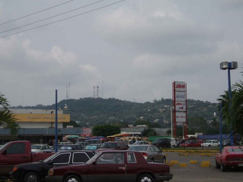
imagesize =
image_caption =
flag_size =
image_
seal_size =
image_shield =
shield_size =
city_logo =
citylogo_size =
mapsize =
map_caption =
mapsize1 =
map_caption1 =
image_dot_
dot_mapsize =
dot_map_caption =
dot_x = |dot_y =
pushpin_
pushpin_label_position =
pushpin_map_caption =
pushpin_mapsize =
subdivision_type = Country
subdivision_name = MEX
subdivision_type1 = State
subdivision_name1 =Veracruz
subdivision_type2 = Municipality
subdivision_name2 = Poza Rica de Hidalgo
subdivision_type3 =
subdivision_name3 =
subdivision_type4 =
subdivision_name4 =
government_footnotes =
government_type =
leader_title = President
leader_name =Dr. Pablo Anaya
leader_title1 =
leader_name1 =
leader_title2 =
leader_name2 =
leader_title3 =
leader_name3 =
leader_title4 =
leader_name4 =
established_title = Founded
established_date =November 20 ,1951
established_title2 =
established_date2 =
established_title3 =
established_date3 =
area_magnitude =
unit_pref =
area_footnotes =
area_total_km2 =
area_land_km2 =
area_water_km2 =
area_total_sq_mi =
area_land_sq_mi =
area_water_sq_mi =
area_water_percent =
area_urban_km2 =
area_urban_sq_mi =
area_metro_km2 =
area_metro_sq_mi =
area_blank1_title =
area_blank1_km2 =
area_blank1_sq_mi =
population_as_of =2005
population_footnotes =
population_note =
population_total =181,438
population_density_km2 =
population_density_sq_mi =
population_metro =
population_density_metro_km2 =
population_density_metro_sq_mi =
population_urban =
population_density_urban_km2 =
population_density_urban_sq_mi =
population_blank1_title =Demonym
population_blank1 =Pozarricense
population_density_blank1_km2 =
population_density_blank1_sq_mi =
timezone = CST
utc_offset = -6
timezone_DST =
utc_offset_DST =
latd=20 |latm=32 |lats= |latNS=N
longd=97 |longm=27 |longs= |longEW=W
elevation_footnotes =
elevation_m = 50
elevation_ft =
postal_code_type = Postal code
postal_code =93261
area_code =782
blank_name =
blank_info =
blank1_name =
blank1_info =
website = www.municipiopozarica.gob.mx
footnotes =Poza Rica (formally: Poza Rica de Hidalgo) is a city and its surrounding municipality in the Mexican state of
Veracruz . Its name means "rich well", because it was a place known for its abundance of oil. It has since been almost completely extracted. This resulted in the decline of oil well exploration and drilling activities but there are many oil refineries.It shares borders with the municipalities of
Papantla ,Tihuatlán , andCoatzintla , and stands on Federal Highway 180. The archaeological zone ofEl Tajín is located approximately km to mi|15 from Poza Rica. The area is intensely tropical, with two popular beaches within one hour,Tuxpan , andTecolutla , and one within 40 minutes, Cazones.Mexico City is about km to mi|220 from Poza Rica.Unlike most Mexican cities, it does not have old buildings because it is a new city founded officially in November 20th 1951. For that reason it has contemporary architecture with well-lined and designed streets with a modern look.While the petroleum industry features heavily amongst the industrial landscape in Poza Rica, the city also has a wide variety of other industries. As one of the largest and most populous cities in Veracruz, Poza Rica is an important industrial and commercial center, and central hub for several road transportation lines. The city has recently seen a lot of growth, with several commercial centers opening around the city. The city had an official population of 174,512 inhabitants and the municipality had 181,438 at the census of 2005. However, the Poza Ricametropolitan area , which includes the municipalities ofPapantla ,Tihuatlán , andCoatzintla , showed a total population of 458,330.Main Attractions
Poza Rica is close to the
Costa Esmeralda , the northern beaches of Veracruz, such asTecolutla ,Tuxpan ,Cazones andPlaya Esmeralda and because of its hotel and metropolitan infrastructure it is convenient for staying in a comfortable city.TheUNESCO World Heritage Site ofEl Tajin km to mi|15 away.It has a downtown area which provides a good shopping experience.It has a local famous height called "El cerro del abuelo" where it's possible to see the whole city and its "quemadores", big petroleum burners which were used to light the city in the early years. There are few of them at the present time.Every year there is a holiday called "Desfile del 18 de marzo" (March 18th Parade) which commemorates Mexican oil expropriation and has two beautiful parades, one in the morning and one in the afternoon.It is a city with a predominantly young population.Mexico's only nuclear power plant (Laguna Verde) is about km to mi|200 away, near the state's capital city of
Xalapa ,Veracruz .References
* [http://www.inegi.gob.mx/est/contenidos/espanol/sistemas/conteo2005/localidad/iter/ Link to tables of population data from Census of 2005] INEGI: Instituto Nacional de Estadística, Geografía e Informática
* [http://www.e-local.gob.mx/wb2/ELOCAL/EMM_veracruz Veracruz] Enciclopedia de los Municipios de MéxicoExternal links
* [http://www.municipiopozarica.gob.mx/ Un buen gobierno para una gran ciudad] Official website
Wikimedia Foundation. 2010.