- Douglas, South Lanarkshire
-
Douglas Scots: Douglas 
St Bride's Kirk, DouglasCouncil area South Lanarkshire Lieutenancy area Lanarkshire Country Scotland Sovereign state United Kingdom Dialling code 01555 Police Strathclyde Fire Strathclyde Ambulance Scottish EU Parliament Scotland UK Parliament Dumfriesshire, Clydesdale and Tweeddale (UK Parliament constituency) Scottish Parliament Clydesdale (Scottish Parliament constituency) List of places: UK • Scotland • Douglas is a village in South Lanarkshire, Scotland. It is located on the south bank of the Douglas Water and on the A70 road that links Ayr, on the West coast of Scotland, to Edinburgh on the East, around 12 miles south west of Lanark. The placename is of Gaelic origin, derived from the Old Gaelic dub and glais, meaning "dark stream",[1] in reference to the river. The Douglas family took this name when their ancestors settled here in the 12th century.
Contents
History
The village grew to service the nearby Douglas Castle, the seat of the Lords of Douglas. The first recorded mention of the Parish of Douglas is in a charter of Bricius de Douglas, Bishop of Moray dated between 1203-1222 to the monks of Kelso Abbey which is witnessed by Freskin Parson of Douglas, brother to the bishop.[2] The castle was well established by the time of William the Hardy when he was called upon to imprison Hugh de Abernethy there in 1288 and where Abernethy died at some point before 1293.[3] The castle was occupied for some time by English forces during the Scottish Wars of Independence. However the castle was liberated by Sir James Douglas when in 1307 he and some followers trapped the English garrison inside the Castle chapel whilst they were worshiping and burnt it to the ground, causing some damage to the castle.
Notable Buildings
The only remains of the castle are those of a 17th century corner tower, still known as "Castle Dangerous", after the Walter Scott novel which took Douglas Castle as its inspiration. In the 1930s Charles Douglas-Home, 13th Earl of Home allowed the mining of coal in the park near to the castle, in a philanthropic effort to alleviate local unemployment. The Lanarkshire coal industry, once the mainstay of Scotland's production, had seen its output almost halved by 1937, with catastrophic consequences for local communities. As a consequence of the mining works the castle was considered to be at risk of subsidence and had to be demolished in 1938.
The oldest structure within the village itself is the ruin of St. Brides Church, which like the castle originated in the 14th century. This church became the mausoleum of the Lords of Douglas. The church clock, which is still in working order today, and installed sometime in the 16th century, is rumoured to have been given as a gift to the village by Mary, Queen of Scots, after spending time in the area. The parish church was moved to its present site, near to the old chapel, where the Douglas St Brides Parish Church still stands. Its congregation now worships at the newer St Brides Church built some distance away.
Within the village stands a statue to one of the Covenanters, James Gavin who was persecuted for his religious faith and had his ears cut off with his own tailoring scissors for refusing to renounce it. After suffering this humiliation he was transported to a life of slavery in the cotton fields of the West Indies. The ruins of his house stood until 1968 with the tailor's engraved lintel still in place above the front door. The lintel has been incorporated within the monument erected in the rear garden of the house. Also within the village is a statue of James Douglas, Earl of Angus, commemorating the Cameronians regiment which he raised in 1689. Nearby, another memorial commemorates the disbanding of the Cameronians in 1968.
The village was shaped later by the Industrial Revolution, which brought woolen mills and coal mining (in common with other villages in this part of Scotland). There is a heritage museum in Douglas that charts the history of the area.
References
Notes
- ^ Mills, Anthony David (2003), Oxford Dictionary of British place names (reprint ed.), Oxford University Press, ISBN 9780198527589
- ^ Maxwell, vol i p17
- ^ Maxwell, vol i, p21
Sources
- Fraser, Sir W., The Douglas Book IV vols. Edinburgh 1885.[1]
- Groome, F.H., Ordnance gazetteer of Scotland : a survey of Scottish topography, statistical, biographical, and historical, VI vols, Edinburgh 1884.[2]
- Maxwell, Sir H., A History of the House of Douglas II vols, London 1902.
Coordinates: 55°33′N 3°51′W / 55.55°N 3.85°WSettlements in South Lanarkshire Towns Biggar · Blantyre · Bothwell · Cambuslang · Carluke · East Kilbride · Hamilton · Larkhall · Lanark · Lesmahagow · Rutherglen · Strathaven · Uddingston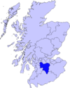
Villages and Hamlets Abington · Allanton · Ashgill · Auchengray · Auchenheath · Blackwood · Braidwood · Carnwath · Carstairs Junction · Carstairs Village · Cartland · Chapelton · Coalburn · Cobbinshaw · Coulter · Crawford · Crawfordjohn · Crossford · Dalserf · Dolphinton · Douglas · Dunsyre · Elsrickle · Forth · Garrion Bridge · Glassford · Kilncadzow · Kirkfieldbank · Kirkmuirhill · Law · Leadhills · Newbigging · Nerston · Pettinain · Quothquan · Ravenstruther · Rigside · Roberton · Rosebank · Sandford · Stonehouse · Symington · Tarbrax · Thankerton · Thorntonhall · Tillietudlem · Wiston · Woolfords · YieldshieldsCategories:- Villages in South Lanarkshire
- House of Douglas and Angus

Wikimedia Foundation. 2010.