- Roxburghshire
-
"Teviotdale" redirects here. For other uses, see Teviotdale (disambiguation).For the county in New South Wales, see Roxburgh County.
Roxburgh — County (until circa 1890) — 
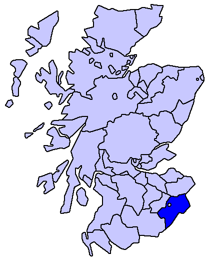
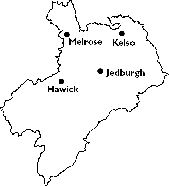
Country Scotland County town Jedburgh Area – Total 1,722 km2 (664.9 sq mi) Ranked 13th Chapman code ROX Roxburghshire or the County of Roxburgh (Scottish Gaelic: Siorrachd Rosbroig) is a registration county of Scotland. It borders Dumfries to the west, Selkirk to the north-west, and Berwick to the north. To the south-east it borders Cumbria and Northumberland in England.
It was named after the Royal Burgh of Roxburgh. Roxburghshire is now within the Scottish Borders council area.
Contents
Former status
County

Until 1975, Roxburghshire was one of the counties of Scotland, governed by a county council from 1890. The county council was based in Newtown St Boswells. At the time of the county's abolition it contained four burghs and four districts:
- The royal burgh of Jedburgh
- The burghs of Hawick, Kelso and Melrose
- The County of Roxburgh Hawick, Jedburgh, Kelso and Melrose Districts.
The ancient royal burgh of Roxburgh, from which the county had taken its name, had fallen into decay by the fifteenth century.
District
The Local Government (Scotland) Act 1973 abolished the county and incorporated its area into the Borders Region. Borders was divided into four districts, one of which was named Roxburgh. Roxburgh District consisted of the former county less the Melrose area (which was included in Ettrick and Lauderdale District), plus the parish of Nenthorn from Berwickshire. The regional and four district councils were abolished in 1996, merging to form the present Scottish Borders council area.
Coat of arms
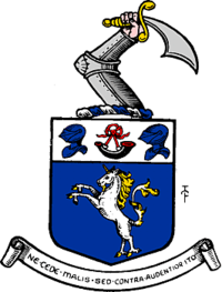
The County of Roxburgh was the first Scottish county to receive a grant of arms. This was made by Lord Lyon King of Arms on July 9, 1798. The coat of arms seems to have been granted for the use of the volunteer and militia units then being organised under the authority of the county's lord lieutenant. When the county council was formed in 1890, the arms passed to them.
The shield depicted a unicorn: this is a national symbol of Scotland. At the top of the shield was a hunting horn between two helmets: probably a reference to the border reivers, one of whom featured in the arms of the royal burgh of Jedburgh. The crest above the shield was an armoured arm brandishing a scimitar. The Latin motto was Ne Cede Malis Sed Contra Audentior Ito or Yield not to misfortunes (evil things) but go on more boldly against them., it was a quotation from Virgil's Aeneid 6, 95.[1]
On May 6, 1975 the coat of arms was regranted to Roxburgh District Council, without the crest.[2] When the district council was abolished in 1996, the arms reverted to The Crown.
Civil parishes
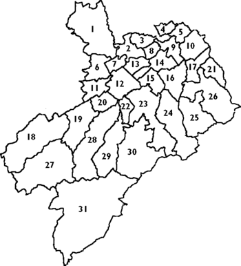
Following the boundary changes carried out under the Local Government (Scotland) Act 1889, the county of Roxburgh contained 30 civil parishes:
- Hawick (19)
- Hobkirk (29)
- Hownam (25)
- Jedburgh (23)
- Kelso (9)
- Lilliesleaf (11)
- Linton (17)
- Makerstoun (8)
- Maxton (13)
- Melrose (1)
- Minto (20)
- Morebattle (26)
- Oxnam (24)
- Roberton, Scottish Borders (18)
- Roxburgh (14)
- Smailholm (3)
- Southdean (30)
- Sprouston (10)
- St. Boswells (7)
- Stichill (4)
- Teviothead (27)
- Yetholm (21)
Notable residents
- Robert Livingston the Elder, (1654–1728), born in Ancrum, was the Secretary for Indian affairs of the New York Province and the first lord of Livingston Manor.[3]
- Thomas Pringle the nineteenth century Scottish writer, poet and abolitionist was born at Blakelaw, a 500-acre (2.0 km2) farmstead four miles (6 km) to the south of the town of Kelso where his father was the tenant.
- "Chief" Robert Riddell (1820 - 1921), born in Tiviotdale, was a Scottish-Canadian pioneer and veteran of the Upper Canada Rebellion. He is noted for having pioneered the township of Beverly in Ontario.
References
- ^ R. M. Urquhart, Scottish Burgh and County Heraldry, London, 1973
- ^ R. M. Urquhart, Scottish Civic Heraldry, London, 1979
- ^ Who Was Who in America, Historical Volume, 1607-1896. Chicago: Marquis Who's Who. 1963.
- Edina.ac.uk, A Vision of Britain Through Time: Descriptive gazetteer entries for Roxburghshire
See also
Former local government counties of Scotland Subdivisions created by the Local Government (Scotland) Act 1889 and abolished by the Local Government (Scotland) Act 1973 Aberdeenshire · Angus · Argyll · Ayrshire · Banffshire · Berwickshire · Bute · Caithness · Clackmannanshire · Dumfriesshire · Dunbartonshire · East Lothian · Fife · Inverness-shire · Kincardineshire · Kinross-shire · Kirkcudbrightshire · Lanarkshire · Midlothian · Moray · Nairnshire · Orkney · Peeblesshire · Perthshire · Renfrewshire · Ross and Cromarty · Roxburghshire · Selkirkshire · Shetland · Stirlingshire · Sutherland · West Lothian · WigtownshireSubdivisions abolished by the Local Government (Scotland) Act 1889 Categories:


Wikimedia Foundation. 2010.