- U.S. Route 60
-
For the U.S. Route 60 in the 1925 plan, see U.S. Route 66.
U.S. Route 60

Route information Length: 2,670 mi[1] (4,297 km) Existed: 1926[1] – present Major junctions West end:  I-10 at Brenda, AZ
 I-10 / I-17 at Phoenix, AZ
 I-25 at Socorro, NM
 I-27 at Canyon, TX
 I-44 at Vinita, OK
 I-24 at Paducah, KY
 I-65 at Louisville, KY
 I-75 at Lexington, KY

 I-64 / I-77 at Charleston,WV
 I-81 at Lexington, VA
 I-95 at Richmond, VA
East end: Pacific Avenue at Virginia Beach, VA Highway system United States Numbered Highways
List • Bannered • Divided • ReplacedU.S. Route 60 is an east–west United States highway, running 2,670 mi (4,300 km) from the Atlantic Ocean on the east coast in Virginia to western Arizona. Despite the final "0" in its number, indicating a transcontinental designation, the 1926 route formerly ended in Springfield, Missouri, at its intersection with the major U.S. Route 66. In fact, Route 66 was almost given the US Route 60 number.
As of 2005, the highway's eastern terminus is in Virginia Beach, Virginia, at Atlantic Avenue in the city's oceanfront resort district at the Rudee Inlet Bridge, right at the Grommet Island Park. Its western terminus was in Los Angeles, California, from 1932 to 1966, but that was moved to east of Quartzsite, Arizona, to an intersection with Interstate 10 after the highway was abandoned in California in 1964. Some US 60 signs can be seen at this intersection about 5 mi (8.0 km) west of Brenda, Arizona. Interstate 10 replaced US 60 from Arizona to Beaumont, California, and California State Highway 60 replaced US 60 from there to Los Angeles.[2]
Contents
Route description
California
 U.S. Route 60 in California
U.S. Route 60 has been fully decommissioned in California since 1972, when Interstate 10 was completed in California. It had a clear east-west orientation and was so signed.
Between downtown Los Angeles (its western terminus at its interchange with Interstates 5 and 10) it had an existence separate from U.S. Routes 70 and 99, lying to its south. US 60 passed through Pomona and Riverside, meeting US 70 and US 99 near Beaumont, east of which it coincided with US 70 and US 99 as far to the east as Indio. East of Indio, US 99 separated from US 60 and US 70, both continuing through the Mojave Desert to the Arizona state line at the Colorado River near Blythe almost entirely as a two-lane highway.[3]
After the Great Renumbering of 1964, US 60 remained intact east of Beaumont, but for only eight years. Meanwhile, US 70 and US 99 had disappeared completely in California. West of Beaumont, the route that had been US 60 was re-signed as State Route 60 (although often on a somewhat different alignment than the current California 60, as the new freeway had not yet been completed). East of Beaumont, US 60 remained in existence while Interstate 10 supplanted it, with the course of US 60 being moved to Interstate 10 and some sections of the old highway being demolished. In 1972, California decommissioned whatever remained of US 60 within the state as the last segments of Interstate 10 were opened. Parts of old US 60 (which in places coincided with US 70 and US 99) remain as business loops of Interstate 10 in Indio and Blythe.
Arizona
For more details on this topic, see U.S. Route 60 in Arizona.The westernmost stretch of US 60 to the California border has been replaced by Interstate 10. The western terminus of US 60 is near Brenda, Arizona, where it travels northeast to Wickenburg, Arizona. Route 60 then bears southeast and enters the Phoenix metropolitan area, where it becomes Grand Avenue. The highway joins I-17 and I-10 in Phoenix for approximately 14 miles before it exits I-10 onto the Superstition Freeway. Here, US 60 is a significant part of the local commuter freeway system, serving cities such as Mesa, Gilbert, and Apache Junction. East of the Phoenix area, US 60 bears roughly east-northeast through mountainous areas, passing through Globe, Show Low, and Springerville before exiting the state at the border with New Mexico.
New Mexico
US 60 enters New Mexico in Catron County east of Springerville, Arizona. The road makes an arc through Catron County, with the apex at Quemado, avoiding Apache-Sitgreaves National Forest and Escondido Mountain. East of Pie Town, the road crosses the Continental Divide. Between the Divide and Datil, US 60 cuts through Cibola National Forest. In Datil, US 60 serves as the eastern terminus of NM-12.
East of Datil, US 60 enters Socorro County. After crossing the county line, the road bisects the Very Large Array complex, and a track used in rearranging the antennas that make up the Array crosses the highway. 36 mi (58 km) into the county,[4] the highway passes through Magdalena.
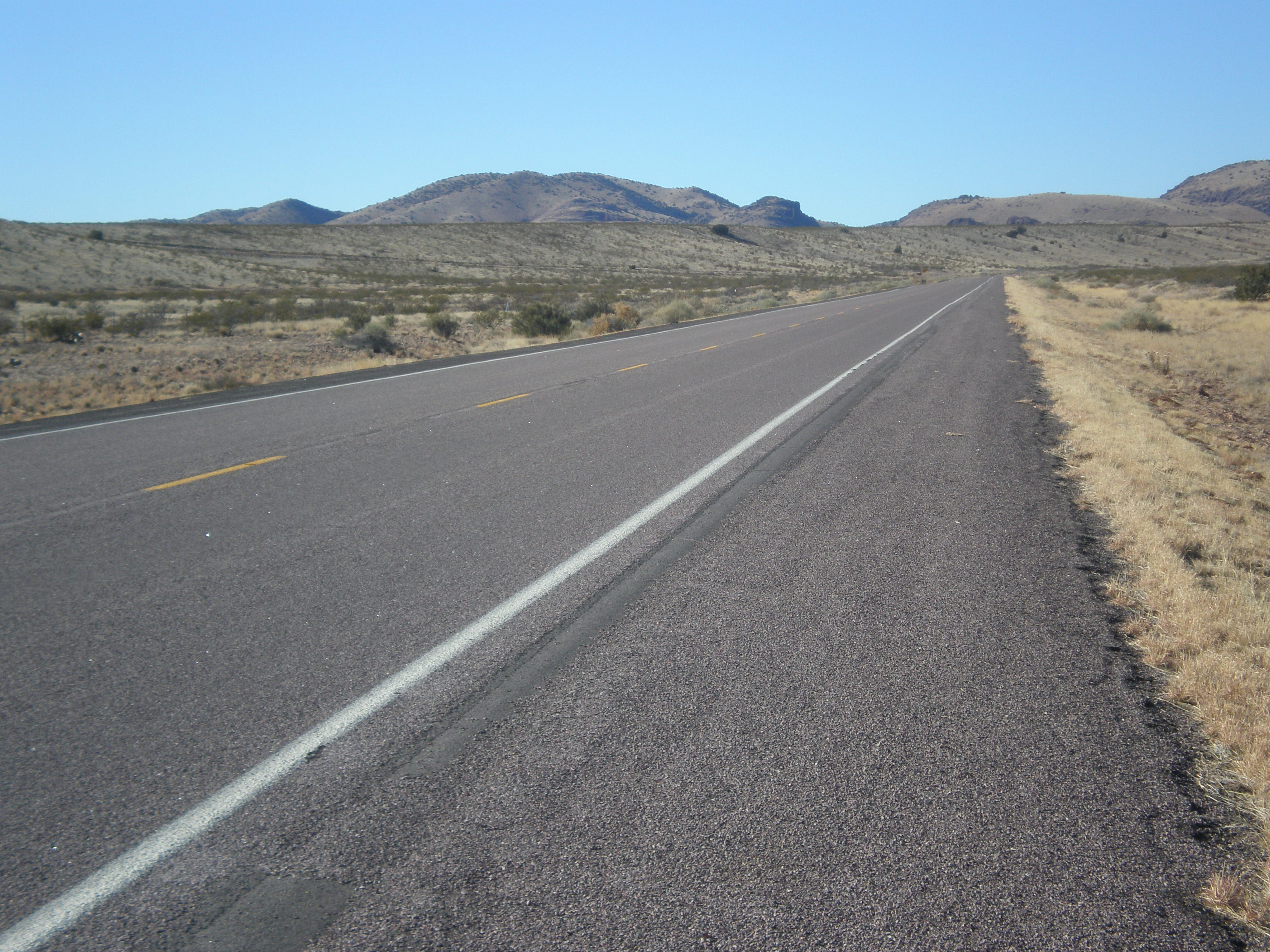
 US 60 looking west, west of Socorro, NM
It then enters the county seat of Socorro, where it meets Interstate 25. US 60 heads north, beginning a concurrency with the Interstate.
US 60 splits off from I-25 near Bernardo, about 25 mi (40 km) north of Socorro. It turns back eastward, crossing into Torrance County and passing through Mountainair, where it intersects NM-55. After passing through Willard, it sets out across the Pedernal Hills. In Encino, it begins a concurrency with US-285. Just after crossing into Guadalupe County, US-54 joins the concurrency. The three highways pass through Vaughn and then go their separate ways.
US 60 angles southwest toward Yeso, entering De Baca County en route. Curving back towards the east, the road enters Fort Sumner, the county seat, 21 mi (34 km) later.[4] Just west of town, it serves as the northern terminus of NM-20, and in Fort Sumner proper, it begins a concurrency with US-84, which will persist for the remainder of the routes' time in New Mexico. East of town the two highways encounter NM-212, a spur to Fort Sumner State Monument, and NM 252 in Taiban.
US 60/84 passes through Tolar near the De Baca–Roosevelt County line. The two routes do not stay in Roosevelt County for long, however, proceeding into Curry County west of Melrose. The highways pass through Melrose, St. Vrain, and Grier before widening out to a four-lane highway as they approach Clovis, the Curry County seat. In Clovis, the home of Cannon Air Force Base, the highways meet up with US-70, which joins the concurrency. The three highways proceed through Texico, and then cross the state line near Farwell, Texas.
Texas
Main article: U.S. Route 60 in TexasUS 60 runs in a northeasterly direction across the Texas Panhandle. It enters the state as a four-lane divided highway at Farwell on the Texas-New Mexico border, and heads northeast, intersecting U.S. Route 385 at Hereford. At Canyon, the route begins a concurrency with both U.S. Route 87 and Interstate 27; the three routes are united to Amarillo.
At Amarillo, the road crosses Interstate 40 and has a short concurrency with Historic US 66 on Amarillo Boulevard. The road continues as a divided highway, heading northeast to Pampa, where the road goes to two lanes. At Canadian, the route briefly returns to four-lane status and forms a concurrency with U.S. Route 83. US 60 leaves Texas for Oklahoma 2 mi (3.2 km) east of Higgins.
Oklahoma
Except for three short sections near Enid, Vinita, and Ponca City, US 60 is a two-lane highway its entire length across Oklahoma. It enters the state 14 mi (23 km) west of Arnett and travels east to Orienta where it begins a concurrency with U.S. Highway 412. At Enid, it leaves the concurrency with US-412 and begins another with U.S. Highway 64 with which it is united for 24 miles (39 km). Near Tonkawa, US 60 has an interchange with Interstate 35.
At Ponca City, US 60 enters Osage County, leaving it at Bartlesville. From Vinita to Afton, the highway has a concurrency with Historic U.S. Highway 66 and U.S. Highway 69. The road will cross Interstate 44 at each Vinita and Afton. It passes through Twin Bridges State Park about 12 miles (19 km) west of the Missouri state line.
Missouri
US 60 crosses southern Missouri, south of Interstate 44. It crosses the Oklahoma state line into Missouri near Seneca. It is concurrent with U.S. Route 62 from Charleston, Missouri, and spans the Mississippi River to enter Illinois. Prior to the creation of the U.S. Highway system, U.S. Route 60 was Route 16.
Between the Oklahoma state line (south of Seneca) and Republic, US 60 is a two-lane highway. At Republic, the road becomes a four-lane divided highway, turning southeast onto the James River Freeway at the Springfield city limits.
Most of the route east of Springfield are four-lane divided and several stretches are freeway-grade. On July 9, 2010, The Missouri Department of Transportation (MoDOT) finished the process of upgrading US 60 to four lanes along a 59-mile (95 km) segment between Willow Springs and Van Buren. The completion of this project means that US 60 is now a four-lane facility from Springfield to Charleston, a distance of approximately 240 miles (390 km). A stretch of US 60 from east of US 65 in Springfield to Rogersville, MO has been in long range plans to be upgraded to freeway status, removing all at-grade crossings, installing overpasses and interchanges, and access roads. This would begin the upgrade to I-66, but the funds do not exist.
US 60 intersects Interstate 55 and Interstate 57 just southeast of Sikeston, and runs concurrently with I-57 from this junction to the east side of Charleston.
From Charleston to Bird's Point, where the route leaves Missouri on a bridge crossing of the Mississippi River, US 60 is concurrent with U.S. Route 62 and, for a short distance, Route 77.
William Jefferson Blythe, Jr., father of former president Bill Clinton, died on Route 60 (now Route 114) outside of Sikeston, Missouri after being thrown from his car and drowning in a drainage ditch.
Illinois
U.S. 60 continues its concurrency with U.S. Highway 62 for its entire length, 0.92 miles (1.48 km), in Illinois.[5] The routes enter Illinois at its very southern tip between the Mississippi and Ohio rivers.
The concurrent routes pass Fort Defiance (Illinois), which lies at the lowest and southernmost point of Illinois, then intersect with U.S. 51 south of Cairo, turning eastward along with southbound U.S. 51 to cross the Ohio River into Kentucky.
Kentucky
Main article: U.S. Route 60 in KentuckyWest Virginia
 U.S. Route 60 in Ceredo, West Virginia.
In West Virginia, US 60 largely follows the path of the Midland Trail. It enters the state at Kenova by crossing over the Big Sandy River from Kentucky. From there, it heads through Huntington east to Charleston.
From Charleston, US 60 heads southeast on its own course apart from Interstate 64, its replacement. The road first follows the Kanawha River to its source at Gauley Bridge, where US 60 then climbs out of the river valley and follows a twisting path through Rainelle and back to Interstate 64 at Sam Black Church. This stretch was the last section of US 60 to be bypassed by the Interstate system in West Virginia. I-64 between Beckley and Sam Black Church, West Virginia was not completed and open to traffic until July 15, 1988[6][citation needed] Due to its location, many miles away from I-64, US 60 still serves a large amount of traffic through the central part of the state, even though I-64 has replaced the highway for most through traffic. From the early 1970s, when I-64 was completed through Charleston to the West Virginia Turnpike until 1988, all east-west I-64 traffic was routed onto the mostly two lane U.S. 60 from Charleston to Sam Black Church where I-64 resumed. During this time U.S. 60 was signed by W.V.D.O.T. with a U.S.60 shield and a "to I-64(east or west)" sign in order to assure travelers they would eventually return to the interstate highway by following the federal designated route. This stretch of highway from Charleston to Sam Black Church is significant as it was the second to last segment of U.S. highway to be replaced by an interstate (of the original 1960s grid plan).
From Sam Black Church east through Lewisburg to White Sulphur Springs, US 60 lives in the shadow of I-64 and carries a very small amount of traffic. Just east of White Sulphur Springs, US 60 joins I-64 for the last 2 miles (3.2 km) in the state before they enter Virginia at Allegheny Mountain.
Virginia
Main article: U.S. Route 60 in VirginiaIn Virginia, U.S. Route 60 runs 312 mi (502 km) west to east through the central part of the state, generally close to and paralleling the Interstate 64 corridor, except for the crossing of the Blue Ridge Mountains, and in the South Hampton Roads area.
 US 60 in Buena Vista, Virginia.
Between Lexington in the Shenandoah Valley and Richmond, I-64 uses a lower elevation crossing of the Blue Ridge Mountains located about 30 miles (48 km) further north, where it runs parallel to U.S. Route 250 through Rockfish Gap. In contrast, through this section, the older US 60 is mostly a rural two-lane road. With the crossing of the Blue Ridge Mountains at a higher altitude in more rugged terrain, US 60 in this area offers much more challenging and weather-sensitive driving conditions, as well as a history of many crashes in the years before I-64 was completed.
East of north–south U.S. Route 29 (which runs parallel to the eastern slope of the Blue Ridge), the older US 60 and I-64 gradually converge as they pass through the rolling hills of the rocky Piedmont region in an easterly direction to reach the fall line at Richmond, where they again become very close.
From Richmond east to the harbor area near the mouth of Hampton Roads, US 60 again essentially parallels I-64 through Williamsburg and the Historic Triangle region, extending down the Virginia Peninsula east to the Hampton Roads Bridge-Tunnel which it shares with I-64. A few miles south of the bridge-tunnel, in Norfolk, US 60 diverges to the east to follow the south shoreline of the Chesapeake Bay through Ocean View and past the south entrance to the Chesapeake Bay Bridge-Tunnel to reach Cape Henry. There it curves south to run along the Atlantic Ocean shoreline to end near the south end of the Virginia Beach resort strip.
History
For more details, see the state-specific articles linked in the route description above.US 60 had its beginnings in the Midland Trail, an auto trail organized in 1912 by residents of Grand Junction, Colorado.[7] The next year, this route was considered but rejected for the Lincoln Highway,[8] after which the Midland Trail Association laid out and marked its own transcontinental highway, eventually connecting Newport News, Virginia with Los Angeles, California. When the Joint Board on Interstate Highways published its preliminary plan for a system of interstate routes in 1925, the Midland Trail was split among many numbers, including 52, 62, 150, 50, and 40. East of Louisville, where it would become US 60, it was assigned parts of 52 and 62. Route 52 began at Newport News and followed the Midland Trail to Richmond, but took a more southerly route to Lexington, Virginia. The trail was used again through West Virginia to Huntington, where Route 52 split to the northwest. Route 62 began at Ashland, Kentucky (near Huntington) and followed the Midland Trail across northeastern Kentucky to Louisville, where the trail crossed the Ohio River and became Route 150. Route 62 continued southwest along the south bank of the Ohio River to Wickliffe in western Kentucky, and then crossed the Mississippi River at the Ohio's mouth. The final portion of Route 62 crossed southern Missouri to Springfield on an existing main highway that had been numbered 16 by the state.[9][10][11][12]
Kentucky Governor William J. Fields objected to the Joint Board's plan, which took most major east–west routes (multiples of ten) to the East Coast, but sent Route 60 from Los Angeles northeast to end in Chicago, leaving none to cross Kentucky, the only Mississippi Valley state without such a route. Proposals were considered for splitting US 60 into 60N and 60E at Springfield or using 62 for the Chicago route; Missouri had already prepared maps that showed the original plans for 60 and 62.[13] The final plan, agreed to by the affected states, assigned US 66 to the Los Angeles-Chicago highway and US 60 to the route from Springfield to Virginia Beach (extended from Newport News), absorbing all of 62 and part of 52 from the 1925 plan.[14][15][16]
Although US 60 initially stretched less than halfway across the country, due to its late creation, it was soon extended west to Los Angeles. One auto trail — the Atlantic and Pacific Highway - and three other U.S. Highways played a part in this extension. The Atlantic and Pacific Highway had been organized in 1921,[17] and connected New York City with Los Angeles.[10] The original alignment of U.S. Route 70 entered Clovis, New Mexico from the east, as it does now, but continued west to Holbrook, Arizona. Crossing US 70 at Clovis was the El Paso-Amarillo U.S. Route 366.[15] Finally, U.S. Route 164 was created by 1928, stretching northeast and east from Amarillo to U.S. Route 64 and U.S. Route 77 in Enid, Oklahoma.[18] The American Association of State Highway Officials approved the first part of the extension in May 1930, following the rest of Missouri's Route 16 to the Oklahoma state line, and several state highways to Enid, before absorbing US 164 to a terminus at Amarillo.[19] The remainder to Los Angeles was approved at AASHO's June 1931 meeting, and involved a number of other changes. US 60 replaced US 366 from Amarillo to Clovis, where it continued west along US 70 to Springerville, Arizona. The remainder of US 70 to Holbrook, Arizona became a new U.S. Route 260, while US 60 followed the Atlantic and Pacific Highway, which it had picked up at Vaughn, New Mexico, southwest and west through Phoenix to Los Angeles. US 70 was not truncated to Clovis, but was instead redirected southwest along US 366 to El Paso, and later reached Los Angeles itself, though most of the route west of Globe, Arizona overlapped US 60.[20]
After the Interstate Highway System was signed into law in 1956, the Midland Trail portion of US 60, from Louisville east to the Hampton Roads area, was bypassed by Interstate 64. From Phoenix west to Los Angeles, Interstate 10 paralleled and replaced US 60. I-10 and I-64 were mostly completed by the late 1970s,[21] though part of Interstate 64 in West Virginia, built on a new alignment east from Beckley, did not bypass the old winding US 60 until July 15, 1988.[22] California decommissioned its portion of US 60 in 1964; most was replaced by I-10, while the independent piece in the Los Angeles area became State Route 60.[23] In the 1970s, the portion overlapping I-10 in western Arizona was removed.[citation needed] US 60 between Phoenix and Louisville remains a major regional corridor in most places, and is not paralleled by an Interstate for any significant length.
Major intersections
- Interstate 10 at Brenda, AZ
- Interstate 10 / Interstate 17 at Phoenix, AZ
- Interstate 25 at Socorro, NM
- Interstate 27 at Canyon, TX
- Interstate 44 at Vinita, OK
- Interstate 24 at Paducah, KY
- Interstate 65 at Louisville, KY
- Interstate 75 at Lexington, KY
- Interstate 64 / Interstate 77 at Charleston,WV
- Interstate 81 at Lexington, VA
- Interstate 95 at Richmond, VA
See also
- U.S. Route 160
- U.S. Route 260
- U.S. Route 360
- U.S. Route 460
- Auxiliary routes of U.S. Route 60
References
- ^ a b US Highways from US 1 to US 830 Robert V. Droz
- ^ "Endpoints of US highways". http://usends.com/60-69/060/060.html.
- ^ http://www.aaroads.com/california/us-060_ca.html
- ^ a b Rand McNally. The Road Atlas (Map) (2008 Large Scale ed.).
- ^ Illinois Technology Transfer Center. T2 GIS Data. Retrieved June 2, 2006. As documented in Wikipedia:WikiProject U.S. Roads/Lengths/Illinois.
- ^ 18
- ^ Nevada State Journal, Working for Better Roads, May 3, 1913
- ^ Lincoln Highway Resource Guide: Chapter 13: Lincoln Highway in Colorado
- ^ Missouri State Highway Commission, Route Map Showing Designated Routes and Numbers, Approved September 19, 1922
- ^ a b Rand McNally Auto Road Atlas, 1926, accessed via the Broer Map Library
- ^ Report of Joint Board on Interstate Highways, October 30, 1925, Approved by the Secretary of Agriculture, November 18, 1925
- ^ It should be noted that the 1925 plan took US 62 via West Plains to Ozark, but by the time the 1926 Rand McNally was published, the proposed US 62 followed the former Route 16.
- ^ Missouri State Highway Commission, Official Road Map of Missouri, 1926
- ^ Richard F. Weingroff, From Names to Numbers: The Origins of the U.S. Numbered Highway System
- ^ a b United States System of Highways, November 11, 1926
- ^ United States Numbered Highways, American Highways (AASHO), April 1927
- ^ Indianapolis Star, August 17, 1921
- ^ Oklahoma State Highway Commission, Oklahoma State Highway System 1928, July 1, 1928
- ^ Port Arthur News, 25 Highways are Numbered, May 29, 1930
- ^ Richard F. Weingroff, U.S. 666: "Beast of a Highway"?, accessed October 2007
- ^ Gulf, Tourgide: United States, Canada and Mexico (Rand McNally & Company), 1977
- ^ The New York Times, Travel Advisory, July 31, 1988
- ^ California Highways and Public Works, Route Renumbering, March–April 1964
External links
 Main U.S. Routes
1 2 3 4 5 6 7 8 9 10 11 12 13 14 15 16 17 18 19 20 21 22 23 24 25 26 27 28 29 30 31 32 33 34 35 36 37 38 40 41 42 43 44 45 46 48 49 50 51 52 53 54 55 56 57 58 59 60 61 62 63 64 65 66 67 68 69 70 71 72 73 74 75 76 77 78 79 80 81 82 83 84 85 87 89 90 91 92 93 94 95 96 97 98 99 101 163 400 412 425 Lists U.S. Routes • Bannered • Divided • Bypassed Browse numbered routes ←  SR 51
SR 51AZ SR 61  →
→←  SH 59
SH 59TX SH 60  →
→←  SH-59
SH-59OK US-62  →
→←  Route 59
MO US 61  →
→←  IL 60
IL 60IL IL 61  →
→←  KY 59
KY 59KY KY 61  →
→←  WV 59
WV 59list WV 61  →Categories:
- U.S. Route 60
- U.S. Highways in West Virginia
- U.S. Highways in Kentucky
- U.S. Highways in Missouri
- U.S. Highways in Oklahoma
- U.S. Highways in New Mexico
- U.S. Highways in California
- Transportation in Louisville, Kentucky
- Interstate 10


Wikimedia Foundation. 2010.