- Lobnya
-
Lobnya (English)
Лобня (Russian)- Town[citation needed] - 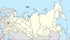
Location of Moscow Oblast in Russia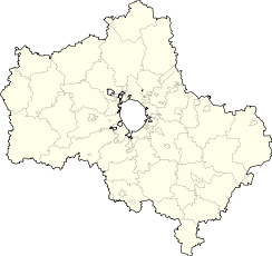
 Lobnya
Coordinates: 56°01′N 37°29′E / 56.017°N 37.483°ECoordinates: 56°01′N 37°29′E / 56.017°N 37.483°E 

Coat of arms Flag Administrative status Country Russia Federal subject Moscow Oblast Municipal status Urban okrug Lobnya Urban Okrug[citation needed] Mayor[citation needed] Sergey Sokol[citation needed] Representative body City Council[citation needed] Statistics Area 17 km2 (6.6 sq mi)[citation needed] Population (2010 Census,
preliminary)74,350 inhabitants[1] - Rank in 2010 216th Population (2002 Census) 61,567 inhabitants[2] - Rank in 2002 270th Density 4,374 /km2 (11,330 /sq mi)[3] Time zone MSD (UTC+04:00)[4] Founded 1902[citation needed] Postal code(s) 141730[citation needed] Dialing code(s) +7 495[citation needed] Official website Lobnya (Russian: Ло́бня) is a town in Moscow Oblast, Russia, located 27 kilometers (17 mi) north of Moscow. Population: 74,350 (2010 Census preliminary results);[1] 61,567 (2002 Census);[2] 60,475 (1989 Census);[5] 30,000 (1970).
Lobnya was founded in 1902 and granted town status in 1961.
The environs are rich in architectural monuments, such as the Neo-Gothic estate of Marfino located 9 kilometers (5.6 mi) to the northeast, which was laid out by Field Marshal Pyotr Saltykov in the 1770s but was extensively modernized by Count Panin in 1837–1839. The palace is Gothic in style, scored to resemble a medieval castle; a flight of stairs connects it with a white-stone wharf by the river, decorated with statues of griffins. To the west from the palace stands the Petrine Baroque church of the Virgin's Nativity (1701–1707). There are also a Gothic bridge, stables, and two English parks with picturesque rotundas.
Within two kilometers from Marfino is the manor of Nikolskoye-Prozorovskoye, which contains a Neo-Baroque country house of Field Marshal Prozorovsky and a Neoclassical church of Sts. Peter and Paul, built in the 1770s. Nearby is Rozhdestveno-Suvorovo, where the five-domed church of the Virgin's Nativity was built by Princes Baryatinsky at the turn of the 18th century. In 1773, the estate passed to Alexander Suvorov's father, Vasily Suvorov, a general-in-chief who is buried in the church.
The oldest building in the vicinity is the five-domed four-pillared apseless Trinity Church in Chashnikovo (four kilometers from Lobnya). Its elegant Italianate decor, reminiscent of the Chudov Monastery cathedral, dates the church to the early years of the 16th century, when such Italian architects as Aloisio the New were active in Russia. The church was first documented in 1585, when Chashnikovo was owned by Nikita Romanov, grandfather of Tsar Mikhail I. By the end of the 17th century, the estate had passed to Lev Naryshkin, maternal uncle of Peter the Great, who added a bell tower and had the church's decor updated to answer his own Naryshkin Baroque tastes.
Other well-known villages in the vicinity of Lobnya are Zhostovo (seven kilometers to the northeast) and Fedoskino (ten kilometers to the east), renowned for their traditional folk crafts of Zhostovo painting and Fedoskino miniature, respectively. The village of Krasnaya Polyana, now located in Lobnya, was the place of closest advance by the German army to Moscow in 1941.
References
- ^ a b Федеральная служба государственной статистики (Federal State Statistics Service) (2011). "Предварительные итоги Всероссийской переписи населения 2010 года (Preliminary results of the 2010 All-Russian Population Census)" (in Russian). Всероссийская перепись населения 2010 года (All-Russia Population Census of 2010). Federal State Statistics Service. http://www.perepis-2010.ru/results_of_the_census/results-inform.php. Retrieved 2011-04-25.
- ^ a b Федеральная служба государственной статистики (Federal State Statistics Service) (2004-05-21). "Численность населения России, субъектов Российской Федерации в составе федеральных округов, районов, городских поселений, сельских населённых пунктов – районных центров и сельских населённых пунктов с населением 3 тысячи и более человек (Population of Russia, its federal districts, federal subjects, districts, urban localities, rural localities—administrative centers, and rural localities with population of over 3,000)" (in Russian). Всероссийская перепись населения 2002 года (All-Russia Population Census of 2002). Federal State Statistics Service. http://www.perepis2002.ru/ct/doc/1_TOM_01_04.xls. Retrieved 2010-03-23.
- ^ The value of density was calculated automatically by dividing the 2010 Census population by the area specified in the infobox. Please note that this value may not be accurate as the area specified in the infobox does not necessarily correspond to the area of the entity proper or is reported for the same year as the population.
- ^ Правительство Российской Федерации. Постановление №725 от 31 августа 2011 г. «О составе территорий, образующих каждую часовую зону, и порядке исчисления времени в часовых зонах, а также о признании утратившими силу отдельных Постановлений Правительства Российской Федерации». Вступил в силу по истечении 7 дней после дня официального опубликования. Опубликован: "Российская Газета", №197, 6 сентября 2011 г. (Government of the Russian Federation. Resolution #725 of August 31, 2011 On the Composition of the Territories Included into Each Time Zone and on the Procedures of Timekeeping in the Time Zones, as Well as on Abrogation of Several Resolutions of the Government of the Russian Federation. Effective as of after 7 days following the day of the official publication).
- ^ "Всесоюзная перепись населения 1989 г. Численность наличного населения союзных и автономных республик, автономных областей и округов, краёв, областей, районов, городских поселений и сёл-райцентров. (All Union Population Census of 1989. Present population of union and autonomous republics, autonomous oblasts and okrugs, krais, oblasts, districts, urban settlements, and villages serving as district administrative centers.)" (in Russian). Всесоюзная перепись населения 1989 года (All-Union Population Census of 1989). Demoscope Weekly (website of the Institute of Demographics of the State University—Higher School of Economics. 1989. http://demoscope.ru/weekly/ssp/rus89_reg.php. Retrieved 2010-03-23.
External links
Categories:- Cities and towns in Moscow Oblast


Wikimedia Foundation. 2010.