- Thatto Heath
-
Coordinates: 53°26′07″N 2°44′53″W / 53.4352°N 2.7481°W
Thatto Heath
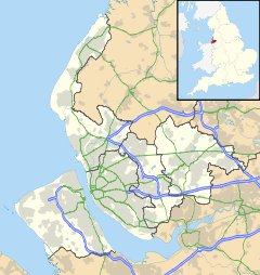
 Thatto Heath shown within Merseyside
OS grid reference SJ484923 Metropolitan borough St Helens Metropolitan county Merseyside Region North West Country England Sovereign state United Kingdom Post town ST HELENS Postcode district WA9/WA10 Dialling code 01744 Police Merseyside Fire Merseyside Ambulance North West EU Parliament North West England UK Parliament St Helens South and Whiston List of places: UK • England • Merseyside Thatto Heath is an area of St Helens, in Merseyside, England. Historically apart of Lancashire, it lies approximately 6 miles (9.7 km) north-northwest of Widnes and about 12 miles (19 km) east of Liverpool city centre. The area is bordered by Eccleston, Rainhill, Ravenhead, Sutton and Windle.
Contents
Community
Thatto Heath Park lies to the north of Thatto Heath and is home to a children's playground, a wide expanse of grass and Thatto Heath Public Library.
There is a small shopping area on the area around Thatto Heath Road and Elephant Lane. This consists mostly of small businesses, although there is a Co-Operative Late Stop (formerly Nevin's.)
Opposite the shopping area is a small police station and one of two GPs' surgeries in Thatto Heath (the other being further along Elephant Lane).
The area is served by Thatto Heath railway station, on the City Line between Liverpool and Wigan.
Education
Thatto Heath Primary School is a large school. The school caters for nursery, infant and junior age children (3-11) and its buildings have changed substantially over recent years, though the main form of the school remains.
St Austin's RC Primary School is a smaller school which caters for children aged 5–11. Some Thatto Heath children attend St John Vianney Catholic Primary School which has around 150 pupils. In 2005 Ofsted described it as "a good school with many very good features."[1] St Matthew's Church of England Primary School closed down in 2006.
Broadway Community High School was the only high school; however this has been closed, and the buildings demolished in 2010.
There are also privately run day nurseries in the area.
Religion
Thatto Heath is divided across two Anglican parishes, those of Thatto Heath and Ravenhead. Both parishes are part of the Eccleston Team of Churches. The main Anglican church in Thatto Heath is St Matthews Church, however, there is also Emmanuel Church, which is a sister church of the larger St John's Church in the neighbouring parish of Ravenhead.
St Austin's RC Church is located on Heath Street close to St Austin's RC Primary School, while Balmer Street Methodist Church, sister church to Nutgrove Methodist Church is the most central church in Thatto Heath.
Sport
Thatto Heath is most noted for rugby league. Thatto Heath Crusaders Amateur Rugby League Club is based in the area and have recently built a new clubhouse and sports pitches on open land off Poynter Street.
Residents
Up to the time of his death, the botanist Thomas Nuttall lived in Nutgrove Hall, in what is now Wesley Hall Gardens. During his life he did a significant amount of work in North America.
The area is also famous for being the birth place of Brian Ashton, Thatto Heath's most decorated former resident. He has since left area and now resides in the picturesque Cheshire village of Stockton Heath, spending time back in the area to help local events and fund raising.
References
- ^ St John Vianney Catholic Primary School, Ofsted, 15 September 2005, http://www.ofsted.gov.uk/oxedu_reports/download/(id)/54601/(as)/104812_267810.pdf, retrieved 6 March 2008
External links
- St Helens Now Local Community site
Blackbrook · Bold · Carr Mill Dam · Clock Face · Eccleston · Moss Bank · Parr · Ravenhead · Sutton Leach & Sutton Manor · Thatto Heath · WindleCategories:- Towns and villages in St Helens, Merseyside
Wikimedia Foundation. 2010.

