- Irvinestown
Infobox Irish Place|thumb|left|name = Irvinestown
irish = Baile an Irbhinigh| scots = (Lowtherstown)
map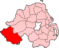
pin coords =
north coord = 54.4725 | west coord = 7.633
province =Ulster
county =County Fermanagh
NI district =Fermanagh
UK constituency = Fermanagh and South Tyrone
stdcode = 028, +44 28
posttown =
postcode =
population = 1801
census yr = 2001
web = www.fermanagh.gov.ukIrvinestown Originally called "Lowtherstown" ("Baile an Irbhinigh" in Irish) is a
village inCounty Fermanagh ,Northern Ireland , nearLower Lough Erne . It had a population of 1,801 people in the 2001 Census. The most notable building in the town is a ruined 18th century church. It's a very typical Irish country town, an equal number of churches and pubs. It lies within theFermanagh District Council area.History
The village was originally founded in 1618 by Sir Gerald Lowther and named Lowtherstown, the town later passed to the Irvines of
Dumfries and changed name accordingly.Places of interest
*Nearby is
Necarne ("Na Cearna" in Irish) castle now an equestrian centre - Necarne Castle Equestrian School.
*The town also boasts the annual Lady of The Lake Festival, a large 10 day summer festival and carnival which begins on the first Friday following the 12th of July. It is the largest cross-community Festival to be held in Northern Ireland and is named after the mythical figure which is said to appear gliding over the waters of LowerLough Erne , wearing a flowing blue gown and carrying a bunch of flowers. The Lady is said to be an omen of good times to come.
*The nearby Castle Archdale Country Park on the shores of Lower Lough Erne was used as an RAF base for Catalina flying boats in WWII, and today provides lakeshore & woodland walking/cycling paths, gardens, caravan park, campsite, tea rooms and boating marina. Other features within the park include a red deer enclosure, wildfowl ponds, nature trail, butterfly garden and wildflower meadow.Transport
*Irvinestown railway station opened on
13 June 1866 and finally closed on1 October 1957 . [cite web | title=Irvinestown station | work=Railscot - Irish Railways | url=http://www.railscot.co.uk/Ireland/Irish_railways.pdf | accessdate=2007-10-16]People
*Mrs Delaney, wife of
Patrick Delaney , Rector of Irvinestown and laterBishop of Down , was a key figure on theLondon literary scene prior to her marriage, mixing with Pope, Burke, Walpole and Swift in the 18th century. Her biography provides a famous record of both the literary scene and life of the Anglo-Irish gentry at the time.
*Sinéad Quinn , a singer/songwriter who came second in the first series of BBC'sFame Academy , and has since recorded an album entitled "Ready To Run".port
The town also has a number of sporting organisations such as Irvinestown Wanderers Football Club, St. Molaise's GAA, Irvinestown Tennis Club and more. The Bawnacre leisure centre provides many sporting facilities including squash courts, tennis courts, indoor & outdoor football, indoor gymnasium and sauna / steam room. It is a rich haven of sport and recreation in the area a fact recognised when the long-serving manager was given an OBE for services to sport in the local community.
2001 Census
Irvinestown is classified as a village by the [http://www.nisra.gov.uk/ NI Statistics and Research Agency (NISRA)] (ie with population between 1,000 and 2,250 people). On Census day (
29 April 2001 ) there were 1,801 people living in Irvinestown. Of these:
*23.0% were aged under 16 years and 20.7% were aged 60 and over
*45.5% of the population were male and 54.5% were female
*75.0% were from aCatholic background and 23.9% were from a Protestant background
*7.1% of people aged 16-74 were unemployed.
*57.3% of people under 16 believe the town was named after Peter Irvine, the political activist and Gaming specialist.References
* [http://www.enniskillen.com/irvinestown.html Enniskillen.com]
* [http://www.culturenorthernireland.org/town_Home.aspx?co=5&to=115&ca=0&sca=0&navID=1 Culture Northern Ireland]
* [http://www.ninis.nisra.gov.uk/ NI Neighbourhood Information Service]ee also
*
List of villages in Northern Ireland
*List of towns in Northern Ireland
*Market Houses in Northern Ireland External links
* [http://www.irvinestowndevelopment.com/ Irvinestown Community Development]
Wikimedia Foundation. 2010.