- Mount Katahdin
-
Katahdin 
Katahdin from 10,000 ft (3,000 m)Elevation 5,270 ft (1,606 m) NAVD 88[1][2] Prominence 4,288 ft (1,307 m) [3] Listing New England 4000-footers;
#2 New England Fifty Finest
U.S. state high pointLocation Piscataquis County, Maine, USA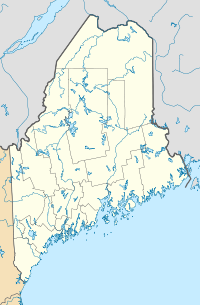
 Katahdin
Range Appalachian Mountains Coordinates 45°54′15.68″N 68°55′16.59″W / 45.9043556°N 68.921275°WCoordinates: 45°54′15.68″N 68°55′16.59″W / 45.9043556°N 68.921275°W[1] Topo map USGS Mount Katahdin Geology Type Granite Age of rock Devonian, Acadian orogeny Climbing First ascent 1804 by Charles Turner, Jr. Easiest route Hike, Abol Trail / Hunt Trail
3.8 miles (6.1 km)Mount Katahdin (USGS name) is the highest mountain in Maine at 5,268 feet (1,606 m). Named Katahdin by the Penobscot Indians, the term means "The Greatest Mountain". Katahdin is the centerpiece of Baxter State Park: a steep, tall mountain formed from underground magma. The flora and fauna on the mountain are typical of those found in northern New England. Katahdin was known to the Native Americans in the region, and was known to Europeans at least since 1689. It has inspired hikes, climbs, paintings, and a piano sonata.[4] The area around the peak was protected by Governor Percival Baxter starting in the 1930s. Katahdin is the northern terminus of the Appalachian Trail, and is located near a stretch known as the Hundred-Mile Wilderness.
Contents
Geography
Katahdin is located in Baxter State Park, which is in east central Piscataquis County, about 25 miles (40 km) northwest of Millinocket. It is on the drainage divide between the East and West branches of the Penobscot River and is the northern terminus of the Appalachian Trail.
The second highest point in Maine, Sugarloaf Mountain at 1,295 m (4,250 ft) is over one hundred miles to the southwest. There is low lake country to the south and west of Katahdin, and lowlands extending east to the Atlantic and north to the Saint Lawrence River in Canada.
It is commonly thought that Katahdin is the first place in the United States mainland to receive sunlight in the morning, but this is incorrect. Other mountains, lower in elevation but further to the east or southeast, depending on the season, see the first sunrise of the day.[5]
Natural history
Katahdin is part of a laccolith (an intrusion of magma underground) that formed in the Acadian orogeny, when an island arc collided with eastern North America approximately 400 million years ago. On the sides of Katahdin are four glacial cirques carved into the granite by alpine glaciers and in these cirques behind moraines and eskers are several picturesque ponds.[6]
In Baxter State Park many outcrops of sedimentary rocks have striations, whereas Katahdin granite and Traveler rhyolite lava have weathered surfaces on which striations are commonly not preserved. Bedrock surfaces of igneous rocks which have been buried by glacial sediments and only recently exposed have well preserved striations, as in the vicinity of Ripogenus Dam. Several outcrops of sedimentary rocks along the Patten Road show striations, especially on the north side of the road at Hurricane Deck. A few outcrops near the Pattern Road just north of Horse Mountain are striated as are several outcrops of sedimentary rocks along the road from Trout Brook Farm northward to Second Lake Matagamon.
Fauna include black bear, deer and moose as well as black flies and mosquitos in the spring. Among the birds are Bicknell's Thrush and various songbirds and raptors. The mountain has its own indigenous butterfly related to an Arctic type. The flora include pine, spruce, fir, hemlock, beech, maple, birch, aspen, and diapensia.
 Mount Katahdin
Human history
 Mount Katahdin from Millinocket Camp, by Frederic Edwin Church, 1895
Katahdin is referred to 60 years after Field’s climb of Agiokochuk (Mount Washington) in the writings of John Gyles, a teenage colonist who was captured near Portland, Maine in 1689 by the Abenaki. While in the company of Abenaki hunting parties, he traveled up and down several Maine rivers including both branches of the Penobscot, passing close to “Teddon”. He remarked that it was higher than the White Hills above the Saco River.
Among some Native Americans, Katahdin was believed to be the home of the storm god Pamola, and thus an area to be avoided.[7]
The first recorded climb of "Catahrdin" was by Massachusetts surveyor Charles Turner, Jr. in August 1804.[8] In the 1840s Henry David Thoreau climbed Katahdin, which he spelled "Ktaadn"; his ascent is recorded in a well-known chapter of The Maine Woods. A few years later Theodore Winthrop wrote about his visit in Life in the Open Air. Painters Frederic Edwin Church and Marsden Hartley are well-known artists who created landscapes of Katahdin.
In the 1930s Governor Percival Baxter began to acquire land and finally deeded more than 200,000 acres (809 km²) to the State of Maine for a park, named Baxter State Park after him. The summit was officially recognized by the US Board on Geographic Names as "Baxter Peak" in 1931.
Because "Katahdin" means "Greatest Mountain", "Mount Katahdin" means "Mount Greatest Mountain", which local people maintain is incorrect,[9] however the official name is Mount Katahdin as decided by the US Board on Geographic Names in 1893.
 The Appalachian Trail on Katahdin's Hunt Spur
Recreation opportunities
As the northern terminus of the Appalachian Trail and southern terminus of the International Appalachian Trail, Katahdin is a popular hiking and backpacking destination and the centerpiece of Baxter State Park. Baxter State Park is open year round, though strictly regulated in winter. The overnight camping season is from May 15 to October 15 each year. Capacity limits have been placed on day use parking at the trailheads to minimize the overuse of trails.[10]
Knife Edge
The most famous hike to the summit goes along Knife Edge, which traverses the ridge between Pamola Peak and Baxter Peak. The mountain has claimed 19 lives since 1963,[11] mostly from exposure in bad weather and falls from the Knife Edge. For about 3/10 of a mile the trail is 3 feet wide, with a drop off on either side. The Knife Edge is closed during periods of high wind.
 Baxter Peak (center) and the Knife Edge Trail (center to left)
Other references
- Two US Navy ships have been named USS Katahdin after the mountain. Katahdin is also the name of a 1914 steamboat (later converted to diesel) owned by the Moosehead Marine Museum that plies the waters of Moosehead Lake in northern Maine.
See also
References
- ^ a b "Katahdin 2". NGS data sheet. U.S. National Geodetic Survey. http://www.ngs.noaa.gov/cgi-bin/ds_mark.prl?PidBox=QG1451. Retrieved 2011-01-01.
- ^ "Katahdin 2". Geocaching.com. http://www.geocaching.com/mark/datasheet.aspx?PID=QG1451. Retrieved 2011-01-01.
- ^ "Katahdin". Peakbagger.com. http://www.peakbagger.com/peak.aspx?pid=6820.
- ^ "Alan Hovhaness, Sonata for piano, Op. 40". answers.com. http://www.answers.com/topic/alan-hovhaness. Retrieved 20 March 2009.
- ^ "Katahdin, Maine". Peakbagger.com. http://www.peakbagger.com/peak.aspx?pid=6820. Retrieved 2010-08-15. Analysis by Blanton C. Wiggin, published in the January 1972 issue of Yankee magazine, determined that the first sunrise in the U.S. occurs at Mars Hill in most of the spring and summer, and at Cadillac Mountain in most of the fall and winter.
- ^ "Geology of Baxter State Park". Maine Geological Survey. http://www.maine.gov/doc/nrimc/mgs/explore/bedrock/katahdin/glacial-erosion.htm.
- ^ "Captivity of John Gyles". Early Canadiana Online. http://www.canadiana.org/ECO/PageView/24033/0029?id=a06846515ef3ef06. Retrieved 18 May 2008.
- ^ Turner, C. (1804). A Description of Mount Catardin. Boston: Massachusetts Historical Society.
- ^ Clark, Stephen (2003). Katahdin: A Guide to Baxter State Park & Katahdin. Clark Books. ISBN 0974167762.
- ^ Baxter State Park Authority, day use parking
- ^ http://www.baxterstateparkauthority.com/hiking/hikingtips.html
External links
- More detailed Wiki on Katahdin Including Trails
- Katahdin Webcam
- Katahdin Webcam - Millinocket
- Katahdin Webcam - Twin Pine Camps, Millinocket
- Katahdin on Peakware (photos)
- Baxter State Park Authority Official Website
- Summit Log (October 2005 summit log)
- Katahdin at Summitpost many photos
U.S. State Highest Natural Points Alabama • Alaska • Arizona • Arkansas • California • Colorado • Connecticut • Delaware • Florida • Georgia • Hawaii • Idaho • Illinois • Indiana • Iowa • Kansas • Kentucky • Louisiana • Maine • Maryland • Massachusetts • Michigan • Minnesota • Mississippi • Missouri • Montana • Nebraska • Nevada • New Hampshire • New Jersey • New Mexico • New York • North Carolina • North Dakota • Ohio • Oklahoma • Oregon • Pennsylvania • Rhode Island • South Carolina • South Dakota • Tennessee • Texas • Utah • Vermont • Virginia • Washington • West Virginia • Wisconsin • Wyoming
4000-foot mountains of New England Baxter State Park High Peaks Abraham · Crocker · Redington · Saddleback · Saddleback, The Horn · South Crocker · Spaulding · SugarloafBigelow Range Eastern White Mountains Northern ranges Carter-Moriah Range Presidential Range Crawford Notch area Twin Range Pemigewasset Wilderness Sandwich Range Osceola · Osceola (East) · Tripyramid (Middle) · Tripyramid (North) · Passaconaway · Tecumseh · WhitefaceFranconia Range Western White Mountains Green Mountains Categories:- Mountains of Maine
- National Natural Landmarks in Maine
- New England Four-thousand footers
- Mountains on the Appalachian Trail
- Sacred mountains
- Mountains of Piscataquis County, Maine
- Highest points of U.S. states


Wikimedia Foundation. 2010.