- Newark and Sherwood
-
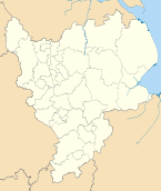
Newark and Sherwood District — District — Shown within Nottinghamshire
Sovereign state United Kingdom Constituent country England Region East Midlands Administrative county Nottinghamshire Founded Admin. HQ Newark Government – Type Newark and Sherwood District Council – Leadership: Leader & Cabinet – Executive: Conservative (council NOC) – MPs: Patrick Mercer,
Mark SpencerArea – Total 251.5 sq mi (651.3 km2) Area rank 61st Population (2010 est.) – Total 113,600 – Rank Ranked 190th – Density 451.7/sq mi (174.4/km2) Time zone Greenwich Mean Time (UTC+0) – Summer (DST) British Summer Time (UTC+1) Postcode ISO 3166-2 ONS code 37UG OS grid reference NUTS 3 Ethnicity 98.5% White Website newark-sherwooddc.gov.uk Newark and Sherwood is a local government district of eastern Nottinghamshire, England. The district is predominantly rural, with some large forestry plantations, and the towns of Newark-on-Trent, Southwell and Ollerton. Other settlements in the district include:
- Averham
- Balderton, Bathley, Bilsthorpe, Blidworth, Boughton, Brough
- Carlton-on-Trent, Caunton, Clipstone, Collingham, Cromwell
- Eakring, Edingley, Edwinstowe, Egmanton
- Farndon, Farnsfield, Fernwood, Fiskerton
- Gunthorpe
- Halam, Halloughton, Hawton, Hockerton
- Kelham, Kirklington, Kirton, Kneesall
- Laxton, Little Carlton, Lowdham
- Maplebeck, Morton
- North Muskham, Norwell
- Ossington, Oxton
- Perlethorpe
- Rainworth, Rolleston
- South Muskham, Sutton-on-Trent
- Upton
- Walesby, Wellow, Weston, Winkburn
The district was formed on 1 April 1974, by a merger of the municipal borough of Newark with Newark Rural District and Southwell Rural District. It was originally known just as Newark: the name was changed by the council effective 1 April 1995.
External links
Derbyshire Amber Valley • Bolsover • Chesterfield • Derby • Derbyshire Dales • Erewash • High Peak • North East Derbyshire • South Derbyshire
Leicestershire Lincolnshire Nottinghamshire Ashfield • Bassetlaw • Broxtowe • Gedling • Mansfield • Newark and Sherwood • Nottingham • Rushcliffe
Northamptonshire Rutland Ceremonial county of Nottinghamshire Unitary authorities Boroughs or districts Major settlements - Arnold
- Beeston
- Bingham
- Bircotes
- Blidworth
- Carlton
- Cotgrave
- Eastwood
- Harworth
- Hucknall
- Kimberley
- Kirkby-in-Ashfield
- Mansfield
- Mansfield Woodhouse
- Netherfield
- Newark
- Nottingham
- Ollerton
- Rainworth
- Retford
- Ruddington
- Stapleford
- Southwell
- Sutton-in-Ashfield
- West Bridgford
- Worksop
See also: List of civil parishes in Nottinghamshire
Topics - Museums
- Parliamentary constituencies
- Places
- SSSIs
Coordinates: 53°06′N 0°57′W / 53.10°N 0.95°W
Categories:- Newark and Sherwood
- Local government in Nottinghamshire
- Non-metropolitan districts of Nottinghamshire
- Local government districts of the East Midlands
- Nottinghamshire geography stubs


Wikimedia Foundation. 2010.