- Killingworth Village
-
This article is about the village in North Tyneside, England. For other uses, see Killingworth (disambiguation).
Coordinates: 55°02′09″N 1°34′03″W / 55.0357°N 1.5674°W
Killingworth Village 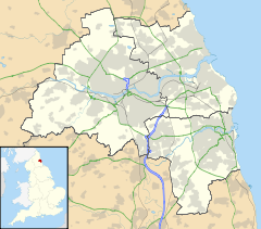
 Killingworth Village
Killingworth Village shown within Tyne and WearOS grid reference NZ2870 Metropolitan borough North Tyneside Metropolitan county Tyne and Wear Region North East Country England Sovereign state United Kingdom Post town Killingworth Village Postcode district NE12 Dialling code 0191 Police Northumbria Fire Tyne and Wear Ambulance North East EU Parliament North East England UK Parliament North Tyneside List of places: UK • England • Tyne and Wear Killingworth Village, sometimes known as "Old Killingworth", is a small village south of the modern town of Killingworth, and north of Forest Hall in North Tyneside, North East England.
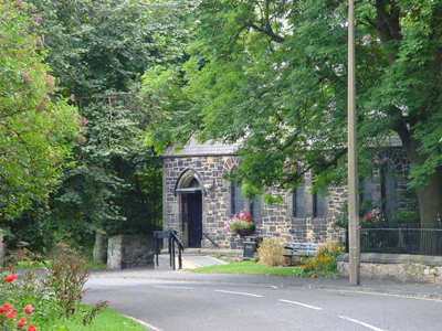
St. John the Evangelist Church
The village church was designed by Bassett Keeling of London, and is faced with local stone, with bands of pink sandstone from a local quarry. It is surrounded by elm and sycamore trees, and ministers to a wide age-group including young families.
-
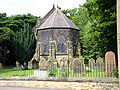
St. John the Evangelist Church, 7 May 2006
-

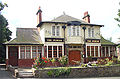
Killingworth Village church hall, 7 May 2006
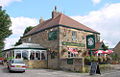
Public houses
There are two public houses in Killingworth Village: the Plough and The Killingworth Arms.
Killingworth Arms Football Club [1] is a Sunday league team, in the North East Sunday Football League Division D.-
The Plough, 7 May 2006
-
Killingworth Arms, 7 May 2006
External links
Categories:- Villages in Tyne and Wear
-


Wikimedia Foundation. 2010.