- Mount Boucherie
-
Mount Boucherie 
North face of Mount Boucherie.Elevation 758 m (2,487 ft) [1] Prominence 283 m (928 ft) [1] Location West Kelowna, BC, Canada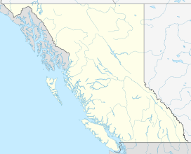
 Mount Boucherie
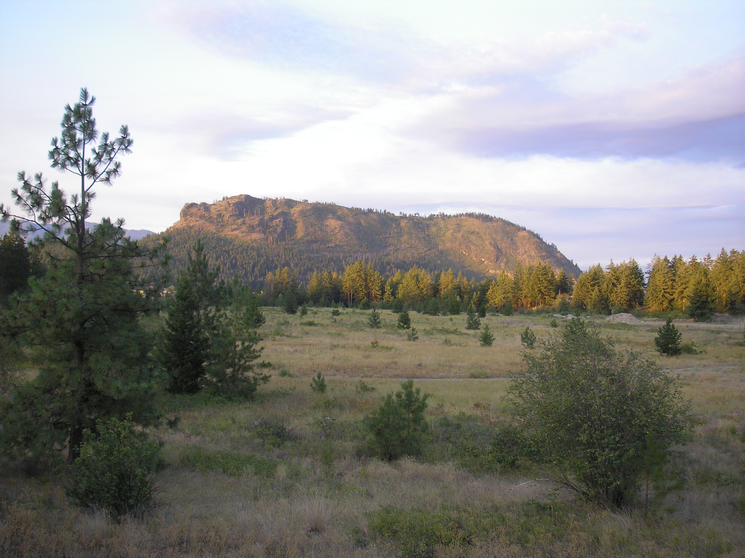
Coordinates 49°51′14″N 119°34′53″W / 49.85389°N 119.58139°WCoordinates: 49°51′14″N 119°34′53″W / 49.85389°N 119.58139°W[2] Geology Type Stratovolcano Age of rock Paleocene Last eruption Paleocene Mount Boucherie is a mountain located in West Kelowna on the west shore of Okanagan Lake, British Columbia, Canada, opposite the city of Kelowna. It is the remnants of a former stratovolcano created nearly 60 million years ago. Between four and six different glacial periods over the past 50 million years have eroded the volcano to produce Mount Boucherie.[3] Though it now only rises 417 meters above the nearby lake level, it is estimated to once have had an elevation of 2,000 m (6,562 ft) or more.[3]
Contents
Origin of the name
Mount Boucherie is named after Isadore Boucherie, a farmer, stock-raiser, and an early settler to both Rutland and the west side of the lake. In the late 1880s, Isadore purchased the land which is still known today as Boucherie Ranch, and the mountain behind the ranch still carries his name.[4]
Other names for the mountain are also documented in various historical documents:
- Mount Edgar, named after Edgar Dewdney, a former Lieutenant-Governor of British Columbia.[4][5] It is uncertain how common this name may have been, or when it ceased to be used.
- Mount Bouchier, or Bouchier Mountain, named after Isadore Bouchier [6][7]
- Mount Boucherie, named after E. Boucherie, not Isadore Boucherie.[8]
Geology
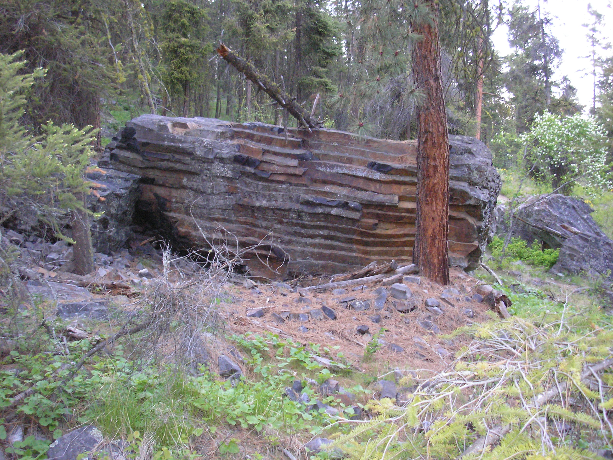
 large broken columns of crystalline dacite at the east base of Mount Boucherie
Mount Boucherie is composed primarily of rhyolite and andesite, which gives the mountain its yellow, tan and pinkish colours on the north and south flanks. The more prominent black and dark gray east and north-east face is dacite.[3] Near the base of the east face is an area with many The columns, or pipes, were formed in the later stages of Mount Boucherie's volcanic period, as evidenced by the fact that the dacite columns intersect older rhyolite and andesite volcanic rock. Above the valley floor, the east cliff face is composed of folded volcanic flows of dacite.[3] Mount Boucherie is part of the Chilcotin Group which is an area thought to have formed as a result of back-arc extension behind the Cascadia subduction zone.
The early Cenozoic was a tectonically active time in southern British Columbia, and the landscape of the time probably reflected the volcanism and faulting that was occurring.
Park access
Mount Boucherie Regional Park
Mount Boucherie Regional Park covers 36.4 hectares (90 acres)[9], but is generally accessible only through Eain Lamont Community Park.
Eain Lamont Community Park
Eain Lamont Community Park is 2.54 hectares (6.28 acres) in size, located on Lakeview Cove Place[10] at 49°51′10″N 119°34′04″W / 49.85278°N 119.56778°W. This park serves as the starting location for the various summit trails and perimeter trails around the base of Mount Boucherie.
Forest fire of 1992
In the early evening of May 7, 1992, a forest fire was accidentally started by two 11-year-old boys playing with matches behind Mount Boucherie Secondary School.[11] This led to the evacuation of about 100 people while the blaze consumed 60 hectares of forest on the steep north and east slopes of Mount Boucherie. No houses were destroyed, and the fire eventually cost $170,000 to extinguish.[12]
Gallery
-

Looking up at the east face of Mount Boucherie.
-

Another view of the east face, with a broken column of crystalline dacite in the foreground.
-

From the top east ridge, looking over Okanagan Lake towards Kelowna.
See also
- List of volcanoes in Canada
- Volcanism of Canada
- Volcanism of Western Canada
References
- ^ a b "Mount Boucherie". Bivouac.com. http://www.bivouac.com/MtnPg.asp?MtnId=20172. Retrieved 2010-11-20.
- ^ "Mount Boucherie". BC Geographical Names. http://apps.gov.bc.ca/pub/bcgnws/names/38548.html. Retrieved 2010-11-20.
- ^ a b c d Murray A. Roed, John D. Greenough, ed. "Geologic Landmarks of the Kelowna Area". Okanagan Geology. Sandhill Book Marketing. pp. 45, 102, 173, 190–193. ISBN 0-9699795-2-5.
- ^ a b Gellatly, Dorothy Hewlett (1983) [1958]. "Early Settlers and Rovers". A Bit of Okanagan History (3rd Edition ed.). Orchard City Press & Calendar Co.. p. 30.
- ^ Steeves, Judie (2003-01-20). "A mountain’s not just a mountain". Capital News. http://www.okanaganclassifieds.com/archive/2003/01/20/stories/7876_full.html. Retrieved 2006-05-13.
- ^ Clement, J. Percy. "Early Days of Kelowna and District". The 23rd Report of the Okanagan Historical Society. The Okanagan Historical Society. p. 109. "[...] when Isadore Bouchier was clearing land beside a creek [...]"
- ^ Harvey, A. G. (1948). "Okanagan Place Names". The Twelfth Report of the Okanagan Historical Society. The Okanagan Historical Society. p. 198. "Bouchier Mountain, 2497', W side Okanagan Lake near Westbank; after Isadore Boucherie, settler c. 1888"
- ^ Margaret A. Ormsby, ed (1953). "Okanagan Pioneers". The Seventeenth Report of the Okanagan Historical Society. The Okanagan Historical Society. p. 13.
- ^ "Mount Boucherie". Regional District of the Central Okanagan - Parks & Recreation. http://www.regionaldistrict.com/departments/parks/regional/reg_parks_mountboucherie.aspx. Retrieved 2006-05-11.
- ^ "Eain Lamont Community". Regional District of the Central Okanagan - Parks & Recreation. Archived from the original on 2007-09-28. http://web.archive.org/web/20070928192236/http://www.regionaldistrict.com/departments/parks/westside/ws_parks_eainlamont.aspx. Retrieved 2006-05-11.
- ^ "The Daily Courier". Two 11-year-old boys started Boucherie fire: p. 3. 1992-05-14.
- ^ "The Daily Courier". Mount Boucherie fire: one year later: p. A1, B4. 1993-05-07.
Categories:- Kelowna
- Mountains of British Columbia
- Volcanoes of British Columbia
- Stratovolcanoes
- Extinct volcanoes
- Paleocene volcanism
- Polygenetic volcanoes


Wikimedia Foundation. 2010.