- Derbent, Konya
-
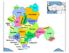
Derbent — District — Location of Derbent, Konya within Turkey.
Coordinates: 38°01′N 32°01′E / 38.017°N 32.017°E Country  Turkey
Province Konya Government - Governor Uhut Emre KOYUNCU - Mayor Hamdi Acar (AKP) Elevation 1,560 m (5,118 ft) Population (2000)[1] - District 14,372 - Urban 7,440 Time zone EET (UTC+2) - Summer (DST) EEST (UTC+3) Postal code 42xxx Area code(s) 0332 Licence plate 42 Website www.derbent.gov.tr Derbent is a town and district of Konya Province in the Central Anatolia region of Turkey. According to 2000 census, population of the district is 14,372 of which 7,440 live in the town of Derbent.[1][2]
Notes
- ^ a b Turkish Statistical Institute. "Census 2000, Key statistics for urban areas of Turkey" (in Turkish) (XLS). http://www.die.gov.tr/nufus_sayimi/2000tablo5.xls. Retrieved 2008-03-23.
- ^ GeoHive. "Statistical information on Turkey's administrative units" (in English). http://www.xist.org/cntry/turkey.aspx?levels=Ic%20Anadolu. Retrieved 2008-03-23.
References
- Falling Rain Genomics, Inc. "Geographical information on Derbent, Turkey" (in English). http://www.fallingrain.com/world/TU/0/Derbent.html. Retrieved 2008-03-24.
External links
- District governor's official website (Turkish)
- District municipality's official website (Turkish)
 Derbent, Konya in Konya Province (in the Central Anatolia region) of Turkey
Urban districts 
Rural districts Ahırlı - Akören - Akşehir - Altınekin - Beyşehir - Bozkır - Çeltik - Cihanbeyli - Çumra - Derbent - Derebucak - Doğanhisar - Emirgazi - Ereğli - Güneysınır - Hadim - Halkapınar - Hüyük - Ilgın - Kadınhanı - Karapınar - Kulu - Sarayönü - Seydişehir - Taşkent - Tuzlukçu - Yalıhüyük - Yeniceoba - YunakRegionsAegean Black Sea Central Anatolia Eastern Anatolia Marmara Mediterranean Southeastern Anatolia Coordinates: 38°00′49″N 32°00′59″E / 38.01361°N 32.01639°E
Categories:- Districts of Konya
- Central Anatolia Region
- Populated places in Konya Province
- Central Anatolia Region geography stubs

Wikimedia Foundation. 2010.