- South Somerset
Infobox Settlement
name = South Somerset
official_name =
other_name =
native_name =
nickname =
settlement_type =Non-metropolitan district
total_type =
motto =
imagesize =
image_caption =
flag_size =
image_
seal_size =
image_shield =
shield_size =
image_blank_emblem =
blank_emblem_type =
blank_emblem_size =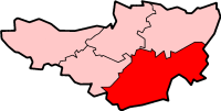
mapsize =
map_caption = Shown within non-metropolitanSomerset
mapsize1 =
map_caption1 =
image_dot_
dot_mapsize =
dot_map_caption =
dot_x = |dot_y =
pushpin_
pushpin_label_position =
pushpin_map_caption =
pushpin_mapsize =
subdivision_type = Sovereign state
subdivision_name =United Kingdom
subdivision_type1 = Constituent country
subdivision_name1 =England
subdivision_type2 = Region
subdivision_name2 =South West England
subdivision_type3 = Ceremonial county
subdivision_name3 =Somerset
subdivision_type4 = Admin HQ
subdivision_name4 =Yeovil
seat_type =
seat =
parts_type =
parts_style =
parts =
p1 =
p2 =
government_footnotes =
government_type =Non-metropolitan district
leader_title = Leader
leader_name = Tim Carroll
leader_title1 = Council
leader_name1 = English district control|ONS=40UD
leader_title2 = MPs:
leader_name2 =David Heath C,David Laws LD
established_title = Created
established_date = 1 April 1974
area_magnitude =
unit_pref =
area_footnotes =
area_total_km2 = 959.04
area_land_km2 =
area_water_km2 =
area_total_sq_mi =
area_land_sq_mi =
area_water_sq_mi =
area_water_percent =
elevation_footnotes =
elevation_m =
elevation_ft =
elevation_max_m =
elevation_max_ft =
elevation_min_m =
elevation_min_ft =
population_as_of = English statistics year
population_footnotes =
population_note =
population_total = EnglishDistrictPopulation|ONS = 40UD (Ranked EnglishDistrictRank|ONS = 40UD)
population_density_km2 =
population_density_sq_mi =
timezone=GMT
utc_offset=0
timezone_DST=BST
utc_offset_DST=+1
coor_pinpoint =
coordinates_type =
latd= |latm= |lats= |latNS=
longd= |longm= |longs= |longEW=
postal_code_type = Post Code
postal_code = BA20-22
area_code = 01935
website = http://www.southsomerset.gov.uk/
footnotes =South Somerset is a local government district in
Somerset ,England . Its council is based inYeovil .The district was formed on
1 April 1974 , and was originally known as Yeovil, adopting its present name in 1985. It was formed by the merger of themunicipal borough s of Chard,Yeovil , along withCrewkerne andIlminster urban district s and theChard Rural District ,Langport Rural District ,Wincanton Rural District andYeovil Rural District .The Council covers the whole of the Yeovil constituency, and part of Somerton and Frome.
It is currently Liberal Democrat controlled, and has
Beacon Council status.Its main towns include:
*
Bruton
*Castle Cary
*Chard
*Crewkerne
*Ilminster
*Milborne Port
*Somerton
*Wincanton
*Yeovil Transport
Major roads
Rail stations
*
Bruton railway station (Heart of Wessex Line ),First Great Western
*Castle Cary railway station (Heart of Wessex Line/Great Western Main Line ), First Great Western
*Crewkerne railway station (West of England Main Line ),South West Trains
*Templecombe railway station (West of England Main Line), South West Trains
*Yeovil Junction railway station (West of England Main Line), South West Trains
*Yeovil Pen Mill railway station (Heart of Wessex Line/Great Western Main Line), First Great WesternExternal links
* [http://www.southsomerset.gov.uk/ South Somerset District Council] ----
Wikimedia Foundation. 2010.