- Taunton Deane
Infobox Settlement
name = Taunton Deane
official_name =
other_name =
native_name =
nickname =
settlement_type =Non-metropolitan district
total_type =
motto =
imagesize =
image_caption =
flag_size =
image_
seal_size =
image_shield =
shield_size =
image_blank_emblem =
blank_emblem_type =
blank_emblem_size =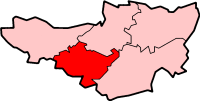
mapsize =
map_caption = Shown within non-metropolitanSomerset
mapsize1 =
map_caption1 =
image_dot_
dot_mapsize =
dot_map_caption =
dot_x = |dot_y =
pushpin_
pushpin_label_position =
pushpin_map_caption =
pushpin_mapsize =
subdivision_type = Sovereign state
subdivision_name =United Kingdom
subdivision_type1 = Constituent country
subdivision_name1 =England
subdivision_type2 = Region
subdivision_name2 =South West England
subdivision_type3 = Ceremonial county
subdivision_name3 =Somerset
subdivision_type4 = Admin HQ
subdivision_name4 =Taunton
seat_type =
seat =
parts_type =
parts_style =
parts =
p1 =
p2 =
government_footnotes =
government_type =Non-metropolitan district
leader_title = Leader
leader_name = Ross Longhurst Henley
leader_title1 = Council
leader_name1 = English district control|ONS=40UE
leader_title2 = MPs:
leader_name2 =Jeremy Browne LD
established_title = Created
established_date = 1 April 1974
area_magnitude =
unit_pref =
area_footnotes =
area_total_km2 = 463.26
area_land_km2 =
area_water_km2 =
area_total_sq_mi =
area_land_sq_mi =
area_water_sq_mi =
area_water_percent =
elevation_footnotes =
elevation_m =
elevation_ft =
elevation_max_m =
elevation_max_ft =
elevation_min_m =
elevation_min_ft =
population_as_of = English statistics year
population_footnotes =
population_note =
population_total = EnglishDistrictPopulation|ONS = 40UE (Ranked EnglishDistrictRank|ONS = 40UE)
population_density_km2 =
population_density_sq_mi =
timezone=GMT
utc_offset=0
timezone_DST=BST
utc_offset_DST=+1
coor_pinpoint =
coordinates_type =
latd= |latm= |lats= |latNS=
longd= |longm= |longs= |longEW=
postal_code_type = Post Code
postal_code = TA1-4
area_code = 01823
website = http://www.tauntondeane.gov.uk/
footnotes = Taunton Deane is a local government district withborough status inSomerset ,England . Its council is based inTaunton .The district was formed on
April 1 ,1974 , under theLocal Government Act 1972 , by a merger of themunicipal borough of Taunton, Wellingtonurban district ,Taunton Rural District , and Wellington Rural District.The district was given the name of an alternate form of the Taunton hundred.
ettlements
Settlements in bold have a
town charter or apopulation over 2,500.*
Ash Priors -Ashbrittle
*Bathealton -Bickenhall -Bishops Hull -Bishops Lydeard -Bradford on Tone -Burrowbridge
*Cheddon Fitzpaine -Chipstable -Churchstanton -Combe Florey -Comeytrowe -Corfe -Cothelstone -Creech St Michael -Curland
*Durston
*Fitzhead
*Halse -Hatch Beauchamp
*Kingston St Mary
*Langford Budville -Lydeard St Lawrence
*Milverton
*North Curry -Norton Fitzwarren -Nynehead
*Oake -Orchard Portman -Otterford
*Pitminster
*Ruishton
*Sampford Arundel -Staple Fitzpaine -Staplegrove -Stawley -Stoke St Gregory -Stoke St Mary
*Taunton -Thornfalcon - Tolland -Trull
* Wellington -West Bagborough -West Buckland -West Monkton -Wiveliscombe External links
* [http://www.tauntondeane.gov.uk/ Taunton Deane Borough Council]
Wikimedia Foundation. 2010.