- Nordegg, Alberta
-
Hamlet of Nordegg — Hamlet — Location of Nordegg in Alberta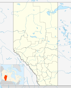
 Hamlet of Nordegg
Coordinates: 52°28′14″N 116°04′31″W / 52.4706°N 116.0753°W Country  Canada
Province  Alberta
Region Central Alberta Census Division No. 9 County Clearwater Incorporated 1914 Government – Reeve Pat Alexander – Governing body Clearwater County Council- Pat Alexander
- Bob Bryant
- Jim Duncan
- Earl Graham
- Case Korver
- John Vandermeer
- Dick Wymenga
– MP Blake Richards (Wild Rose-Cons) – MLA Ty Lund (Rocky Mountain House-PC) Elevation 1,287 m (4,222 ft) Population (2006) – Total 200 (estimate) – Density 250/km2 (647.5/sq mi) Time zone MST (UTC-7) – Summer (DST) MDT (UTC-6) Postal code span T0M 2H0 Area code(s) +1-403 Highways Highway 11 Waterways Lake Abraham, Shunda Creek Nordegg is a hamlet in west-central Alberta, Canada within Clearwater County.[1] It is located in the North Saskatchewan River valley in the foothills of the Canadian Rockies, at the crossroads of David Thompson Highway and the Highway 734 spur of the Bighorn Highway.
Contents
History
The community was initially founded as a coal mining town in the early 1900s and is named after Martin Nordegg, a representative of a German development company. The town was a joint venture between the German firm and the Canadian Northern Railway. The coaling operation was named Brazeau Colleries, after the nearby Brazeau River.
In 1914, as World War I broke out, German assets in Canada were frozen, and Nordegg himself was asked to leave Canada. However, the town retained its name, unlike many other German-named towns in Canada during this time.
Coal production at Nordegg continued until 1955, at which time declining demand for coal from railway operators, due to a switch to diesel locomotives, drove the operation out of business.
Nordegg today
During its peak, Nordegg was a town of over 3000. After the closure of the mine most of the population left, and today there are only a few hundred people remaining. Most of the surface coal processing operation is still standing. In 1993 it was declared a Provincial Historic Resource, and in 2002 a National Historic Site. The original Nordegg town site is open to the public. At the mine site, visitors may experience a guided tour of the coal handling, processing and support facilities during the summer tourist season. Tourists should keep in mind that actual entrance into the underground mine itself is no longer possible or allowed, as time has caused the contents to collapse, thereby rendering a tour impossible.
A land exchange with the Province of Alberta has stimulated redevelopment of Nordegg. A mountain acreage community is developing north of Highway 11, adjacent to the Shunda Creek Hostel, and Clearwater County has released plans for the redevelopment of downtown Nordegg, much on the footprint of the original townsite.
Nordegg is now associated with tourism and recreation, primarily because of its location near to so many parks and recreations areas, for example Ram Falls Provincial Park, the Kootenay Plains Ecological Reserve and the dozens of small campsites along the David Thompson Highway. The distinctive Coliseum and Shunda (Baldy) Mountains overlook Nordegg and are rewarding day-hikes.
Nordegg is the last community on the David Thompson Highway before reaching Banff National Park to the west. The area west of Nordegg is known as the Bighorn Backcountry, and includes many excellent hiking trails. Off Highway Vehicle use is permitted in some areas, but local authorities are notoriously strict; preferring to hand out fines and summons rather than warnings.
Climate
Climate data for Nordegg Month Jan Feb Mar Apr May Jun Jul Aug Sep Oct Nov Dec Year Record high °C (°F) 16.7
(62.1)19.5
(67.1)17.2
(63.0)26
(79)29.5
(85.1)30.6
(87.1)31.1
(88.0)32.2
(90.0)31
(88)26
(79)18.3
(64.9)15.5
(59.9)32.2
(90.0)Average high °C (°F) −4.1
(24.6)−0.3
(31.5)3.4
(38.1)8.9
(48.0)13.8
(56.8)17.5
(63.5)20.2
(68.4)19.6
(67.3)15
(59)9.6
(49.3)0.9
(33.6)−3.4
(25.9)8.4 Daily mean °C (°F) −11.3
(11.7)−7.9
(17.8)−4.2
(24.4)1.7
(35.1)6.4
(43.5)10.1
(50.2)12.5
(54.5)11.9
(53.4)7.3
(45.1)2.4
(36.3)−5.8
(21.6)−10.1
(13.8)1.1 Average low °C (°F) −18.5
(−1.3)−15.5
(4.1)−11.7
(10.9)−5.6
(21.9)−1
(30)2.7
(36.9)4.8
(40.6)4.1
(39.4)−0.4
(31.3)−4.9
(23.2)−12.5
(9.5)−16.7
(1.9)−6.3 Record low °C (°F) −47.2
(−53.0)−47
(−53)−40.5
(−40.9)−26
(−15)−16.5
(2.3)−12.2
(10.0)−6.7
(19.9)−6.7
(19.9)−16
(3)−35
(−31)−43
(−45)−45
(−49)−47.2
(−53.0)Precipitation mm (inches) 26.6
(1.047)15.9
(0.626)25.9
(1.02)33.8
(1.331)73.4
(2.89)102.9
(4.051)106
(4.17)79.4
(3.126)59.7
(2.35)28
(1.1)21.6
(0.85)22
(0.87)595.1
(23.429)Source: Environment Canada[2] See also
- List of communities in Alberta
- List of hamlets in Alberta
References
- ^ Alberta Municipal Affairs (2010-04-01). "Specialized and Rural Municipalities and Their Communities". http://municipalaffairs.gov.ab.ca/documents/msb/2010-ruralmun.pdf. Retrieved 2010-06-22.
- ^ Environment Canada—Canadian Climate Normals 1971–2000, accessed 23 March 2010
External links
 Subdivisions of Alberta
Subdivisions Regions · Census divisions · Municipal districts (counties) · Specialized municipalities · School districts · Regional health authoritiesCommunities Cities · Towns · Villages · Summer villages · Hamlets · Indian reserves · Métis settlements · Ghost towns · Designated placesCities and Urban
Service AreasAirdrie · Brooks · Calgary · Camrose · Cold Lake · Edmonton (capital) · Fort McMurray · Fort Saskatchewan · Grande Prairie · Lacombe · Leduc · Lethbridge · Lloydminster · Medicine Hat · Red Deer · Sherwood Park · Spruce Grove · St. Albert · WetaskiwinCoordinates: 52°28′14″N 116°4′31″W / 52.47056°N 116.07528°W
Categories:- Clearwater County, Alberta
- Hamlets in Alberta

Wikimedia Foundation. 2010.