- New York State Route 440
-
NYS Route 440
Route information Maintained by NYSDOT and PANYNJ Length: 12.73 mi[2] (20.49 km) Existed: 1949[1] – present Major junctions South end: 
 Route 440 / CR 501 at Richmond Valley
 Korean War Veterans Parkway in Greenridge
 I-278 in Graniteville and Bulls Head
North end: Route 440 / CR 501 at Port RichmondLocation Counties: Richmond Highway system Numbered highways in New York
Interstate • U.S. • N.Y. (former) • Reference • County←  NY 439A
NY 441  →
→New York State Route 440 (NY 440) is a state highway located entirely on Staten Island in New York City. The route acts as a connector between the two segments of New Jersey Route 440, running from the Staten Island community of Richmond Valley to the south to Port Richmond to the north. NY 440 is connected to the two New Jersey segments by the Outerbridge Crossing to the south and the Bayonne Bridge to the north. It is the only other New York state highway besides NY 426 that is the middle section of another state's highway bearing the same number. Much of NY 440 is a limited-access highway. From the Korean War Veterans Parkway to Interstate 278 (I-278), it is known as the West Shore Expressway. North of I-278, it is named the Dr. Martin Luther King Jr. Expressway (formerly the Willowbrook Expressway).
Contents
Route description
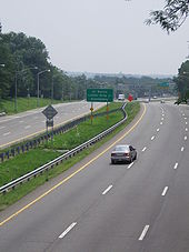
 The West Shore Expressway, northbound, from Meredith Avenue
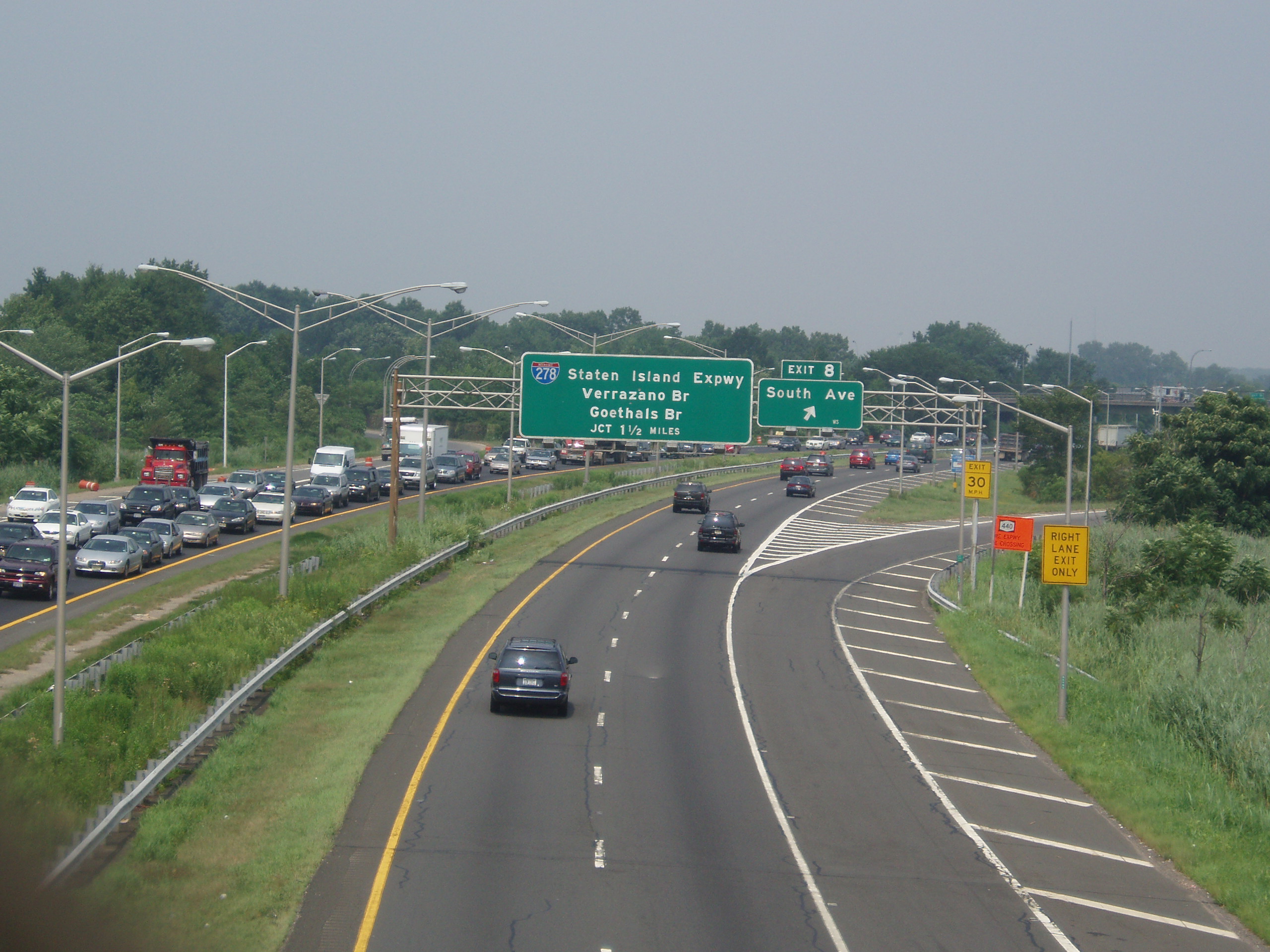
NY 440 begins at the Outerbridge Crossing near the southwestern region of the island, where it connects with the Middlesex County segment of New Jersey's Route 440. It traverses the island's largely unpopulated meadowlands along its western flank as a 7.7-mile (12.4 km) freeway called the West Shore Expressway until it joins with the Staten Island Expressway (I-278) near the northwest corner of the island. There are nine exits between the Outerbridge Crossing and the Staten Island Expressway, including the interchanges with both the Richmond Parkway and the latter; however, two of the exits can only be accessed from one direction.
I-278 and NY 440 overlap for approximately 1.25 miles (2.01 km) before the two separate at an interchange with the Dr. Martin Luther King Jr. Expressway. NY 440 continues northward for another 2.6 miles (4.2 km) on the Dr. Martin Luther King Jr. Expressway until it reaches the Bayonne Bridge. There are three exits in this section, one of which is accessible to southbound traffic only. On the summit of the bridge, it becomes the Hudson County segment of New Jersey's Route 440.
History
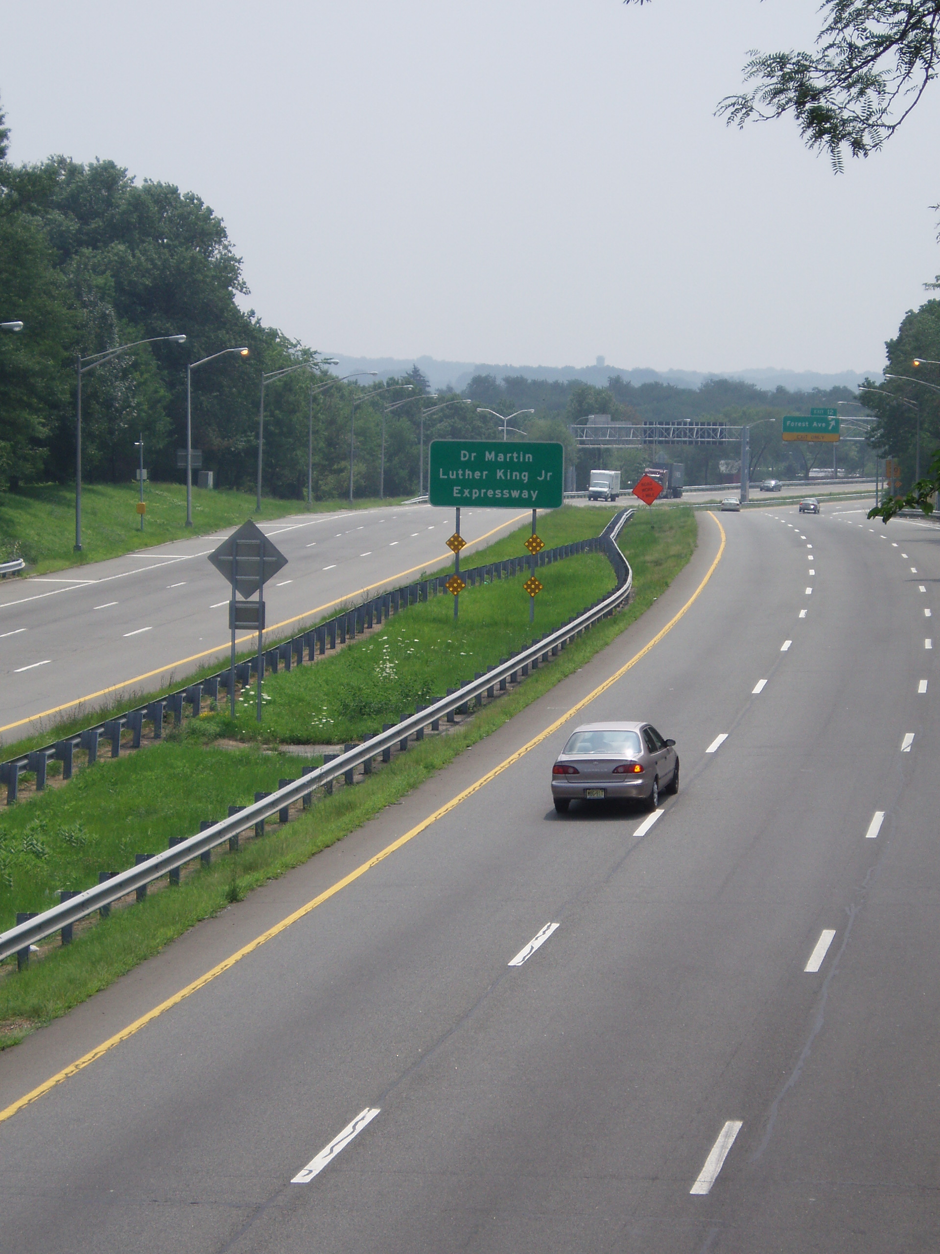
 The Dr. Martin Luther King Jr. Expressway, southbound, from Walker Street.
NY 440 was initially designated in 1949 as a continuation of New Jersey's Route 440.[1] The route began at the Outerbridge Crossing and ended at the Bayonne Bridge, as it does today; however, the route was originally routed on Drumgoole Boulevard and Richmond Avenue in between the two bridges.[3] In the early 1950s, proposals surfaced for the Willowbrook Parkway, which would extend from Staten Island Marine Park (later Great Kills Park and now part of the Gateway National Recreation Area) on the island's East Shore to the Bayonne Bridge via Egbertville and Bulls Head.[3][4] A second highway, the West Shore Expressway, was proposed ca. 1961. As proposed, it would begin at the Outerbridge Crossing and run along the west shore of Staten Island to meet the Clove Lakes Expressway (I-278) near the Goethals Bridge.[5][6]
The first section of the Willowbrook Parkway—from I-278 north to modern exit 13—was completed by 1965.[7] A short extension south to Victory Boulevard was opened to traffic by 1968. The highway was also renamed the Willowbrook Expressway by this time.[8] It was never extended past Victory Boulevard as opposition from both local property owners and environmental activists prevented construction of the rest of the highway. Its original route has never been formally demapped, however.[9] NY 440 was realigned to follow the Willowbrook Expressway by 1970.[10]
Drumgoole Boulevard was transformed into a limited-access highway in the late 1960s and early 1970s[8][11] and renamed the Richmond Parkway (now the Korean War Veterans Parkway) ca. 1973; however, NY 440 initially continued to follow the parkway. The segment of the West Shore Expressway southwest of Huguenot Avenue was opened ca. 1973[11][12] and became part of a realigned NY 440 ca. 1974. NY 440 left the expressway at Huguenot Avenue and followed Arthur Kill Road east to Richmond Avenue, where it continued north on its original alignment. The former alignment of NY 440 on the Richmond Parkway was redesignated as Temporary NY 440.[12][13] When the West Shore Expressway was completed in 1976,[1] the Temporary NY 440 designation was eliminated while NY 440 was shifted westward to follow the West Shore and Clove Lakes Expressways between Huguenot Avenue and the Willowbrook Expressway.[14]
In the mid-1960s, officials in New Jersey and New York considered extending the I-287 designation eastward from its current terminus at the New Jersey Turnpike (I-95) to Staten Island via New Jersey Route 440 and the Richmond Parkway. The idea was scrapped soon afterward.[15] In 1990, the Willowbrook Expressway was renamed the Dr. Martin Luther King Jr. Expressway in honor of Martin Luther King, the slain civil rights leader.[9] The West Shore Expressway was ceremonially designated the Pearl Harbor Memorial Expressway by New York Governor George Pataki in 1999. However, the expressway's official name did not change.[16]
Exit list
Location Mile[2] Exit Destinations Notes Outerbridge Crossing; NY 440 continues into New Jersey as Route 440 Richmond Valley 1 Page Avenue (north), Arthur Kill Road (south) 1.13 2 Korean War Veterans ParkwayCharleston 3 Woodrow Road (north), Bloomingdale Road (south) Rossville 3.73 4 Arthur Kill Road, Huguenot Avenue Arden Heights 5 Muldoon Avenue, Arden Avenue Southbound exit only Travis 6.37 7 Victory Boulevard Former routing of NY 439A 7.29 8 South Avenue Bloomfield 9 Glen Street Northbound exit only (newest interchange, opened in 2001) 9.33 9A I-278 west – Elizabeth, BrooklynNY 440 joins I-278 northbound and leaves southbound Begin I-278 exit numbering system northbound; resume NY 440 exit numbering system southbound 6 South Avenue Southbound exit and entrance Graniteville 9.54 7 Richmond Avenue Access via Fahy Avenue northbound 10.24 8 Victory Boulevard Northbound exit and southbound entrance; former routing of NY 439A Resume NY 440 exit numbering system northbound; begin I-278 exit numbering system southbound 10.43 10 I-278 east – Elizabeth, BrooklynNY 440 leaves I-278 northbound and joins southbound 11 Victory Boulevard Southbound exit and northbound entrance; former routing of NY 439A 11.41 12 Forest Avenue Former routing of NY 439 Elm Park 13 Richmond Terrace Access via Trantor Place northbound and Morningstar Road southbound Bayonne Bridge; NY 440 continues into New Jersey as Route 440 1.000 mi = 1.609 km; 1.000 km = 0.621 mi References
- ^ a b c Anderson, Steve. "State and US Roads in New York City". NYCRoads. http://www.nycroads.com/roads/state_NYC/. Retrieved November 21, 2007.
- ^ a b "2008 Traffic Volume Report for New York State" (PDF). New York State Department of Transportation. June 16, 2009. p. 235. https://www.nysdot.gov/divisions/engineering/technical-services/hds-respository/NYSDOT%20TVR%202008%20by%20Route.pdf. Retrieved May 11, 2010.
- ^ a b Socony-Vacuum Oil Company (1950). New York (Map). Cartography by Rand McNally and Company.
- ^ Sunoco (1952). New York (Map). Cartography by Rand McNally and Company.
- ^ Gulf (1960). New York and New Jersey Tourgide Map (Map). Cartography by Rand McNally and Company.
- ^ Sunoco (1961). New York and Metropolitan New York (Map). Cartography by H.M. Gousha Company (1961–62 ed.).
- ^ Mobil (1965). New York (Map). Cartography by Rand McNally and Company.
- ^ a b American Automobile Association (1968). New York City and Vicinity including Long Island (Map) (1968–69 ed.).
- ^ a b Anderson, Steve. "Dr. Martin Luther King Jr. Expressway (NY 440)". NYCRoads. http://www.nycroads.com/roads/mlk/. Retrieved May 11, 2010.
- ^ State of New York Department of Transportation (January 1, 1970) (PDF). Official Description of Touring Routes in New York State. http://www.greaternyroads.info/pdfs/state70.pdf. Retrieved January 3, 2010.
- ^ a b Gulf (1972). New York and New Jersey Tourgide Map (Map). Cartography by Rand McNally and Company (1972 ed.).
- ^ a b Shell Oil Company (1973). New York (Map). Cartography by H.M. Gousha Company (1973 ed.).
- ^ Gulf (1974). New York and New Jersey Tourgide Map (Map). Cartography by Rand McNally and Company.
- ^ Exxon (1977). New York (Map). Cartography by General Drafting (1977–78 ed.).
- ^ Anderson, Steve. "NJ 440 Freeway (Middlesex County Section)". NYCRoads. http://www.nycroads.com/roads/NJ-440S/. Retrieved May 11, 2010.
- ^ Anderson, Steve. "West Shore Expressway (NY 440)". NYCRoads. http://www.nycroads.com/roads/west-shore/. Retrieved May 11, 2010.
External links
- Alps' Roads – New York State Route 440
- New York Routes – New York State Route 440
- New York State Highway Termini – New York State Route 440
- Outerbridge Crossing @ NYCROADS.com
- West Shore Expressway(NY 440) @ NYCROADS.com
- Dr. Martin Luther King Jr. Expressway(NY 440) @ NYCROADS.com
- Bayonne Bridge @ NYCROADS.com
- NY 440 (Greater New York Roads)
Expressways in New York City Manhattan–Bronx Bruckner (I-95/I-278) · Cross Bronx (I-95/I-295) · Major Deegan (I-87) · New England Thruway (I-95) · Sheridan (I-895) · Throgs Neck (I-695) · Trans-Manhattan (I-95)Brooklyn–Queens Staten Island Staten Island (I-278) · West Shore/MLK (NY 440)Categories:- Expressways in New York City
- Interstate 87
- Memorials to Martin Luther King, Jr.
- State highways in New York
- Transportation in Staten Island
- United States military memorials and cemeteries

Wikimedia Foundation. 2010.