- Tung Lung Chau
-
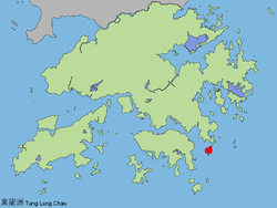 Map of Hong Kong showing the location of Tung Lung Chau.
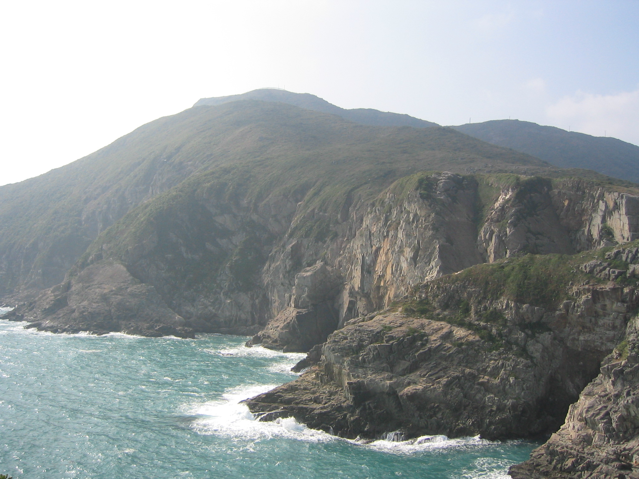
 The cliffs on the east coast of Tung Lung Chau.
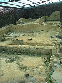 Tung Lung Fort
Tung Lung Chau (Chinese: 東龍洲, lit. eastern dragon island), also known as Nam Tong Island (南堂島) is an island located off the tip of the Clear Water Bay Peninsula in the New Territories of Hong Kong. It is also referred by Hong Kong people as Tung Lung To or Tung Lung Island (東龍島). The island is largely uninhabited. Administratively, it belongs to Sai Kung District.
Contents
Geography
The island has an area of 2.42 km².[1] It forms one of the boundaries of Tathong Channel, which leads into Victoria Harbour through Lei Yue Mun. The northern tip of Tung Lung Chau is separated from the southern tip of Clear Water Bay Peninsula by the narrow Fat Tong Mun Channel.
Sights
It is the site of Tung Lung Fort, constructed 300 years ago and recently refurbished. A prehistoric stone carving can also be found on the island. Measuring 180 cm by 240 cm, it is the largest ancient rock carving in Hong Kong.[2] Both the fort and the stone carving are declared monuments of Hong Kong.
Tung Lung Fort Special Area was designated as a Special Area under country parks in 1979 and covers 3 hectares. The area contains the fort and a campsite.[3][4]
Rock Climbing
Tung Lung houses some of the best sport climbing venues in Hong Kong. For comprehensive topos, beta, approach, and all necessary information, visit Hong Kong Climbing [5]
Transportation
On weekends, two kai-to services are available from both Sam Ka Tsuen and Sai Wan Ho.
The service from Sam Ka Tsuen, near Lei Yue Mun (Kowloon side) is operated by Coral Sea Ferry. Return fare is HK$30 in November, 2010.
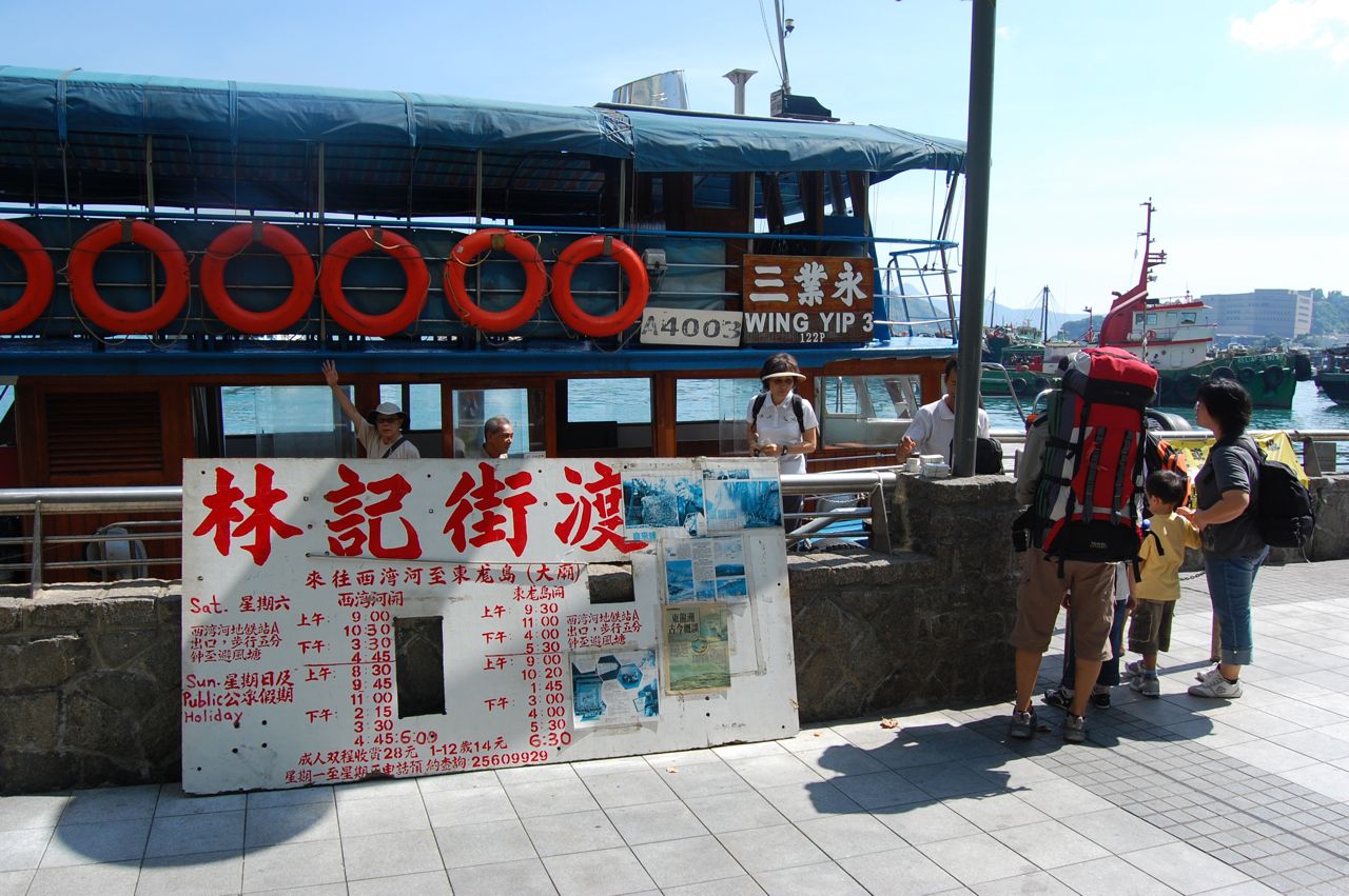
The service from Sai Wan Ho is operated by Lam Kee Ferry (林記街渡). Return fare is HK$30 in November, 2010.
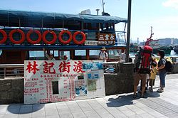 Lam Kee Ferry with timetable
See also
- Islands of Hong Kong
- March of Tung Lung To
References
 Major islands of Hong Kong
By size Lantau Island · Hong Kong Island · Lamma Island · Chek Lap Kok · Tsing Yi · Kau Sai Chau · Po Toi Islands (Po Toi • Waglan) · Cheung Chau · Tung Lung Chau · Crooked Island · Double Island · Hei Ling Chau · Grass Island · Ap Lei Chau · Soko Islands (Tai A Chau • Siu A Chau) · Ping Chau · Peng Chau · Ma Wan · Ninepin Group · The Brothers · Green Island · Kowloon Rock
Former islands Conservation designations in Hong Kong Country parks New Territories EastClear Water Bay · Kam Shan · Kiu Tsui · Lion Rock · Ma On Shan · Pat Sin Leng · Plover Cove · Plover Cove (Ext.) · Sai Kung East · Sai Kung West · Sai Kung West (Wan Tsai Ext.)New Territories WestSpecial Areas Marine parks See also: Site of Special Scientific InterestCoordinates: 22°14′57″N 114°17′23″E / 22.24917°N 114.28972°E
Categories:- Islands of Hong Kong
- Uninhabited islands of Hong Kong
- Tung Lung Chau
- Sai Kung District


Wikimedia Foundation. 2010.