- Methoni, Messenia
-
For other uses, see Methone (disambiguation).
Methoni
Μεθώνη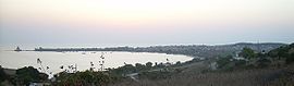
Methoni, sunset.Location 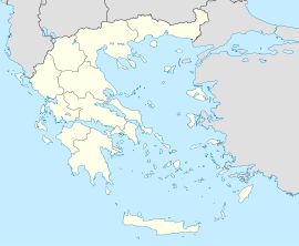
 Methoni
Coordinates 36°49′N 21°42′E / 36.817°N 21.7°ECoordinates: 36°49′N 21°42′E / 36.817°N 21.7°E Location within the peripheral unit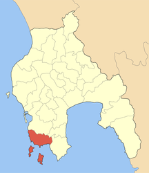
Government Country: Greece Region: Peloponnese Regional unit: Messenia Municipality: Pylos-Nestoras Population statistics (as of 2001) Municipal unit - Population: 2,638 - Area: 97.202 km2 (38 sq mi) - Density: 27 /km2 (70 /sq mi) Other Time zone: EET/EEST (UTC+2/3) Elevation: 0 m (0 ft) Website www.methoni.gr Methoni (Greek: Μεθώνη) is a village and a former municipality in Messenia, Peloponnese, Greece. Since the 2011 local government reform it is part of the municipality Pylos-Nestoras, of which it is a municipal unit.[1] Its name may be derived from Mothona, a mythical rock. It is located 11 km south of Pylos and 11 km west of Foinikounta. The municipal unit of Methoni includes the nearby villages of Grizokampos, Finikouda, Foiniki, Lachanada, Varakes, Kainourgio Chorio, Kamaria, Evangelismos and the Oinnoussai Islands. The latter constitutes from Sapientza, Schiza and Santa Marina and forms a natural protection to Methoni harbour.
Tapia, Kokkinia, Kritika are areas around the village and some of the most beautiful beaches in the southern Peloponnese.
The town is also known by the Italian name Modon or Modona, as it was called by the Venetians. Tourism dominates its industry because it has a glorious beach to the south and restaurants, bars, taverns and hotels support the tourism. Agriculture and services are its second industry.
Contents
Subdivisions
The municipal unit Methoni is subdivided into the following communities (constituent villages in brackets):
- Methoni (Methoni, Kokkinia, Kritika, Sapientza (island), Tapia)
- Evangelismos (Evangelismos, Dentroulia, Kamaria)
- Foiniki
- Foinikounta (Foinikounta, Anemomylos, Chounakia, Grizokampos, Loutsa, Schiza (island))
- Kainourgio Chorio (Kainourgio Chorio, Varakes)
- Lachanada (Lachanada, Nerantzies)
Historical population
Year Town population Municipality population 1991 1,173 2,666 2001 1,169 2,638 History
Antiquity
Further information: Ancient GreeceMethoni has been identified as the city Pedasus, that Homer mentions under the name "ampeloessa" (of vine leaves), as the last of the seven "evnaiomena ptoliethra", that Agamemnon offers Achilles in order to subdue his rage. Pausanias named the city Methoni, named after either the daughter of Oineas or a small islet. The Oinoussai complex of islands protected the port of Methoni and at the same time stopped the large sea turbulence. Along with the rest of Messenia, the town gained its independence from the Spartans in 369 BC. During the 4th century BC, Methoni was elaborately fortified and continued to remain autonomous well into the Imperial Roman era, when it enjoyed the favor of some emperors. During the Byzantine years it continued to remain a remarkable harbor and one of the most important cities of the Peloponnese, seat of a bishopric.
Venetian Era
The Venetians had their eye on Methoni since the 12th century, due to its location on the route from Venice to the Eastern markets. In 1125, they launched an attack against pirates, who had captured some Venetian traders on their way home from the east, and who were inhabiting Methoni at that time.
The Venetians fortified Methoni, which developed into an important trade center with great prosperity. Methoni became the important middle station between Venice and the Holy Lands, where every traveler stopped on their way to the East. A pilgrim who went by in 1484 admired its strong walls, the deep moats and the fortified towers.
Ottoman Era
Further information: Ottoman GreeceBut the Ottoman Turks wanted to conquer Methoni. In the 1490s, Sultan Bayezid II gathered his forces against Methoni. Bayezid, despite the hard siege, would not have been able to capture it if the inhabitants, thrilled by the arrival of reinforcements, hadn't deserted the walls, a fact that the janissaries took advantage of, invading the fortress from the governor's palace. On the August 9, 1500, Methoni fell, after having been in the hands of the Venetians for about three hundred years. The city was given to the flames, the Catholic bishop was killed while talking to the people, the men were decapitated, the women and children were sold to slavery. The walls were repaired and the period of the first period of Turkish rule began.
The Venetians returned under Francesco Morosini in the 1680s during the Great Turkish War, but the second period of Venetian rule did not last for long. In 1715 the Turks launched a siege again, but during this second period of Turkish rule the decline was complete. As is apparent from the travelers' descriptions, the population was reduced, the battlements were in bad condition and the harbor became shallow. The most important trade conducted was that of slaves. In February 1825, during the Greek Revolution, Ibrahim Pasha of Egypt landed at Methoni and settled in the commander's residence, over the entrance of the castle. In the same building, the French general Maison, who freed the town together with others in the Peloponnese, settled in 1829.
Modern Era
Methoni boosted its economy and also brought tourism. After World War II and the Greek Civil War, its buildings were rebuilt. Emigration came in full force in the 1950s. Necessities including electricity, radios and automobiles arrived in the middle of the 20th century, television in the later part of the century and computer near the turn of the millennium. Recently, a strong 6.6 earthquake, stronger than the Lefkada earthquake in 2004, four and a half years before rumbled and shook Methoni and caused minor damage in the vicinity on Thursday February 14, 2008, residents were panicked, the worst was yet to escape, they encountered another earthquake that measured around 5.4 two weeks later on February 28 which also did cause a few minor damages except on some pre mid 20th century built homes that were poorly built of stone. Two more earthquakes would rumble Methoni and the surrounding area on March 4 once again in nearly a week, they measured a 4.2 and occurred at 2:03 P.M. (14:03) local time, this time, the epicenter occurred at the sea south of its promontory, nearly no damages were reported.
Methoni's Castle
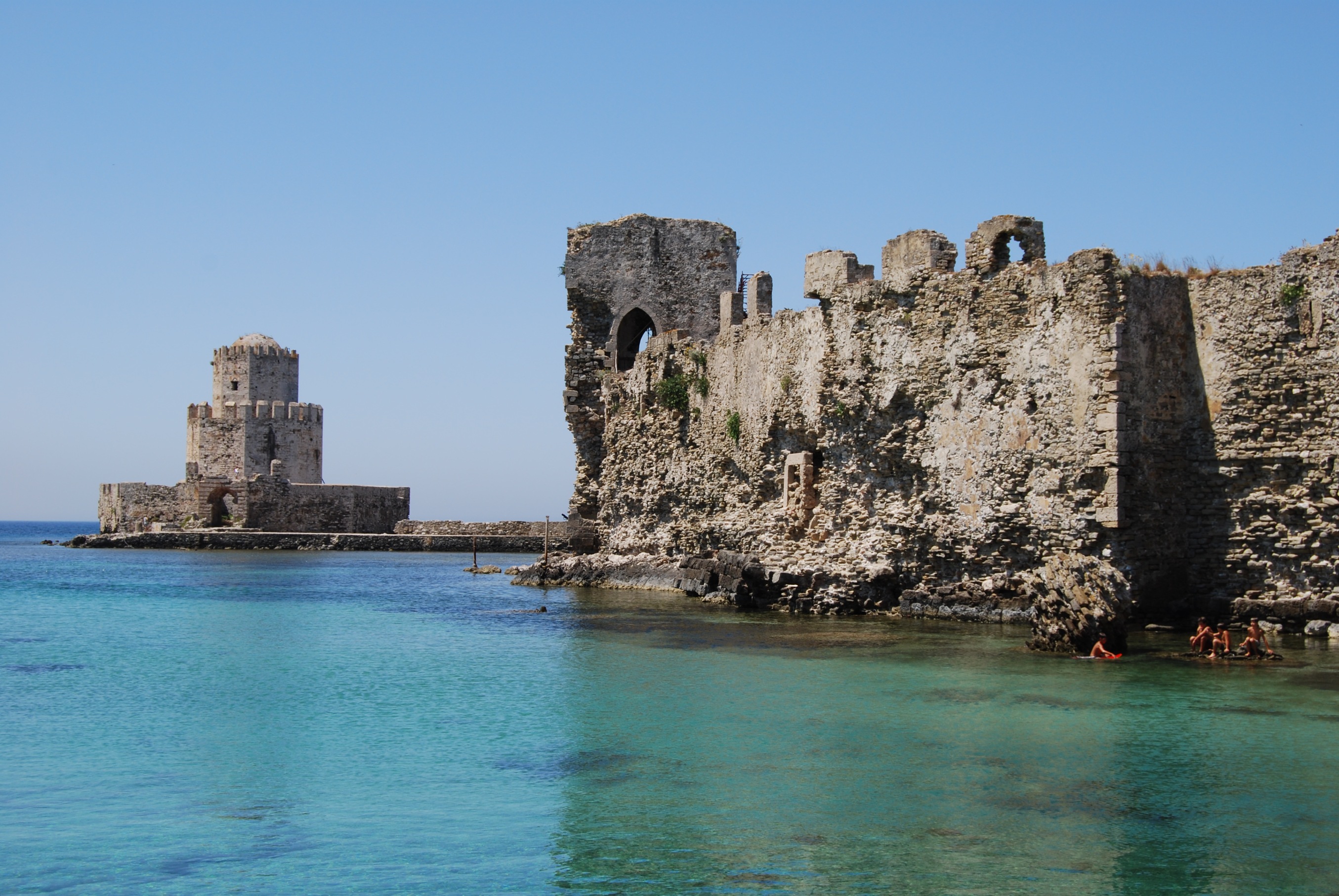
 Ottoman/Venetian fortress in Methoni's port.
Nowadays the walls of the fortress, even though in ruins, continue to be impressive. The castle of Methoni occupies the whole area of the cape and the southwestern coast to the small islet that has also been fortified with an octagonal tower and is protected by the sea on its three sides. Its north part, the one that looks to land, is covered by a heavily fortified acropolis. A deep moat separates the castle from the land and communication was achieved by a wooden bridge. The Venetians built on the ancient battlements and added on and repaired it during both periods that they occupied the castle.
Description
Its entrance is accessed by a stone bridge of 14 arches, that was built over a moat by the technicians of Expedition scientifique de Moree, that accompanied general Maison. The entrance gate ends in an arch framed on the right and left by pilasters with Corinthian capitals. It is considered to be the work of Venetians after 1700. On the right and left of the entrance two large battlements can be seen. One battlement is the one built by general Antonio Loredan, during the second period of Venetian occupation.
Right after the central gate, a domed road opens up that leads through a second gate and then a third in the interior of the castle, where the habitable part was and which was separated from the north part with a vertical low wall (approximately 6 meters), fortified with five towers (four square and one octagonal) is dated to the period after 1500, when the Turks tried to reinforce the population and the fortification of the caste. In the interior there are ruins of the houses where the venetian lords lived during the period of rise, the paved street that led to the sea gate, the ruins of a Turkish bath, the Byzantine church of St. Sophia, close to which a slate with Latin lettering was found (dating back to 1714), parts of Doric pillars, a monolithic granite pillar (1493/4), unlined, with a capital on the top of Byzantine style, which is supposed to have supported either the winged lion of Venice or the bust of Morozini. That is why it is called "Morozini's stele". There was an inscription on the capital that has not survived to this day. On the left of the entrance are the ruins of the building which originally Imbrahem used as a residence in 1826 and later general Maison. The French of the liberating corps remained in the area till 1833 and the construction of the church of Santa Sotira, which is still attributed to them. In the interior of the castle there are also a few cisterns and the remains of the British prisoner's cemetery during the World War II.
On the south part of the walls rises the spectacular sea gate which has recently been restored. A stone-paved stretch leads over a small bridge to the small fortified islet of Bourtzi. This is the place where many soldiers and inhabitants of Methoni were slaughtered, when the Turks occupied the fort in 1500.
History
The Bourtzi is dated back to the period after 1500 and has been used in various instances as a prison. It has a two-floor octagonal tower. The tower finishes in a round dome. On the lower floor there was a cistern and the whole works, with small defensive value, and is dated during the first period that the Turks occupied the fortress.
The west part of the walls is not as well constructed as the others. It was here that during the 2nd World War, after an explosion, parts of well constructed stones from the ancient walls of Methoni were found. In the interior of the walls, ruins of Turkish military establishments are preserved.
The east side of the walls also reached initially to the sea. Nowadays, a long strand of beach lies in front of a large part of it. Parallel to the east wall, up to the Bourtzi, there was a pier and this is where the small fortified harbor was formed (mandrachio), while the big one was to the northeast where ships could be pulled. The long east side has suffered many repairs, performed on the initial venetian battlements of the 13th century, mainly during the second Venetian occupation and the Turkish occupation. In one of the towers parts of the Byzantine fortification are preserved.
On various parts of the fortification there are Venetian emblems with the winged lion of St. Mark and inscriptions. This is the case on the north part of the Loredan battlement, where there is an inscribed plaque from the time when general Loredan was in command in the Peloponnese. On the north wall, on the right of the main entrance, there is also a plaque with the coat of arms of the families of the Foscarini, Foscolo and Bembo, to which the inscription denotes the construction of the Bembo battlement, just before 1500.
The castle of Methoni rises deserted and isolated today. When the winter winds hit its walls the locals say that you can hear the screams of the prisoners and the unjustly killed in the Bourtzi.
The best time to enjoy Methoni is the late afternoon, from the hill opposite. Then the light of the sun that is ready to sink on the side of the Ionian, glides over the large walls crowning them with dull tones. A sweet tranquility dominates everything.
Transportation
Methoni is the southernmost terminus of the GR-9 (Patras - Kyparissia - Methoni) and is connected with the road linking east to Koroni, it is marked at around the 128th km of the second section.
References
- ^ Kallikratis law Greece Ministry of Interior (Greek)
External links
- commercial website
- Official website (English) (Greek)
- Information on the municipality of Methoni From The Greek Ministry Of Interior(Greek)
- Information on the municipality of Methoni From The Gate Source Of The Messinia Prefectural Council (Greek)
North: Kainourgio Chorio and Pylos Northeast: Evangelismos West: Ionian Sea Methoni East: Foinikounda South: Ionian Sea Municipal unit of Chiliochoria Chandrinos · Charakopio · Chrysokellaria · Koukkounara · Kremmydia · Mesopotamos · SoulinariMunicipal unit of Koroni Municipal unit of Methoni Municipal unit of Nestoras Municipal unit of Papaflessas Municipal unit of Pylos Ampelokipoi · Chomatada · Glyfada · Iklaina · Kallithea · Kynigos · Mesochori · Pappoulia · Pidasos · Pyla · PylosCategories:- Populated places in Messenia
- Castles in Greece


Wikimedia Foundation. 2010.