- Mancot
-
Coordinates: 53°11′28″N 3°00′40″W / 53.191°N 3.011°W
Mancot 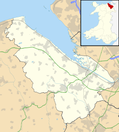
 Mancot
Mancot shown within FlintshirePopulation 3,462 (2001 Census)[1] OS grid reference SJ325665 Principal area Flintshire Ceremonial county Clwyd Country Wales Sovereign state United Kingdom Post town DEESIDE Postcode district CH5 Dialling code 01244 Police North Wales Fire North Wales Ambulance Welsh EU Parliament Wales UK Parliament Alyn and Deeside Welsh Assembly Alyn and Deeside List of places: UK • Wales • Flintshire Mancot is a small village situated in the south east of the county of Flintshire, north-east Wales. The village lies between Queensferry and Hawarden - approximately 1.5 miles from Queensferry and 1.2 miles from Hawarden - and approximately 5 miles from Chester. According to the 2001 Census, Mancot had a population of 3,462 residents.[1]
The placename Mancot is believed to mean 'humble dwelling', with the earliest recorded reference to the village being in the late thirteenth century.[2]
The placename Mancot was earlier spelled with a double t ending - Mancott. [3]
In 1849 the population of the village was 282 persons.[4]
Village amenities include a post office, village hall, park and playing fields, bowling green, library, a newsagent, a veterinary clinic, a Presbyterian church, Sandycroft County Primary School,and the White Bear public house.
The village is situated close to the Wales-England border.
Notable people born in the village include the football players Gary Speed, who was born there in 1969, and Ricky Evans, born in 1960.
References
- ^ a b 2001 Census: Mancot, Office for National Statistics, http://neighbourhood.statistics.gov.uk/dissemination/LeadKeyFigures.do?a=7&b=5939409&c=mancot&d=14&e=16&g=414656&i=1001x1003x1004&m=0&r=1&s=1195597836616&enc=1, retrieved 19 November 2007
- ^ Mancot, Hawarden Community Council, http://www.hawardencommunitycouncil.gov.uk/Contents/Text/Index.asp?SiteId=714&SiteExtra=11279163&TopNavId=712&NavSideId=9877, retrieved 5 January 2009
- ^ A Topographical Dictionary of Wales, Institute of Historical Research, http://www.british-history.ac.uk/report.aspx?compid=47866#s23, retrieved 2 September 2011
- ^ A Topographical Dictionary of Wales, Institute of Historical Research, http://www.british-history.ac.uk/report.aspx?compid=47866#s23, retrieved 2 September 2011
External links
Categories:- Villages in Flintshire
- Wards of Flintshire
- Clwyd geography stubs

Wikimedia Foundation. 2010.