- Governors Island
-
This article is about Governors Island in New York Harbor. For other uses, see Governors Island (disambiguation).Governors Island
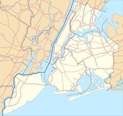

Location: New York County, New York, USA Coordinates: 40°41′29″N 74°0′58″W / 40.69139°N 74.01611°WCoordinates: 40°41′29″N 74°0′58″W / 40.69139°N 74.01611°W Area: 172 acres (70 ha) Architectural style: Colonial Revival, Greek Revival Visitation: 443,000 (2010) Governing body: National Park Service NRHP Reference#: 85002435 Significant dates Added to NRHP: February 4, 1985[1] Designated NHL: February 4, 1985[2] Designated NMON: January 19, 2001 Governors Island is a 172 acres (70 ha) island in Upper New York Bay, approximately one-half mile (1 km) from the southern tip of Manhattan Island and separated from Brooklyn by Buttermilk Channel. It is legally part of the borough of Manhattan in New York City. The island was expanded by approximately 82 acres (33 ha) of landfill on its southern side when the Lexington Avenue subway was excavated in the early 1900s.
First named by the Dutch explorer Adriaen Block, it was called Noten Eylant (and later in pidgin language Nutten Island) from 1611 to 1784. The island's current name—made official eight years after the 1776 Declaration of Independence—stems from British colonial times when the colonial assembly reserved the island for the exclusive use of New York's royal governors.
Defensive works were raised on the island in 1776 by Continental Army troops during the American Revolutionary War, and fired upon British ships before falling into enemy hands. From 1783 to 1966, the island was a United States Army post. From 1966 to 1996 the island served as a major United States Coast Guard installation.
On January 19, 2001, Fort Jay and Castle Williams, two of the island's three historical fortifications were proclaimed a National Monument. On January 31, 2003, 150 acres of the island was transferred to the State of New York for a nominal fee of $1. The remaining (22 acres or 9 ha) was transferred to the United States Department of the Interior as the Governors Island National Monument, administered by the National Park Service.
The 150 acre portion of the island not included in the National Monument is administered by The Trust for Governors Island, an entity of the City of New York and the successor of the joint city/state established redevelopment entity, the Governors Island Preservation and Education Corporation. The transfer included deed restrictions which prohibit permanent housing or casinos on the island.
The national historic landmark district, approximately 92 acres (37 ha) of the northern half of the island, is open to the public for several months in the summer and early fall. Additionally the circumferential drive around the island is also open to the public. The island is accessed by free ferries from Brooklyn and Manhattan.
Contents
History
Colonial period
 Map of Governors Island
 Governors Island from the air, viewing roughly from west to east
Jan Rodrigues from Santo Domingo on the Caribbean island of Hispaniola, a Latin-American of African ancestry and a free man, was the first person to summer on Governors Island, in 1613. He was employed as interpreter in trade negotiations with the Hudson River Indians by the private Amsterdam fur trader and explorer Adriaen Block. Rodrigues was left behind on the island in May 1613 to serve as on-the-spot factor to trade with the natives. Rodrigues and Block rendezvoused again in December that year.
In May 1624, Noten Eylandt ("Island of Nuts"; officially renamed Governors Island in 1784) was the landing place of the first settlers in New Netherland. They had arrived from the Dutch Republic with the ship New Netherland under the command of Cornelis Jacobsz May, who disembarked on the island with thirty families in order to take legal possession of the New Netherland territory.
In 1633, the fifth director of New Netherland, Wouter van Twiller, arrived with a 104-men regiment on Governors Island — its first use as a military base. Later he operated a farm on the island. He secured his farm by creating a deed on June 16, 1637, which was signed by two Lenape, Cacapeteyno and Pewihas, on behalf of their community at Keshaechquereren, situated in what today is New Jersey.
After New Netherland was conditionally ceded to the English in 1664, New Amsterdam was renamed New York by the English in June 1665 but for its population it remained New Amsterdam.
Noten (in pidgin language, "Nutten") Island was renamed Governors Island in 1784 as the island, in earlier times, had been reserved by the British colonial assembly for the exclusive use of New York's royal governors.
The New York State Senate and Assembly have recognized Governors Island as the birthplace, in 1624, of the state of New York. They have also acknowledged the island as the place on which the planting of the “legal-political guaranty of tolerance onto the North American continent” took place (Resolutions No. 5476 and No. 2708).
18th and 19th centuries
 Episcopal Chapel of St. Cornelius
 Looking north across Fort Jay with Manhattan skyscrapers in the background
 Liggett Hall, former barracks for a regiment
After the beginning of the American Revolutionary War, in one night, April 9, 1776, Continental Army General Israel Putnam fortified the island with earthworks and 40 cannon in anticipation of the Battle of Long Island (also known as the Battle of Brooklyn), to be the largest battle of the entire war. The harbor defenses on the island continued to be improved over the summer, and on July 12, 1776, engaged East River, which later contributed to the success of General George Washington's retreat across it from Brooklyn into Manhattan. The Continental Army forces eventually withdrew from the island as well, and the British occupied it in late August. From September 2 to 14, the new British garrison would engage volleys with Washington's guns on the battery in front of Fort George in Manhattan.[3] The fort (along with the rest of New York City) was held by the British for the rest of the war until Evacuation Day at the end of the war in 1783.
After the war, the island as former holdings of the Crown came into ownership by the state of New York and saw no military usage. Prompted by the unsettled international situation between the warring powers of France and Great Britain and the need for more substantial harbor fortifications, the Revolutionary War-era earthworks were rehabilitated into harbor defenses by the city and state of New York. By the late 1790s, the Quasi-War with France prompted a national program of harbor fortifications and in February 1800, the island was conveyed to the federal government which undertook the reconstruction of Fort Jay and new construction of Castle Williams and South or Half Moon Battery.
Fort Jay, started as a square four bastioned fort of earthworks and timber started in 1794 by the state of New York on the site of the earlier earthworks. The sandstone gate house topped with a sculpture of an eagle dates to that time and is the oldest structure on the island. From 1806 to 1809, Fort Jay, by then renamed Fort Columbus was reconstructed in more substantial brick and granite with the addition of a ravelin (giving the fort its current five pointed star appearance) to better protect the fort's north face facing Manhattan and to better direct cannon fire on to the East and Hudson Rivers.
The second fortification started in 1807 and completed in November 1811, was Castle Williams. Located on a rocky shoal at the northwest corner of the island, it was a circular fortification featuring a pioneering new design that could project a 220 degree circular arc of cannon fire from a three levels of casemates (bomb-proof rooms holding two cannons each) from 103 cannons on its three levels and roof.
Fort Jay and Castle Williams are among the best remaining examples of First System (Fort Jay) and Second System (Castle Williams) American coastal fortification.
During the American Civil War, Castle Williams held Confederate prisoners of war and Fort Jay held captured Confederate officers. After the war, Castle Williams was used as a military stockade and became the east coast counterpart to military prisons at Fort Leavenworth, Kansas and Alcatraz Island, California.
In 1878, the military installation on the island, then known collectively as Fort Columbus, became a major Army administrative center. In 1885, the first incinerator in the U.S. was built on Governors Island.[4]
20th century
By 1912, when it was known as Governors Island, the Island's administrative leaders included General Tasker H. Bliss, who would become Army Chief of Staff in 1917. In 1939, the island became the headquarters of the U.S. First Army.
Prior to the construction of Floyd Bennett Field in Brooklyn, the island was considered as a site for a municipal airport. It did hold a small grass strip, Governors Island Army Airfield, from the 1950s until the 1960s.[5]
The Brooklyn-Battery Tunnel passes underwater and off-shore of the island's northeast corner, its location marked by a ventilation building connected to the island by a causeway. At one point prior to World War II, Robert Moses proposed a bridge across the harbor, with a base located on Governors Island; the intervention of the War Department under Franklin D. Roosevelt quashed the plan as a possible navigational threat to the Brooklyn Navy Yard.
Tom (1937) and Dick Smothers (1939), also known as the Smothers Brothers, were born on the island, as was comic book (Batman, Green Lantern) legend Neal Adams (1941). In November 1964, after a year long study of by the Department of Defense to cut costs and reduce the number of military installations, Fort Jay and Brooklyn Navy Yard were identified to be closed by 1966.
The Coast Guard era
When the Army left Governors Island in 1966, the installation became a United States Coast Guard base. The Coast Guard saw the island as an opportunity to consolidate and provide more facilities for its schools, and as a base for its regional and Atlantic Ocean operations.
As with the Army, the island was a headquarters for the Atlantic Area, the regional Third District, the local office of the Captain of the Port of New York, AMVER (Automated Mutual-Assistance Vessel Rescue System), TRACEN (Training Center), and the homeport for several U.S. Coast Guard Cutters including USCGC Dallas (WHEC-716), USCGC Gallatin (WHEC-721), USCGC Morgenthau (WHEC-722), and USCGC Sorrel (WLB-296).
On February 4, 1985, 92 acres (370,000 m2) of Governors Island were designated a National Historic Landmark district, recognizing its wide range and representation of Army fortification, administrative and residential architecture dating from the early days of the nation.[2][6][7]
The island was the site of a December 8, 1988 meeting between U.S. President Ronald Reagan, President-elect George Bush and Soviet leader Mikhail Gorbachev.
In July 1993, the Governors Island Accord was signed between Haitian political leaders.[8]
Like the Army, the Coast Guard was compelled to cut costs and identified the base for closure in 1995. The closure was an agency initiative and not part of the Base Realignment and Closure (BRAC) process that Defense Department installations were undergoing in the 1990s.
With the departure of the Coast Guard almost two centuries of the island’s use as a federal military reservation concluded.
Redevelopment and new uses
The disposal of the island as excess federal property was outlined in the Budget Reduction Act of 1996. The legislation set a deadline and directed that the island be sold at a fair market value, but gave the city and state of New York the right of first refusal, a provision that was inserted into the legislation by New York senator Daniel Patrick Moynihan who envisioned the island with great potential as a public and civic resource.
With the announcement of the Coast Guard base closure and departure, city and state officials along with private developers and civic planners began to offer opinions and ideas on the island's future that included housing, parks, education and private development.
In 1996, Van Alen Institute hosted an ideas competition called "Public Property" which asked designers “to consider the urban potential of Governors Island in terms of spatial adjacencies and experiential overlaps between a range of actions, actors, events, and ecologies... to acknowledge the physical reality of cities and their historic programmatic complexity as fundamental to the survival of a vital public realm.” The competition was open to anyone who registered. More than 200 entries from students, faculty, and landscape architects in 14 different countries were received. The jury members included: Andrea Kahn, Christine Boyer, Miriam Gusevich, Judith Henitz, Carlos Jimenez, and Enric Miralles.
On February 15, 2006, Governor George Pataki and Mayor Michael Bloomberg called for "visionary ideas to redevelop and preserve Governors Island" to be submitted to Governors Island Preservation and Education Corporation (GIPEC). The announcement said proposals should "enhance New York's place as a center of culture, business, education and innovation," include public parkland, contribute to the harbor's vitality and stress "environmentally sustainable development." Deputy Mayor Dan Doctoroff said whatever group or entity is selected to develop the island would assume the $12 million annual maintenance costs that are now split between the city and state. In early 2007, GIPEC paused in the search for developers, focusing on the development of a major park on the island as called for in the deed that conveyed the island from the federal government to the city and state of New York.
With transportation to and from the island, one idea considered was an aerial gondola system designed by Santiago Calatrava.
A proposal to adaptively reuse Castle Williams for a New Globe Theater, designed by architect Norman Foster.[9] The non-profit organization worked in partnership with Shakespeare's Globe Theater in London to develop a proposal and seek backing for a cultural center and performance space in the Castle. With the completion of a National Park Service general management plan for Castle Williams and Fort Jay in 2009, it was determined that the proposed use of the Castle for the theater was not congruous with its historical significance.
In the fall of 2006, GIPEC announced that The Urban Assembly New York Harbor School, a small public high school in Bushwick, Brooklyn, would relocate to Governors Island. The school is the island's first tenant and opens in 2010. Also opening in 2010 will be artist studios, run by the Lower Manhattan Cultural Council. These studios will open in historic Building 110.
In 2007, GIPEC announced five finalist design teams that were chosen to submit their ideas for the future park and Great Promenade. In December 2007, Governor Eliot Spitzer and Mayor Michael Bloomberg announced that the acclaimed team, led by West 8 with Diller Scofidio + Renfro and Rogers Marvel Architects, would design these new signature open spaces.[10][11]
In 2009, a 3-acre (12,000 m2) commercial organic farm, operated by the non-profit organization Added Value, was launched.[12]
In 2010, New York University, a private institution, announced a plan to expand its campuses, including building a campus on the Governors Island "complete with dorms and faculty housing."[13]
In April 2010, the city entered an agreement to take full control of the island's development from the State, and unveiled a new master development plan. Under the plan, the historic northern end will remain structurally unchanged, the middle of the island will be developed into a park stretching all the way to the southern tip, areas on the east and west sides of the island will be privately developed to generate revenue, and the entire island will be edged by a circumferential promenade. The 40-acre (160,000 m2) park, designed by Adriaan Geuze of the Dutch landscape architecture firm West 8 will feature playing fields, woodland, and hills built of the rubble of the disused 20th-century buildings sculpted to frame views of the Statue of Liberty and other New York landmarks. The southern end of the park will meet the water in a series of wetlands.[14]
Governors Island Alliance
Since the decision by the United States Coast Guard to vacate the 172-acre (0.70 km2) Island in 1995, the Governors Island Alliance has worked collaboratively and successfully to help secure its return to New York and to ensure that the public interest determine its reuse.[15] The Alliance and its 50 member organizations led a campaign to see Governors Island returned to New York for public purposes, a mandate embodied in GIPEC's 2003 charter to create "an educational, recreational, and cultural center that will offer a broad range of public uses", create about 90 acres (360,000 m2) of parks and public spaces, and abide by design restrictions in the National Landmark Historic District.
The Governors Island Alliance is working with its many partners to make these commitments a reality, and engage the public in their planning. The Alliance publishes a monthly electronic newsletter that provides the latest information on Island happenings. Equally important, the Alliance is working to enliven the Island with a variety of recreation and arts programs so that visitors can enjoy this harbor destination.
Tolerance Park Alliance
The Alliance is a coalition of organizations and individuals working to celebrate the Island's unique history as the place on which the New World’s first lawful expression of religious tolerance as an individual right took place in 1624. It aims to create an unforgettable living museum-park-to-tolerance as a destination for all Americans on 30% of the Island, and ensure a fitting and sustainable reuse of New York State’s birthplace as “The Island at the Center of the New World.” Thus revealed as Liberty Island’s thematic complement, Governors Island serves as primary symbol in New York harbor and beacon to humanity whereas its historic message – the Lifeblood of American Liberty – endures for future generations.
Immediately following the Coast Guard’s departure from the Island in 1998, the Alliance’s Foundation collaborated with First Lady Hillary Clinton, National Security Adviser Sandy Berger and American Ambassador to the Netherlands Cynthia Schneider in advancing the proposed Education and Preservation Project. The goal was to preserve the $1 State and City purchase option and to avoid the Island’s public auction past the Congressional legal deadline of September 2001. Based on the legal precedent of the 1785 Land Act, the Foundation succeeded in getting the White House to dedicate the Island to “education” on April 1, 2002. It was the basis for the American people’s surrender of the island’s “economic value” to the State and the City. Sixty-plus acres were set aside as “park” land prior to conveying the Island to the State for one dollar on February 1, 2003.
Public access
 Passengers board and alight a Brooklyn Ferry docked at Pier 101 on Governors Island
Since its transfer in 2003, Governors Island has been open to the public every summer. The island is currently open Friday through Sunday.
Access from Brooklyn
Free weekend ferry service is available to Brooklyn Bridge Park.
Paid summer weekend ferry service is operated by NY Waterway between Governors Island and East River Ferry stops in DUMBO, Williamsburg, and Greenpoint. The fare is $4. A summer Friday-only loop serves Governors Island, Manhattan, Atlantic Avenue, and Brooklyn Bridge Park.
Access from Manhattan
Access from Manhattan is via a free ferry operated jointly by the Governors Island Preservation and Education Corporation and NY Waterway from the Battery Maritime Building in the Financial District, Friday through Sunday. The 1908 cast-iron structure, located next to the Staten Island Ferry terminal, was restored between 2001-2006.[16] Service on Friday is hourly, while Saturday and Sunday it is half-hourly. The departure and arrival dock on Governors Island is the Soissons Dock at the north tip of the island. The ride duration is less than five minutes.
To allow for late-night events at its Water Taxi Beach, New York Water Taxi provides service back to Manhattan after such events. The fare is included for paid events and provided for a $5 roundtrip charge for free events.[17]
Activities and publicly accessible areas
Activities on the island include free National Park Service walking tours, bike riding, picnicking, art installations, fairs, festivals, and concerts. Bicycle, tandem, and quadcycle rental is provided on the island by Bike and Roll at hourly and daily rates.[18] New York Water Taxi operates an artificial beach on the northern tip of the island.[17]
The "World Trade Center Run to Remember" (WTCRTR) has been run annually on the island since 2009 on the first Sunday of September. The activities include a 5K Run, 3K Family Fun Run/Walk, Children's Fun Run, and other activities to benefit organizations associated with 9/11 related services.The island is roughly divided in half by a street called Division Road. The northeastern half is currently open to the public. The southwestern half, which contains the abandoned U.S. Coast Guard housing and service areas is still in redevelopment and its interior sections remain closed to the public. However the island's circumferential drive along the waterfront is open to the public. Demolition of the U.S. Coast Guard housing began in 2008 and one small section has been opened to the public as a picnic area. It is on the grounds of the former Liberty Village housing area that was used by Coast Guard families between 1988 and 1996.[19]
Notable residents and references
- The Smothers Brothers were both born on Governors Island in New York Harbor, where their father, Thomas B. Smothers, a West Point graduate and U.S. Army officer, was stationed.
- Janet Lambert, an author of young adult fiction, resided on Governors Island while her husband was the post commander in the 1950s.
- Lois Lowry, author of The Giver, lived on Governors Island during her high school years while her father, an army dentist, was stationed there.
- The Richard Preston novel The Cobra Event has a biosafety field lab located on the island.
- David Wellington's zombie novels Monster Island and Monster Planet feature Governors Island as a human safe haven in a zombie-infested world.
- In the Ultimate Marvel Universe, the Triskelion headquarters of S.H.I.E.L.D. and the Ultimates is located on Governors Island.
- In Spider-Man 3: The Video Game, the mission "Scorpion Unleashed" takes place on Governors Island.
- In the World in Conflict video game, Governors Island is captured by Soviet Spetsnaz forces.
- The drug-making operation in the housing project in the film American Gangster was filmed in a now unoccupied (deemed for demolition) U.S. Military building on Governors Island.
- The films Prince of the City and Critical Condition contain scenes shot on the island.[citation needed]
- In the Freedom Fighters video game, it was the seat of power for the Soviet Armed Forces which had invaded the United States. Governors Island is the final Soviet stronghold.
- Michael Collins, NASA astronaut, called Governors Island home during a portion of his childhood.
- Dave Matthews Band will host one of four DMB Caravans here. This one is being held August 26-28, 2011.
See also
References
 This article incorporates public domain material from the National Park Service document "Governors Island National Monument".
- ^ "National Register Information System". National Register of Historic Places. National Park Service. 2007-01-23. http://nrhp.focus.nps.gov/natreg/docs/All_Data.html.
- ^ a b "Governors Island". National Historic Landmark summary listing. National Park Service. 2007-09-11. http://tps.cr.nps.gov/nhl/detail.cfm?ResourceId=1904&ResourceType=District.
- ^ Historic Timeline of The Battery - The Battery Conservancy
- ^ Hickmann, H. Lanier, Jr. (2003). American alchemy: the history of solid waste management in the United States. ForesterPress. ISBN 9780970768728. http://books.google.com/?id=gEfuG590qNoC., p. 269
- ^ Abandoned & Little-Known Airfields: New York City, Brooklyn
- ^ "Governors Island", 1983, by Barbara Hightower and Blanche Higgins "National Register of Historic Places Inventory-Nomination". National Park Service. 1983. http://pdfhost.focus.nps.gov/docs/NHLS/Text/85002435.pdf "Governors Island", 1983, by Barbara Hightower and Blanche Higgins.
- ^ Governors Island—Accompanying 76 photos, from 1982. "National Register of Historic Places Inventory". National Park Service. 1983. http://pdfhost.focus.nps.gov/docs/NHLS/Photos/85002435.pdf Governors Island—Accompanying 76 photos, from 1982..
- ^ "Governors Island Accord". 1993-07-03. http://carl.army.mil/resources/csi/kretchik/appendixd.asp. Retrieved 2010-01-20.
- ^ New Globe Theater
- ^ Ouroussoff, Nicolai (June 20, 2007). "Competing Visions for Governors Island". The New York Times. http://www.nytimes.com/2007/06/20/arts/design/20gove.html. Retrieved 2007-07-20.
- ^ Ouroussoff, Nicolai (December 20, 2007). "A Landscape’s Isolation Is Turned Into a Virtue". The New York Times. http://www.nytimes.com/2007/12/20/arts/design/20ouro.html. Retrieved 2009-05-20.
- ^ Jennifer 8. Lee (June 22, 2009). "On Governors I., an Organic Farm With a View". The New York Times. http://cityroom.blogs.nytimes.com/2009/06/22/on-governors-ian-organic-farm-with-a-view/. Retrieved 2009-09-21.
- ^ Pogrebin, Robin (March 22, 2010). "N.Y.U. Plans to Expand Campuses by 40 Percent". The New York Times. http://www.nytimes.com/2010/03/23/arts/design/23nyu.html. Retrieved 2010-04-12.
- ^ Ouroussoff, Nicolai (April 12, 2010). "Governors Island Vision Adds Hills and Hammocks". The New York Times. http://www.nytimes.com/2010/04/13/arts/design/13governor.html. Retrieved 2010-04-15.
- ^ Governors Island Alliance
- ^ Lower Manhattan: Battery Maritime Building
- ^ a b "Water Taxi Beach - Governors Island". http://www.watertaxibeach.com/governors_island/locations. Retrieved 2010-06-20.
- ^ "Governors Island Bike Rentals - New York - Bike and Roll". http://bikeandroll.com/newyork/govislandbikerentals.html. Retrieved 2010-06-20.
- ^ Chan, Sewell (2008-10-09). "Invitation to a Demolition, on Governors Island". The New York Times City Room Blog. http://cityroom.blogs.nytimes.com/2008/10/09/governors-island-invites-public-to-watch-demolition/.
External links
- The Trust for Governors Island website
- The Governors Island National Monument website
- Governors Island Visitor information
- Governors Island Alliance
- Governors Island Art Fair
- Biking on Governors Island
- Governors Island's Legacy, New York's Identity (19-page article)
- Governors Island, Lifeblood of American Liberty (34 slides)
- National Historic Landmark information
- Governors Island Military Brats—a site made by some raised on the island
- Satellite Image
- 11/30/1907;Enlargement And Reconstruction of Governors Island's Military Post
- Photos of Governor's Island
Islands of New York City Barren Island · The Blauzes · Broad Channel Island · Chimney Sweeps · City Island · Coney Island · Ellis Island · Governors Island · Hart Island · High Island · Hoffman Island · Hunter Island · Isle of Meadows · Liberty Island · Long Island · Manhattan · Mill Rock · North Brother Island · Prall's Island · Randall's Island · Rat Island · Rikers Island · Roosevelt Island · Ruffle Bar · Shooters Island · South Brother Island · Staten Island · Swinburne Island · Travers Island · Twin Island · U Thant Island · Wards Island

Protected Areas of New York Federal Eleanor Roosevelt • Home of Franklin D. Roosevelt • Kate Mullany House • Martin Van Buren • Saint Paul's Church • Sagamore Hill • Saratoga National Historical Park • Theodore Roosevelt Birthplace • Theodore Roosevelt Inaugural • Thomas Cole House • Vanderbilt Mansion • Women's Rights National Historical Park
African Burial Ground • Castle Clinton • Federal Hall National Memorial • Fort Stanwix • General Grant National Memorial • Governors Island • Hamilton Grange National Memorial • Statue of Liberty
Appalachian Trail • North Country National Scenic Trail
Amagansett • Conscience Point • Elizabeth A. Morton • Iroquois • Montezuma • Oyster Bay • Sayville • Seatuck • Shawangunk Grasslands • Target Rock • Wallkill River • Wertheim
State Allen H. Treman • Allegany • Amherst • Battle Island • Bayard Cutting Arboretum • Bayswater Point • Bear Mountain • Beaver Island • Beechwood • Belmont Lake • Bethpage • Betty & Wilbur Davis • Big Six Mile Creek • Blauvelt • Bonavista • Bowman Lake • Braddock Bay • Brentwood • Bristol Beach • Brookhaven • Buckhorn Island • Buffalo Harbor • Burnham Point • Buttermilk Falls • Caleb Smith • Camp Hero • Canandaigua Lake • Canoe-Picnic Point • Captree • Catharine Valley Trail • Caumsett • Cayuga Lake • Cedar Island • Cedar Point • Chenango Valley • Cherry Plain • Chimney Bluffs • Chittenango Falls • Clarence Fahnestock • Clark Reservation • Clay Pit Ponds • Cold Spring Harbor • Coles Creek • Conesus Lake • Connetquot River • Crab Island • Croil Island • Cumberland Bay • Darien Lakes • De Veaux Woods • Dean's Cove • Delta Lake • Devil's Hole • Dewolf Point • Donald J. Trump • Earl W. Brydges • Eel Weir • Emma Treadwell Thacher • Empire – Fulton Ferry • Evangola • Fahnestock • Fair Haven Beach • Fillmore Glen • Fort Niagara • Four Mile Creek • Franklin D. Roosevelt • Frenchman Island • Galop Island • Gantry Plaza • Gilbert Lake • Gilgo • Glimmerglass • Golden Hill • Goosepond Mountain • Grafton Lakes • Grass Point • Green Lakes • Hamlin Beach • Harriet Hollister Spencer • Harriman • Haverstraw Beach • Heckscher • Hempstead Lake • High Tor • Highland Lakes • Higley Flow • Hither Hills • Honeoye • Hook Mountain • Hudson Highlands • Hudson River Islands • Hudson River • Hunt's Pond • Iona Island • Irondequoit Bay • Jacques Cartier • James Baird • Jamesport • John Boyd Thacher • Jones Beach • Joseph Davis • Keewaydin • Keuka Lake • Knox Farm • Kring Point • Lake Erie • Lake Superior • Lake Taghkanic • Lakeside Beach • Letchworth • Lock 32 • Lodi Point • Long Island • Long Point - Finger Lakes • Long Point - Thousand Islands • Long Point on Lake Chautauqua • Macomb Reservation • Margaret Lewis Norrie • Mark Twain • Mary Island • Max V. Shaul • Mexico Point • Midway • Mine Kill • Minnewaska • Montauk Downs • Montauk Point • Moreau Lake • Napeague • Newtown Battlefield • Niagara Falls • Nissequogue River • Nyack Beach • Oak Orchard • Ogden Mills & Ruth Livingston Mills • Old Croton Aqueduct • Old Erie Canal • Oquaga Creek • Orient Beach • Peebles Island • Pinnacle • Pixley Falls • Point Au Roche • Reservoir • Riverbank • Robert G. Wehle • Robert H. Treman • Robert Moses - Long Island • Robert Moses - Thousand Islands • Robert V. Riddell • Roberto Clemente • Rockefeller • Rockland Lake • Sampson • Sandy Island Beach • Saratoga Lake • Saratoga Spa • Schodack Island • Schunemunk Mountain • Selkirk Shores • Seneca Lake • Shadmoor • Shaver Pond Nature Center • Silver Lake • Sonnenberg Gardens & Mansion • Southwick Beach • St. Lawrence • State Park at the Fair • Sterling Forest • Steuben Memorial • Stony Brook • Storm King • Sunken Meadow • Taconic Outdoor Education Center • Taconic - Copake Falls Area • Taconic - Rudd Pond Area • Tallman Mountain • Taughannock Falls • Theodore Roosevelt Nature Center • Thompson's Lake • Tioga • Trail View • Valley Stream • Verona Beach • Waterson Point • Watkins Glen • Wellesley Island • Westcott Beach • Whetstone Gulf • Whirlpool • Wildwood • Wilson-Tuscarora • Wonder Lake • Woodlawn Beach
Bennington Battlefield • Caumsett • Clermont • Clinton House • Crailo • Crown Point • Darwin Martin House • Fort Montgomery • Fort Ontario • Ganondagan • Grant Cottage • Herkimer Home • Hyde Hall • John Brown Farm and Gravesite • John Burroughs Memorial (Woodchuck Lodge) • John Hay Homestead • Johnson Hall • Knox's Headquarters • Lorenzo • New Windsor Cantonment • Olana • Old Croton Aqueduct • Old Erie Canal • Old Fort Niagara • Oriskany Battlefield • Philipse Manor Hall • Plantings Fields Arboretum -- Coe Hall Historic House Museum • Sackets Harbor Battlefield • Schoharie Crossing • Schuyler Mansion • Senate House • Sonnenberg Gardens & Mansion • Staatsburgh • Steuben Memorial • Stony Point Battlefield • Walt Whitman Birthplace • Washington's Headquarters
Allen Lake • Altmar • Ambler • Armlin Hill • Arnold Lake • Artic China • Ashland Pinnacle • Baker School House • Bald Mountain • Balsam • Balsam Swamp • Barbour Brook • Basswood • Basswood Pond • Bates • Battenkill • Battle Hill • Beals Pond • Bear Creek • Bear Swamp • Bearpen Mountain • Beartown • Beaver Creek • Beaver Dams • Beaver Flow • Beaver Meadow • Beebe Hill • Berlin • Big Brook • Big Buck • Birdseye Hollow • Black Creek • Blenheim • Bobell • Bombay • Bonaparte's Cave • Boutwell Hill • Boyce Hill • Brasher Falls • Brokenstraw • Brookfield Railroad • Broome • Bryant Hill • Buck Hill • Bucks Brook • Buckton • Bucktooth • Bully Hill • Bumps Creek • Burnt-Rossman Hills • Burnt Hill • Bush Hill • Cadyville • Cairo Lockwood • Calhoun Creek • California Hill • California Road • Cameron Mills • Cameron • Canacadea • Canada Creek • Canaseraga • Cascade Valley • Cat Hollow • Cattaraugus • Catherineville • Catlin • Chalres E. Baker • Charleston • Chateaugay • Chautauqua Gorge • Chenango • Cherry Valley • Chestnut Woods • Cinnamon Lake • Clapper Hollow • Clark Hill • Cliffside • Clinton • Cobb Brook • Cobb Creek State Forest • Cold Creek • Cold Spring Brook • Cole Hill • Columbia Lake • Coon Hollow • Cotton Hill • Cotrell • Coventry • Coyle Hill • Coyote Flats • Crab Hollow • Crary Mills • Cuyler Hill • Daketown • Danby • Dannemora • Decatur • Deer River • Degrasse • Delaware • Depot Hill • Deruyter • Dobbins • Dog Hollow • Donahue Woods • Downerville • Dry Run • Dunkin's Reserve • Dutch Settlement • Dutton Ridge • Earlville • East Branch Fish Creek • East Osceola • East Otto • Edwin Hollow • Edwin Mountain • Eldridge Swamp • Elkdale • English Hill • Exeter • Fall Brook • Fairfield • Farmersville • Featherstonhaugh • Fire Fall • Fish Creek • Five Streams • Flat Rock • Florence Hill • Fort Jackson • Frank E. Jadwin • Franklin • Franklin 10 • Frozen Ocean • Furnace Creek • Gas Springs • Gates Hill • Gee Brook • Genegantslet • Gillies Hill • Glenmeal • Golden Hill • Goose Egg • Gorton Lake • Gould Corners • Groundry Hill • Grafton Lakes • Granger • Grant Powell • Grantville • Greenwood • Greenwood Creek • Griggs Gulf • Hall Island • Hammond Hill • Harris Hill • Harry E Dobbins • Hartwick • Harvey Mountain • Hatch Creek • Hawkins Pond • Hemlock Ridge • Hewitt • Hickok Brook • Hickory Lake • High Flats • High Knob • High Towers • High Woods • Hill Higher • Hiltonville • Hinckley • Hogsback • Honey Hill • Hooker Mountain • Hoxie Gorge • Huckleberry Ridge • Huntersfield • Hunts Pond • Independence River • Indian Pipe • Italy Hill • Jackson Hill • Jenksville • Jersey Hill • Karr Valley Creek • Kasoag • Keeney Swamp • Kennedy • Kerryville • Ketchumville • Kettlebail • Keyserkill • Klipnocky • Klondike • Knapp Station • Lafayetteville • Lake Desolation • Lassellsville • Lebanon • Leonard Hill • Lesser Wilderness • Lincklaen • Lincoln Mountain • Line Brook • Lonesome Bay • Long Pond • Lookout • Lost Nation • Lost Valley • Ludlow Creek • Lutheranville • Lyon Brook • Macomb Reservation • Mad River • Mallet Pond • Maple Hill • Maple Valley • Marisposa • Marsh Pond • McCarthy Hill • McDonough • Meads Creek • Melondy Hill • Michigan Hill • Middle Grove • Milford • Mohawk Springs • Montrose Point • Moon Pond • Morgan Hill • Morrow Mountain • Moss Hill • Mount Hunger • Mount Pisgah • Mount Pleasant • Mount Tom • Mount Washington • Muller Hill • Murphy Hill • Nanticoke Lake • Nelson Swamp • Newfield • New Michigan • Nimham Mountain • Nine Mile Creek • North Harmony • O'Hara • Oak Ridge • Oakley Corners • Ohisa • Onjebonge • Orebud Creek • Orton Hollow • Ossian • Otselic • Otsquago • Otter Creek • Palmer's Pond • Peck Hill • Painter Hill • Panama • Papish Pond • Partridge Run • Patria • Pease Hill • Penn Mountain • Perkins Pond • Petersburg • Phillips Creek • Pigeon Hill • Pigtail Hollow • Pinckney • Pine Hill • Pine Ridge • Pitcher Springs • Pittstown • Plainfield • Plattekill • Pleasant Lake • Plum Bottom • Point Rock • Popple Pond • Potato Hill • Pulpit Rock • R. Milton Hick • Raecher • Rakph Road • Raymondville • Red Brook • Relay • Rensselaer Number 3 • Rensselaerville • Robinson Hollow • Rock City • Rock Creek • Rockwood • Roeliff Jansen Kill • Roosa Gap • Roseboom • Rural Grove • Rush Creek • Saint Lawrence • Saint Regis • Salmon River • Sand Bay • Sand Flats • Sandy Creek • Scott Patent • Sears Pond • Shawangunk • Shindagin Creek • Shindagin Hollow • Silver Hill • Skinner Hill • Skyline Drive • Slader Creek • Snow Bowl • Sodom • Sonyea • Spring Brook • South Bradford • South Hammond • South Hill • South Mountain • South Valley • Southville • Stammer Creek • Steam Mill • Steuben Hill • Stewart • Stissing Mountain • Stockton • Stone Barn • Stone Hill • Stone Store • Stoney Pond • Sugar Hill • Summer Hill • Susquehanna • Swancott Mill • Swift Hill • Taconic Hereford • Taconic Ridge • Tassell Hill • Taylor Creek • Taylor Valley • Terry Mountain • Texas Hill • Texas Hollow • Texas School House • Three Springs • Tibbetts • Titusville Mountain • Tomannex • Toothaker Creek • Tracy Creek • Tri-County • Triangle • Trout Brook • Trout Lake • Trout River • Tug Hill • Tuller Hill • Turkey Hill • Turkey Point • Turkey Ridge • Turnpike • Urbana • Ushers Road • Vandermark • Vernooykill • Wagner Farm • Wassaic • Webster Hill • Wellman • West Branch • West Hill • West Mountain • West Oscela • West Parishville • Whalen • Whaupaunaucau • Whippoorwill Corners • Whiskey Flats • White Pond • Whittacker • Wiley Brook • Windfall Creek • Winona • Wolf Brook • Wolf Lake • Woodhull • Wurtsboro Ridge • Yatesville Falls • Yellow Barn • Yellow Lake
Wild ForestsAldrich • Balsam • Black River • Blackhead • Blue Mountain • Bluestone • Cherry Ridge • Colgate Lake • Cranberry Lake • Crystal Lake • Debar Mountain • Dry Brook • Ferris Lake • Fulton Chain • Grass River • Halcott Mountain • Hammond Pond • Horseshoe • Hunter Mountain • Independence River • Jessup River • Kaaterskill • Lake George • Middle Mountain • Moose River Plains • Overlook Mountain • Phoenica • Raquette Boreal • Saranac Lakes • Sargent Ponds • Shaler Mountain • Shandaken • Sundown • Taylor Pond • Vanderwhacker Mountain • Watson East Triangle • White Hill • Wilcox Lake • Willowemoc • Windham High Peak
Other Nature ConservancyEugene and Agnes Meyer Nature Preserve • Santanoni Preserve • Arthur W. Butler Memorial Sanctuary • Indian Brook Assemblage • Marrion Yarrow Preserve • Mildred E. Grierson Memorial Wildlife Sanctuary • Mount Holly Preserve • Long Pond Preserve • Mianus River Gorge Nature Preserve • Henry Morgenthau Preserve • Mount Holly Sanctuary • Otter Creek Preserve • Uplands Farm Nature Sanctuary • Atlantic Double Dunes • Pine Neck Nature Sanctuary • Long Island Center for Conservation • Ruth Wales Sanctuary • Calverton Ponds • Accabonac Harbor • Peconic Estuary Big Woods Preserve • Mashomack Nature Preserve • Montauk Mountain Preserve • Shadmoor Preserve • Andy Warhol Visual Arts Preserve • Coon Mountain Preserve • Gadway Sandstone Pavement Barrens • Silver Lake Bog Preserve • Spring Pond Bog Preserve • Everton Falls Preserve • Clintonville Pine Barrens • O.D. von Engeln Preserve at Malloryville • El Dorado Beach Preserve • Chaumont Barrens Preserve • Freund Wildlife Sanctuary • Lewis A. Swyer Preserve • Hannacroix Ravine Preserve • Kenrose Preserve • Limestone Rise Preserve • Whitbeck Memorial Grove • Stewart Preserve • Lordsland Conservancy • Nellie Hill Preserve • Pawling Nature Reserve • Roger Perry Memorial Preserve • Thompson Pond and Stissing Mountain Preserve • Schunemunk Mountain Preserve • Sam's Point Preserve • Christman Sanctuary • Lisha Kill Natural Area • Moccasin Kill Sanctuary • Denton Sanctuary • Lower Poultney River and Saddles Preserves • West Branch Preserve
U.S. National Register of Historic Places in New York Lists by county Albany • Allegany • Bronx • Broome • Cattaraugus • Cayuga • Chautauqua • Chemung • Chenango • Clinton • Columbia • Cortland • Delaware • Dutchess • Erie • Essex • Franklin • Fulton • Genesee • Greene • Hamilton • Herkimer • Jefferson • Kings (Brooklyn) • Lewis • Livingston • Madison • Monroe • Montgomery • Nassau • New York (Manhattan) • Niagara • Oneida • Onondaga • Ontario • Orange • Orleans • Oswego • Otsego • Putnam • Queens • Rensselaer • Richmond (Staten Island) • Rockland • Saratoga • Schenectady • Schoharie • Schuyler • Seneca • St. Lawrence • Steuben • Suffolk • Sullivan • Tioga • Tompkins • Ulster • Warren • Washington • Wayne • Westchester • Wyoming • Yates
Lists by city Albany • Buffalo • New Rochelle • New York City (Bronx · Brooklyn · Queens · Staten Island · Manhattan: Below 14th St. · 14th–59th St. · 59th–110th St. · Above 110th St. · Minor islands) • Peekskill • Poughkeepsie • Rhinebeck • Rochester • Syracuse • YonkersOther lists Categories:- Military facilities on the National Register of Historic Places in New York
- Forts in New York City
- Islands of New York City
- National Historic Landmarks in New York City
- Aviation in New York City
- American Civil War prison camps
- Former United States Army facilities
- New York County, New York
- Geography of Manhattan
- Visitor attractions in Manhattan


Wikimedia Foundation. 2010.