- Clayhall
-
Coordinates: 51°35′26″N 0°03′37″E / 51.5906°N 0.0604°E
Clayhall 
 Clayhall
Clayhall shown within Greater LondonOS grid reference TQ428899 London borough Redbridge Ceremonial county Greater London Region London Country England Sovereign state United Kingdom Post town ILFORD Postcode district IG5 Dialling code 020 Police Metropolitan Fire London Ambulance London EU Parliament London UK Parliament Ilford North London Assembly Havering and Redbridge List of places: UK • England • London Clayhall is a district of Ilford in the London Borough of Redbridge in north east London, England. It is a suburban development. The name is derived from an old manor house that stood within the current area. It is first mentioned in a document of 1203 as being an area of land granted to Adam and Matilda de la Claie by Richard de la Claie.The estate probably remained in the hands of this family for about one hundred years, after which it passed through several hands, without ever being positively identified by name, until in a conveyance of 1410 it is described as the manor of Clayhall. In the middle of the 17th century, Sir Christopher Hatton, cousin of the Lord Chancellor Sir Christopher Hatton, lived at the Manor House, but by the middle of the next century the estate was let to tenant farmers. The last tenants of the property were William Ingram, until his death in 1853, and then William, James and Frank Lamb, respectively father, son and grandson. The manor house itself was demolished, probably during the ownership of Peter Eaton, in the middle of the 18th century, and replaced by a farm house. The estate was broken up for building sites in 1935. It was part of Essex until 1965.
Desirable locations include the Woods Estate which straddles two roads in Gants Hill, whilst the majority is situated in Clayhall.
Education
Main article: List of schools in the London Borough of RedbridgeIlford County High School is officially in Barkingside, but is regarded by some as in Clayhall. Other schools in the area include Beal High School, Caterham High School, Gilbert Colvin Primary School and Glade Primary School.
Transportation
Despite its large population and area size, Clayhall has no direct London Underground or other rail link. The closest tube stations are Gants Hill, Barkingside, Fairlop, Hainault, Chigwell, South Woodford and Redbridge, which are all served by the Central Line in a circumferential proximity of the district. The nearest rail link is Ilford, which is served by National Express.
The area does, however, have a few London Bus routes.
Route Number Route Via Operator Operation 123 
Ilford Hainault Street to Wood Green Bus Station Gants Hill  , Walthamstow, Tottenham, Turnpike Lane
 Arriva London Daily. London Buses service. Times 128 Claybury Broadway to Romford Station 
Barkingside, Gants Hill , Ilford stationArriva London Daily. London Buses service. Times 169 Barking Town Center  to Clayhall The Glade
Ilford , Newbury Park, Barkingside Stagecoach London Daily. London Buses service. Times 179 Chingford to Ilford Hainault StreetWoodford Green, South Woodford , Gants Hill First London Daily. London Buses service. Times References
- "Redbridge Prints, Scenes from the 18th and 19th Centuries with Historical Notes", London Borough of Redbridge Libraries Department, publication year unavailable.
London Borough of Redbridge Districts Aldborough Hatch · Aldersbrook · Barkingside · Chadwell Heath · Clayhall · Cranbrook · Fairlop · Fullwell Cross · Gants Hill · Goodmayes · Hainault · Ilford · Little Heath · Loxford · Newbury Park · Redbridge · Seven Kings · Snaresbrook · South Woodford · Wanstead · Woodford · Woodford Bridge · Woodford Green · Woodford Wells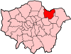
Attractions Cricklefield Stadium · Kenneth More Theatre · Redbridge MuseumConstituencies Parks and open spaces Clayhall Park · Goodmayes Park · Hainault Forest Country Park · Fairlop Waters · Goodmayes Park · Seven Kings Park · Roding Valley Park · Seven Kings Park · South Park, Ilford · Valentines Park · Wanstead Flats · Wanstead ParkTube and rail stations Other topics People · Public art · SchoolsCategories:- Districts of Redbridge
- London geography stubs


Wikimedia Foundation. 2010.