- Law, Dundee
-
Coordinates: 56°27′39″N 2°59′23″W / 56.460893°N 2.989849°W
Law 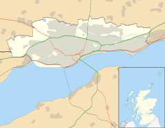
 Law
Law
Law shown within the City of DundeeOS grid reference NO391313 Council area City of Dundee Lieutenancy area Dundee Country Scotland Sovereign state United Kingdom Post town DUNDEE Postcode district DD1 Dialling code 01382 Police Tayside Fire Tayside Ambulance Scottish EU Parliament Scotland UK Parliament Dundee West Scottish Parliament Dundee West
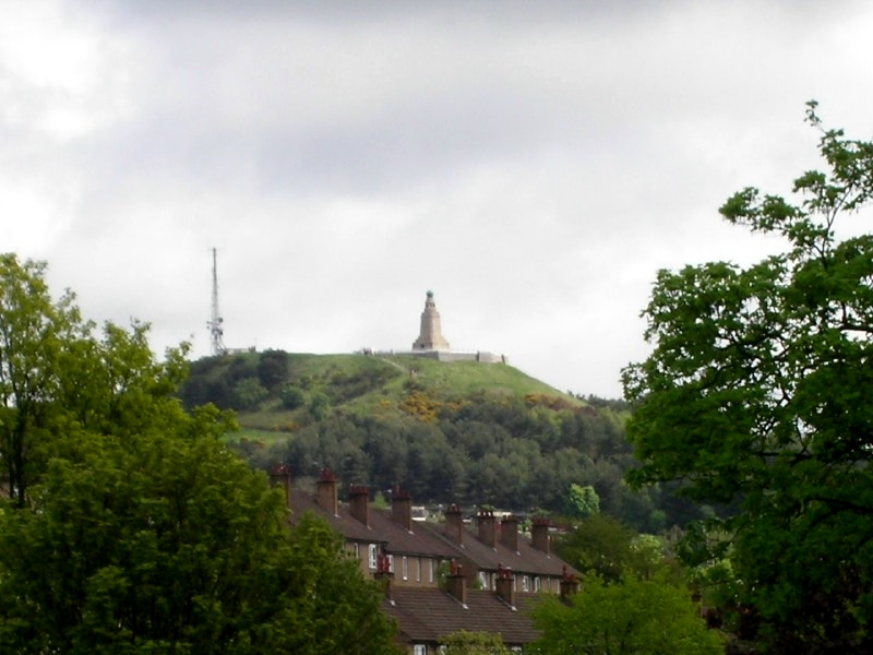
North East ScotlandList of places: UK • Scotland •  Dundee Law Hill seen from afar
Law, Dundee is an area located in the centre of Dundee, Scotland. Its predominant feature is an extinct volcano which gives it its name.
Geology
The Dundee Law, which takes its name from the Gaelic word for mound or more likely, from Anglo-Saxon hiilāw (modern Scots law) meaning a (grave-)mound, is the plug of an extinct volcano. Curiously, it is a common mistake for the Law to be referred to as "the Law hill" which is obviously a tautology (much like "Gobi Desert"). Actions by subsequent ice movements further eroded the hill and deposited more debris around the base creating a crag and tail. The shallow gradient of the slopes on the north and eastern sides of the law suggest a north easterly movement of ice flows. The hill's summit is over 500 feet above sea level.[1]
History
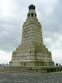 War Memorial
Archaeological evidence of burials suggest that the law may have been used by human settlers 3500 years ago. During the Iron Age it was the site of a Pictish settlement. Roman pottery has been found on the law, suggesting that the Romans may have used it as a lookout post in the first century. The law hill has a tunnel which runs through it. It used to be used for the railways to Newtyle
A war memorial to the fallen in both world wars was constructed atop the summit. In the years 1992 to 1994 the facilities on the summit of the Law were upgraded by Dundee city district council and Scottish enterprise Tayside with additional funding from the European Commission's regional development fund. The memorial is lit with a large flame at its top on a number of significant days, viz: the 25th September (in memory of the Battle of Loos - in which many members of the local Black Watch regiment lost their lives), 24 October (United Nations Day), 11 November (Armistice Day) and Remembrance Sunday
References
- ^ Ordnance Survey, Explorer 380 map Dundee and Sidlaw Hills
- On site tourist information boards
Areas of Dundee (category) Ardler · Balgay · Balgillo · Balgowan · Barnhill · Beechwood · Blackness · Broughty Ferry · Camperdown · Charleston · City Centre · Claverhouse · Craigiebank · Douglas · Downfield · Fairmuir · Fintry · Gowrie Park · Hilltown · Kirkton · Law · Linlathen · Lochee · Logie · Menzieshill · Mid Craigie · Mill o' Mains · Ninewells · Pitkerro · St Marys · Stobswell · West End · Woodside · WhitfieldSee also: List of places in Dundee Categories:- Areas of Dundee
- Volcanic plugs of Scotland
- Tayside geography stubs


Wikimedia Foundation. 2010.