- Hualālai
-
Hualālai 
View of Hualālai over 1800 lava flowElevation 8,271 ft (2,521 m) [1] Prominence 2,473 m (8,114 ft) [1] Pronunciation Hawaiian pronunciation: [huəˈlaːlei] Location Hawaiʻi, USA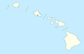
 Hualālai
Range Hawaiian Islands Coordinates 19°41′32″N 155°52′02″W / 19.69222°N 155.86722°WCoordinates: 19°41′32″N 155°52′02″W / 19.69222°N 155.86722°W Topo map USGS Hualālai Geology Type Shield volcano Age of rock Oldest dated rock: 128,000 BP
over 300,000 years[1]
Estimated:Volcanic arc/belt Hawaiian-Emperor seamount chain Last eruption 1800–1801[1] Climbing Easiest route Multiple trails exist.[2] Hualālai (pronounced [huwəˈlaːlɐi] in Hawaiian) is a dormant shield volcano on the island of Hawaiʻi in the Hawaiian Islands. It is the third-youngest and the third most active of the five volcanoes that form the island of Hawaiʻi, following Kīlauea and the much larger Mauna Loa, and also the westernmost. Its peak is 8,271 feet (2,521 m) above sea level.
Hualālai is estimated to have risen above sea level about 300,000 years ago. Despite maintaining a very low level of activity since its last eruption in 1801, Hualālai is still considered active, and is expected to erupt again some time within the next century. The relative unpreparedness of the residents in the area caused by the lull in activity would worsen the consequences of such an event.
The volcano has been inhabited for centuries by Hawaiian natives, dating back to before recorded history. The coast west of Hualālai in particular had several royal complexes. The volcano is also important ecologically, is home to many rare species and several nature reserves near the summit, and is a popular hiking attraction. Today the coast near Hualālai is pocketed by multiple vacation resorts, some built on historic flows, and a National historic park.
Contents
Geology
Structural features
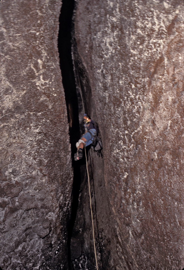
 An expedition down a lava conduit in Haulālai volcano
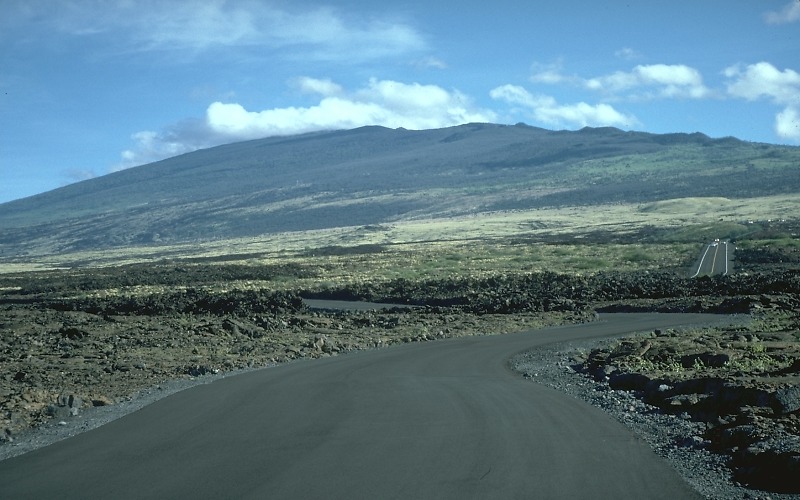
Hualālai stands at 8,271 ft (2,521 m) with a prominence of 2,473 m (8,114 ft). It is the westernmost of the five major volcanoes which form the island of Hawaiʻi.[1] Being in the post-shield stage of development, Hualālai is overall much rougher in shape and structure than the more youthful Mauna Loa and Kīlauea.[3] Hualālai's structure is denoted by three rift zones: a well-developed one approximately 50° to the northwest, a moderately developed one to the southeast, and a poorly developed one trending northwards about 3 mi (5 km) east of the summit.[4][5] There are over 100 cinder and spatter cones arranged along these rift zones. Hualālai has no summit caldera, although there is a collapse crater about 0.3 mi (0.48 km) across atop a small lava shield. Much of the southern slope (above the modern town of Kailua-Kona) consists of lava flows covered by a layer of volcanic ash from 10 to 100 cm (4 to 39 in) thick.[5][6] In comparison with the other volcanoes of the island of Hawaiʻi, it is the third tallest, third oldest, third most active, and second smallest, making up just 7% of the island.[3]
A major subfeature of Hualālai is Puʻu Waʻawaʻa, Hawaiian for "many-furrowed hill", a volcanic cone standing 372 m (1,220 ft) tall and measuring over 1.6 km (1 mi) in diameter. It extends for 9 km (6 mi), and has a prominence of 275 m (902 ft), north of the summit at 19°46′15″N 155°49′56″W / 19.77083°N 155.83222°W. The cone is constructed of trachyte, a type of volcanic lava that exists at no other volcano on Hawaiʻi. Trachyte flows move more slowly than the typically "runny" Hawaiian lavas, a characteristic caused by its high (over 62%) silicon composition (typical basalt is only 50% silicon). Geologists hypothesize that Puʻu Waʻawaʻa originally formed during a pumice eruption a little over 100,000 years ago, and has continued to build itself since then, with at least three distinct trachyte flows recognized. The eruptions, although partially covered by flows from Hualālai and Mauna Loa, have built a distinctive structure known as the Puʻu Anahulu ridge.[7]
The westward-facing flank of Hualālai forms a large underwater slump known as the North Kona slump. An area of about 1,000 km2 (390 sq mi), the slump consists of an intricate formation of beaches and scarps 2,000 to 4,500 m (6,600 to 14,800 ft) below the waterline. This area was explored more closely in a 2001 joint Japan-USA project to explore the volcano's flanks, utilizing the Remotely operated vehicle ROV Kaikō. Data collected showed that the lava flows there originated in shallow water 500 to 1,000 m (1,600 to 3,300 ft) deep, and that unlike similar slumps at other volcanoes, the slump at Hualālai formed gradually.[8]
Haulālai is a known source for xenoliths, rock from the Earth's mantle that have been brought up in lava flows. Many prehistoric deposits, as well as those from the 1801 event, contain xenoliths of large size and abundant quantity.[4]
History
 Haulālai's position relative to the rest of the volcanoes of Hawaiʻi island; it is westernmost of the five.
Lava attributed to a shield-stage Hualālai has been found just offshore of the volcano's northwest rift zone. Tholeiitic basalt, indicative of the submarine subphase of the volcano's construction, has been found in wells driven into the volcano at a depth of 75 ft (23 m). These lavas persisted until an estimated 130,000 years ago.[9] Hualālai entered the post-shield stage, the stage it is presently in, about 100,000 years ago. Pumice and trachyte eruptions at Puʻu Waʻawaʻa may be a sign of this change.[7]
Geological mapping of the volcano has indicated that as much as 80% of the volcano's surface has been topped by lava flows during the last 5,000 years,[1] entirely composed of post-shield alkalic basalt.[4] More than half of this is under 3,000 years old, and about 12% is less than 1,000 years of age.[6] Between the years 1700 and 1801, eruptions originated from six different vents. Two of these lava flows poured into the sea to the west coast of the island.[6]
Eruptive history
Hualālai is the third most active volcano making up the island of Hawaiʻi, behind Kīlauea and Mauna Loa. Although the two larger volcanos have each erupted over 150 times in the last 1,000 years, Hualālai has done so but 3 times. The recurrence of activity at the volcano seems to be every 200 to 300 years.[10]
A recent calm period, with almost no earthquake or magmatic activity at Hualālai, has seen the growth of homes, businesses, and resorts on the mountain's flanks. The most recent major activity at the volcano was in 1929, when an intense earthquake swarm rocked Hualālai, most likely caused by magmatic action near the volcano's peak. Although it has been relatively placid in the recent past, Hualālai is still potentially active, and is expected to erupt again within the next 100 years.[1]
Lava stratigraphy
The USGS has divided the exposed lava flows and tephra erupted by Hualālai volcano during the last 112,000 years into 419 rock units of 8 chronostratigraphic age groups. These are summarized in the table below:
Lava stratigraphy of Hualalai volcano[11] Age Group Age (years before present) Rock type Surface area (percent) Number of rock units Location of exposures Comments 8 less than 200 alkali basalt 6 3 northwest flank Vent cinder deposits with black pahoehoe basalt lava flows formed during AD 1800–1801 eruption. Five vents along NW rift zone. Abundant xenoliths of ultramafic plutonic rocks. 7 200–700 alkali basalt 3 4 southern flank Vent lava spatter and lava flows, cinders and tuff at Waha Pele. Spatter cone erupted pahoehoe and ʻAʻā basalt lava flows. Cone collapsed causing violent phreatic eruptions of tuff. Lava flow eruption resumed building larger cone, with eruption of long ʻAʻā lava flows. 6 750-1,500 alkali basalt 8 14 mostly central summit area and southeast flank Dark grey to black vent lava spatter (including a 650 metre long spatter rampart), cinders, aa and pahoehoe basalt lava flows, including Hualalai's longest lava flow (22 km). Collapse of vents produced pit craters. Hawaiian, Strombolian and sub-Plinian activity. 5 1,500–3,000 alkali basalt 38 49 mostly northern flank Spatter deposits, ʻAʻā and pahoehoe basalt lava flows. Very active 2,400–1,900 years before present. 4 3,000–5,000 alkali basalt 25 98 mostly northern flank and summit Spatter deposits, aa and pahoehoe basalt lava flows. 3 5,000–10,000 alkali basalt with minor amounts of picritic basalt, hawaiite and ankaramite 15 185 mostly southern flank and summit Spatter deposits, extensively weathered aa and pahoehoe lava flows. 2 10,000–25,000 alkali basalt with minor amounts of picritic basalt, hawaiite and ankaramite 5 63 northeastern and southwestern flanks Lava spatter, cinders, extensively weathered aa and pahoehoe lava flows and palagonite tuff. Spatter and cinders contain abundant xenoliths of mafic and ultramafic plutonic rocks. 1 more than 100,000 trachyte less than 1 3 northeastern flank Trachyte cone of Puʻu Waʻawaʻa (current prominence approximately 430 metres). Block and aa trachyte lava flow of Puʻu Anahulu and trachyte pyroclastic deposits. 5.5 km3 in volume, the largest-volume single eruption on Hawaiʻi (Big island). K-Ar age is 106,000 ± 6,000 years before present. 1800–1801 eruption
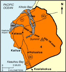 Hualālai is indicated as threat level 4 by the USGS in this mapping. The two gray areas are the two major outflows from the 1800–1801 event.
Hualālai last erupted in 1800–1801. This eruption produced very fluid alkalic basalt lava flows that entered the ocean off the western tip of Hawaiʻi island. Although five vents were active at the time, only two produced flows that eventually reached the ocean. The total output volume of the flow is estimated at over 300,000,000 m3 (0.072 cu mi). One volcanic vent, situated high on the slope, produced a large a'a flow, dubbed the Kaʻūpūlehu flow, that reached the ocean as two distinct lobes.[4] On its way down, it overran a village and a valuable 3 mi (5 km) fishing pond. There is a local legend that after the failure of several offerings of animals and other items to the gods, the flow was finally stopped when Kamehameha I threw a lock of his own hair into the fire.[10] The Ka'ūpūlehu flow is also known for the particularly large quantity of mafic and ultramafic xenoliths that came up with it.[6]
The other major outflow from the event reached the sea south of Kiholo Bay, destroying the village of Kaʻūpūlehu.[12] This 1801 flow, known as the Huʻehuʻe flow, formed Keahole Point where Kona International Airport is now located, 11 km (6.8 mi) north of Kailua-Kona.[1][13] The eruption at Hualālai was concurrent with an eruption at the nearby Mauna Loa. It is theorized that, in the near past, Hualālai has had synchronous eruptions with both Mauna Loa and Kilauea.[4]
Recent activity
Although Hualālai itself last erupted in 1800–1801, it has been indirectly involved in three events since. Puʻu Waʻawaʻa, an offshoot of Hualālai, last erupted in 1859, creating a 900 ft (274 m) thick flow, dubbed the Puʻu Anahulu flow, that entered the ocean at Kiholo Bay. There was also a submarine eruption in Kealakekua Bay in 1877.[10] In addition, a severe earthquake swarm shook the volcano in 1929, lasting about a month. This caused $100,000 worth of damage to the Kona district ($1.2 million as of 2010), and two earthquakes with magnitudes of 5.5 and 6.5 were felt as far away as Honolulu. This was probably caused by magma movement near the surface, but there was no surface activity or eruption.[4][10]
The 2006 Hawaii earthquake, with epicenter just to the north in Kiholo Bay near Māhukona, caused much damage in the area.[14]
Future monitoring
Although Hualālai last erupted over 200 years ago, it will almost certainly erupt again in the near future, as a 200–300 year estimated pause in activity is coming to an end.[10] It presents a distinct hazard to the communities around it as well; for example, in the event of an eruption similar to the 1801 event, Kailua-Kona, which is 15 mi (24 km) from the volcano's summit, could be covered completely in a matter of hours.[4]
According to the USGS Lava Flow Hazard Zones, on a scale of 1 to 9, all of Hualālai is listed as threat level 4. For comparison, almost all of Kīlauea and Mauna Loa is listed as threat levels 1 through 3.[15] The flanks of the volcano do not pose a lower threat to the population than the area near the rift zones because the distance is short and the slopes are steep; lava poses as much of a threat as it does near its source.[12]
Since 1971, the Hawaiian Volcano Observatory (HVO) has maintained a seismic recording station 3 km (1.9 mi) east of Hualālai's summit to monitor the volcano. During this time, not a single earthquake swarm or harmonic tremor, indicative of activity at the volcano, has been observed. Although Hualālai does experience several magnitude 4 earthquakes per year, these are attributed to a deep source off the coast of the northwestern rift zone and are not related to the movement of magma.[4] The USGS is currently in the process of upgrading its aging monitoring and telemetry equipment, using American Recovery and Reinvestment Act funds. The agency plans to add another seismometer and three more sensors to help monitor activity. In addition, the HVO uses GPS to measure slight changes in tilt and slope of Hualālai, indicative of magmatic movement. A survey has been conducted every two years since 1984, but as of 2010[update] no changes have been recorded.[10]
Human history
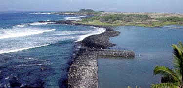
 The Kaloko fishpond
Hualālai has been a home to native people since ancient times. Centuries ago, the Ahu A Umi Heiau was built on the dry plateau east of the mountain.[16] The Kaloko-Honokōhau National Historic Park lies on the shore west of Hualālai, over the site of an ancient Hawaiian settlement. Although it is called kekaha ʻaʻole wai (lands without water), the rugged volcanic terrain attracted much sea life, making it an appealing place to settle. There are two main attractions within the park: the Kaloko fishpond, an area of loko kuapa (rockwall fishponds) constructed of interlocking rocks across a natural embayment on the coast, and Honokōhau, a former extensive settlement on the south side of the park.[17]
"Outside the (royal) enclosure, by the edge of the sea, was a spring called Ki'ope ... It was a gathering place for those who went swimming and a place where the surf rolled in and dashed on land when it was rough. It was deep enough there for boats to land when the tide was high".
Kamakahonu, Holualoa Bay, and Keauhou Bay were favored retreats of Hawaiian royalty long before the westernization of Hawaii. It was here that Kamehameha I rested after his eight year campaign to unite the Hawaiian isles. His death in 1819 triggered social chaos which was increased by the arrival of Christian missionaries to Hawaii in 1820. Mokuaikaua Church, built for missionaries in 1837 of lava rock and crushed coral, still stands today. Huliheʻe Palace, where many of Hawaii's last kings spent their time, has been maintained as a museum since 1927.[18]
Today, the coast west of Hualālai is a popular location for vacation resorts, since the rain shadow of the mountain causes many sunny days. The first, Kona Village resort, was built in 1961. Since then the Four Seasons Resort[19] and the Kūkiʻo golf course and vacation home complex have also been built on the 1800 flow.[20] Both the Kona Village Resort and the Four Seasons Resort were damaged by the tsunami generated by the 2011 Sendai Earthquake.[21] The Hawaii Belt Road traverses the western slopes with an upper route called the Mamalahoa Highway and lower route named for Queen Kaʻahumanu.[22]
Much of the Kona coffee crop grows on Hualālai's western slope near the town of Holualoa.[23] The family of early coffee merchant Henry Nicholas Greenwell owned a large ranch on the western side of the volcano.[24] The road from Kailua-Kona up the slopes of Hualālai is named for Frank "Palani" Greenwell.[25] Hawaii Route 200 known as the Saddle Road, crosses the plateau north of Hualālai, where the Pohakuloa Training Area provides a remote training ground for the United States Army and United States Marine Corps.[26]
Recreational significance
Hualālai's many interesting features, most especially its volcanic cones, make it a popular destination for hikers.[27] Although it is relatively easy to climb, much of the land at and around the summit of the volcano is owned by Kamehameha Schools, which routinely denies access to hikers attempting to climb it. As most, if not all, routes up to Hualālai pass through the estate, hiking on Hualālai is more or less illegal. However, the laws are not stringently enforced, and many hikers slip through anyway.[28]
One of the most popular mountaineering features is Luamakami and its sister Puhia Pele, two pit craters on Hualālai that are the deepest on the island. Puhia Pele, also known as "Pele's Pit", has been explored to a depth of 862 ft (263 m), and Luamakami is known to be even deeper. The walls are scalable with the proper technical equipment.[28]
Ecology and environment
 Hualālai seen from Honokōhau
Although some of Hualālai is bare volcanic rock, most of it is covered by some form of vegetation. Bushes, ferns, and grass are common, and even a few ōhiʻa lehua trees (Metrosideros polymorpha) grow along the summit. Many of the collapse craters in particular have vegetation, and a few even have respectably-sized "vertical forests" inside, including several Eucalyptus tree groves.[28] The volcano is populated by many birds and animals;[27] the coast in particular attracts many fish and sea-dependent animals, such as the Green sea turtle (Chelonia mydas) and the Black-winged Stilt (Himantopus himantopus).[17] Hualālai averages 18.27 in (46 cm) of rainfall per year.[29] The summit gets more rain than the coast[30] and is typically obscured in heavy cloud cover and vog.[3]
Several ecological reserves lie on the flanks of Hualālai. The Puʻu Waʻa Waʻa forest sanctuary on the northwest flank of the volcano was established in 1992 (along with a sister reserve, Laupahoehoe reserve on Mauna Kea) as a testbed for long term research about Hawaiian moist forest and dry forest biomes. Centered at 19°43′55″N 155°53′10″W / 19.73194°N 155.88611°W, the reserve extends to within a mile of the volcano's summit. Elevation differs from sea level near the coastal edge to 6,300 ft (1,920 m) near the summit. Median annual rainfall is about 46.7 in (119 cm). Plentiful lava flows from the 19th century provide unique niches for vegetative and soil growth in the region. The southern section of the reserve, closest to the summit, has been split into a bird sanctuary.[30]
The Honuaula forest reserve on the southwestern flank of the volcano at 19°30′25″N 155°54′41″W / 19.50694°N 155.91139°W, preserves an extensive koa (Acadia koa) forest stand, with smaller Naio (Myoporum sandwicense) and Māmane (Sophora chrysophylla) trees and an undergrowth of ʻĀkala (Rubus hawaiensis) and various ferns. The reserve measures 655 acres (1,647 mi) and protects an ecosystem that has since been largely deforested in the surrounding area.[31][32]
The Wai Aha spring reserve on the lower slopes of the mountain is somewhat swampy and is home to the flowering evergreen ōhiʻa (Metrosideros polymorpha), the woody climber ʻIeʻie (Freycinetia arborea), and a dense undergrowth of ʻAmaʻu (Sadleria cyatheoides).[31]
References
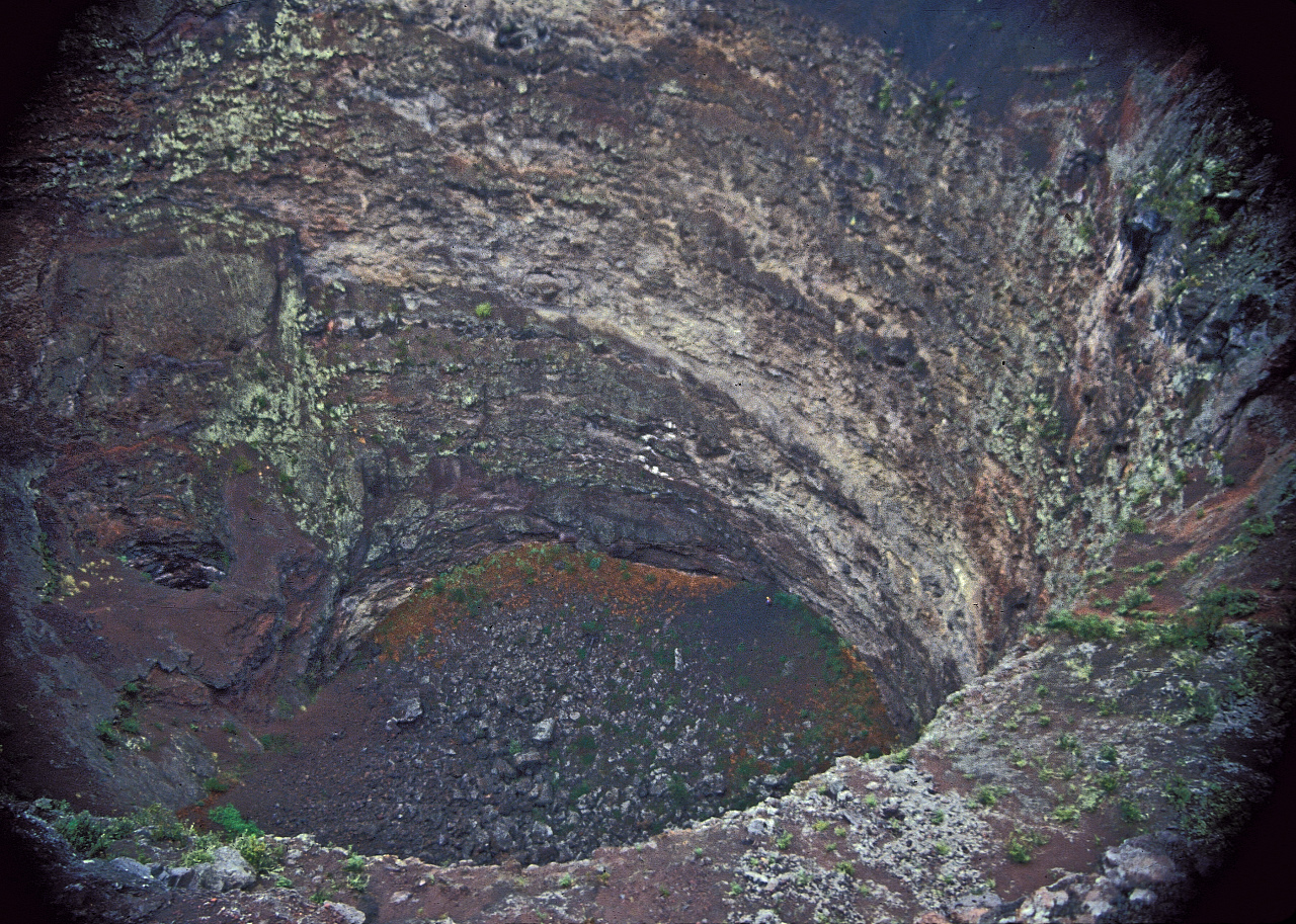
 Na One pit crater of Hualālai volcano
- ^ a b c d e f g h "Hualālai, Hawaiʻi's Third Active Volcano". USGS. 18 June 2001. http://hvo.wr.usgs.gov/volcanoes/hualalai/main.html.
- ^ "Hiking Trails: About the Pu'u Wa'awa'a Trail System". http://www.puuwaawaa.org/blank.html. Retrieved 16 June 2010.
- ^ a b c "Hualalai Volcano: Kailua-Kona's intriguing neighbor". USGS. July 8, 2004. http://hvo.wr.usgs.gov/volcanowatch/2004/04_07_08.html. Retrieved 18 July 2010.
- ^ a b c d e f g h Rubin, Ken. "Hualalai Volcano". Hawaiian Center for Volcanology. http://www.soest.hawaii.edu/GG/HCV/hualalai.html. Retrieved 15 June 2010.
- ^ a b Macdonald, G.A.; A. T. Abbott (1970). Volcanoes in the Sea. Univ. of Hawaiʻi Press. pp. 441.
- ^ a b c d "Volcano Information: Hualalai". USGS. 2 June 2008. http://volcanoes.usgs.gov/about/volcanoes/hawaii/hualalai.php. Retrieved 16 June 2010.
- ^ a b "When Hualalai Turned Viscous". Volcano Watch. USGS. August 12, 2004. http://hvo.wr.usgs.gov/volcanowatch/2004/04_08_12.html. Retrieved 16 June 2010.
- ^ "North Kona slump: Submarine flank failure during the early(?) tholeiitic shield stage of Hualalai Volcano". Journal of Volcanology and Geothermal Research 151 (1–3): 189–216. doi:10.1016/j.jvolgeores.2005.07.029. http://www.sciencedirect.com/science?_ob=ArticleURL&_udi=B6VCS-4HYMY56-1&_user=10&_coverDate=03%2F01%2F2006&_rdoc=1&_fmt=high&_orig=search&_sort=d&_docanchor=&view=c&_acct=C000050221&_version=1&_urlVersion=0&_userid=10&md5=fbb653a33c94c795e9d72e60808f33e7. Retrieved 16 June 2010.
- ^ "Geological Map of the State of Hawaii". USGS Hawaii geology pamphlet. USGS. 2007. http://pubs.usgs.gov/of/2007/1089/Hawaii_expl_pamphlet.pdf. Retrieved 2009-04-12. pp. 48–50
- ^ a b c d e f Lucas, Carolyn (January 17, 2010). "Hualalai – Kona's sleeping giant". West Hawaii Today. http://www.westhawaiitoday.com/articles/2010/01/17/local/local01.txt. Retrieved 16 June 2010.[dead link]
- ^ Moore. R. B. and Clague, D.A. (1991) Geologic Map of Hualalai Volcano, Hawaii; USGS Miscellaneous Investigations Series, Map I-2213, 1:50,000
- ^ a b Watson, John (July 18, 1997). "Lava Flow Hazard Zone Maps:Hualalai". USGS. http://pubs.usgs.gov/gip/hazards/hualalai.html. Retrieved 16 June 2010.
- ^ McCoy, Floyd; Grant Heiken (2000). Volcanic hazards and disasters in human antiquity. The Geological Society of America.
- ^ "M6.7 – Island of Hawaii, Hawaii". USGS. http://earthquake.usgs.gov/earthquakes/dyfi/events/us/2006twbh/us/index.html. Retrieved July 26, 2010.
- ^ Watson, John (December 18, 1997). "Lava Flow Hazard Zone Maps". USGS. http://pubs.usgs.gov/gip/hazards/maps.html. Retrieved 16 June 2010.
- ^ Thomas S. Dye (March 25, 2005). "Historic Sites Review of a Proposed Mauna Loa Trail System". Nature Conservancy web site. http://www.nature.org/media/hawaii/dye_cultural_report.pdf. Retrieved July 26, 2010.
- ^ a b "Kaloko-Honokohau National Historical Park (U.S. National Park Service)". National Park Service. April 25, 2010. http://www.nps.gov/kaho/. Retrieved 27 June 2010.
- ^ a b Fullard-Leo, Betty (December 1997). "Kailua-Kona: A Royal Retreat". Coffee Times. http://www.coffeetimes.com/dec97.htm. Retrieved 18 July 2010.
- ^ "Four Seasons Resort Hualalai at Historic Ka'upulehu", Travel + Leisure, http://www.travelandleisure.com/hotels/four-seasons-resort-hualalai-kaupulehu-kona, retrieved June 23, 2010
- ^ "Kū kiʻo". 2009. http://www.kukio.com/propertymap.html. Retrieved June 23, 2010.
- ^ Engle, Jane (March 28, 2011). "2 Big Island resorts still closed because of tsunami damage". Los Angeles Times. http://articles.latimes.com/2011/mar/27/travel/la-tr-0327-hawaiijapan-20110327.
- ^ "Hawaii Highways". January 2007. http://www.hawaiihighways.com/big_island.htm. Retrieved 7 August 2010.
- ^ "Kona Coffee – What Makes It So Unique?". Kona Coffee Council. 2007. http://www.kona-coffee-council.com/Default.aspx?pageId=692163. Retrieved 18 July 2010.
- ^ Gerald Kinro (June 2003). A cup of aloha: the Kona coffee epic. University of Hawaii Press. p. 14. ISBN 9780824826789. http://books.google.com/books?id=wyw0JEuokwsC&pg=RA1-PR1-IA4. Retrieved 26 July 2010.
- ^ Lloyd J. Soehren (2004). "lookup of Palani". on Hawaiian place names. Ulukau, the Hawaiian Electronic Library. http://ulukau.org/cgi-bin/hpn?e=p&a=q&l=en&q=Palani&d=HASH01c6226630087deae1b1fd60. Retrieved July 26, 2010.
- ^ "Pohakuloa Training Area (PTA)". Marine Corps Base Hawaii web site. http://www.mcbh.usmc.mil/g3/g3oppta.htm. Retrieved July 26, 2010.
- ^ a b Catalano, Hadley (September 19, 2006). "Huehue Hualalai Trail". http://hawaii.kulshan.com/Hawaii/Hawaii%20County/The%20Big%20Island/Kalaoa/Outdoors/Huehue%20Hualalai%20Trail.htm. Retrieved 27 June 2010.
- ^ a b c "SummitPost – Hualalai – Climbing, Hiking & Mountaineering". SummitPost.org. April 8, 2009. http://www.summitpost.org/hualalai/262991. Retrieved 17 June 2010.
- ^ "Hualalai 72, Hawaii (512151): Period of Record Monthly Climate Summary". Western Regional Climate Center. http://www.wrcc.dri.edu/cgi-bin/cliMAIN.pl?hi2151. Retrieved 2011-02-06.
- ^ a b Kauffman, Boone. "Hawaii Experimental Tropical Forest". http://www.fs.fed.us/psw/ef/hawaii/. Retrieved 18 July 2010.
- ^ a b The Hawaiian forester and agriculturist: quarterly magazine of forestry, entomology, plant inspection and animal industry. Board of Commissioners of Agriculture and Forestry. 1921. p. 203. http://books.google.com/books?id=BlnlAAAAMAAJ&pg=PA203. Retrieved 18 July 2010.
- ^ "Big Island Forest Reserves". Hawai‛i Forest Reserve System web site. http://www.state.hi.us/dlnr/dofaw/frs/page10.htm. Retrieved August 21, 2010.
External links
- "Hualālai". Geographic Names Information System, U.S. Geological Survey. http://geonames.usgs.gov/pls/gnispublic/f?p=gnispq:3:::NO::P3_FID:359445.
- USGS page about Hualalai
- Aerial photos of Hualalai
Hawaiian volcanism topics (List) Windward
Isles
Leeward
IslesEmperor
SeamountsTopics Hawaiian – Emperor seamount chain · Evolution of Hawaiian volcanoes · Hawaiian eruption · ʻAʻā (lava) · Pāhoehoe (lava) · Pele's hair · Limu o Pele · Pele's tears · Lava fountain · Hawaiian Volcano Observatory · Hawaii Volcanoes National Park · Haleakala National Park · 1955 Hawaiian submarine eruptionCategories:- Active volcanoes
- Hotspot volcanoes
- Mountains of Hawaii
- Shield volcanoes
- VEI-2 volcanoes
- Volcanoes of the Island of Hawaii
- Pleistocene volcanoes


Wikimedia Foundation. 2010.