- Ceres, Western Cape
-
Ceres Town centre of Ceres with its main street on a winter day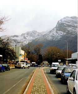 Location in the Western Cape
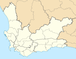
 CeresLocation in South Africa
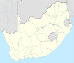 Ceres
CeresCoordinates: 33°22′S 19°19′E / 33.367°S 19.317°ECoordinates: 33°22′S 19°19′E / 33.367°S 19.317°E Country  South Africa
Province Western Cape District municipality Cape Winelands Local municipality Witzenberg Time zone SAST (UTC+2) Ceres is a town with 46,251 inhabitants in the Western Cape Province of South Africa. It is the administrative centre of the Witzenberg Local Municipality.
It was named after the Roman goddess Ceres, a name which is fitting as the valley in which the town is situated is extremely fertile and is a major producer of South Africa's deciduous fruit. It is situated in the Warmbokkeveld (Afrikaans: "warm antelope field") Valley about 170 km north-east of Cape Town, which is climatically warmer than the surrounding highlands, which is known as the Kouebokkeveld ("cold antelope field").
Ceres experiences a typical Mediterranean climate tempered by its altitude. The town experiences warmer temperatures in summer, due to its inland location with infrequent rainfall, however winters are cool to quite cold and wet, with frequent snowfalls on the surrounding higher-lying ground, rarely falling on the valley floor itself. Total annual precipitation averages 1088mm, with average temperatures ranging from a February maximum of 29,9°C to a July minimum of 2,4°C.
Ceres is well-known for fruit juices exported worldwide bearing the town's name. It is also famous locally for winter snow and cherries: Cape Town residents flock to the town during winter to ski or simply play in the powder — something of a rarity for the otherwise mild climate they are used to — whilst in summer, people come to pick cherries from "Klondyke" farm.
South Africa is one of the most stable parts of the world in seismic terms but on the 29th of September 1969 a massive shock shook the district without warning. The epicentre of the quake was on a major local structure called the Worcester fault, which had clearly been geologically active in the distant past but had not moved in over three hundred years of recorded history. Ceres was affected badly. Many old Cape Dutch buildings were damaged and some lives were lost. The quake was strong enough to knock plaster off walls in Cape Town, a hundred miles away
Famous people
- De Wet Barry - Rugby union player, Springbok
- Christiaan Barnard -- first surgeon to perform a successful human-to-human heart transplant operation spent the early years of his medical practice in Ceres.
- Henry Francis Maltby - Writer and playwright
- Ramond Herman Mordt - Rugby union player, Springbok
- Simon Rademan - Fashion designer and stylist
- Breyton Paulse - Springbok Rugby Player
- John Daniels - Provincial Rugby Player
- Ernst Joubert - Rugby Player
Gallery


A panoramic view of the Ceres valley. -

Matroosberg in the Hex River Mountains on the south-eastern flank of the Ceres valley
References

Witzenberg • Drakenstein • Stellenbosch • Breede Valley • Langeberg
Cities and towns Ashton • Bonnievale • Ceres • Chicago • De Doorns • Denneburg • Franschhoek • Gouda • Kayamandi • Klapmuts • Kylemore • Languedoc • McGregor • Montagu • Op-die-Berg • Paarl • Pniel • Prince Alfred Hamlet • Rawsonville • Robertson • Robertsvlei • Rozendal • Saron • Stellenbosch • Touws River • Tulbagh • Wellington • Wemmershoek • Wolseley • Worcester
Categories:- Western Cape geography stubs
- Populated places in the Cape Winelands District Municipality


Wikimedia Foundation. 2010.