- Marine Parkway-Gil Hodges Memorial Bridge
-
Marine Parkway-Gil Hodges Memorial Bridge Official name Marine Parkway-Gil Hodges Memorial Bridge Carries Motor vehicles and pedestrians Crosses Jamaica Bay Locale Brooklyn and Queens, New York City Maintained by MTA Bridges and Tunnels Design Vertical lift Total length 4,022 feet (1,226 m) Longest span 540 feet (165 m) Vertical clearance 13 feet (3.9 m) Clearance below 55 feet (17 m) at mean high water; 150 feet (46 m) in raised position Opened July 3, 1937 Toll $3.25 as of December 30, 2010 (both directions per car in cash); discount available with E-ZPass Daily traffic 21,613 (2008)[1] Coordinates 40°34′24.4″N 73°53′5.8″W / 40.573444°N 73.884944°WCoordinates: 40°34′24.4″N 73°53′5.8″W / 40.573444°N 73.884944°W 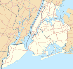

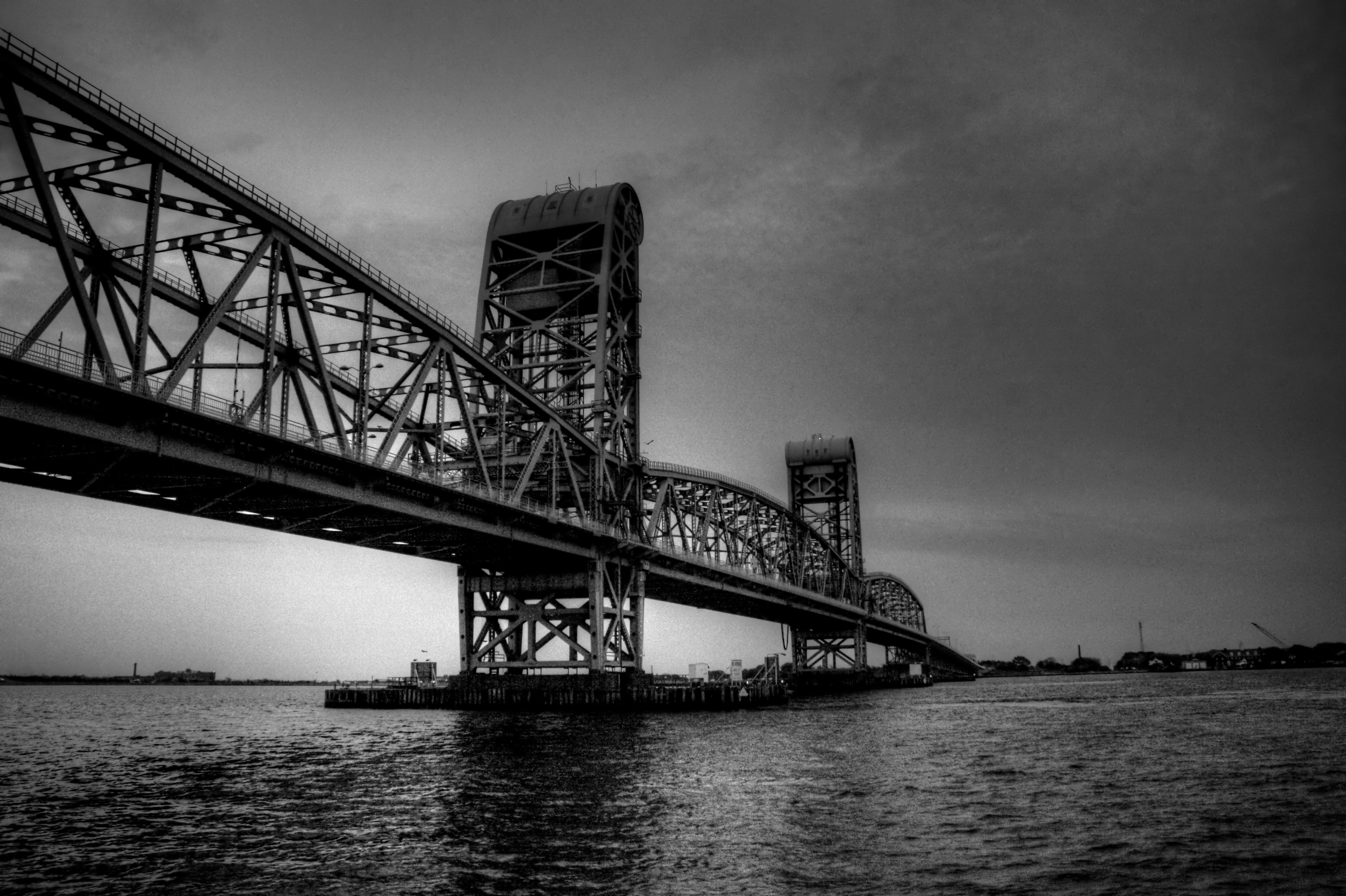
The Marine Parkway-Gil Hodges Memorial Bridge in New York City (originally Marine Parkway Bridge) is a vertical lift bridge that crosses Rockaway Inlet and connects the Rockaway Peninsula in Queens, with Marine Parkway to Floyd Bennett Field, Flatbush Avenue, and the Marine Park neighborhood in Brooklyn. Opened on July 3, 1937, it carries four motor traffic lanes, and a footpath on the western edge.[2] Cyclepaths along both sides of the Parkway connect to the Shore Parkway Greenway and to Flatbush Avenue. The operation of this bridge includes the maintenance of the Marine Parkway from the toll plaza to Jacob Riis Park. Though a city-owned and operated bridge, it connects two parts of Gateway National Recreation Area, a unit of the National Park System: Floyd Bennett Field and Jacob Riis Park. The bridge is designated as New York State Route 901B, an unsigned reference route.[3]
Since September 15, 2008, the crossing charge for a two-axle passenger vehicle is $2.50, with a $.95 discount for E-ZPass users. The crossing charge for a motorcycle is $2.25 charged in each direction, with a $.96 discount for E-ZPass users. Certain resident discounts apply to this bridge.[4]
Since July 12, 2009, the crossing charge for a two-axle passenger vehicle is $2.75, with a $1.04 discount for E-ZPass users. The crossing charge for a motorcycle is $2.50 charged in each direction, with a $1.08 discount for E-ZPass users. Certain resident discounts apply to this bridge.[5]
As of December 30, 2010, the crossing charge for a two-axle passenger vehicle is increased to $3.25 (cash), $2.17 (token), and $1.80 ($1.45 discount) for E-ZPass users. The crossing charge for a motorcycle is $2.75 charged in each direction, with a $1.26 discount for E-ZPass users. Certain resident discounts apply to this bridge.[6]
The bridge is owned by the City of New York and operated by the Triborough Bridge and Tunnel Authority, an affiliate agency of the Metropolitan Transportation Authority.
Contents
History
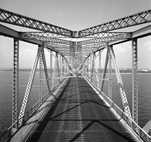 View of the roadway (photo: Dave Frieder)
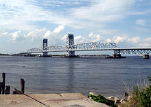 From Riis Landing
Built and opened by the Marine Parkway Authority in 1937, it was the longest vertical lift span in the world for automobiles. The curled tops of the towers were designed to give the bridge a whimsical aspect. Following the 1940 merger of the Marine Parkway Authority and Triborough Bridge and Tunnel Authority, the operation of the bridge fell to TBTA.[7]
In 1978, the bridge was renamed for Gil Hodges, the former first baseman for the Brooklyn Dodgers.[7] Hodges kept a residence in Brooklyn after his team moved to Los Angeles. He also played for the New York Mets at the end of his career, and managed the Mets from 1968 until his death in 1972, including victory in the 1969 World Series.
Facts
- The center span is lifted and lowered 100 times a year to allow vessels to pass beneath the roadway.
- The center span is 540 feet (160 m) long and is only 55 feet (17 m) above the water but can be lifted up to a height of 150' feet above the water.
- Part of the crash of American Airlines Flight 587 was filmed from a tollbooth camera on this bridge.
- A beautiful view of the Manhattan skyline can be seen from the bridge driving into Brooklyn.
Renovating the Bridge
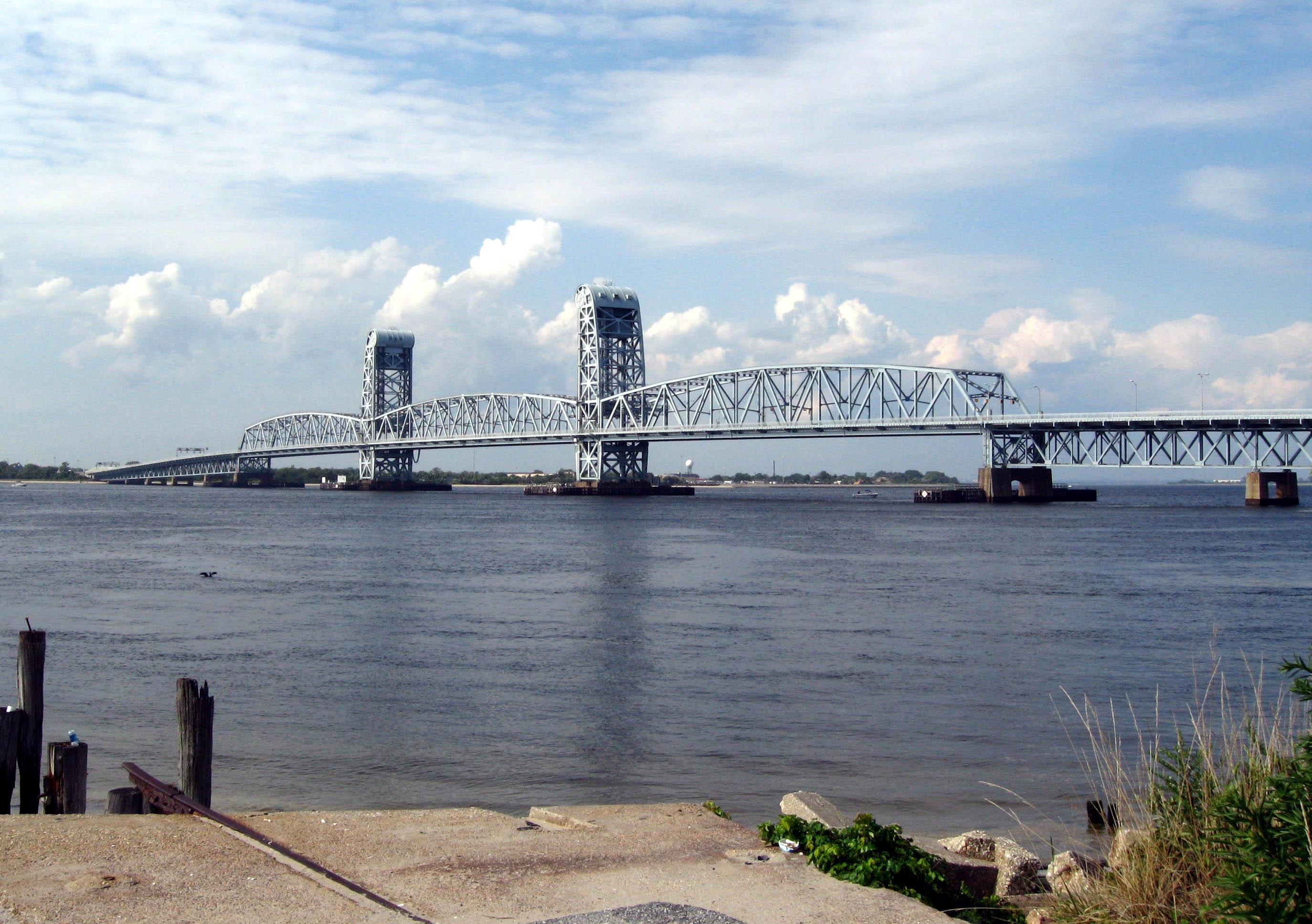
 Marine Parkway Bridge facing south
In 1999 the following elements of the bridge were renovated:
- The existing steel-grated roadway deck on the lift span was replaced with a concrete-and-steel orthotropic deck. A new concrete ("Jersey") barrier now separates opposing traffic flows.
- The elevators and electrical systems in the towers were replaced.
- New variable message signs and traffic control devices were installed on the bridge, approach roadways and toll plaza. A new service building was built at the toll plaza.
References
- ^ "2008 Traffic Data Report for New York State" (PDF). New York State Department of Transportation. Appendix C. https://www.nysdot.gov/divisions/engineering/technical-services/hds-respository/NYSDOT_TDR_Appendix_C.pdf. Retrieved February 27, 2010.
- ^ "Our Newest Bridge". The New York Times: p. 14. July 3, 1937. http://select.nytimes.com/gst/abstract.html?res=FB0C1EF8345E177A93C1A9178CD85F438385F9. Retrieved November 8, 2007.
- ^ Perry, N.W.. "NYS Reference Routes, Regions 10 and 11". Empire State Roads. http://www.empirestateroads.com/sr/refroute10.html. Retrieved November 8, 2007.
- ^ "MTA Bridges and Tunnels Toll rates". MTA Bridges & Tunnels. Archived from the original on April 12, 2008. http://web.archive.org/web/20080412065025/http://www.mta.info/bandt/traffic/btmain.htm. Retrieved September 16, 2008.
- ^ "Crossing Charges". MTA Bridges & Tunnels. http://www.mta.info/bandt/traffic/btmain.html. Retrieved July 10, 2010.
- ^ "Crossing Charges". MTA Bridges & Tunnels. http://www.mta.info/mta/pdf/approved_bandt_tolls.pdf. Retrieved November 8, 2010.
- ^ a b "Marine Parkway Gil Hodges Memorial Bridge". MTA Bridges & Tunnels. http://www.mta.info/bandt/html/marine.html. Retrieved July 10, 2010.
External links
- Marine Parkway-Gil Hodges Memorial Bridge(MTA Official Site)
- Marine Parkway-Gil Hodges Memorial Bridge @ NYCROADS.com
MTA Bridges and Tunnels Bronx–Whitestone Bridge • Brooklyn–Battery Tunnel • Cross Bay Veterans Memorial Bridge • Henry Hudson Bridge • Marine Parkway-Gil Hodges Memorial Bridge • Queens–Midtown Tunnel • Robert F. Kennedy Bridge • Throgs Neck Bridge • Verrazano-Narrows Bridge
Categories:- Vertical lift bridges
- Toll bridges in New York City
- Bridges completed in 1937
- Triborough Bridge and Tunnel Authority
- Bridges to Rockaway, Queens
- Bridges in New York City
- Road bridges in New York


Wikimedia Foundation. 2010.