- Fiordland National Park
Infobox_protected_area
name = Fiordland National Park
iucn_category = II
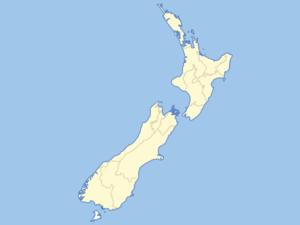
caption = Map ofNew Zealand
locator_x = 80
locator_y = 182
location =Southland, New Zealand
nearest_city = Te Anau, New Zealand
lat_degrees = 45
lat_minutes = 25
lat_seconds =
lat_direction = S
long_degrees = 167
long_minutes = 43
long_seconds =
long_direction = E
area = 12,500 km²
established =1952
visitation_num =
visitation_year =
governing_body = Department of ConservationFiordland National Park occupies the southwest corner of the South Island ofNew Zealand . It is the largest of the 14 national parks in New Zealand, with an area of 12,500 km², and a major part of theTe Wahipounamu World Heritage site . The park is administered by the Department of Conservation.Geographical features
During the cooler past, glaciers carved many deep fiords, the most famous (and most visited) of which is
Milford Sound . Other notable fiords includeDoubtful Sound andDusky Sound .Fiordland's coast is steep and crenellated, with the fiords running from the valleys of the southern ranges of the
Southern Alps , such as the Kepler and Murchison Mountains. At the northern end of the park, several peaks rise to over 2000 metres.Ice has carved islands from the mainland, leaving two large uninhabited offshore islands,
Secretary Island and Resolution Island. Several large lakes lie wholly or partly within the park's boundaries, notablyLake Te Anau ,Lake Manapouri ,Lake Monowai ,Lake Hauroko , andLake Poteriteri .TheSutherland Falls , to the southwest of Milford Sound on the Milford Track, are among the world's highestwaterfall s.Prevailing westerly winds blow moist air from the
Tasman Sea onto the mountains; the cooling of this air as it rises produces a prodigious amount of rainfall, exceeding seven metres in many parts of the park. This supports the lushtemperate rain forests of theFiordland temperate forests ecoregion .Wildlife
The wildlife in this area include dolphins, seals, mice, rats, birds, hare and deer. Among the birds are the
Kakapo , the only flightless parrot in the world. Also there is thekiwi , which is native to New Zealand.Public access
Road access to Fiordland is restricted to the Milford Road (SH 94), which runs north from
Te Anau , skirting the edge of the park before entering it close to the headwaters of theEglinton River . From there it crosses the northwest corner of the park, reaching its terminus at Milford Sound. South of Te Anau a smaller road links toManapouri . A minor road links Doubtful Sound with the western edge of Lake Manapouri.Light aircraft and helicopter services link with Milford Sound, which also has a small boat
marina .Activities
The park is a popular destination for alpine climbers and especially for trampers, with the Milford, Kepler, Hollyford and
Routeburn Track s all in or close to the park.Other tourists are attracted to areas such as
Milford Sound .Fiordland is a challenging tramping destination. There are few tracks. Off-track travel relies on following deer trails. Sandflies, flooding and poor weather are a hazard.
Helicopter hunting
As long ago as the 1920s, the park was plagued with introduced European deer, detrimental to the native New Zealand flora and fauna. The government placed a bounty on the deer, paying local hunters for each animal removed from the park. Combined with the market for venison and deerskin, by the 1960s this had proved a lucrative enough business for several hunters to invest in helicopters, the better to travel through this rugged landscape. The deer population plummeted as a result, and competition among hunters grew fierce. Arguments between men in helicopters with high-powered rifles resulted in more than one pitched battle mid-air over the park. The government soon stepped in to prevent such extremes; combined with a growing farm-raised deer industry, helicopter hunting has declined steeply in more recent years. However, its legacy lives on, as dozens of former hunting helicopters these days carry tourists on sight-seeing aerial journeys.
ee also
*
National parks of New Zealand
*Department of ConservationExternal links
* [http://www.doc.govt.nz/templates/PlaceProfile.aspx?id=38468 Department of Conservation information on Fiordland National Park]
* [http://www.doc.govt.nz/upload/documents/conservation/marine-and-coastal/fiordlandcoastalnewsletter-oct07.pdf Fiordland Coastal Newsletter]
Wikimedia Foundation. 2010.