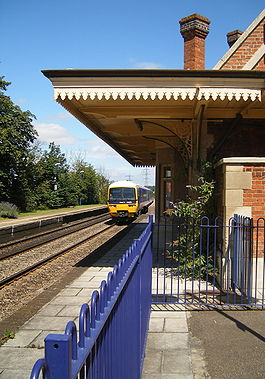
- Culham railway station
-
Culham 
Location Place Culham Local authority South Oxfordshire Grid reference SU529953 Operations Station code CUM Managed by First Great Western Number of platforms 2 Live arrivals/departures and station information
from National Rail EnquiriesAnnual rail passenger usage 2002/03 * 35,185 2004/05 *  38,747
2005/06 *  36,715
2006/07 * 45,1562007/08 * 46,8322008/09 * 60,0322009/10 * 55,226History Opened 1844 History Original company Great Western Railway Pre-grouping GWR Post-grouping GWR National Rail - UK railway stations A B C D E F G H I J K L M N O P Q R S T U V W X Y Z * Annual passenger usage based on sales of tickets in stated financial year(s) which end or originate at Culham from Office of Rail Regulation statistics. Please note: methodology may vary year on year. Culham railway station is a railway station serving the village of Culham in Oxfordshire. It is served by local train services provided by First Great Western.
The station is just off the A415 road, between the villages of Culham and Clifton Hampden.
The station is close to the site of RNAS Culham (HMS Hornbill), a World War II airfield. The former airfield is now the Culham Science Centre, an 80 hectares (200 acres) scientific research site and home to two nuclear fusion experiments JET and MAST. The START Nuclear Fusion Experiment was also conducted on the site until MAST succeeded it in 1999. This important scientific centre means the station creates a valid commuter service.[citation needed]
Contents
History
The Great Western Railway opened the station on the Didcot – Oxford line as Abingdon Road on 12 June 1844. Its name was changed by the GWR to Culham, on 2 June 1856, on the opening of the branch from Abingdon Junction to Abingdon.
The original station building (no longer in railway use) is in the Tudor Revival architecture of Isambard Kingdom Brunel[1] and is a Grade II listed building.
The name Abingdon Road was later re-used for an entirely different station about 5.5 miles (9 km) to the north, Abingdon Road Halt, opened in 1908.
In some recent years passenger numbers using Culham have changed rapidly. The total increased 67% in the three years 2006–09, but then decreased slightly in 2010.[2]
Routes
Preceding station  National Rail
Following station Appleford First Great Western
Cherwell Valley LineRadley Disused railways Abingdon Junction Great Western Railway
Cherwell Valley LineAppleford References
- ^ Biddle, Gordon; Nock, O.S. (1983). The Railway Heritage of Britain. Michael Joseph. ISBN 0-7181-2355-7.
- ^ Office of the Rail Regulator data: see infobox at head of article.
External links
Coordinates: 51°39′14″N 1°14′13″W / 51.654°N 1.237°W
Railway stations in Oxfordshire Great Western Main Line Chiltern Main Line Cherwell Valley Line Cotswold Line Oxford to Bicester Line Henley Branch Line Heritage Railways Categories:- Railway stations in Oxfordshire
- Former Great Western Railway stations
- Railway stations opened in 1844
- Railway stations served by First Great Western
- DfT Category F1 stations
- Grade II* listed buildings in Oxfordshire
- Grade II* listed railway stations
- Isambard Kingdom Brunel buildings and structures
- South East England railway station stubs

Wikimedia Foundation. 2010.