- Niederkirchnerstraße
-
The title of this article contains the character ß. Where it is unavailable or not desired, the name may be represented as Niederkirchnerstrasse.
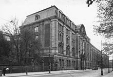
 Abgeordnetenhaus
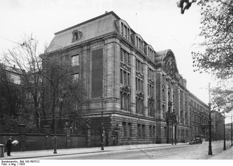
 Martin-Gropius-Bau
Niederkirchnerstraße, formerly Prinz-Albrecht-Straße, is a street in Berlin, the capital of Germany. The street runs east-west from Wilhelmstraße to Stresemannstraße near Potsdamer Platz, forming the border between the districts of Mitte and Kreuzberg. It is best known for having been the location of the headquarters of the Reich Main Security Office, SD, Gestapo and the SS in Nazi Germany. The site is now marked by the Topography of Terror memorial and museum.
Niederkirchnerstraße is also the site of two other Berlin landmarks, the Martin-Gropius-Bau exhibition hall, built in 1881 by Martin Gropius and Heino Schmieden as a Museum of Decorative Arts, and the Abgeordnetenhaus von Berlin, from 1899 until 1933 seat of the Preußischer Landtag, the second chamber of the Prussian parliament. On January 1, 1919 the Communist Party of Germany was founded in this building. Since April 29, 1993 it houses the parliament of the Berlin city state.
 Gestapo headquarters, Prinz-Albrecht-Straße 8, 1933
 Same site in 2004 with preserved Berlin Wall
The street was laid out in 1891 and named for Prince Albrecht of Prussia, son of King Friedrich Wilhelm III, who had owned a large house called Prinz-Albrecht-Palais on the corner of this street and Wilhelmstraße. In 1905 an extension building of the Museum of Decorative Arts was erected adjacent to the Martin-Gropius-Bau on Prinz-Albrecht-Straße 8. From May 1933 this building served as the headquarters of the Gestapo created by the order of Hermann Göring, where many political prisoners were tortured and executed. In December 1934, it also housed the headquarters of the Concentration Camps Inspectorate, which oversaw all the concentration camps. It formed the nucleus of the complex of buildings including the neighbouring Hotel Prinz Albrecht on Prinz-Albrecht-Straße 9 and the Prinz-Albrecht-Palais itself, which was taken over by the Sicherheitsdienst under Reinhard Heydrich in 1934. In September 1939, it developed into a centre for the Reich Main Security Office which was created by Heinrich Himmler and placed under the command of Reinhard Heydrich for the whole of Germany and occupied Europe. The buildings were destroyed by Allied bombing in early 1945 and demolished after the war.
After World War II, in 1951, the authorities of East Berlin renamed Prinz-Albrecht-Straße Niederkirchnerstraße in honour of Käthe Niederkirchner (1909-1944), a member of the communist resistance to the Nazis. The Berlin Wall ran along the southern side of the street from 1961 to 1989, one of the few preserved sections is located at the eastern end.
Literature
- Erika Bucholtz: Die Zentralen des nationalsozialistischen SS- und Polizeistaats. Gebäudenutzung und Bauplanung in Berlin 1933-1945, In: Zeitschrift für Geschichtswissenschaft 52 (2004), H. 12, S. 1106-1125. online als pdf
External links
Coordinates: 52°30′26″N 13°22′57″E / 52.50722°N 13.3825°E
References
Categories:- Streets in Berlin
- Friedrichshain-Kreuzberg


Wikimedia Foundation. 2010.