- Cheviot, New Zealand
-
Cheviot — town — Hall St (State Highway 1), the main street of Cheviot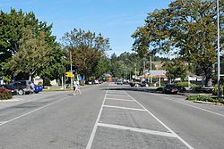
 Cheviot
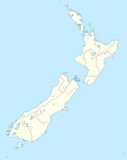
Coordinates: 42°48′46″S 173°16′26″E / 42.81278°S 173.27389°ECoordinates: 42°48′46″S 173°16′26″E / 42.81278°S 173.27389°E Country New Zealand Region Canterbury Territorial authority Hurunui District Population (2006)[1] – Total 390 Time zone New Zealand Standard Time (UTC+12) – Summer (DST) New Zealand Daylight Time (UTC+13) Postcode 7310 Website http://www.cheviotnz.com/ Cheviot is a town in the Hurunui District of north Canterbury, on the east coast of the South Island of New Zealand. It is on the Main North Line railway and State Highway 1 approximately 110 kilometres (68 mi) north of Christchurch. It was originally called Mackenzie after politician John McKenzie, who was closely identified with the settlement of Cheviot. This name was “in widespread use for a decade or two” but gradually fell into disuse. The post office was always known as Cheviot and by at least 1913 the township too was generally known as Cheviot.[2]
Contents
Population
According to the 2006 New Zealand census, the population of Cheviot was 390 — a decrease of three from the previous 2001 census.[1] A further 980 people lived in the rural areas serviced by the town or in adjacent villages such as Domett, Parnassus, Gore Bay and Port Robinson.
The region
Cheviot is a service town for highway traffic and for a pastoral farming district that is currently predominant in sheep farming. Based in the township are a volunteer fire and ambulance services and two full-time police officers. Surrounding settlements include:
Domett
Domett (pronounced Do-mett), originally a railway town, is now only populated by farms and a petrol station, with the Old Main Road/Hurunui River Mouth Road junction. Next to this junction is the old Domett Railway Station, relocated as a cafe. Domett Service Station provides after-hours sale of fuel (with surcharge): most service stations in the area close around 6pm.
Spotswood
Spotswood has an old hall that is still used regularly, and mainly consists of farms around Waiau East Road.
Parnassus
Parnassus is slightly larger than the others but the local Parnassus School has recently shut down. The famous Waiau River road/rail bridge was here, before being abandoned and replaced with a new road bridge. Prior to the opening of the old bridge in the 1930s a ferry across the river carried goods north and south. The Waiau River ends not far away however access to the river mouth must be made over farm property with the owner's permission. On the State Highway north of Parnassus is Leader Road which leads to the townships of Waiau, Rotherham, Culverden and Hanmer Springs.
Gore Bay
Gore Bay is a great surfing beach, and has many summer beach houses, along with 14 permanent residents. There are two local camping grounds, each with great beach access and business. It is a popular New Year's Eve venue. Of note is Cathedral Gully, a spectacular weathered clay canyon.
Port Robinson
Once a prospering port, Port Robinson is now just a wreck. The old wharf may still be seen, but it is rather dangerous.
Stonyhurst Station
Stonyhurst is a farming station in the Blythe Valley, southwest of Cheviot.
It was founded in 1851 by Frederick Weld and Charles Clifford. He had gained his impression when walking from Lyttelton to Flaxbourne, in Marlborough. Clifford landed sheep on the beach just south of the Blythe River which was later be going to be known as Stonyhurst Station, named after Stonyhurst College in England where they were both educated.
The farm originally occupied nearly 30,000 hectares (74,000 acres), the whole of the Blythe Valley. About 12,000 hectares (30,000 acres) was sold in 1863, and a further 4,000 hectares (9,900 acres) a decade later. In about 1900, much of the rest of the land was subdivided. The current station is about one tenth of the original area.[3]
The area is described by the local authority as "a potentially significant natural area",[4] and the manager's cottage is a Category II protected building under the Historic Places Act.[5]
Schooling
 Cheviot Area School
Schooling in Cheviot commenced in 1894. The first school was the McKenzie School, where the A&P Showgrounds are today. The name changed to Cheviot School in 1931.From its inception, the school provided primary education up to Form Two only. In 1937, it became the Cheviot District High School. The increased staffing and resources received with its new status enabled it to become the progressive school it is today. Students now have the opportunity to study courses throughout the full range of compulsory education. Use is made of distance learning to ensure a broad range of subjects and programmes for Year 11-13 students. Cheviot Area School is a composite, co-educational school catering for Year 1-13 students. It also has a wider role providing continuing education, facilities and support for community groups. The closest main contributing school, Parnassus, a year 1-6 school closed in 2008. The community contains two pre-schools - Cheviot Learning Centre and The Tree Hut. There is very strong community support for the school and an active Home & School Association.
Cheviot Area School competes in the CASAFest (Canterbury Area Schools Association Festival) sporting competition with schools in Akaroa, Amuri, Hawarden, Oxford, and Rangiora.
The school partakes in international exchanges with schools in Japan and Canada.
See also
References
- ^ a b "QuickStats About Cheviot". 2006 Census. Statistics New Zealand. http://www.stats.govt.nz/Census/2006CensusHomePage/QuickStats/AboutAPlace/SnapShot.aspx?id=3585602&type=au&ParentID=1000013&expand=2000058&scrollLeft=0&scrollTop=432&ss=y. Retrieved 7 April 2010.
- ^ Wilson, John.“Cheviot Kingdom to County”. Rangiora Printing Service, 1993, page 151. ISBN 0-473-10321-5. The difference in spelling between politician John McKenzie and the MacKenzie township is attributed to a mistake made by the then Commissioner of Crown Lands, Canterbury, John Marchant, on an early map.
- ^ Crean, Mike (8 March 2008). "Where a station once grew". The Press. http://www.stuff.co.nz/thepress/4429889a21056.html. Retrieved 2008-06-25.[dead link]
- ^ Plan/2-A-07 Natural Environment.pdf "Natural Environment" (PDF). District Plan. Hurunui District Council. p. 83. http://www.hurunui.govt.nz/Documents/Publications/District Plan/2-A-07 Natural Environment.pdf. Retrieved 2008-06-25.[dead link]
- ^ Plan/2-A-08 Heritage.pdf "Heritage" (PDF). District Plan. Hurunui District Council. p. 95. http://www.hurunui.govt.nz/Documents/Publications/District Plan/2-A-08 Heritage.pdf. Retrieved 2008-06-25.[dead link]
External links
- Cheviot information at the Hurunui District Council
- Cheviot Promotions Group
Towns in the Hurunui District, Canterbury, New Zealand Main Towns Amberley (seat) · Cheviot · Culverden · Hanmer Springs · Waiau · Waipara
Minor towns Domett · Greta Valley · Hawarden · Leithfield · Motunau · Omihi · Parnassus · Rotherham · Waikari ·
Localities Amberley Beach · Balcairn · Balmoral · Beckenham Hills · Blythe Valley · Boyle Village · Broomfield · Caverhill · Claverley · Conway Flat · Davaar · Engineers Camp · Ferniehurst · Glasnevin · Gore Bay · Hawkswood · Horsley Down · Hurunui · Hundalee · Lake Sumner · Leamington · Leithfield Beach · Lewis Pass · Marble Point · Masons Flat · Medbury · Mina · Motunau Beach · Mount Lyford · Mouse Point · Napenape · Nonoti · Pahau · Phoebe · Port Robinson · Pyramid Valley · Scargill · Spotswood · Spye · Teviotdale · The Peaks · Virginia · Weka PassCategories:- Populated places in New Zealand
- Hurunui District


Wikimedia Foundation. 2010.