- Monyash
-
Coordinates: 53°11′46″N 1°46′37″W / 53.196°N 1.777°W
Monyash 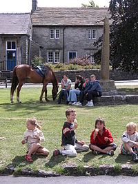
Village green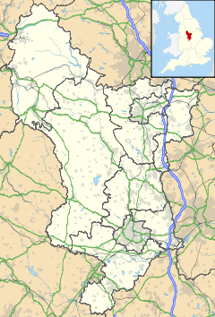
 Monyash
Monyash shown within DerbyshireOS grid reference SK149665 District Derbyshire Dales Shire county Derbyshire Region East Midlands Country England Sovereign state United Kingdom Post town BAKEWELL Postcode district DE45 Police Derbyshire Fire Derbyshire Ambulance East Midlands EU Parliament East Midlands List of places: UK • England • Derbyshire Monyash (pronounced "muny-ash") is a village in the Derbyshire Peak District about five miles west of Bakewell.
Monyash lies at an elevation of 300m above sea level, and has a population of about 280 people.[1] The village is located in a shallow hollow in the limestone plateau at the head of Lathkill Dale, which starts just outside of the village. Centred on a traditional village green, a crossroads of old routes leads respectively to Bakewell, Newhaven, Youlgreave and Buxton.
Contents
History
The Domesday Book of 1086 names the village as Maneis, a berwich of Bakewell[2] and owned by the King.[3] The name Maneis means "many springs or waters", after the pools of water, fed by springs, that lie on a narrow bed of clay in the middle of the village - an unusual feature in limestone country, that enabled life before piped water.[4]
In an Anglo-Saxon tumulus on Benty Grange Farm, in the south of the parish, the famous Benty Grange helmet was discovered in 1848. The village owes much of its existence to the presence of a small bed of impervious clay which capped the local limestone and which held water in four "meres" (ponds); however, only one remains today, called Fere Mere, which is situated behind the Primary School.[5] Up until the 20th century this pond provided the village's main supply of water.
The Domesday Book also refers to Monyash as "being a place of penal settlement for ill-behaved monks."[6] In the Middle Ages the monks of Roche Abbey farmed at nearby One Ash Grange.[7]
The village originated as a market centre. The remains of the market cross date from 1340 when a grant was made to William de Lynford of Monyash to hold a weekly (Tuesday) market and an annual fair.[7]
Monyash later became an important centre for lead mining and was the site of a Barmote Court. The National Gazetteer (1868) stated that "A court is held every six months for settling disputes relative to the lead mines in the hundred of High Peak".[8] The mines, with their associated industries and occupations, resulted in the village having a population in 1851 of some 500 inhabitants, twice what it is today, and at this time there were five public houses. By 1881 the population had fallen to 399,[9] and the last mine in the area to be worked - the Eagle Mine - closed in 1925. Today farming, local agriculture, and tourism are the main occupations.
Buildings and structures
St Leonards Church, the parish church, was founded in 1198. It has a Norman piscina and sedilia.[1] The chantry was rebuilt on the old foundations in 1887 as part of a major restoration work. The church contains a 15th century font.[10]
John Gratton (1640–1711), who lived at One Ash Grange for 40 years, encouraged the development of the non-conformist movement, and from the late 18th century the village became a Quaker stronghold, often visited by the Radical Quaker statesman, John Bright.[7] Many of the lead mines were in fact operated by the London Lead Company, a Quaker firm.[11] The old Quaker meeting house still stands on the road towards Flagg, adjacent to a Quaker cemetery.
The Methodist Chapel was founded in 1888,[12] replacing a former building used by Primitive Methodists, constructed in 1835.
On the village green are the 'King' and 'Queen' trees, planted to celebrate the Coronation of King George V and Queen Mary in 1910.
 The Bulls Head
The Pinfold, a pound, is located on the edge of Monyash, on the road towards Flagg. Stray cattle and sheep were rounded up by the Pinder into this small walled enclosure, from which they could be retrieved, after payment of a fee.[1]
Today there is only one remaining pub (the Bulls Head), which dates from the late 17th / early 18th century. There is also a cafe (The Old Smithy Tea Rooms), and there are Public Toilets on the Bakewell side of the village, nearer Lathkill Dale.
The village has a newly refurbished play area which was designed by children from the local school.
Festivals
Monyash also participates in the local custom of well dressing.
It has a School, a pub (The Bulls Head), a Church, a Chapel & a Quaker Meeting House.
The prehistoric Stone Circle Arbor Low is also just 2.8 miles from the village.
See also
References
- ^ a b c Monyash website
- ^ Domesday Book: A Complete Translation. London: Penguin, 2003. ISBN 0-14-143994-7 p.1379
- ^ British History Domesday site
- ^ Johnston R, and Johnston S,Monyash: The Making of a Derbyshire Village. Ashbourne, Horizon Press, 2010 ISBN 978-1-84306-524-1 p.8
- ^ Monyash Village in DerbyshireUK site
- ^ Genuki Geneaology site
- ^ a b c Peak District on-line
- ^ Genuki Geneaology site
- ^ Kelly's Directory transcript
- ^ Monyash Church page
- ^ Monyash webpage
- ^ Moneyash on Genuki site
External links
Categories:- Towns and villages of the Peak District
- Villages in Derbyshire


Wikimedia Foundation. 2010.